Walk #856: Marshwood to Lyme Regis
 |
 |
|
General Data
| Date Walked | 13/05/2010 |
| County | Dorset |
| Start Location | Marshwood |
| End Location | Lyme Regis Museum |
| Start time | 08.35 |
| End time | 12.30 |
| Distance | 8.8 miles |
| Description | This was a short stroll following the final few miles of the Wessex ridgeway to its conclusion at the sea. |
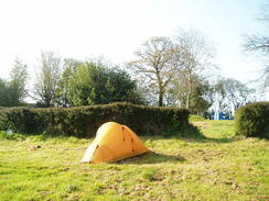
| Pack | Today I carried my Macpac Glissade rucksack containing my North Face Westwind tent, spare clothes, waterproofs, water, and enough food to last three days. In total it weighed about thirty pounds. |
| Condition | I feel very tired after this walk, but otherwise have nothing major to report. |
| Weather | The day was sunny, and it was also the warmest day of the walk so far. All in all it was ideal walking weather. |
| OS map | Landranger number 193 (Taunton & Lyme Regis, Chard & Bridport) |
 |
 |
|
 |
 |
|
Map of the walk
Maps courtesy of Google Maps. Route for indicative purposes only, and may have been plotted after the walk. Please let me have comments on what you think of this new format. For a detailed table of timings for this walk, please see the table file.
 |
 |
|
 |
 |
|
Notes
I awoke early, but instead of hurrying to get up and move on I lay in my sleeping bag, waiting for the sun to rise and lift the moisture off my tent. I had had a good night's sleep and was keen to get on towards the end of the Wessex Ridgeway at Lyme Regis, about eight miles away. There was little reason to set off early as the walk was going to be so short, although I was tempted to extend it by walking onto the station in Axminster to get my train home. The water supply to the Inn was off (a man was working in a cabin directly opposite, a standpipe throwing gallons of water onto the road). I said good morning to the owners of the Inn and their children, who were having breakfast outside, then slowly started to pack my gear up.
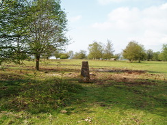
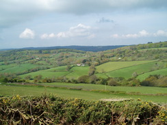
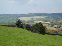
I had made a mistake at the end of yesterday's walk, taking the wrong path to join the road. There seemed little point in heading back to fix my mistake, so instead I took the main road then started heading up the steep path that led onto Lambert's Castle. Initially this headed through trees, the steep slope getting me sweaty. The climb was worth it, however, as the views from the top were absolutely superb, with ranges of hills visible in many directions along with tanatalising glimpses of the sea in the distance. After visiting the trig pillar I wandered around the hill for a little while, before heading down a steep slope to a road.
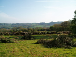
What followed was a pleasant stroll along a road, that climbed up to the top of Coneys's Castle. This was going to be the last hillfort on the Wessex Ridgeway, and the road runs directly through the middle of it. The ramparts were easily seen, although the scale of the place was hard to discern due to the brush and trees that covered the summit. That same vegetation also made it somewhat harder to see the views, but these started to unfold as the road descended once more.
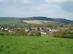
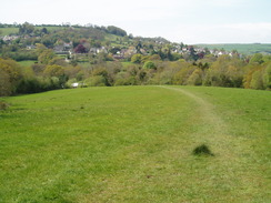
A path led me across a long field covered in long, luscious grass, before descending down to meet a road in Wootton Fitzpaine. More paths led on westwards, and here I took the wrong path for a short distance, having been distracted by a dog yapping angrily around my heels. Fortunately I soon realised my mistake, and I rejoined the proper path.
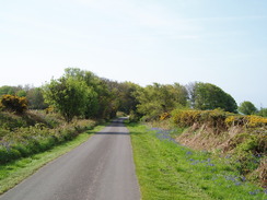
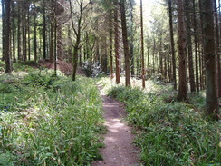
I was starting to feel more than a little fatigued, and the climb up the last hill of the trail towards the main road hardly helped matters. Fortunately the road proved easy to cross, after which the path started the long descent down into Lyme Regis. It entered a lovely stretch of woodland on Hole Common, with bluebells scattered around on the ground surrounding the path. I was too tired to really take any notice, the last few days of walking having taken more out of me than I cared to admit.
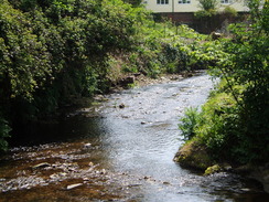
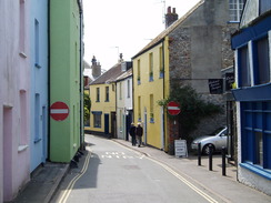
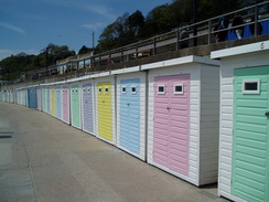
The path emerged out into the middle of a little clump of houses, before heading downhill along another path to reach the outskirts of Lyme Regis in a most salubrious place - right beside a sewage farm. Right after this I met a couple of elderly walkers, who I chatted to for a while as of trying to delay the end of the walk. The route towards the centre of the town was beside a pleasant stream. After a while the route diverted away from this to follow a road; instead, I carried along a track and roads beside the stream that took me through a very pleasant part of the town, with pastel-coloured houses lining the road.
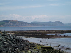
Eventually I reached the museum in the centre of Lyme Regis, which, with the absence of any formal end-point, seemed like a good a place as any to call the end of the walk. The Tourist Information office gave me details of the bus services to the station in Axminster - one every hour - and one was due in within a few minutes. Instead of hurrying I went to a nearby chip shop, bought some chips and sat down on the promenade, staring out to sea. Golden Cap, the highest point on the south coast, was clearly visible to the east, and the sea was clearly inviting. The seafront was busy with people enjoying the sunshine, and I loved the atmosphere - there were no tacky amusement arcades or shops selling garish goods. It felt like a really pleasant place, a bit like Southwold on the Suffolk coast.
I washed my boots in the sea, thanking them for having taken me along the Wessex Ridgeway. All in all it had not a classic trail, but it has some highlights that far exceed the experience of the whole. It is let down by poor waymarking and a general lack of care and attention. Despite this, I was taking back many good memories.
 |
 |
|
 |
 |
|
Directions
|
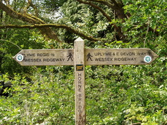
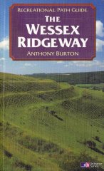
This walk follows the Wessex Ridgeway for the entire day. The route of the Wessex Ridgeway is detailed in the 'Wessex Ridgeway Recreational Path Guide', by Anthony Burton, ISBN 1 85410 613 9 published by Aurum Press Ltd. |
 |
Distances
| From | To | Distance (m) | Ascent (ft) | Descent (ft) |
|---|---|---|---|---|
| Marshwood | Lyme Regis | 8.8 | 1168 | 1726 |
This makes a total distance of 8.8 miles, with 1168 feet of ascent and 1726 feet of descent.
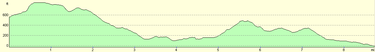
For more information on profiles, ascents and descents, see this page
Transport
There are hourly bus services from Lyme Regis to Axminster during the day. Axminster has a railway station, from where London and the southwest can easily be reached.
 |
 |
|
 |
 |
|
Disclaimer
Please note that I take no responsibility for anything that may happen when following these directions. If you intend to follow this route, then please use the relevant maps and check the route out before you go out. As always when walking, use common sense and you should be fine.
If you find any information on any of these routes that is inaccurate, or you wish to add anything, then please email me.
All images on this site are © of the author. Any reproduction, retransmissions, or republication of all or part of any document found on this site is expressly prohibited, unless the author has explicitly granted its prior written consent to so reproduce, retransmit, or republish the material. All other rights reserved.
Although this site includes links providing convenient direct access to other Internet sites, I do not endorse, approve, certify or make warranties or representations as to the accuracy of the information on these sites.
And finally, enjoy your walking!
Nearby walks
| # | Title | Walk length (miles) |
|---|---|---|
| 319 | West Bexington to Lyme Regis | 15.5 |
| 320 | Lyme Regis to Sidmouth | 16.0 |
| 855 | Rampisham Down to Marshwood | 19.6 |
|
|

|