Walk #807: Bedhampton to Cosham
 |
 |
|
General Data
| Date Walked | 08/02/2008 |
| County | Hampshire |
| Start Location | Bedhampton station |
| End Location | Cosham station |
| Start time | 08.33 |
| End time | 15.50 |
| Distance | 20.2 miles |
| Description | This was a varied walk; a pleasant countryside around the marshes to the east was followed by an interesting walk through Portsmouth and a boring stretch northwards to Cosham. |
| Pack | Today I carried my 30-litre Karrimor rucksack, filled with waterproofs, a book and other odds and ends. |
| Condition | I have had a little rubbing on my left heel today, which was unusual, and I ended the day surprisingly tired. |
| Weather | Today was a bright and sunny day without many clouds in the sky. It was not very warm, however. |
| OS map | Landranger number 197 (Chichester & The South Downs, Bognor Regis & Arundel) and Landranger number 196 (The Solent & The Isle of Wight, Southampton & Portsmouth) |
 |
 |
|
 |
 |
|
Map of the walk
Maps courtesy of Google Maps. Route for indicative purposes only, and may have been plotted after the walk. Please let me have comments on what you think of this new format. For a detailed table of timings for this walk, please see the table file.
 |
 |
|
 |
 |
|
Notes
I wanted to do another coastal walk today, so I headed off down the M27 towards Portsmouth, where I had last walked five years previously during my coastwalk. The day promised to be a varied one, with a coastal first third, followed by a long promenade walk and then a final walk along north from Portsmouth. I arrived at Bedhampton station and tried to find somewhere to park; there was no car park so I pulled up on the roadside nearby. As I was pulling my boots on a man came out of his house and I was immediately concerned that he was going to ask me to move. This did not turn out to be the case, and instead we chatted about walking and Scotland.
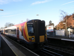
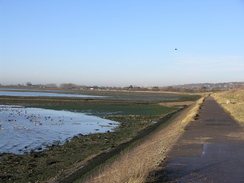
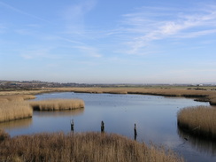
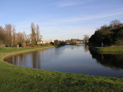
After walking to the station just in time for a train to depart, and I stood on the footbridge as I waited for it to leave. After this I went down the road and joined a path that I had walked along on several different locations. This led to a bridge over the A27(T), and after walking beside a channel I reached the sea proper. It was a very pleasant walk that took me past a car park before heading down along a path that led along the eastern edge of Farlington Marshes. During this part of the walk I was wondering if I would meet up with another coastal walker that was heading in the opposite direction - I found out later that he had passed this point many days before.
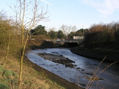
Although they were hardly classic, there were still some good views to be had from the path around the marshes, but it meant a long walk around the marshes to end up near where I started - something that is fairly common in coastal walking. A cycle path took me to a bridge over Ports Creek, and then a path headed south alongside the sea. A man was cutting some brush beside the path, but he did not even to respond when I said, 'Hello'.
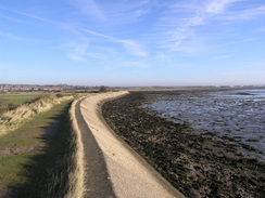
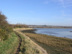
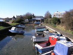
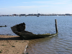
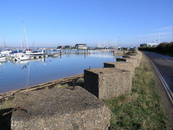
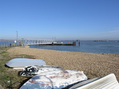
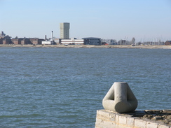
At Kendall's Wharf there was an industrial complex, and I passed landward of this before reaching a sailing club on the right. It was a pleasant walk further south alongside the sea, and I watched a boat coming in towards Kendall's Wharf as I walked. After passing Great Salterns Quay I headed on towards Eastney Lake. I tried to walk around the edge of this for as long as possible, passing the lock of a long-disused canal, but eventually it got too hard, so I was forced to find my way along roads. Eventually I found myself passing a marina that had some very expensive-looking boats stored out of the water in the left, and then headed on to the ferry landing. It was a nice post; in the water to the east I could see part of an old Mulberry Harbour, and across to Hayling Island.
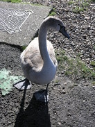
I turned back a short distance to where I had seen a little caf� near the lifeboat station. It was situated in a portable cabin, and I chatted to the couple within as I waited for my bacon sandwich. I had been hoping to walk along the beach past Fort Cumberland, but they told me that it would probably be impassable due to the tide. As we talked a swan that was standing by the van kept on trying to get the food out of my hand, sometimes quite aggressively!
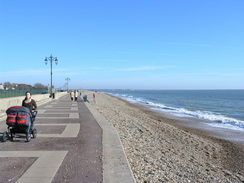
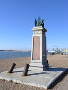
There was no choice but to follow the road back to the landward side of Fort Cumberland, and I walked to join the promenade in Eastney. This gave me easy walking as I headed westwards, passing a couple of old forts on the other side of the road and the Royal Marines Museum, marked by a large and imposing statue of a marine.
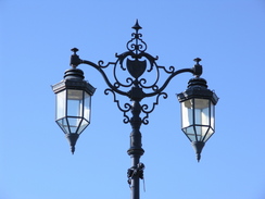
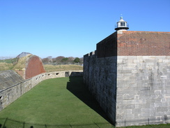
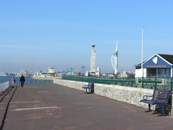
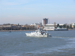
The walk along the promenade was enjoyable and there was much to see, from ferries arriving to the startling number of monuments that are arrayed alongside the promenade in places. Southsea Castle is an impressive structure, and one that I would like to go back and visit sometime. As In neared the Square Tower an HM Customs boat, the Valiant came in, and I clambered up to the top of the tower to get a better view.
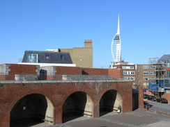
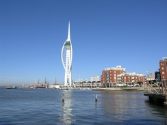
Here I left the promenade and headed along a road through Old Portsmouth to reach The Point. There was a pub, The Spice Island, here, so I nipped in for a quick drink and a rest. The pub was quiet and I could sit by one of the windows, looking across the water at the spectacular Spinnaker Tower, which was under construction when I had walked this way in early 2003.
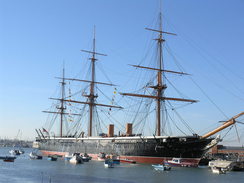
After leaving the pub I headed through Portsmouth towards the Historic Dockyard, passing various housing developments that were being built and HMS Warrior, the first iron-hulled warship in the world. It is an interesting ship; it looks exactly like a sailing ship, and it is hard to guess that it is made of metal. Soon afterwards I passed under the viaduct leading to Portsmouth Harbour station, and near this was a memorial to Brunel, who was born nearby. Next came the entrance to the Historic Dockyard, and from here a fairly uninspiring walk took me east past a functioning dockyard to the A3.
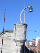
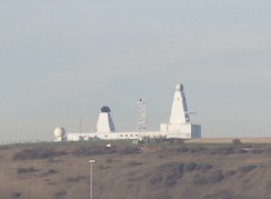
The next few miles northwards were along a combination of roads and paths and were, as expected, fairly uninspiring. There were few, if any, views of the sea, and even when the path did start running alongside it the views across the water were to the M275 motorway. In the distance to the north could be seen a white structure that looked like the topsides of a modern warship - and that is exactly what it is - Fort Widley was used as a test site of the new radar system used by the Type 45 destroyers.
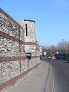
The path passed the ramparts of Hilsea Lines, and from here roads took me on towards the end of the walk at Cosham station. A train was due fairly immediately, and when I arrived back at Bedhampton station I found that I was almost too tired to walk. It had only been a twenty-mile day, but had felt like much further.
 |
 |
|
 |
 |
|
Directions
This walk starts at Bedhampton Station. Leave the station and turn right to head east down West Street for a short distance, before crossing a stream and turning right to head southwestwards down a road. Keep the stream on the right as the road becomes a footpath ; it crosses the stream to join the side of a railway line. It follows this southwestwards for a hundred yards, and after passing under a bridge turn left to climb up onto the bridge and turn right, to head south along a track. This leads to a footbridge over the A27(T), and on the other side start heading south along a footpath that skirts the edge of a channel, joining the Solent Way before turning to the right at a car park to start heading in a more westerly direction.
Continue along the Solent Way as it skirts between the water's edge and the A27(T), eventually turning to the left to head south for a mile down the eastern edge of Farlington Marshes. At the bottom of the island the path turns to the right to head along the western side of the island for a mile until it reaches a car park by the A27(T). Turn left and parallel the A27(T) westwards for a third of a mile along a cycle path; at a large roundabout turn left to continue along the Solent Way as it heads southwards, crossing a bridge over Ports Creek.
On the other side of the bridge turn left and follow the Solent Way as it follows the water's edge southwards, going on the landward side of Kendall's Wharf and continuing on past Great Saltern's Quay until Eastney Lake is reached after a couple of miles. At low tide it may be possible to follow the coast around here, but instead I followed roads westwards and then southwards into Eastney, joining Henderson Road. Follow this southeastwards and turn left up Ferry Road, which skirts the southern side of the lake before curving to the right to join another road. Turn left to start heading northeastwards for over half a mile, passing a marina on the left to a landing stage for a ferry.
Turn around and head back along the road for four-fifths of a mile; Ferry Road becomes Fort Cumberland Road, and when this curves to the right turn left down a minor road that head westwards before ending at a T-junction. Turn left along this road, immediately passing a swimming baths on the left and reaching the start of the promenade. Follow the promenade for a little over three miles, heading southwestwards to Southsea Castle before curving northwestwards to end at the Square Tower.
Here leave the promenade and turn right for a few yards to reach a road, and then turn left to head northwestwards up to The Point. Turn back, and then past a little harbour on the left turn left along a footpath that heads northeastwards and join Gunwharf Road. Follow this as it heads northwards and curves to the right. At a road junction turn left to head northwards along The Hard. This passes under a railway line and passes Portsmouth Harbour station. By the Historic Dockyard turns to the right, becoming Queen Street as it heads eastwards until it ends at the A3. Turn left to follow the A3 northwestwards for a third of a mile to a roundabout, and then turn left up Hope Street. Take the first road off to the left, Flathouse Road, and then turn right down Kerber Street. At the end of this street turn left to join a cycle path that heads under the A3 on an underpass.
On the other side turn left to head northwards with the A3 on the left. At a large roundabout use an underpass to head northwestwards, now alongside the M275. The path heads through Stamshaw, and then enters Stamshaw Park. At the northern end of the park turn right along Jervis Road, and then turn left up Widley Road. At the end turn right along Tipner Road, and then almost immediately left up Target Road. When this reaches a Greyhound Stadium turn right along a track that heads eastwards to reach the end of Twyford Road. Turn left along this for a few yards, and then turn right to start heading through Alexandra Mountbatten Park.
Stick to the coast as it heads northwards along the side of Tipner Lake, eventually curving to the right to reach a large roundabout. Carefully make your way around the roundabout to take the second major exit, the A397 road that heads northeastwards. Take the first road off to the right, Portsmouth Road, and follow this northwards for a third of a mile until Cosham Station is reached on the right.
 |
 |
|
 |
 |
|
Distances
| From | To | Distance (m) | Ascent (ft) | Descent (ft) |
|---|---|---|---|---|
| Bedhampton station | Eastney Ferry | 9.9 | 151 | 164 |
| Eastney Ferry | Old Portsmouth | 4.6 | 39 | 36 |
| Old Portsmouth | Cosham station | 5.7 | 49 | 39 |
This makes a total distance of 20.2 miles, with 239 feet of ascent and 239 feet of descent.
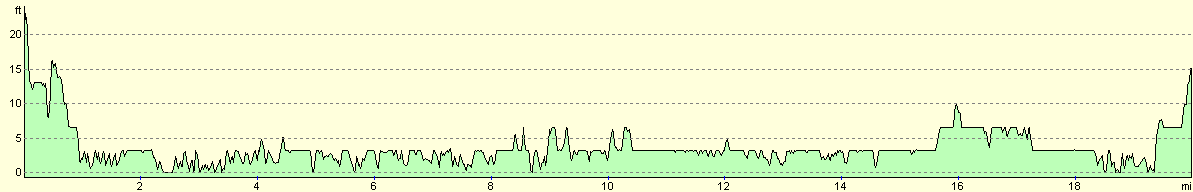
For more information on profiles, ascents and descents, see this page
Transport
There are regular train services back from Bedhampton to Cosham, although you may have to change on some services. See the National Rail Enquiries website for more details.
 |
 |
|
 |
 |
|
 |
 |
|
 |
 |
|
 |
 |
|
 |
 |
|
Disclaimer
Please note that I take no responsibility for anything that may happen when following these directions. If you intend to follow this route, then please use the relevant maps and check the route out before you go out. As always when walking, use common sense and you should be fine.
If you find any information on any of these routes that is inaccurate, or you wish to add anything, then please email me.
All images on this site are © of the author. Any reproduction, retransmissions, or republication of all or part of any document found on this site is expressly prohibited, unless the author has explicitly granted its prior written consent to so reproduce, retransmit, or republish the material. All other rights reserved.
Although this site includes links providing convenient direct access to other Internet sites, I do not endorse, approve, certify or make warranties or representations as to the accuracy of the information on these sites.
And finally, enjoy your walking!
Nearby walks
| # | Title | Walk length (miles) |
|---|---|---|
| 301 | Pagham to West Itchenor | 19.4 |
| 302 | West Itchenor to Chidham | 14.9 |
| 303 | Chidham to Langstone | 16.0 |
|
|

|