Walk #677: Gomshall to Merstham
 |
 |
|
General Data
| Date Walked | 12/06/2005 |
| County | Surrey |
| Start Location | Gomshall Station |
| End Location | Merstham Station |
| Start time | 07.19 |
| End time | 13.16 |
| Distance | 17.4 miles |
| Description | This was a very enjoyable stroll, mainly through woodland along the top of the North Downs escarpment. |
| Pack | Today I carried my 30-litre Karrimor rucksack that was filled with various accoutrements. |
| Condition | Compared to yesterday I felt much better that I did yesterday; I have no new blisters and although the chaffing ached it was nowhere near as bad as yesterday. |
| Weather | It had rained overnight and it was overcast when I set off, so I was not too hopeful for a dry day. Fortunately I need not have worried, and the clouds slowly parted and the sun made increasing appearances throughout the day. There was no wind, and it therefore a superb day for a walk. |
| OS map | Landranger number 187 (Dorking, Reigate & Crawley area) |
 |
 |
|
 |
 |
|
Map of the walk
Maps courtesy of Google Maps. Route for indicative purposes only, and may have been plotted after the walk. Please let me have comments on what you think of this new format. For a detailed table of timings for this walk, please see the table file.
 |
 |
|
 |
 |
|
Notes
I had a fairly restless night in the top bunk of the room. I did not manage to get off to sleep until well after eleven, as one of the other two men had left the light on so there friend would have light when he arrived. Unfortunately he did not come back for ages, and whilst the other two were asleep (and one snoring loudly) and I did not want to wake them, I was loathed to climb down to switch it of. Instead I lay prone in bed, tired out but never quite reaching the blissful relief of sleep. Eventually the third man came in, and after making lots of noise he finally switched off the light, climbed into the bunk below me. Silence reigned, and I could finally let sleep take me.
This morning I awoke at my normal time of 06.00, and I carefully climbed down the ladder, picked my roll bag up and headed out to the common room. After doing my ablutions and drinking two litres of water I was ready to go, so I unlocked the door and headed out to my car. It was Stillwell before seven in the morning, and I drove around the surrounding villages looking for a shop that was open; eventually I found between the station and the youth hostel, and I bought a paper and some chocolate to keep me going through the day. Unfortunately they did not have any zinc oxide tape or Vaseline, both of which I had stupidly neglected to take with me on this trip.
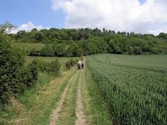
Gomshall station was eerily quiet when I pulled up in my car, parking right beside the station fence and away from the adjacent caravan centre, which I assumed would be quite busy in the afternoon. It did not take me long to get my rucksack on my back and head off, stretching my legs as I crossed the tracks between the staggered platforms. I soon found myself climbing up the heavily rutted lane that I had descended yesterday afternoon, the ascent being much easier than the descent had been the day before as my feet were nowhere near as sore. I turned around occasionally to take a look at the views over the plains to the south, although these views were often obscured by the surrounding trees, which hung gloomily over the track.
A burnt-out van marked the point where I rejoined the North Downs Way, and I took a couple more photographs of it, to go with the ones that I had taken the previous afternoon. As I did so I found myself getting increasingly irate with the sort of people who not only (I am assuming) steal cars and set fire to them, but also leave them literally in the middle of nowhere. Shaking my head at the sheer insanity of it, I turned of and started following the NDW as it headed eastwards through the trees along the top of the ridge. I soon came across another burnt-out car, the surrounding trees showing signs of where the fire had licked at them.
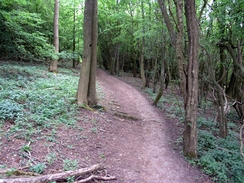
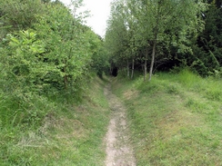
Despite being nearly totally encompassed by trees, the next stretch of path was a very enjoyable stroll, and although the trees blocked what should have been superb views southwards, they added much of interest to glance at as I walked. Occasionally beside the path I came across brick-built pillboxes, remnants of the defensive line that was constructed along the top of the North Downs. Some of these structures were in good condition, and I went inside one that had brickwork inside that seemed so fresh that it left me wondering if it had been restored. All of them had trees growing close by (and, in one case, on top of it), and these had obviously grown up since the buildings were abandoned, as they blocked all sight lines form the gun slots. They are fascinating pieces of our heritage, and I hope that they remain on the ridge acting as lonely sentinels to our turbulent past for many more years,
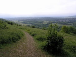
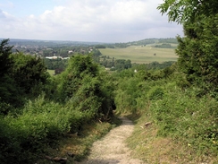
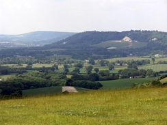
All too soon I found myself emerging from the cloak of trees onto Ranmore Common, from where I got the first substantial views of the day over the plains to the south. I could easily make out Leith Hill (the highest point in the southeast of England) which I had visited on a previous walk, and I enjoyed the stroll towards the substantial church on the common, which seems all to large for its rural location. Reaching the church meant that I was on a section of path that I had walked before, and I fund myself on autopilot as I walked along the path through Denbies vineyard. The views to the south over Dorking were very pleasant, and as I walked I let my eyes subconsciously stray over towards them. There was an easy descent down towards the A24 dual carriageway near Westhumble, before which the track passed under an attractive railway bridge that looked too grand for its location.
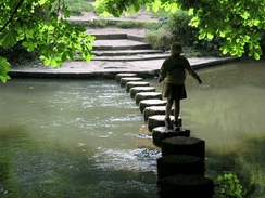
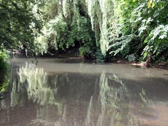
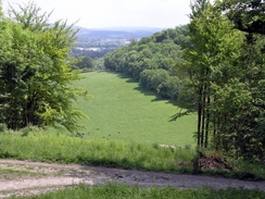
Instead of using the subway a few hundred metres to the north I crossed straight across the A24 and made my way down towards the stepping stones over the River Mole. These were situated in a pleasant tree-lined stretch of the river, and beside them there were a group of Brownies, running from one bank to the other across the stones. It took a few minutes for them all to come back to the bank, and I then found that I could cross the stones, which were firmly planted and far from the most difficult that I have ever crossed. Halfway across I stopped to take a couple of photos of the river, which burbled pleasantly past me. Once on the other bank I steeled myself for what I knew was ahead - the steep climb up to the top of Box Hill. I had walked down this hill on a previous walk, and I had not really been looking forward to what promised to be a steep climb. I was not disappointed, and the steep steps that led inexorably up the hill soon had me gasping for breath, as I was determined not to stop on the ascent.
Fortunately the top soon came, and once the gradient slackened I increased my pace to reach the trig pillar at the top of Box Hill, from where there are expansive views to the south over Dorking. Again I could easily make out Leith Hill in the distance, and I believe that I could even make out the tower that stands at the top. I had been here before, however, and so I soon found myself moving on, following the North Downs Way as it headed eastwards through the trees. On the way I came across five or six groups of teenagers carrying heavy rucksacks, which led me to conclude that the Duke of Edinburgh's Award season is well and truly on us. It was nice encountering these groups as I walked, and I tried to make individual comments to each group; quite what they made of this I can hardly imagine!
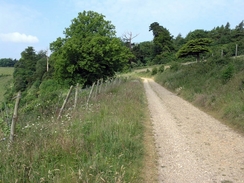
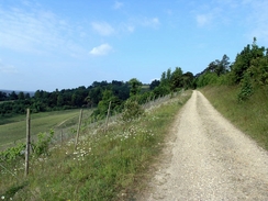
A short distance further on the Way headed down past a quarry - at first I thought that this was disused, but further down I passed some machinery that made me wonder if some of the quarry was still in use. This led down to the B2032 road immediately to the north of Betchworth station, and it was quite dismaying to find that the road was very busy with traffic, even on a Sunday, as I had to follow it for about half a mile. I was therefore quite relieved when I found that the North Downs Way had been diverted onto a rough path that ran in a field beside the road, giving a much safer walk. Just as I reached the footpath that led eastwards away from the B2032 I was passed by about ten joggers, coming straight past me and heading down the path away from me. I was quite jealous of their obvious fitness, and for the second time in two days I found myself wishing that I could run, or at least jog.
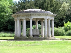
The path skirted the lower edge of the escarpment, not following an easy route through the field, but instead taking a route through the trees, which twisted, turned, climbed and fell, seemingly at the same time, before eventually I reached the last steep climb of the day. This led me uphill as the path nearly doubled back on itself, heading westwards as it climbed. The overhanging trees made the climb gloomy, and I was not feeling too happy due toe the exertion and the dawning realisation that I may be running too late to be able to catch the train that I wanted. Various alternative plans flooded by mind, such as finishing the walk early by heading off down into Reigate (which I could easily make in time to get the train). I quickly rejected these, however, and decided to press on, just in case I made the train in time. On Colley Hill I was treated to some superb views to the south over Reigate, and right at the end of the open space there was a grandstand-type structure with an exquisite blue painted ceiling. I was annoyed at not having time to look at it, and so I pressed on.
A little further on the path passed the site of Reigate Fort, the surface structures of which have been only demolished (although much of the structure is underground in casements). The ditch around the rectangular site remains, as does a gateway leading in. This fort was one of the series of mobilisation centres built between 1889 and 1903 as part of the London Defence Scheme, but was abandoned in 1907 (I am surprised that it was not used in the Second World War considering the number of pill boxes I saw today). A little further on a pedestrian footbridge took me over the A217, and I reached a car park, which was complete with a large refreshment hut. Despite the obvious time pressures that I was under I could not resist an ice cream, and I bought a more modest one than yesterday. This made me feel a little better, and the next few miles seemed to fly by, despite my worries abou time.
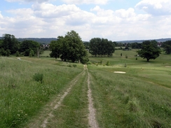
The path slowly descended to pass through the grounds of Gatton Park School, and as the path skirted the side of the complex of buildings lots of teenagers enjoying the afternoon sun on the grass became visible. I strolled on, heading across a golf course before starting the descent down to Merstham. By this stage I was well aware that I had missed the first train, but I was still hopeful that I may be able to catch the indirect train to Redhill. As I reached the main road through Merstham I knew that I had missed it, and I finally reached the station after that train had been gone for five minutes. I still had a little hope that the train may have been late, but when I went into the ticket office I discovered that it had indeed gone. Frustrated, I walked outside; this delay meant that I had about a three-hour wait (one hour for a train to Redhill, and then two hours for the train back to Gomshall). When I walked back to the front of the station I was relieved to see a taxi standing right beside the entrance; a plan quickly formed in my mind and a couple of minutes later I was roaring through the outskirts of Redhill towards the station. This cost me four pounds ten pence, and it got me to the station fifteen minutes before the train to Gomshall was due to go. This elated me, and as I sat on the train on the journey back to the car I could look back on what had been a surprisingly nice start to the North Downs Way.
 |
 |
|
 |
Directions
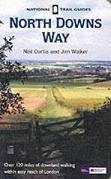
The walk is also covered in detail in the North Downs Way National Trail Guide, by Neil Curtis and Jim Walker, ISBN 1 85410 853 0, published by Aurum Press Ltd.
The exception to this is the start of the walk; from the car park use the pedestrian crossing between the staggered platforms and head down a path that leads to the A25 road. Once there, turn left and walk eastwards away from the railway bridge until a restaurant is reached on the right. Her turn left to start following a track, Beggar's Lane, which heads northwards, passing under a railway line before climbing steeply uphill. The North Downs Way is reached at about grid reference TQ09647.
Distances
| From | To | Distance (m) | Ascent (ft) | Descent (ft) |
|---|---|---|---|---|
| Gomshall Station | Beggar's Lane | 1.1 | 397 | 39 |
| Beggar's Lane | Box Hill | 6.7 | 951 | 1040 |
| Box Hill | Reigate Hill | 6.6 | 1417 | 1217 |
| Reigate Hill | Merstham Station | 3.0 | 115 | 561 |
This makes a total distance of 17.4 miles, with 2880 feet of ascent and 2857 feet of descent.
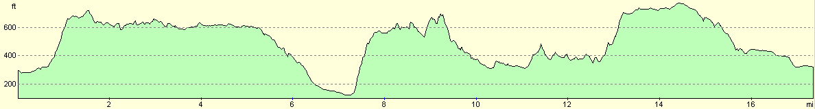
For more information on profiles, ascents and descents, see this page
Transport
There are regular train services between Merstham and Gomshall railway stations, changing at Redhill on the way. On Sundays the trains between Merstham and Redhill run at roughly hourly intervals, and those between Redhill and Gomshall at two-hourly intervals.
Disclaimer
Please note that I take no responsibility for anything that may happen when following these directions. If you intend to follow this route, then please use the relevant maps and check the route out before you go out. As always when walking, use common sense and you should be fine.
If you find any information on any of these routes that is inaccurate, or you wish to add anything, then please email me.
All images on this site are © of the author. Any reproduction, retransmissions, or republication of all or part of any document found on this site is expressly prohibited, unless the author has explicitly granted its prior written consent to so reproduce, retransmit, or republish the material. All other rights reserved.
Although this site includes links providing convenient direct access to other Internet sites, I do not endorse, approve, certify or make warranties or representations as to the accuracy of the information on these sites.
And finally, enjoy your walking!
This walk was mentioned in the following routes:
| The North Downs Way |
Nearby walks
| # | Title | Walk length (miles) |
|---|---|---|
| 217 | Greenwich to Whyteleafe | 17.9 |
| 599 | A circular walk from Westhumble to Surrey's highest point | 20.0 |
| 601 | A circular walk along the North Downs from Whyteleafe | 21.6 |
|
|

|