Walk #535: Littleferry to Meikle Ferry
 |
 |
|
General Data
| Date Walked | 22/08/2003 |
| County | Highlands |
| Start Location | Littleferry |
| End Location | Meikle Ferry |
| Start time | 09.14 |
| End time | 17.03 |
| Distance | 21.1 miles |
| Description | This was an enjoyable walk around Loch Fleet and down to the northern side of the Dornoch Firth. |
| Pack | Today I carried my 30-litre Karrimor HotRock rucksack, which was filled with my packed lunch, waterproof leggings, water bottle and a couple of spare shirts, together with the usual assortment of odds and ends. |
| Condition | I did not have many problems with today's walk, and I managed the miles quite well. the small blister that I had on my right foot yesterday ached towards the end of today, despite the fact that I put a Compeed on it yesterday. |
| Weather | There were some strong gusts of wind overnight, and these were accompanied by sharp showers. This pattern continued into this morning, with very strong wind and showers. By lunchtime the showers had ended but the winds worsened, and unfortunately as they were southwesterly they were a headwind for the last part of the day. |
| OS map | Landranger number 21 (Dornoch & Alness, Invergordon & Tain) |
 |
 |
|
 |
Map of the walk
Maps courtesy of Google Maps. Route for indicative purposes only, and may have been plotted after the walk. Please let me have comments on what you think of this new format. For a detailed table of timings for this walk, please see the table file.
Notes
I set off this morning knowing that I had to walk around Loch Fleet, a long diversion and the first sea loch that I had encountered since Loch Eriboll on the north coast. Graham had walked across the mouth of the loch at low tide and had sunk up to his knees in the mud for his troubles, but I had no desire to copy this. As I am ahead of schedule I am also in a position where I can extend the walk rather than shorten it, so I was quite looking forward to the walk around the Fleet.
The tide was quite high as I set off, and Loch Fleet looked beautiful in the little glimpses of sunshine that I got. The walk through Balblair Wood was nice, with the trees preventing the worst of the rain from hitting me. Once I reached the northwestern side of the woodland I was faced with a choice; I could follow the railway line for a kilometre to The Mound, but I did not fancy this (i.e. I chickened out) and I walked up a slight hill across a field of cut corn to the A9(T).
The Mound is a funny little structure that carries the A9(T) over Loch Fleet. It was built by Thomas Telford in 1815 to reclaim the boggy valley of the Fleet, but the area is now an attractive nature reserve. The Mound consists of a bridge at it's northeastern end with some sluice gates beneath, through which the River Fleet flows, and the rest of it is a long embankment. I like this sort of structure, especially when it is so old and fits into the environment so well.
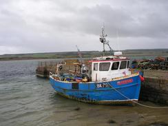
On the southern side of Loch Fleet I passed the ruins of Skelbo Castle, a 14th century castle of which only the walls and keep remain. It is in a very prominent position, and it must have had superb views over Loch Fleet and eastwards to the coast. From the castle I made my way along a road and track to the dilapidated jetty directly opposite Littleferry. This meant that I had walked nearly nine miles to get only a couple of hundred yards from where I started! I tried not to dwell on this, and walked quickly through the dunes to the firm beach beside Coul Links.
I met Sam for lunch at the pub in Embo, which feels like it is in the middle of a large caravan site, with static caravans everywhere. Outside the pub there is a very unusual feature, however - the ruins of a chambered cairn making an interesting obstacle to parking cars! We went into the pub for a quick drink, the first time that I have had a lunchtime drink for ages, the west coast of Scotland not being known for having frequent pubs! It was my first pint for a week, and it soon went down, and we then went out to Mervan for lunch.
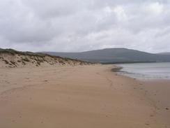
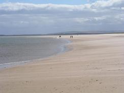
From Embo I walked south along the beach past Dornoch towards Dornoch Point. I really wanted to go into Dornoch to have a look around, but I really could not afford he time. This was a shame, as Sam told me that the town was superb, with a beautiful cathedral that I would not have minded seeing. At Dornoch Point I got a view out to perhaps one hundred seals basking on the sandbanks of Gizzen Briggs, the most that I have seen of these creatures in one place on this trip. I wished that I could go the short distance over to the sandbanks so I could take some close-up photographs, but I really did not fancy the swim.
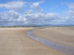
Past Dornoch Point the sands become muddier, and the walk was, for me, unmemorable due to he extremely strong headwind that I had to put up with. It as never strong enough to life me off my feet as the winds in October at Skegness did, but in the prolonged strong gusts it made every step hard and use much more energy than it should. After what seemed like an eternity I finally reached the Dornoch Bridge, which carries the A9(T) over the Dornoch Firth. The bridge is in my opinion of an unexceptional design, and it cuts straight across the estuary. It has quite a low profile, however, and this makes it fit into the scenery better than if it had been higher. I met Sam beside the jetty at Meikle Ferry, where we decided to spend the night despite the no overnight parking sign that we parked beside.
We are booked into a campsite a few miles west of Tain for two nights from tomorrow, as I am intending to take Sunday off. Glenmorangie is my favourite whisky, and the distillery is near the campsite and so we are going on a tour of it on Sunday afternoon, something that I have been looking forward to for the entire trip. This means that I have to walk as far as possible around Dornoch Firth so that I am not far away from the campsite tomorrow night, which will definitely mean over a twenty mile walk. I can only hope that the weather will be better tomorrow than it was today, and that I have good weather (and most of all an end to this strong wind) for the walk.
Directions
This walk starts off at a car park a few yards to the north of the jetty at Littleferry. Leave the car park and turn right to head northwards for a couple of kilometres along the road past the Ferry Links. Turn left to join a track that heads westwards, entering Balblair Wood and crossing the Culmaily Burn on a little bridge. When a track leads off to the left join this track and follow it past a cottage at Balblair. Here the track ends, and a path continues onwards along the southern edge of the area of woodland.
At the western end of Balblair Wood that path became indistinct, and so I joined the foreshore and followed this northwards for a little over a kilometre until I reached a railway line. I crossed over the line, and then headed northwestwards uphill across a field, with an area of woodland to the left, for a little under a kilometre until the A9(T) is reached. Turn left and head southwestwards along the A9(T) past the junction with the A839 road, and down onto a causeway called The Mound. Cross The Mound, and follow the road as it curves around to the left along the northwestern side of Loch Fleet.
When a road junction is reached on the left turn left down this road and follow it as it heads southeastwards along the southern edge of Loch Fleet. The road passes the ruins of Castle Skebo, and a little under a kilometre further on turn left up a track that heads northeastwards for a kilometre to the remains of a jetty at the mouth of Loch Fleet. Here follow tracks through the sand dunes eastwards to gain access to the beach, and once this is met turn right to head south along the beach for a couple of kilometres to Embo. Follow the beach through Embo and past a caravan park.
The beach continues southwards for a couple of miles past Dornoch, and then onwards for a couple of kilometres to Dornoch Point. Round the point and then head northwestwards following the coast as it heads past Dornoch Sands. The coast slowly curves around to head westwards and then southwestwards across the Cuthill Sands, until the northern end of the Dornoch Bridge is reached. A gate allows you to gain access to a track that heads under the bridge past the northern abutment, and on the other side follow the coast around for a couple of miles until the jetty is reached at Meikle Ferry, where this walk ends.
Distances
| From | To | Distance (m) | Ascent (ft) | Descent (ft) |
|---|---|---|---|---|
| Littleferry | Pub in Embo | 11.2 | 509 | 512 |
| Pub in Embo | Dornoch | 2.3 | 26 | 46 |
| Dornoch | Meikle Ferry | 7.6 | 56 | 49 |
This makes a total distance of 21.1 miles, with 591 feet of ascent and 607 feet of descent.
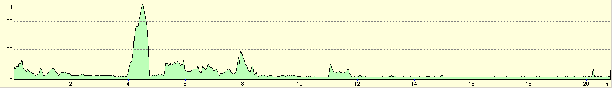
For more information on profiles, ascents and descents, see this page
Accommodation
We parked for the night at a little car park beside the jetty at Meikle Ferry. This was a quiet place to spend the night with some great views over the Dornoch Firth and the Dornoch Bridge. There was a sign stating no overnight parking, but as usual we ignored this.
Disclaimer
Please note that I take no responsibility for anything that may happen when following these directions. If you intend to follow this route, then please use the relevant maps and check the route out before you go out. As always when walking, use common sense and you should be fine.
If you find any information on any of these routes that is inaccurate, or you wish to add anything, then please email me.
All images on this site are © of the author. Any reproduction, retransmissions, or republication of all or part of any document found on this site is expressly prohibited, unless the author has explicitly granted its prior written consent to so reproduce, retransmit, or republish the material. All other rights reserved.
Although this site includes links providing convenient direct access to other Internet sites, I do not endorse, approve, certify or make warranties or representations as to the accuracy of the information on these sites.
And finally, enjoy your walking!
This walk was mentioned in the following routes:
| My walk around the coastline of Britain |
Nearby walks
| # | Title | Walk length (miles) |
|---|---|---|
| 534 | Helmsdale to Littleferry | 21.6 |
| 536 | Meikle Ferry to Dornoch Ferry Inn | 27.6 |
|
|

|