Walk #512: Shieldaig to Melvaig
 |
 |
|
General Data
| Date Walked | 28/07/2003 |
| County | Highlands |
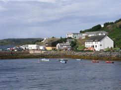
| Start Location | Shieldaig |
| End Location | Melvaig |
| Start time | 10.15 |
| End time | 16.15 |
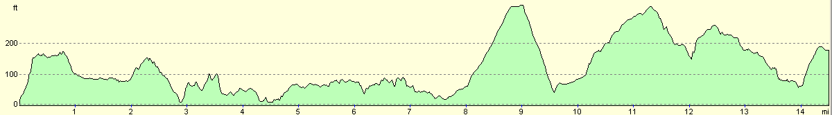
| Distance | 14.7 miles |
| Description | This was a short but enjoyable day, yet again with some lovely views available over Loch Gairloch and over towards the northern end of Skye. |
| Pack | Today I carried my 30-litre Karrimor HotRock rucksack, which was filled with my packed lunch, waterproof leggings, water bottle and a couple of spare shirts, together with the usual assortment of odds and ends. |
| Condition | I am slightly footsore after yesterday, which is the same situation as yesterday. This is getting annoying, and I cannot imagine why this has started happening after they have been fine with the same pair of boots since I got them. Apart from this I have been fine, and have no other problems to report. |
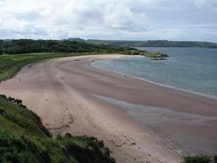
| Weather | Today was another changeable day, with some periods of heavy rain and others of sunshine. When it was raining it could get relatively chilly with the accompanying wind, and when it was sunny I got to hot. Fortunately there were not too many wet periods, although I still kept my coat on all day. |
| OS map | Landranger number 19 (Gairloch & Ullapool, Loch Maree) |
 |
 |
|
 |
 |
|
Map of the walk
Maps courtesy of Google Maps. Route for indicative purposes only, and may have been plotted after the walk. Please let me have comments on what you think of this new format. For a detailed table of timings for this walk, please see the table file.
Notes
As has frequently happened over the last few weeks, I woke up to rain drumming on the roof of Mervan a few inches above my head. It seems like an eternity since I last had a completely dry and sunny day, but unfortunately that is the way things go - a few days of rain is all it takes to forget sunny weather. I was not in a hurry to start as I knew it was only going to be a short walk, and so I decided to wait to see if the rain would stop before stetting out.
The rain stopped once or twice, but by the time I got ready to go it had restarted and I sat down once again. Eventually I realised that it was getting too late, and so I reluctantly set off into the rain. In a classic example of my oft-stated saying 'the fear of rain is worse than the experience of rain itself', the rain was not as bad as I had feared, and I strode on through it. Within twenty minutes the rain had stopped and was replaced with cloud and even an occasional burst of sunshine that soon made me overheat. I was loathed to take my coat off as some of the clouds looked threatening, and so I just strode on.
As I approached the junction with the A832 road I was aware of a queue of traffic in front of me. When I reached the junction I could see that five or six cows were walking down the road towards me and holding up the traffic, including a large foreign tourist bus. I turned left and walked down the road and was soon joined by the cows. They were causing massive traffic disruption on what is not a busy road, but I did not know what I should do - should I put them safely in the nearest field, but when I tried to direct them away from one side of the road I found that I could not direct them. So instead I walked on down the road, and simply waved my left arm at oncoming drivers to try to get them to slow down. With the cows closely behind me I felt like the pied piper of Gairloch, leading the cows down the road. Fortunately after five minutes they diverted off to a wide area beside the road and I left them behind.
I met Sam in Gairloch library, where I went in so that I could quickly check my emails. I had a really nice email from someone who likes my website, and it is nice that people find it useful. There was little else to reply to, and so we left and I went to the public toilets adjacent to the tourist information office, only to find that they were in an absolutely disgusting state. I really did not fancy using them, so Sam walked with me for half a mile to the Millcrest Hotel, where we had a drink. It also allowed me to use their facilities, which was a welcome relief. After this Sam followed me as far as the youth hostel before turning back - it was nice to be walking with her, but it took me some time to get used to having someone beside me as I walked.
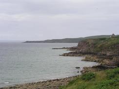
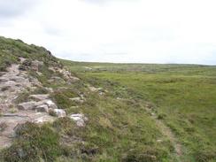
Once Sam had left me I decided to divert off the road and walk along a couple of paths instead, that led through the holiday park at Big Sand before climbing between two hills and reaching the village of North Erradale. This was a most agreeable little diversion, and was far better than walking along the road, which was the alternative.
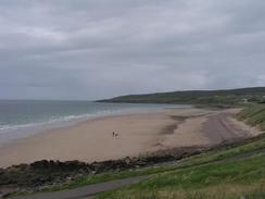
My feet had been sore for the last few miles, and so I was very glad when I saw Mervan parked at the end of the public road in Melvaig. If I had changed into my trainers I could have walked further to the lighthouse at Rubha Reidh, but we had been told at the Gairloch tourist information office that it was not really possible to drive a motorhome up the private road there. I was not disheartened about having a short day, particularly as my feet were aching, and it leaves me well set for the pathless walk along the northern side of the peninsular tomorrow morning.
This was not an ideal place to park as there were no facilities nearby, but it was a nice and quiet place, and it was nice to be able to watch the sun go down as we looked over the sea to Skye and the Western Isles, with a cruise ship ploughing north through the Minches. One of the greatest things about the itinerant lifestyle that I have committed myself to over the last ten months is the way that when we open the blinds each morning we have a different views, and whilst some of these are bland, others are fantastic. Sam describes it as having the largest backyard in the world, and I can only agree with her.
Directions
This walk starts off in a car park just off the B8056 road in Shieldaig, near the Shieldaig Lodge Hotel. Leave the car park and turn right to head southeastwards along the road, and follow it as it curves to the left to head northeastwards before it crosses the River Kerry and ends at a T-junction with the A832 road. Turn left to head northwestwards along the road as it skirts the River Kerry before descending down into Charlestown and on into Gairloch.
In Gairloch turn left and walk westwards along the B8021 road for three miles until the Carn Dearg Scottish Youth Hostel is reached. Continue around the bend and then take a footpath that heads off to the left and enters a campsite. The path joins a surfaced road that it follows as it curves past a toilet block. When the road curves sharply to the right continue straight on over a little hill and drop down on the other side to a set of stepping stones / bridge over the River Sand.
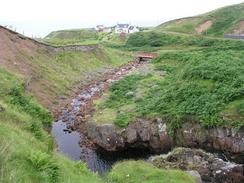
On the north side of the river take an obvious path that heads northwestwards for a few hundred yards until it reaches a public road. Turn right along this public road and follow it as it turns to the left to head northwestwards uphill along a road. When the road ends continue straight on along a track with some power lines to the left. At the top the track ends, and a path continues on downhill with the power lines to the right. The ground underfoot is quite boggy, but eventually the path meets the farm at Fannachainglas. Join the driveway of the farm and follow it downhill as it joins a public road by the bridge over a stream, and continue up this road for a short distance until a road junction is met on the right. Turn down this road and follow it eastwards for a kilometre until it ends at the B8021 road. Turn left and follow the B8021 road northwards for a few miles until the public road ends at Melvaig. This walk ends at a little car park on the left at the end of the road.
Distances
| From | To | Distance (m) | Ascent (ft) | Descent (ft) |
|---|---|---|---|---|
| Shieldaig | Gairloch | 4.3 | 564 | 528 |
| Gairloch | Melvaig | 10.4 | 1270 | 1145 |
This makes a total distance of 14.7 miles, with 1834 feet of ascent and 1673 feet of descent.
For more information on profiles, ascents and descents, see this page
Accommodation
We parked Mervan in the tiny car park at the end of the public road in Melvaig, which had no facilities but did offer some superb views over the northern end of Skye and the Western Isles.
Disclaimer
Please note that I take no responsibility for anything that may happen when following these directions. If you intend to follow this route, then please use the relevant maps and check the route out before you go out. As always when walking, use common sense and you should be fine.
If you find any information on any of these routes that is inaccurate, or you wish to add anything, then please email me.
All images on this site are © of the author. Any reproduction, retransmissions, or republication of all or part of any document found on this site is expressly prohibited, unless the author has explicitly granted its prior written consent to so reproduce, retransmit, or republish the material. All other rights reserved.
Although this site includes links providing convenient direct access to other Internet sites, I do not endorse, approve, certify or make warranties or representations as to the accuracy of the information on these sites.
And finally, enjoy your walking!
This walk was mentioned in the following routes:
| My walk around the coastline of Britain |
Nearby walks
| # | Title | Walk length (miles) |
|---|---|---|
| 511 | Alligin Shuas to Shieldaig | 19.5 |
| 513 | Melvaig to Poolewe | 18.3 |
|
|

|