Walk #478: Campbletown to Mull of Kintyre
 |
 |
|
General Data
| Date Walked | 21/06/2003 |
| County | Strathclyde |
| Start Location | Campbeltown |
| End Location | Mull of Kintyre |
| Start time | 09.20 |
| End time | 16.43 |
| Distance | 22.1 miles |
| Description | This was an absolutely superb walk, despite the fact that the majority of it was along roads. The highlight was definitely the climb up to the top of the Mull of Kintyre, now immortalised in a song by Paul McCartney. |
| Pack | Today I carried my 30-litre Karrimor HotRock rucksack, which was filled with my packed lunch, waterproof leggings, water bottle and a couple of spare shirts, together with the usual assortment of odds and ends. |
| Condition | Aside from my neck, which is still really aching, I suffered no problems during today's walk. My legs and feet are all fine, and I managed this long walk with no other problems. |
| Weather | Today was a dry day, but it started off overcast without much wind to bother me. Towards the end of the day it became sunny and quite warm, meaning it was excellent walking weather. |
| OS map | Landranger number 68 (South Kintyre & Campbeltown) |
 |
 |
|
 |
 |
|
Map of the walk
Maps courtesy of Google Maps. Route for indicative purposes only, and may have been plotted after the walk. Please let me have comments on what you think of this new format. For a detailed table of timings for this walk, please see the table file.
 |
 |
|
Notes
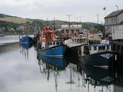
I had a very bad night's sleep last night, as a result of my neck aching severely. I am unsure exactly what I have done to it, but so far it has not really got any better. When I was walking it is not too bad, but it is very hard to get comfortable whilst in bead. It does not matter how many pillows I have or how I place them, my neck still hurt. As a result of this I had a much later start than I expected, and I was tired as I walked down the road eastwards out of Campbeltown, passing the jetty of the NATO POL (Petroleum, Oil and Lubricants) depot. Today is the longest day of the year, and where we are at the moment that means over seventeen and a half hours of daylight. The days may get slightly longer as I head northwards rapidly over the next few days, but officially this it the longest day.
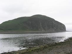
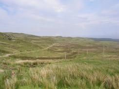
When I was planning this walk the section around the Kintyre peninsular was one that I was looking forward to with some trepidation. To head as far north as Cairndow at the northern end of Loch Fyne just to come a long way south again to round Kintyre looked soul-destroying, but in practice I found it to be a thoroughly enjoyable walk, including the little three-day diversion around Arran. Today I passed a little 188-metre hill marked on the Ordnance Survey map as 'The Bastard', and I can imagine that this was named by a long distance walker fed up with walking around Kintyre!
I met Sam in Southend as arranged, and I went into Mervan so that I could eat my lunch and so that we could work out what I was doing for the rest of the day. I felt perfectly fit aside from my neck and the weather was becoming increasingly clear so I decided to walk on to the Mull of Kintyre. The road leading up to the Mull is quite steep and I was concerned that Sam may not be able to get Mervan up it safely, but she had enquired at the Tourist Information in Campbeltown and found out that it was possible. The only downside of ending the walk at the Mull is that Sam will have to drive up there again in the morning in order to drop me off, but that should not be a problem now that she has already done the journey once.
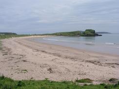
From Dunaverty Bay onwards I could see Ireland to the west, initially just as a grey vague line and then, from the Mull of Kintyre, more detail became visible. The coast of Northern Ireland is only twelve miles away from the Mull of Kintyre, and seeing it reminded me how near we had been to southern Ireland when we were at Strumble Head in Pembrokeshire. Also visible for much of today was the island of Sanda, which with its sister Sheep Island lies off the southeatern tip of Kintyre.
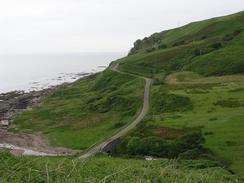
I found the climb along the road to the top of the Mull of Kntyre to be great, and I found the walk fairly easy despite the gradient being steep in places. I powered my way up the road, enjoying the views ahead and behind me, which were nice enough despite not being expansive. A few cars passed me, and these awoke me from my reverie as they passed, but aside fro this the time during the ascent just flew, with only the sheep for company. The sun was also out, and it started to get quite hot whilst I walked.
When I reached Mervan, which was parked in the car park at the top of the Mull, Sam and Graham were waiting for me. We had a quick chat but the mist was starting to roll in, so we decided to get going and make our way back down the road. I sat in the back with Graham whilst Sam drove, and we chatted about our trips so far. I am full of admiration for Graham, and it is also useful to hear about the route that he took through northwestern Scotland. Graham wanted to walk further this evening, so we dropped him off back at Southend so that he could continue northwards for a couple of miles back towards Campbletown. During this time Sam and I filled Mervan up with water, and retired to the pub in Southend to wait for Graham to finish so that we could pick him up and drive him to Campbletown.
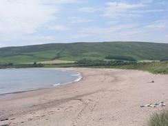
Tomorrow I am intending to walk northwards across the moralnd to Machrinish, which promises to be an absolutely superb high-level moorland walk. There is no path, but hopefully the terrain will not be too difficult. If the weather is bad in the morning then I may be tempted to take a lower-level, inland route instead as I do not fancy wandering across moorland in torrential rain, but hopefully it will be a nice day. Hopefully once I reach Machriniash I will be able to walk on further, as the stretch of beach to the north of the town looks as though it will be a lovely walk.
Directions
This walk starts off by the tourist information office in Campbletown. Head southeastwards past the harbour and then join a little promenade that heads along the southern shore of Campbletown Loch before joining a road near Kilkerran. Join this road as it passes a NATO refuelling pier and Island Davaar, before heading southwards. The road passes the house at Kidalloig before climbing up over Ballinmenach Hill, and the road continue in a rough southerly direction, with many ascents and descents, for several miles until Polliwilline is reached. Here the road turns to the right to head westwards, and after about fifty yards take a road that leads off to the left to head southwards to Macharioch, where it turns to the right to head westwards.
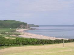
The road passes the little farm at Kilbride, and when it turns to the right turn left down a farm track that passes the farm at Aucharua. The track reaches a farm at Brunerican, which it passes and turns to head towards Conieglen Water. Turn left and then right to reach a little footbridge over the water. On the other side head westwards across fields to a little cottage, from where a track heads northwestwards into the village of Southend. Turn left to head out of the village past Dunraverty Bay, and then continue past Keil Point. Here the road curves to the right to head northwards, and after a mile turn left down a road that leads over Breackerie Water. It then curves to head southwards to the farm at Lephenstrath, and then on to Carskiey. Continue along the road as it climbs uphill for a few miles until it reaches a car park at the Mull of Kintyre, where this walk ends.
Distances
| From | To | Distance (m) | Ascent (ft) | Descent (ft) |
|---|---|---|---|---|
| Campbletown | Southend | 14.0 | 1808 | 1778 |
| Southend | Mull of Kintyre | 8.1 | 1637 | 535 |
This makes a total distance of 22.1 miles, with 3445 feet of ascent and 2313 feet of descent.
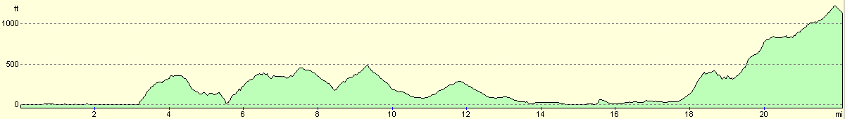
For more information on profiles, ascents and descents, see this page
Accommodation
We parked Mervan in Campbeltown for the night, which was handy for the local pubs that we frequented this evening.
Disclaimer
Please note that I take no responsibility for anything that may happen when following these directions. If you intend to follow this route, then please use the relevant maps and check the route out before you go out. As always when walking, use common sense and you should be fine.
If you find any information on any of these routes that is inaccurate, or you wish to add anything, then please email me.
All images on this site are © of the author. Any reproduction, retransmissions, or republication of all or part of any document found on this site is expressly prohibited, unless the author has explicitly granted its prior written consent to so reproduce, retransmit, or republish the material. All other rights reserved.
Although this site includes links providing convenient direct access to other Internet sites, I do not endorse, approve, certify or make warranties or representations as to the accuracy of the information on these sites.
And finally, enjoy your walking!
This walk was mentioned in the following routes:
| My walk around the coastline of Britain |
Nearby walks
| # | Title | Walk length (miles) |
|---|---|---|
| 477 | Grogport to Campbletown | 19.0 |
|
|

|