Walk #261: Aldeburgh to Chillesford via Orford
 |
 |
|
General Data
| Date Walked | 09/11/2002 |
| County | Suffolk |
| Start Location | South Warren in Aldeburgh |
| End Location | Chillesford |
| Start time | 08.10 |
| End time | 14.50 |
| Distance | 17.8 miles |
| Description | This was a nice walk around various river estuaries, winding inland and back out towards the sea. |
| Pack | Today I carried my 30-litre Karrimor HotRock rucksack, which was filled with my packed lunch, waterproof leggings, water bottle and a couple of spare shirts, together with the usual assortment of odds and ends. |
| Condition | I feel fine after this walk. I had no real problems all day, and I could have walked further if I had needed to. I had a few aches from my left ankle, but these did not last a long time and did not annoy me. |
| Weather | The weather today was far better than it was yesterday, with a mixture of sunshine and cloud and no sign of any rain. The wind was not very strong, which meant that the walk along the river banks was more enjoyable than they would have been if I was trying not get blown over. |
| OS map | Landranger number 156 (Saxmundham, Aldeburgh & Southwold) and Landranger number 169 (Ipswich & The Naze, Clacton-on-sea) |
 |
 |
|
 |
 |
|
Map of the walk
Maps courtesy of Google Maps. Route for indicative purposes only, and may have been plotted after the walk. Please let me have comments on what you think of this new format. For a detailed table of timings for this walk, please see the table file.
 |
 |
|
 |
Notes
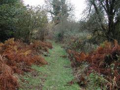
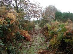
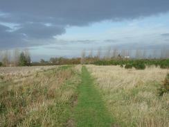
There was a section of path through the woodland to the east of Black Heath Wood that was very, very boggy - there were some sections of boardwalk and bridges over some streams, but the ground in between these was saturated after the rain of the last few days. This made for a very squelchy start to the day's walk, but fortunately my feet did not get wet.
Snape Maltings were taken over by the Aldeburgh Festival organisers and were converted into a concert hall in 1967. There are also some nice shops around, but they were all shut when I walked past them. The theatre burnt down in 1969 on the opening night of the festival, but it was rebuilt in 1970 and the festival continues to this day.
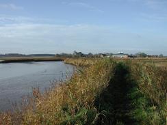
Today was the first day on this trip when I did not see the sea at all. I saw many miles of tidal estuary, but I never actually got to see the sea proper as Orford Ness was in the way. This was a strange feeling, as it feels like I should see the sea every day during a coastal walk. There will be a fair few more days like this on the trip, when walking up and down river estuaries takes me many miles inland.
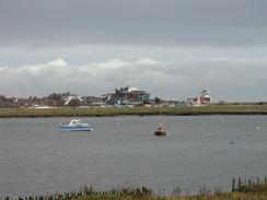
It was nice seeing the masts and buildings on Orford Ness across the river from where I was walking. For many years this was the home of atomic weapons research establishment in Britain, and before and during the war it was the place where radar was developed. One interesting fact that was on a Radio 4 program about the site recently was that radar was initially developed to detect ships at sea, and a few years before the second world war was developed into the earlier form of radar. Some of the masts date from the 'Cobra Mist' experiments conducted between 1967 and 1970, when sailors complained that masts of boats miles out at sea were glowing green a night! The tall radio masts are now used to transmit the BBC World Service programmes. Orford Ness itself is 10 miles long and is one of the longest shingle spits in the whole country and it grows at an average of sixteen yards a year.
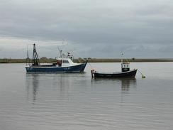
Orford was a very nice little town, and as I approached it the keep on the castle and the tower of the church were prominent above the other buildings. The castle was built between 1165 and 1173 and cost £1,413 9s and 2d, which was an enormous sum of money at the time. It was built for Henry II as pat of his power struggle with Baron Hugh Bigod who controlled the nearby Framlingham Castle. It is the oldest castle for which documentary building evidence has survived, and English Heritage now cares it for. The beautiful Church of St Bartholomews has a tall sixty-foot high tower; next to it there were a few ruins but I could not see if they were once part of the existing church or part of an earlier one. The history of Orford itself is dominated by the river; as the importance of the castle dwindled the harbour began to silt up, and by the end of the sixteenth century the shingle spit of Orford Ness had extended southwards, blocking the entrance to the harbour.
I had been very much looking forwards to seeing my first Martello Tower today, and I was not disappointed. There are many of these impressive structures dotted around the Suffolk, Essex and Kent coasts, and I have never seen one in the flesh before. Unfortunately I did not get near enough to walk around this one as I was on the other side of the river to it, but it was at least a taster of what is to come.
We had a feeling that we were going to have trouble finding accommodation for tonight, but Sam found an entry for a campsite at Chillesford in one of the club handbooks. Unfortunately when she phoned them up it turned out that they had stopped having campers, but when they heard what we were doing they very, very kindly allowed us to stay anyway. This solved the problem for the night, although it is a sign of how difficult it is getting sites now that winter is coming.
Tomorrow I have to walk down the Butley River to the sea, and then along the coast until I reach the River Debden. It is then a case of walking up the river to Woodbridge so that I can cross it, but I doubt if I will make it that far tomorrow, particularly as the weather forecast is for heavy rain in the morning.
Directions
Most of this walk follows the Suffolk Coast and Heaths Path, and so for most of the time the way markers will guide you well.
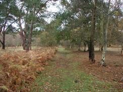
This walk starts off at the South Warren car park to the west of Aldeburgh, which is off the A1094 road. Follow a track that heads out of the car park past some cottages. When the track turns into the last cottage continue straight for a short distance on along a path that meets another track. Turn left down this track and follow it as it heads through the Cliff Plantation. Once it leaves the woodland an area of marshy land is crossed, with boardwalks and bridges carrying the path over the worst bits, before the path enters Black Heath Wood. Follow the path through the woods and then continue on westwards until the track meets a surfaced road to the left of a cottage. At the cottage continue straight on for a short distance until a road is met.
Just before the road is reached turn left down a footpath that heads southwards down a narrow path. When this path approaches the northern bank of the River Alde turn right and follow the bank of the river westwards until it meets a road to the south of Snape.
At the road turn left and cross the river Alde on the road bridge. On the southern side of the river pass the Snape Maltings and continue along the road until a road leads off to the left. Turn down this road and then immediately take a footpath that leads off to the left, to roughly follow the southern side of the River Alde.
The path continues across a marshy area through Iken Wood, through which some of the path is on a boardwalk, before reaching a car park. Pass the car park and continue on to the left of a couple of houses before turning to the right and reaching a road.
At the road the Suffolk Heaths and Coast Path splits. One branch continues south across the road directly towards Chillesford, cutting probably eight miles off the route; this route misses out part of the coast however so I went by the other route, which turns left down the road. Follow the road as it passes to the right of a farm and heads into the little hamlet of Iken. Do not turn to the left to go up to Iken Church but follow the road as it swings to the right to head southwards past Iken Common. Continue on as the road swings to the left past another road junction and heads uphill, passing Hill Farm before heading eastwards towards High Street. Just before High Street is reached turn right and follow the road southwards for about a kilometre before turning left to head eastwards down another road.
This road heads past to the south of Red House and continues on for a kilometre before turning sharply to the right. At this bend continue straight on down a sandy track that leads past the farm at Cowton before it becomes a footpath and drops downhill to meet the river banking beside the River Alde. Turn right and continue alongside the river banking (the map shows the path for this first section to be on the northern side of he bank, but I walked on the southern side) before climbing up onto the top of the bank and following the path to it's easternmost point opposite Slaughden, which is the northernmost part of Orford Ness.
At the point turn right and follow a path along the top of the river banking as it twists and turns alongside the River Alde in a rough southerly direction for about six kilometres. It passes a little building housing a water pumping station on the Sudborune marshes to the right before the masts and buildings of Orford Ness become clearly visible on the other side of the river.
Once Orford Quay is reached turn right and head up the B1084 road past a car park and towards the church. Follow the road as it curves around the church before turning to the right. At the right-hand bend take a footpath that leads off to the left down an unsurfaced track. Follow this track as it heads northwestwards for a mile until it reaches Sudbourne Hall. Opposite the hall turn right through an avenue of trees for a couple of hundred yards and then turn left along a narrow path through a short area of woodland before emerging out into a field. Continue along the path as it heads across Sudbourne Park, sometimes following a footpath and at other times a rough track. Eventually the path meets the B1084 road once more. The Froize Inn is about a hundred yards down the B1084 road to the left.
Distances
| From | To | Distance (m) | Ascent (ft) | Descent (ft) |
|---|---|---|---|---|
| South Warren in Aldeburgh | Snape Maltings | 4.1 | 92 | 118 |
| Snape Maltings | Orford Quay | 10.8 | 194 | 197 |
| Orford Quay | Chillesford | 2.9 | 92 | 66 |
This makes a total distance of 17.8 miles, with 378 feet of ascent and 381 feet of descent.
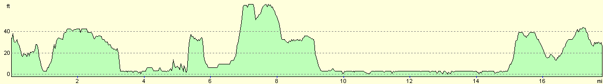
For more information on profiles, ascents and descents, see this page
Accommodation
The landlord of the Froize Inn in Chillesford very kindly allowed to park in his car park, which did not cost us anything and had an electrical hook-up beside it. This was very kind, and so we repaid him by going into the pub for a drink in the evening.
Disclaimer
Please note that I take no responsibility for anything that may happen when following these directions. If you intend to follow this route, then please use the relevant maps and check the route out before you go out. As always when walking, use common sense and you should be fine.
If you find any information on any of these routes that is inaccurate, or you wish to add anything, then please email me.
All images on this site are © of the author. Any reproduction, retransmissions, or republication of all or part of any document found on this site is expressly prohibited, unless the author has explicitly granted its prior written consent to so reproduce, retransmit, or republish the material. All other rights reserved.
Although this site includes links providing convenient direct access to other Internet sites, I do not endorse, approve, certify or make warranties or representations as to the accuracy of the information on these sites.
And finally, enjoy your walking!
This walk was mentioned in the following routes:
| My walk around the coastline of Britain |
Nearby walks
| # | Title | Walk length (miles) |
|---|---|---|
| 131 | Ipswich to Wickham Market Station | 16.7 |
| 132 | Wickham Market Station to Darsham Station | 12.7 |
| 260 | Southwold to Aldeburgh | 18.0 |
|
|

|