Walk #1047: Bolton to Blackburn
 |
 |
|
General Data
| Date Walked | 23/10/2019 |
| County | Greater Manchester, Lancashire |
| Start Location | Bolton station |
| End Location | Blackburn station |
| Start time | 07.56 |
| End time | 15.18 |
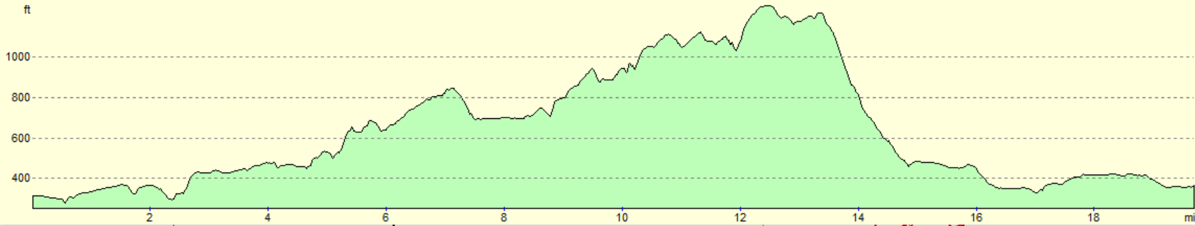
| Distance | 19.6 miles |
| Description | This was a surprisingly varied walk given the start and end points, with what - in good weather at least - are grand views from Darwen Tower, to waterside walking beside a reservoir, all topped off with a towpath stroll. There was also more than its fair share of bog and mud. |
| Pack | Today I carried my 30-litre Karrimor rucksack, filled with water, my spare waterproofs, a book and other odds and ends. |
| Condition | I feel absolutely fine after this walk. |
| Weather | The day was fairly mild for the time of year, but there was a layer of cloud that only allowed occasional glimpses of the sun. There was a very fierce breeze at the top of Darwen Moor by its tower, which made me want to get down off the top as soon as possible. |
| OS map | Landranger number 109 (Manchester, Bolton & Warrington) and Landranger number 103 (Blackburn & Burnley, Clitheroe & Skipton) |
 |
 |
|
Map of the walk
Maps courtesy of Google Maps. Route for indicative purposes only, and may have been plotted after the walk. Please let me have comments on what you think of this new format. For a detailed table of timings for this walk, please see the table file.
 |
 |
|
Notes
This was the last of the four walks I had planned for this mini-trip, and also the least important of them. I have to drive back to my parents’ this evening, so I had an early breakfast, booked out of the hotel and drove for half an hour to Bolton. I had the postcode of the Breightmet Street car park near the station, but when I pulled up it turned out to be a bit dingy. Worse, I was the only car in it. I was a bit nervous about leaving my car there, but I bought a ticket anyway, and then noticed that there was a car moving about nearby. This turned out to be in another part of the car park, and so I went and parked there, where there were at least more cars.
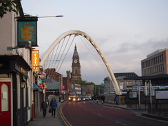
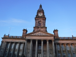
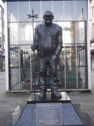
It was a short walk to the station, and I set off north out of Bolton in a good mood. In fact, the town centre impressed me: there was an eye-catching (if slightly dirty) bridge over a railway line, and a first-class Victorian neoclasssical Town Hall with a splendid columned portico and steps. The pedestrian plaza outside it was clean and tidy and although the town does not give off an air of opulence, neither does it appear as down-at-heel as Wigan. There was also a statue of local-man-turned-good Fred Dibnah, the lumberjack who caught the nations’ hearts in the 1980s.
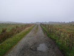
Roads led north out of the town, and I changed my plans somewhat by missing out on a loop I’d planned to the east of the road - it was too early in the day for what was probably not a scenic stretch, and I was pushed for time if I was to get back to my parents in time to put Robert to bed.
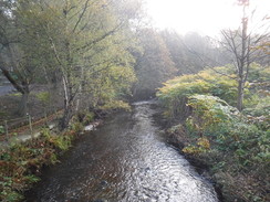
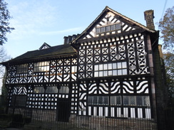
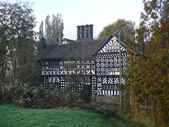
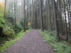
Instead, I took a residential road that led to the A58, and then a rather muddy, dark and undistinguished track uphill, with the Eagley Brook far below. I was just thinking that this was a very bland stretch of walk when, at the top of the hill, an Elizabethan wonder came into view: the Hall i’ th’ Wood. This early 16th Century half-timbered house is now a museum, and was where Samuel Crompton developed the first spinning mule. It is a magnificent gem of a building in a rather surprising setting.
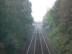
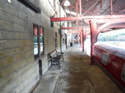
Another muddy path took me north from the house, onto playing fields and then along a narrow path that followed the Bolton to Blackburn railway line. Residential roads then took me past Bromley Cross station, and I nipped through a gate at a pedestrian crossing to take a photograph of the station. When I turned around to leave the gate was locked, so I assumed that the signalman had done this to prevent people from crossing the line in front of an oncoming train. I waited for a minute, and was embarrassed when a toddler came up and pushed the gate open: like a real plonker, I had been pushing on the fence, not the gate!
A road became a track that headed through the middle of a farm above the Jumbles Reservoir, before a path headed uphill to run alongside the railway line. Another path then headed further uphill, passing under the railway through a narrow archway, to enter a golf course. There was a small footpath marker pointing in the wrong direction and, thinking there might be a little diversion across the course, I followed it. When it became clear that I was heading too far out of my way, I retraced my steps and carefully followed the edge of the course around until I found a path heading out of it. It appears too many golf courses are reticent to mark their paths correctly.
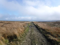
With hindsight, a better route might have been to make my way to the Turton and Entwistle Reservoir via the valley bottom and the Jumbles and Wayoh reservoirs, but instead a fairly nondescript track took me north along the edge of a hillside. During planning this walk, I had looked at climbing Cheetham Close and Turton Heights off to my left, but they were firmly wreathed in cloud this morning and looked distinctly unappealing.
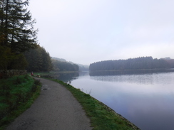
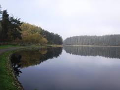
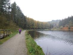
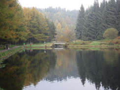
The track descended down to a main road, after which another path took me past a car park to the banks of the Turton and Entwistle Reservoir. I followed this for the best part of a very pleasant mile as the sun tried to break through the cloud overhead. My mood, which had dipped during the trudge along the track, lightened with the sun.
Three reservoirs nestle in the valley of the Bradshaw Brook, to the east of the Turton Heights and northeast of Bolton. These are the Jumbles, Wayoh and Turton and Entwistle Reservoirs, and they were constructed by the mill owners of Bolton to regulate the supply of water downstream to their factories. Turton and Entwistle Reservoir, which I walked alongside, was built in 1832 and at the time had the highest dam in Britain, at 108 feet. Wayoh reservoir was built in 1872, and the Jumbles joined it as late as 1971.
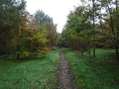
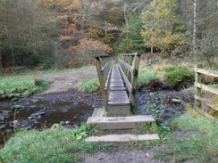
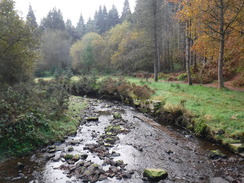
A footbridge crossed the reservoirs inlet stream, which I followed upstream to a second footbridge. Here I made a slight mistake and followed a broad, good track that rose up into the trees. I had not gone too far before I realised that I should have emerged from the trees by then, and so headed back down. A stile by the footbridge led to the proper path, which climbed past gorse onto an area of very boggy land. I quite like boggy areas, and whilst not a joy to walk, the wet and saturated path provided me with plenty of bog-jumping moments, although my walking poles remained firmly strapped to the side of my pack.
Another path soon led uphill, and this too was boggy, with foul-smelling orange water lying in puddles. It became a track, which soon deposited me at a main road. It seemed sensible to get my walking poles out, so I detached them without taking my rucksack off (a useful little trick) and extended them. One, however, would not tighten, and a little examination as I trudged along the pavement showed that the expanding nut at the end of the thread had come off. Assuming it was loose inside the upper part, I tried screwing the middle part into the upper, to no avail. Instead, I extended the other third of the pole, so that it was at least more balanced to carry.
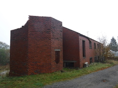
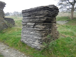
A track led from the main road uphill, and on this I eventually managed to get the recalcitrant pole working properly. A ruined building beside the track had a curious feature: a high stack of odd material, which had obviously been bagged material at some point but had been altered and weathered over many years into an almost organic-looking substance. I just could not work out what the odd, fibrous material was - it looked something like shredded tyres of fragments of shells.
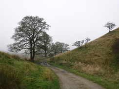
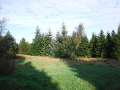
A little further up the track, I came across a couple resting having their lunch. We started chatting, and after they packed up, we walked on together. They were getting ready to lead a group walk, and were just reconnoitring the route in advance. It was a very pleasant chat, but they were only doing ten miles, and so I left them behind as the path entered a patch of woodland.
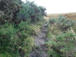
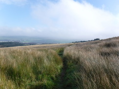
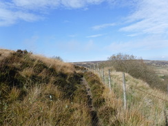
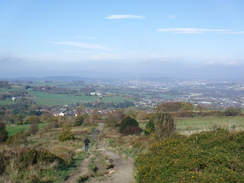
The path emerged from the trees into what should have been a highly pleasant stroll along the edge of the moorland; it was relatively flat, unstrenuous and offered some great views down over Darwen. Unfortunately the path was boggy, and although some stretches had been paved with slabs, weeds had overgrown these, obscuring them. It was not a hard walk, but I had to concentrate more on where I was putting my feet than the views around me.
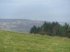
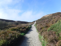
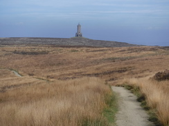
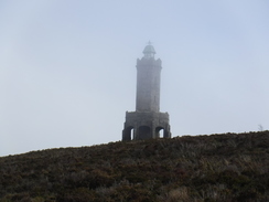
The path eventually joined a track near a white house that seemed out of place so high up on the moors. I then decided to change my route slightly; instead of risking another stretch of boggy path, I headed along a track that climbed up onto the top of Darwen Moor. This proved to be an inspired decision, as it granted me some great views west from the moor. Soon afterwards, I approached the spectacular Darwen Tower.
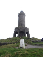
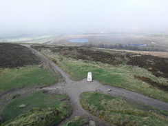
Darwen Tower (actually the ‘Jubilee Tower’) was a most spectacular find, and it is good to see that it is open to the public, who can climb it with no entry fee. It was built in 1898 to celebrate Queen Victoria’s Diamond Jubilee, and its 85 feet in height is made even more prominent by its location on the highest point on the moor. The tower should have a special place in the hearts of walkers, as it also commemorates the ‘Battle of the Moors’, where a landowner tried to prevent access onto this land, only to lose in court. This predated the Kinder Trespass by decades, and I’d never heard of it!
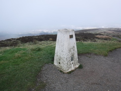
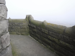
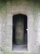
I had not been expecting to find a tower on top of the hill, and was surprised when I had first seen it standing proud on its hilltop a few miles back. The couple had told me that you could climb it, so after paying my respects to the trig pillar, I entered the dark interior and climbed the spiral staircase. This was a rather gloomy climb, and I emerged onto the first level to be greeted by an unexpectedly fierce breeze. The moors’ bulk had sheltered me from the wind on the approach, but the tower sat at its highest point and offered no respite.
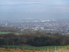
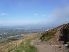
The wind and the dark staircase made me decide not to go to the very top, and instead I descended and started down the hill, passing a family pressing themselves into a bank for shelter as they ate their lunch. The descent was along a steeply-descending rutted track that offered some grand views over the industrial towns to the east and north. How lucky they inhabitants are to have such hills on their doorsteps, compared to the lowlands of Cambridgeshire where I live!
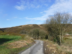
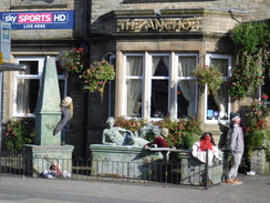
Sadly, this had to end, and a suburban road took me down to the main A666, which headed arrow-straight into Blackburn. A pub had a suitably demonic display, with dummies dressed ready for Halloween clambering up to the upper windows. It was brilliant, and full marks to the owner. The road passed under the M65 and continued north, eventually passing close by Ewood Park, the home of Blackburn football club. It seems odd that there is not a top football club within twenty miles of my home in Cambridgeshire (sorry, Cambridge United!), but this area seems filled to the gunwales with football and rugby clubs. They must love their sport!
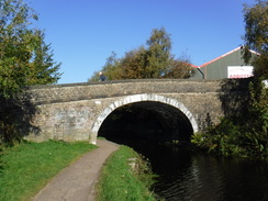
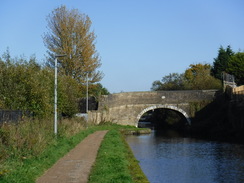
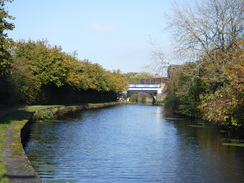
A little further on I passed under an imposing aqueduct, and took a steep path to join the Leeds and Liverpool Canal towpath. Unfortunately the path proved to be totally overgrown, so I scrambled up a bank and climbed a stone wall onto the towpath, much to the dismay of a man who had been following me!
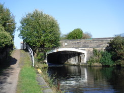
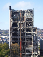
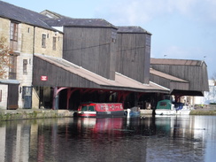
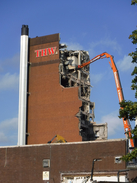
I had two pressures on me: I was keen to maintain my streak of walking more than twenty miles every walk, but I also wanted to get back to my parents’ in time to put Robert to bed. Hoping I could do both, I followed the canal eastwards, in the opposite direction to that I had walked earlier in the year. The sun was shining, it was warm for the time of year, and I felt in my element. A long-armed digger was busy permanently changing Blackburns skyline, nibbling away at the remnants of a brick-and-concrete tower that had once belonged to Thwaites brewery. I headed under a superbly-restored covered wharf at Eanam, where the landlord seemed very keen to chat to me about other walkers who had come past.
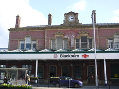
From there, it was simply a case of following roads into the town centre. Despite my extension along the canal, I did not quite reach twenty miles - although I am secretly glad, as it removes that burden off my shoulders in future walks. I had twenty minutes to wait for my train back to Bolton, and the drive home proved quick and easy, meaning I arrived in time to give Robert a bath before putting him to bed.
All in all it had been a very good four days walking, with varied terrain and scenery. Liverpool and Merseyside is not classic walking terrain by any means, but it has its moments.
 |
 |
|
Directions
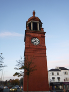
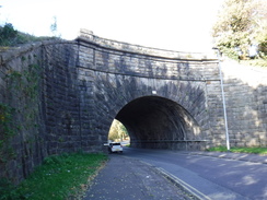
This walk starts off from Bolton railway station at SD71820871. Leave the station at the exit by the clock tower, and turn right to head north up Newport Street. This soon crosses a distinctive bridge over a railway line and reaches Great Moor Street. Cross this, and continue north along a pedestrianised street. This passes the impressive Bolton Town Hall on the left in Victoria Square, and a short distance on becomes the B6204 Knowsley Street. Follow this north until it ends at a T-junction with the B6205 at SD71570956.
Carefully cross the road ahead, and then turn right along it. When a crossroads is soon reached, turn left to head north up the B6206 Higher Bridge Street. This soon reaches the A673 dual carriageway; carefully cross this and continue north along the A673. It becomes Blackburn Road; 1.6km after the A673, and shortly after crossing the Astley Brook on a bridge, turn right to head east along Seymour Road. After 500 metres this ends at a T-junction with the A58 at SD71951142.
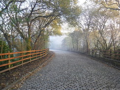
Turn right down the road for a short distance, and when the railings on the other side end after a few metres, carefully cross the road to the northern side, and then turn right for a few more metres to a sliproad that leads off to the left. This soon becomes a cobbled road that curves left to reach a bridge over the Eagley Brook. Cross the bridge, and just before some gates on the other side, turn right down a couple of steps to join a narrow path that squeezes between the stream on the right and a fence on the left. The path soon curves left and starts to climb between low walls through trees, broadening out as it curves right. The path forks; take the right-hand branch that continues to climb, suddenly emerging out beside the Hall i' th' Wood Museum at SD72381163.
By the museum, turn left past a cycle barrier to join a path that heads north, with fences guarding houses on the right and a steep drop down to the Eagley Brook on the left. The path soon emerges onto a playing field; turn right to follow the right-hand boundary of the fields eastwards. At the far corner of the field, turn left to parallel the top of a railway cutting for a short distance, until an ornate footbridge over the railway line is reached. Turn right to cross this, and immediately on the other side, turn left to follow a footpath that runs north, with the railway line down to the left. After 150 metres the path descends a few steps to meet Oaks Lane at SD72851200.
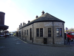
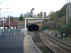
Turn left to follow the lane for a few metres to a level crossing over the railway line. Carefully cross the railway, and immediately on the other side turn right along a path that parallels the railway on the right northwards. When the path forks, take the right-hand branch to continue beside the railway line. 850 metres after the level crossing, the path emerges past a cycle barrier onto the B6472 Darwen Road. Turn right down this (there is a pavement on the other side), and pass under a railway bridge. Immediately on the other side, turn left to head north up Shady Lane. When this forks, take the left-hand branch for a short distance to reach Bromley Cross railway station at SD72931312.
Pass the station and head on along High Shady Lane as it passes between houses. When the road ends at a turning area in front of a house, turn left along a narrow path that leads from the turning area. The path soon curves right to approach a footbridge over the railway line. At the base of the footbridge, turn right down a broad surfaced path that soon ends at a T-junction with Grange Road. Turn left to follow Grange Road as it winds northwards; it passes through the middle of Grange Farm and approaches the Jumbles Reservoir below and to the right. After 800 metres on the road, a cycle barrier is reached ahead at SD73301418.
Just before the barrier, turn left through a clappergate beside double field gates to join a track that runs between fences uphill. This soon curves slightly to the right as it climbs, and as the gradient flattens out go through a clappergate and continue another the path as it runs beside the railway line to the left. As the field narrows, cross a stile on the left and continue following the railway line. It passes a flat open area and curves right to start downhill towards a road; shortly after the bend, turn left down a short stretch of footpath that leads onto the B6391 Chapeltown Road. Carefully cross the road to reach the pavement on the other side, and then turn right to follow the road downhill away from a railway bridge. Immediately after passing a driveway leading up to a house on the left after 75 metres, turn left to join a footpath at SD73051476.
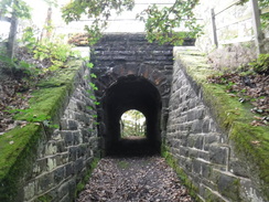
This footpath runs westwards uphill between fences, soon squeezing through a narrow arched bridge under the railway line. Cross a stile into a rough field, and descend to cross a wooden causey and stile to reach a plank bridge over a brook. On the other side, the path starts climbing uphill through scrub woodland before emerging through a clappgate out onto the Turton golf course. Note: golf courses can be dangerous places, and this one was poorly signposted. Take care when using this route. The route I took was to turn right and carefully follow the right-hand edge of the golf course; it soon curves to the left and after 300 metres reaches a track at SD72511494. This is not the official route, however, but it did not involve crossing any greens.
At the track, turn right to immediately follow it to a gate beside double field gates that lead out into open country. A good track heads northeastwards, descending slightly across a field. It passes under some power lines and then, as the main track curves right, turn left through a gateway to join another track that follows a wall on the left. This continues skirting the hillside, curving to take a more north-northwesterly direction. The going is easy and, 2.4km after the golf course, the track enters some woodland and approaches the B6391 road. Just before the road is reached, turn right down a path that runs between fences for about fifty metres to reach the road at SD71921689.
Carefully cross the road, and on the other side go through a bridleway gate and follow an obvious path that heads northeastwards across moorland. This soon goes through another bridleway gate to meet a surfaced access track; cross this and continue along the path as it heads through scrub woodland. The path becomes rougher as it starts to wind around and descend, until it meets a surfaced path. Turn left along this for a few metres to reach Entwistle Reservoir Upper car park. Cross the car park, keeping its edge to the right, and at the far side turn right to descend some steps that lead to the path that runs around the reservoir at SD72131727.
Turn left to follow the path west, with the water on the right. After 1.4km the path curves to the right to reach a little footbridge over the reservoir's inlet stream. Cross the bridge, and on the other side turn left along another path that follows the stream on the left upstream for a short distance to a second footbridge. Keep the footbridge to the left, and cross a stile ahead to enter some woodland at SD70901775. Do not take the broad path from the second footbridge that climbs into the trees.
The path curves right to a second stile and a short stretch of boardwalk, after which the path emerges from the trees and starts to climb up a scrubby area, before the gradient slackens and the path curves right at the corner of a barbed-wire fence to cross a boggy area of ground. 300 metres after leaving the trees, an indistinct junction is reached with another path at SD71181782. Turn hard left to join the other path as it almost doubles back, gently climbing and curving right to take a more northerly course, becoming a track as it does so. The gradient eventually slackens, and after 750 metres cross a stile beside a field gate to reach a T-junction with a better-quality track. Turn left along this track, immediately go through a gate beside a cattle grid and follow it as it curves around to the right. After 300 metres cross a stile beside a field gate as the track ends at the A666 at SD70641861.
Turn left to follow the road south, passing the farm at Cadshaw. There is a pavement on the left-hand side of the road. After 250 metres, pass the farm entrance on the right, and a few metres further on carefully cross the road to reach a stile that leads onto a track. Join the track and follow it to a field gate; go through this and follow the track as it starts to climb uphill, with a fence on the left. After nearly 200 metres the track curves to the right; shortly afterwards, cross a stile beside a field gate and turn left along a track to pass an old ruined building on the right. Continue along the track it as it winds around, and 380 metres after the ruined building it curves right to head diagonally up a slope. It meets a fence on the left; continue on for a few metres to reach a stile beside a field gate in the field corner at SD69951891.
Cross the stile, and follow a wall on the right. After 520 metres, a stile is reached on the right at SD69561925. Turn right to cross this and a boardwalk into a field, and angle left diagonally across this, aiming for a small area of woodland ahead. The path crosses a track before reaching a stile that leads into the trees. Follow the obvious path as it heads diagonally through the woodland. It emerges to another stile at SD69421962.
Cross the stile and follow the path as it heads west along a hillside, with a fence to the right. The path is boggy and overgrown, with occasional stretches of causey slabs. Cross a stile through a fence and continue on. The path curves slightly to the right to head in a more northwesterly direction, roughly towards a white house ahead. Ignore any paths leading off. 1.1km after leaving the woodland, the path crosses a couple of gullies, before meeting a track near the house at SD68472005.
Turn right to head straight on down the track; it curves around a hairpin above Duckshaw Brook, and shortly afterwards turn left (essentially doubling back) up a good gravel track. This climbs west-northwestwards; when it forks, take the right-hand branch. The track levels off as it crosses Darwen Moor, and after 850 metres it reaches another track at SD67692057.
Turn right along this, and follow it as it almost immediately curves left along the moor's western edge. After 670 metres it turns sharply to the right to head in a more northerly direction, and when it forks, take the rougher right-hand branch that slowly ascends to approach Darwen tower. A short path ascends from the track to reach the tower at SD67852159.
Leave the tower, and descend a path northeastwards that reaches a crossing after a few metres, head straight on to descend down a track northeastwards; it soon curves left to take a more northerly course. 750 metres after the tower, it goes through a gateway to meet another track; head straight on to continue heading northwards downhill. The track soon branches; take the left-hand branch. This curves around, and after 330 metres emerges onto Sunnyhurst road at SD67972249.
Turn right down the road for a few metres until it ends at a T-junction with Sunnyhurst Lane. Turn left down the road, and follow it as it curves around to the right, slowly descending as it becomes Earnsdale Road. After 1.2km it ends at a T-junction with the A666 Blackburn Road at SD68552334. Turn left to start following the road north; it passes under the M65, and after 3km it passes Ewood Park football stadium on the right, and curves left to meet a roundabout (apparently called "Shearer's Island") at SD67572602.
Here turn right, to follow a dual carriageway north. Take the second road off to the left, Aqueduct Road, and follow it as it heads through a bridge under the canal. Immediately on the other side, turn right up a grassy path. Note: the following path was very overgrown; you might be better to find another route to the canal towpath via Hamilton Street and Hollin Bridge Street. The path climbs steeply, and becomes very overgrown before it soon joins the canal towpath at SD67662656.
Turn left to follow the canal as it heads northeastwards through Blackburn. After 2.7km the towpath passes under the covered roof of Eanam Wharf; pass this and the pub, and just before the next road bridge, turn left to leave the towpath. Pass the front of the pub, and then angle right for a few metres to reach High Eanam Road at SD68902821.
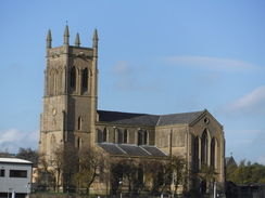
Turn left along this, and head straight on at a roundabout (there is a convenient path to skirt it), and continue on along Eanam road. This becomes Salford Road, and when this curves left, continue straight on along Church Street, passing Blackburn Market on the right. The road curves left, passing Blackburn Cathedral off to the left. Take the first road off to the left, Jubilee Street, and follow it for a short distance until it reaches Blackburn railway station at SD68462792.
 |
 |
|
Distances
| From | To | Distance (m) | Ascent (ft) | Descent (ft) |
|---|---|---|---|---|
| Bolton station | Bromley Cross station | 3.8 | 308 | 148 |
| Bromley Cross station | Cadshaw | 6.0 | 892 | 459 |
| Cadshaw | Darwen Tower | 3.5 | 725 | 364 |
| Darwen tower | Blackburn station | 6.3 | 131 | 1024 |
This makes a total distance of 19.6 miles, with 2094 feet of ascent and 1995 feet of descent.
For more information on profiles, ascents and descents, see this page
Transport
Regular direct train services run between Blackburn and Bolton. During the daytime on a weekday, these run approximately every half hour. See the National Rail Enquiries website for more information.
 |
 |
|
 |
 |
|
 |
 |
|
 |
 |
|
 |
 |
|
 |
 |
|
 |
 |
|
 |
 |
|
 |
 |
|
 |
 |
|
 |
 |
|
 |
 |
|
 |
 |
|
 |
 |
|
 |
 |
|
 |
 |
|
 |
 |
|
 |
 |
|
 |
 |
|
 |
 |
|
 |
 |
|
 |
 |
|
 |
 |
|
 |
 |
|
 |
 |
|
 |
 |
|
 |
 |
|
 |
 |
|
 |
 |
|
 |
 |
|
Disclaimer
Please note that I take no responsibility for anything that may happen when following these directions. If you intend to follow this route, then please use the relevant maps and check the route out before you go out. As always when walking, use common sense and you should be fine.
If you find any information on any of these routes that is inaccurate, or you wish to add anything, then please email me.
All images on this site are © of the author. Any reproduction, retransmissions, or republication of all or part of any document found on this site is expressly prohibited, unless the author has explicitly granted its prior written consent to so reproduce, retransmit, or republish the material. All other rights reserved.
Although this site includes links providing convenient direct access to other Internet sites, I do not endorse, approve, certify or make warranties or representations as to the accuracy of the information on these sites.
And finally, enjoy your walking!
Nearby walks
| # | Title | Walk length (miles) |
|---|---|---|
| 693 | Stockport to Bolton via Manchester | 18.2 |
| 1037 | Leeds and Liverpool Canal: Burnley to Cherry Tree | 21.0 |
|
|

|