Walk #1041: London Loop: Moor Park to Barnet, and then down to Finchley
 |
 |
|
General Data
| Date Walked | 30/03/2019 |
| County | London, Hertfordshire |
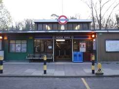
| Start Location | Moor Park station |
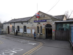
| End Location | Finchley Central station |
| Start time | 06.37 |
| End time | 16.01 |
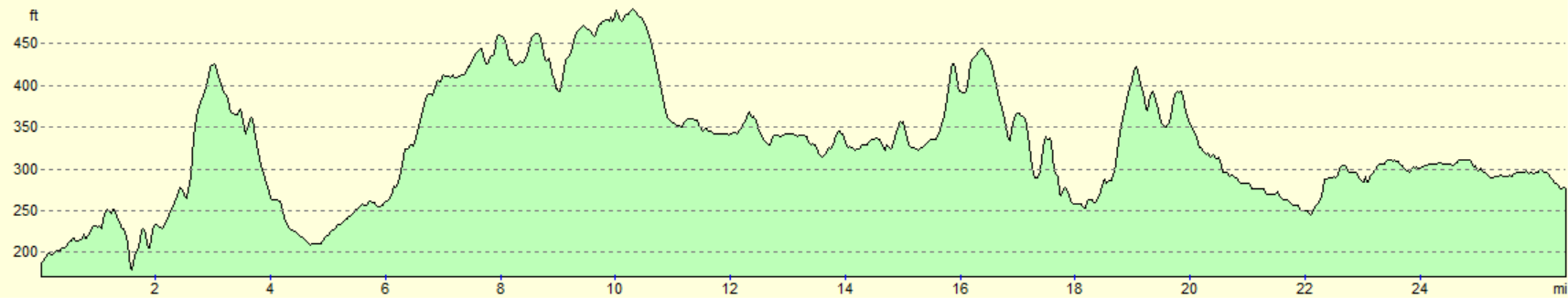
| Distance | 26.5 miles |
| Description | This was a generally pleasant walk following the London Loop walk east across north London, followed by an extension along roads from Barnet down to Finchley. . |
| Pack | Today I carried my 30-litre Karrimor rucksack, filled with water, my spare waterproofs, a book and other odds and ends. |
| Condition | I feel rather tired after this walk, but have no blisters or other issues. |
| Weather | Today started off with cloudless skies and quite chilly, although there had not been a frost. It got warmer during the morning, and although the sky became cloudier as the afternoon wore on, it was a very pleasant day for a stroll. |
| OS map | Landranger number 176 (West London, Rickmansworth & Staines) |
 |
 |
|
Map of the walk
Maps courtesy of Google Maps. Route for indicative purposes only, and may have been plotted after the walk. Please let me have comments on what you think of this new format. For a detailed table of timings for this walk, please see the table file.
 |
 |
|
Notes
A birthday weekend away to Oxford had prevented me walking last week, so I set off very early this morning for the drive down to London and the last leg of the London Loop. It was fairly foggy in places, although the lengthening days meant that I did most of the drive in the light – and I was driving Sencan's car as mine has (ahem) issues and is awaiting a service.
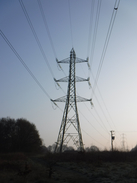
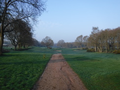
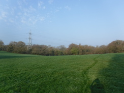
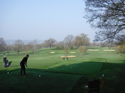
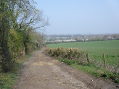
I now knew how to reach Moor Park station, so had none of the problems I'd faced before my previous walk, and I parked up, got my kit on and headed off – this time without having to get a train. I walked to the point I'd left the London Loop on the last walk, and headed down under the railway and beneath power lines to reach a golf course. I was surprised to see a few men playing a round, and the clear, sunny skies meant that it was a beautiful place to be.
The golf course ended at a minor road, and I went slightly wrong here , taking a footpath that led out to a main road, when I should have kept along the former. Fortunately the mistake was easily corrected, and I followed the minor road to the point I'd left it and returned. My annoyance was soon lifted by a rather pleasant stroll through scrubland to a road, and then through Oxhey Woods.
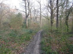
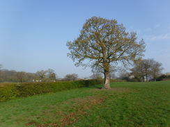
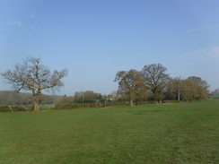
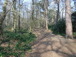
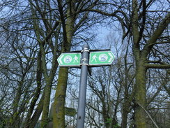
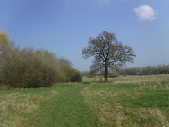
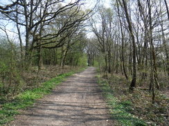
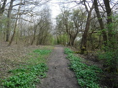
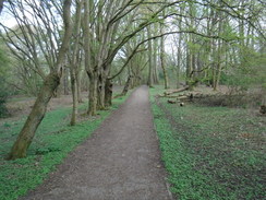
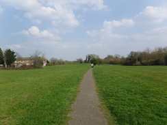
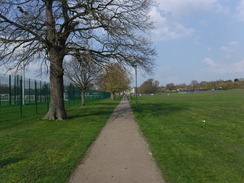
The expanses of woodland I'd walked through earlier in the year had sometimes seemed rather bleak in their winter coats, but now the trees were starting to bud and wildflowers were scattered on the ground. When combined with the sunshine, it made this stretch seem very welcoming. The trail crossed two roads whilst it tried to stay in the woods for as long as possible, but it eventually left the trees to wind around a farm and approach Hatch End. It never actually entered the built-up area, although it did follow a narrow path behind garden fences for a while, but it soon broke out into an open field and paralleled a railway line before reaching a main road.
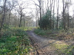
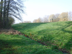
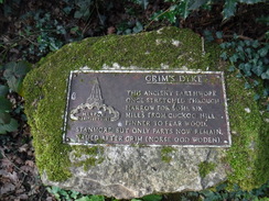
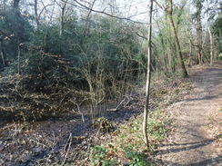
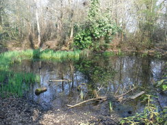
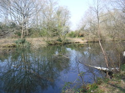
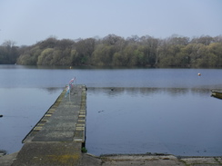
An annoying road plod followed, before the trail climbed up past Grim's Dyke Golf Club, and past the dyke – an old Saxon construction, of which this is one of the few remaining stretches. A stone memorial to the dyke sat beside the track, after which the trail dived into more woodland. I made another mistake here and followed the dyke for too long – fortunately I realised after a few minutes and headed back, so little harm was done. The trail wound through the trees and passed Gilbert's Lake, where Sir William Gilbert drowned in 1911. One of my favourite songs is "The Modern Major-General Song," which he co-wrote with Arthur Sullivan, and I sung it quietly as I headed through the trees.
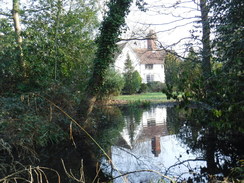
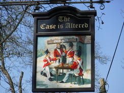
The path left the trees and joined a road to pass a pub, 'The Case has Altered,' which featured interesting signs including the red jackets of Napoleonic soldiers. However it soon dived back into the woods for a pleasant stretch that ended at a main road. The trail then passed the grounds of Bentley Priory – once an RAF station (and what an unusual spot for that, with no airfield nearby), which is now being converted (you guessed it) into housing. The fences that once guarded the site were still present, if rusty in places, and I wondered if the housing development would have the same unfriendly air that Moor Park did – a question that seemingly resolved itself when walking out of the grounds through a gated housing development that also seemed rather overly security conscious.
The trail then made a looping diversion south to pass lakes at the very northern tip of Stanmore, before passing an orthopaedic hospital and diving downhill along a track and across a field to reach a road and a bridge under the M1. A long and fairly uninteresting road walk followed eastwards to Aldenham Reservoir, where a sign pointed along the road, whilst the map showed the trail following the lake edge. It did not look as though the sign had been altered so I followed that, only to realise that I'd made the wrong decision when I found waymarkers pointing down a different path. I headed back along the trail to where I'd made the mistake, checked that the signpost pointed in the wrong direction (it did), and walked back past the reservoir. Annoyingly this was not a pleasant lakeside walk, with the path a fair distance from the water, and with a large fence between the two for much of the way.
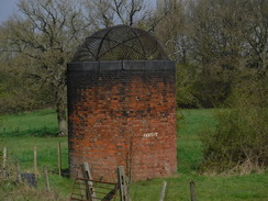
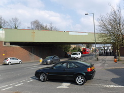
The trail headed across a field, past signs guarding a track leading to The Haberdashers' Aske's School – and you've guessed it, the signs weren't friendly or welcoming. It then met a main road – the old Watling Street – and climbed up fields, before descending past a golf course to reach a road that led into Borehamwood. Since this was the same road I'd been on ten minutes earlier, the diversion seemed rather unnecessary! Before the trail reached Borehamwood station, it diverted off south along a road that ended with a stiff climb up to meet a main road. This then led east, with two brick shafts in a field marking the twin 'Elstree' tunnels, built by the Midland Railway as part of their extension to St Pancras.
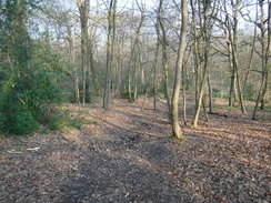
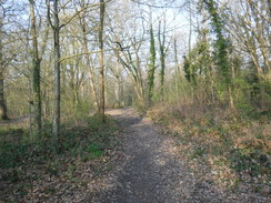
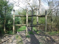
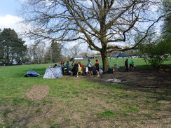
Eventually the trail left the main road and headed into Scratch Wood. This was another pleasant walk through woodland, guarded by a massive wooden structure at its entrance that seemed more fitting for some jungle temple than London! The trail soon emerged out into a clearing, where many people were enjoying picnics in the sunshine – despite the proximity of A1 and M1! I wished I could be joining them, but instead the trail headed back into the woodland and eventually down to the A1.
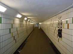
I have walked stretches of the A1 in Edinburgh, Northumberland, St Neots, and now London. Of all of them, this was the least pleasant, with the roadside verges packed with litter and a stationary queue of traffic waiting to go down into London. Eventually an underpass took me to the other side of the road, where I was faced with a long plod back. Eventually a track led away from the hateful dual carriageway into the Moat Mount Open Space, where a path climbed uphill before descending across fields to yet another road.
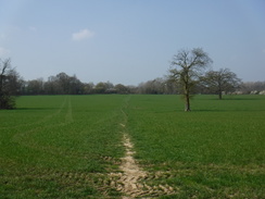
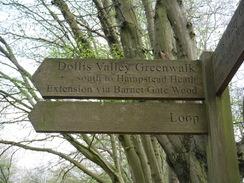
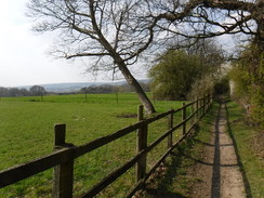
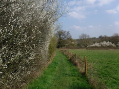
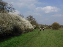
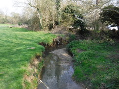
This was all packed with a near-stationary queue of traffic, and I managed to keep up with a Range Rover as I strode along. Eventually (and thankfully) the trail left the road and headed across fields before joining a little stream – the formative Dollis Brook. There were some delightful stretches of hedge bedecked with white curtains of flowers, and what had been a fairly urban walk suddenly became magical.
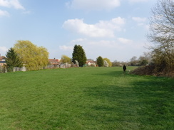
An enjoyable stretch of trail followed the brook east into Barnet. I met two people who were walking the trail in segments, as preparation for the Camino de Santiago, and we chatted for a few minutes before I headed on, eventually leaving the brook and heading across playing fields to reach a main road, where I had started on the trail three months earlier. I allowed myself to feel satisfaction at having finished another trail, and then wondered what to do next.
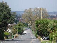
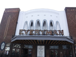
I could have walked up to High Barnet tube station, where I started the trail on January 1st. As I was feeling very fit, however, I decided to extend the walk by walking south: the road more or less paralleled the tube line, meaning that I would pass a station every mile or so. I set off, soon passing a delightfully old-style cinema, and continued south.
I was feeling a little peckish, so I nipped into a chip ship and got an absolutely massive tray of delicious chips that I munched as I walked on. However it was now the mid-afternoon, and I still had to get back to my car and drive home, so I decided to call it a day when I reached Finchley Central station.
The London loop is not a classic trail; it is too urban for that. However it is far better than it has any right to be for its location within the M25, and there are many sections that I would definitely do again in the future if the opportunity arises. It was well worth doing.
 |
 |
|
Directions
This walk starts off at Moor Park tube station at TQ08579348. Leave the station, cross the roundabout immediately in front, and walk up Main Avenue, passing shops on the right. Take the first road on the left, Wolsey Road, and follow it as it heads south-southeastwards. After 750 metres some power lines are reached overhead at TQ08789272; here turn left down a path, joining the London Loop.
The path initially runs between a hedge on the right and a fence on the left; it widens out and crosses a grassy area before reaching Station Approach. Cross this, turn left for a metre and then right down an access road that heads through a low bridge under the railway line. Immediately on the other side of the bridge, turn left along a path that runs between fences that leads to a cycle squeeze. On the other side, turn right across some rough ground, roughly following power lines overhead. The path climbs uphill and passes a pylon on the right at TQ09159304.
Immediately after the pylon, the path curves slightly left across the rough grassland. It skirts a golf course on the left for a short distance, and then angles left to join a small track. After a few metres, turn right to head uphill along another track. Follow this as it climbs uphill with a ditch on the right; when the track and the ditch end, curve slightly left across a fairway, aiming for the left-hand side of a small bank. Pass this on the right, and head on across the course. The path curves left across the course, leaving the course via a track through a tunnel of trees to reach Sandy Lodge Lane. Turn right to head east along this road for 170 metres until it ends at a T-junction with the A4125 at TQ09779377, next to a service station.
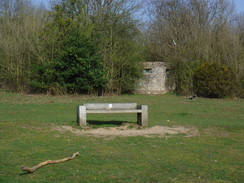
Carefully cross the road, and on the other side join a path that climbs up through an area of scrubby woodland. When this soon meets a wider footpath, turn right along it, and follow it as it curves left. The path soon emerges from the trees into a grassy area; continue on towards a bench beside some trees on the left. Pass the bench, and then continue across the grassy area towards houses ahead. At the houses, go through a clappergate and continue on for ten metres to reach Ashburnham Drive. Turn right along this road which curves left; after 120 metres it ends at a T-junction with Hayling Road at TQ10079341.
Turn left along the road for a short distance, and then right down Nairn Green. When this road soon ends, continue straight on along a path that leads into Oxhey Woods. After about ten metres, turn left along another path and continue on southeastwards through the trees. The path becomes wider and muddier as it curves to the right to start heading uphill, immediately crossing a sleeper bridge over a tiny ditch. It heads uphill to the south; when the gradient slackens, continue straight on along a path through the trees. 600 metres after the ditch, the path curves left as a path comes in from the right. The path then slightly curves right to head towards a vehicle barrier beside a house. Go under the barrier to reach Oxhey Drive at TQ10559263.
Cross the road, and on the other side pass a little barrier to join a path that continues on through Oxhey Woods. Head east along the path, ignoring any paths leading off; after 180 meters it curves to the right, and after another 200 metres it reaches the B4542 road at TQ10799240.
Carefully cross the busy road, and on the other side go through a clappergate to join a path that continues through the woodland. It soon turns left to joins another path that comes in from the right. At the top of the hill, turn left along a path that heads away from the main broad path and heads downhill. The path descends to cross a little footbridge over a stream, and continues on through the trees to a second bridge over a little ditch. The path becomes less distinct as it heads uphill. 570 metres after the road, the path meets a slightly more distinct path; turn left along this and follow it as it heads east down a slope. An area of grassland becomes visible through the trees on the right as the path parallels the southern edge of the woodland. It passes some fences on the left, and curves right to a clappergate that leads into a field at TQ11519195.
Go through the clappergate and turn left to follow the edge of the field eastwards, with a hedge on the left. At the corner of the field go through a clappergate; ignore another gate on the left, and instead turn right along a footpath that heads across grass, with a hedge away to the right. At the bottom of the field, go through a field gate in a muddy area to enter Pinnerwood Farm, and continue past a circular horse-walk on the right. After five metres turn right for another five metres, and then left down another path. The path then curves right along a narrow footpath that leads out to a pedestrian gate that emerges onto the farm's driveway. Turn left along the driveway; after 150 metres it turns sharply to the left, and when the track curves to the right after another 100 metres at TQ11719157, turn left past a fence on the right for ten metres to reach a stile.
Cross the stile into a field, and then turn left across a plank bridge over a ditch. Continue on eastwards, following a hedge on the left. At the corner of the field, turn right to follow a hedge on the left along the field for another eighty metres until a stile is reached in the hedge. Cross this, and then a plank bridge in the hedge, to enter a second field. Angle slightly right to head diagonally across this field, aiming for the far right-hand corner. At the corner, go through a clappergate beside an old field gate into a third field. Continue following a hedge on the right, with houses behind the hedge. At the next field corner, cross a stile on the outskirts of Hatch End at TQ12209137.
The path heads through an area of trees for a few metres with fences on the right, before curving to the left away from the fences. After about 100 metres, turn left along another path through the scrub woodland; it soon squeezes between the field on the left and fences guarding a garden on the right. Cross the end of a road, and continue on beside the fences. The path eventually curves to the right away from the field, and after another twenty metres it curves left away from the houses. The path heads north through a small overgrown area, before reaching a stile that leads into a field. Head north across this field, toward a pylon in the far right-hand corner. It passes the pylon to reach the corner; go through a clappergate and follow a path with a palisade fence guarding a railway line on the right. After 300 metres this path ends at the B4542 road at TQ12159247.
Carefully cross the road to reach the pavement on the other side, and turn right to immediately cross a pedestrian bridge across the railway. The pavement soon rejoins the road; follow it as it heads east; the pavement becomes an access road parallel to the B4542 as it passes houses, and then becomes a pavement once more. 1km after the bridge, the road ends at a T-junction with the A4008 at TQ13019285.
Carefully cross the road ahead, and then head straight on up a little slope for a couple of metres to a field gate. Go past the gate, and continue on along a rough path, immediately heading under power lines and entering scrubland. Join and follow a fence on the right to reach a clappergate that leads out onto the Grims Dyke golf course. Walk past a green, and then follow the edge of the trees on the left up a slope, with the course to the right. It eventually reaches a barn; turn left and then right to join an access track. Head up this, passing the barn on the right, and with the golf course away to the right. The track reaches a stone on the right marking Grim's Dyke at TQ13759271, shortly before the track reaches a road.
At the stone, turn left along a path that enters trees, immediately passing a substation on the left. This roughly follows the dyke, and after 100 metres, just before it reaches a transmitter and beside a pond, turn right along a path that crosses a ditch and heads through the trees to reach an access track for the transmitter. Cross the track, and head on through the trees. It skirts a lake on the left; after a while turn right away from the lake. When the path forks, take the left-hand branch through the trees. Cross a causey over a small pond and continue on; the path emerges out onto Old Redding Road at TQ14289260, opposite a car park.
Cross the road to reach the pavement on the other side and turn left to follow the road eastwards. It passes 'The Case is Altered' pub, and after 300 metres on the road, turn left to cross the road and go past a field gate to join a track that heads north through the woods. After another 300 metres it crosses another track and approaches houses; turn right to pass the houses on the left. Follow a fence on the left northeastwards, with fields beyond; the path crosses a couple of footbridges and some stretches of causey. 500 metres after the houses, the path turns right along a vague path through the trees. It winds around southeasterly as it approaches a road; climb some steps to reach the A409 road at TQ14899319.
Carefully cross the road, and on the other side go through a field gate to join a concrete path. Continue along the track as it passes a tall mast to the left, and then follows a fence on the right. 250 metres after the road, a clappergate is reached. On the other side, angle hard-left to continue along the concrete path across grassland, with Bentley Priory away to the left. Continue along the concrete path through the grounds (aside from a small diversion along gravel around a boggy stretch). After nearly 400 metres the path goes through a clappergate beside a field gate and continues on. After another 400 metres the concrete path ends at a T-junction with a larger path at TQ15789313.
Turn left along this path towards Stanmore Common, which leads to a clappergate beside a field gate that emerges out onto Priory Drive. Turn right along the road, and then take the first road off to the left, which soon reaches a pedestrian gate by a vehicle gate. Go through this to reach the A4140 at TQ15899347.
Carefully cross the road, and then head on up Warren Lane directly opposite. When a height barrier is reached on the left, turn left under the height barrier to enter a car park. Head down through the car park, and by some signs in the bottom right-hand corner, turn right along a path through the trees. When the path forks, take the right-hand branch. Cross a surfaced path and heads on along the rough path through the trees, which emerges out back onto Warren Lane at TQ16159354.
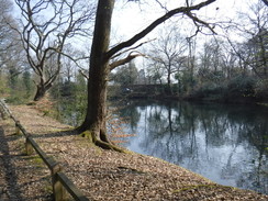
Cross the road, but do not enter a cricket ground opposite. Instead, take a path that angles off to the left through scrubland, with the cricket ground to the right. The path curves left and becomes a wider path. Just before a pond is reached it joins a wider path; turn left along this; it immediately curves right to pass between two ponds. It then curves right to follow the bank of the larger pond, with the water on the right. Near the end of the pond and beside a bin, turn left along a path that meets fences belonging to houses. Turn left along a path, with the fences on the right and woodland to the left. The path meets a rugby field on the left, and then curves right past a lamppost to met the end of a track in front of houses. Immediately turn left along grass, with woodland off to the left. The path then curves left, still keeping the woodland on the left, before entering the trees. The path reaches a pond; turn left, keeping the pond on the right, until Warren Lane is rejoined at TQ16569332.
Turn left to head north along Warren Lane past Harrow Rugby Football Club; as it curves left after 200 metres, take the first road off to the right on the bend (signposted public byway #6), which soon reaches the gates belonging to an orthopaedic hospital. At the gates follow the path as it curves left, and after a couple of metres, turn right through a gate to join a path that follows the hospital fence on the right. It passes a riding school over the hedge on the left. When the fence curves right, cross a stile beside a fence and continue on alongside the fence. After five metres, turn left down a small bank to join a track at TQ16539404.
Follow the track as it heads north downhill. After 500 metres it curves right; continue around the bend for a few metres, and then turn left along a rougher track that follows a fence on the right through a gap in a hedge ahead. It climbs up a bank into a field; at the top angle slightly right to head diagonally across it, aiming for the M1 in the distance. At the far end of the field it joins a palisade fence on the left; go through a clappergate by the fence to join a concrete path that follows the fence on the left to reach another clappergate that leads onto Elstree Road at TQ16139505.
Turn right along the road and follow it as it immediately passes under a massive viaduct that carries the M1 overhead to reach a large roundabout. Carefully cross the road that comes in from the right (the A41), to continue straight on along Elstree road; there is a pavement on the right. The road heads in a rough easterly direction; it passes an industrial estate on the right, and then curves right and then left to reach the southern bank of Aldenham Reservoir. It then passes 'The Fishery' pub on the right, and a short distance on, and about 900 metres after the roundabout, a clappergate beside a field gate on the left leads into the grounds of the lake at TQ17159524.
Continue straight on along a track that heads north, with the reservoir away to the left. A fence soon starts on the left, separating the path from the lake; it passes a sailing club on the left, and nearly 500 metres after the road a driveway is reached, immediately before the lake's dam. Turn right up the driveway to reach a gate beside a field gate. Go through this and continue along the driveway to reach a clappergate beside a field gate that leads onto Aldenham Road at TQ17249576.
Cross the road, and on the other side go through another clappergate to enter a field. Angle slightly right to head east across this field. At the far side of the field go past a scrubby area of land on the left to reach a clappergate. Go through this into a second field, and head straight on, roughly following a hedge on the left (there is a driveway beyond the hedge). At the end of this field, go through another clappergate to reach Elstree Hill North road at TQ17909581.
Carefully cross the road, and head straight on up the B5378 Allum Lane. Continue east along this road along the pavement on the left; when the pavement soon ends, turn left through a clappergate into a field. Head along the field, initially roughly paralleling a hedge on the left. When the hedge curves away to the left, continue straight on to a farm bridge over a ditch between trees. Cross this, and on the other side head up a hill towards a line of tall trees. The path skirts the corner of a fence on the left, and continues on for a few metres to a metal gate in the trees at TQ18079640.
Go through the gate to enter the golf course, and then turn left to follow the edge of the course. When some trees are soon reached ahead, turn right to follow their edge along to a wide track. Turn right along the track, and follow it to a junction with another track. Head straight on, passing greens to reach the corner of some woodland. Follow a little ditch on the right, and then turn left to join a path that follows a hedge on the right, with the golf course behind the hedge. It soon meets a bend in a better-quality track; turn right to follow this track through the trees. 400 metres after the bend, the track goes past a vehicle barrier to reach the B5378 road at TQ18649615.
Turn left to follow the road east. After 350 metres a roundabout is reached (Elstree and Borehamwood station is about 100 metres ahead). At the roundabout, turn right down Deacons Hill Road. This twists right and then left, before settling on a southerly course. It starts to climb steeply uphill, and after 950 metres ends at a T-junction with the A411 Barnet Lane. Turn left to follow this east; there is a pavement on the left. After 1km at TQ20119546, turn right to carefully cross the road near a small red post box.
Pass a field gate, and immediately afterwards go past a clappergate to join a path that heads south, with a fence on the left guarding a house and a hedge on the right. After 250 metres the path passes a massive log barrier to enter Scratch Wood. Follow the obvious path through the wood; after twenty metres turn left down a track. It descends downhill to cross a bridge over a stream. The path heads on, with the northern edge of the woodland a short distance away to the left before eventually emerging out into a clearing. Continue straight on, following a hedge on the left, and the path re-enters the woodland. It soon leaves the trees once more though a clappergate to enter Scratchwood Open Space at TQ20569485, with a cafe and car park straight ahead.
Immediately turn right to head down a grassy slope, with the trees on the right. After a short distance turn right to follow a path that re-enters the trees. The path descends, and then curves slightly left before climbing uphill, to emerge from the trees into a little clearing. Head down this to reach a gap beside a field gate that leads out onto the A1 Barnet By-pass at TQ20949432.
Turn right to follow the pavement beside the road as it heads south. After 850 metres a subway is reached; descend the ramp, turn left to head under the dual carriageway, and on the other side turn left up another ramp to join the eastern side of the road. Continue north with the road on the left, and after 570 metres the entrance to Moat Mount Open Space at TQ20989405.
Turn right through a pedestrian gate just before a vehicle barrier, and join a track that crosses grass. As the track turns left, head straight on along a broad path that heads through the trees; do not continue along the track. After about 150 metres, turn left along a path that soon reaches some steps and continues through the trees. It joins a stream on the left; follow this uphill; when it meets a path, turn right along this path for a few metres to a clappergate. On the other side continue on along a path, with a fence on the right as the path ascends slightly. Go through a second clappergate to join a track at TQ21509428.
Follow the track. As it curves left, angle right to a clappergate that leads to a path that follows between hedges downhill. The hedge on the left is intermittent; at the bottom go through another clappergate and pass a little pond on the left, and continue on until a track is reached. Cross this and angle slightly to the right along a broad path through the trees with a fence and hedge on the right and woodland to the left. The path leads to a pedestrian gate that leads out onto the B552 at TQ21939475.
Carefully cross the road to reach the pavement on the other side, and then turn right to start following it southeastwards. The road curves right and starts to climb; at the top of the hill after 650 metres, turn left through a clappergate beside a field gate and start following a path downhill, with a fence on the right and a hedge on the left. It descends past rough land; after 330 metres, turn left for a few metres to a clappergate; go through this to enter a sports field. Turn right to follow the right-hand edge of the field; halfway along, go past a stile and down some steps, across a footbridge over a ditch and then across a second stile to enter a field at TQ22579433.
Turn left to follow a hedge on the left, with the field away to the right. At the field corner go through a gap in a hedge ahead into a second field, and then head on; the hedge and path soon curve right (do not head straight on across a stream – the Dollis Brook). The path heads between a hedge and stream on the left and a fence on the right; at the corner of the field, the fence on the right becomes a hedge; turn left to reach a clappergate. Go through this into a third field, following another hedge on the left with the field to the right. At the next field corner, cross a plank bridge guarded by clappergates into a fourth field at TQ23009469.
Continue following a hedge on the left; at the end of this field, cross another footbridge guarded by clappergates to enter a fifth field. Keep the hedge on the left; when it ends, go through a gap in the hedge ahead to enter a sixth field. Halfway along this field, as the hedge curves left, angle right across the field to another gap in a hedge into a seventh field. About fifty metres along this field, turn left through a clappergate to reach a footbridge over the Dollis Brook at TQ23469502.
Cross the footbridge to reach the stream's northern bank, and then turn right to head downstream, with a hedge and the stream to the right. Houses soon appear across the grass to the left; at the end of the field, go through a gap in the hedge into a second field and keep on following the stream on the right. At the end of this long field, go past a barrier to join a track at TQ23919510.
Turn right along the track for a couple of metres towards a bridge over the river, but before the bridge is reached, turn left past a barrier to enter a field. When this field ends, go past another barrier and head on, still with the stream to the right. Cross a track leading to a bridge over the stream, and then cut diagonally across the grass for about twenty metres and going past cycle barriers, where it joins a surfaced path. Follow this as it parallels the stream on the right; it climbs a slight rise and eventually leads out onto Barnet Lane at TQ24999525.
Cross the lane, turn right for a couple of metres, and then left down the access driveway leading to the car park of a table-tennis centre. Pass the building on the right and enter the car park. At its far end, go through a gap in a hedge and past a vehicle barrier, and turn left along a surfaced path, with fences guarding a playing field on the left and grassland to the right. When the path meets the end of an access road, go under a height barrier and turn right past the end of the road. A surfaced path continues on, and soon ends at Grasvenor Avenue. Turn left up the avenue, and follow it north for 400 metres until it ends at Barnet Hill Road at TQ25289585. Here the London Loop is left for the day.
I extended the walk down to Finchley; simply turn right and follow the road as it heads under a railway bridge. Continue along the road for 4.3km into North Finchley, where the road forks slightly after passing a McDonalds on the left-hand side of the road. Take the right-hand branch of the road, High Road, and follow it southwestwards; it becomes the A598. After 1.9km it passes a tall tower, Central House, on the right; at the crossroads beside the tower, turn left down Chaville Way to reach Finchley Central tube station at TQ25289067, where this walk ends.
 |
 |
|
Distances
| From | To | Distance (m) | Ascent (ft) | Descent (ft) |
|---|---|---|---|---|
| Moor Park station | Hatch End | 4.8 | 335 | 323 |
| Hatch End | Stanmore Common | 4.7 | 450 | 180 |
| Stanmore Common | Borehamwood | 5.8 | 237 | 414 |
| Borehamwood | Barnet | 7.3 | 520 | 527 |
| Barnet | Finchley Central | 3.9 | 82 | 102 |
This makes a total distance of 26.5 miles, with 1,624 feet of ascent and 1,546 feet of descent.
For more information on profiles, ascents and descents, see this page
Transport
There are no direct tube or train services between High Barnet or Finchley and Moor Park; the former stations are on the Northern Line's High Barnet Branch, whilst the latter is ont he Metrpolitan Line to Watford, Chesham or Amersham. I ended up having a rather convoluted trip that involved three changes, and which took about 90 minutes.
The TFL journey planner might be very useful for planning your journey.
 |
 |
|
 |
 |
|
 |
 |
|
 |
 |
|
 |
 |
|
 |
 |
|
 |
 |
|
 |
 |
|
 |
 |
|
 |
 |
|
 |
 |
|
 |
 |
|
 |
 |
|
 |
 |
|
 |
 |
|
 |
 |
|
 |
 |
|
 |
 |
|
 |
 |
|
 |
 |
|
 |
Disclaimer
Please note that I take no responsibility for anything that may happen when following these directions. If you intend to follow this route, then please use the relevant maps and check the route out before you go out. As always when walking, use common sense and you should be fine.
If you find any information on any of these routes that is inaccurate, or you wish to add anything, then please email me.
All images on this site are © of the author. Any reproduction, retransmissions, or republication of all or part of any document found on this site is expressly prohibited, unless the author has explicitly granted its prior written consent to so reproduce, retransmit, or republish the material. All other rights reserved.
Although this site includes links providing convenient direct access to other Internet sites, I do not endorse, approve, certify or make warranties or representations as to the accuracy of the information on these sites.
And finally, enjoy your walking!
Nearby walks
| # | Title | Walk length (miles) |
|---|---|---|
| 50 | Paddington to Mile End | 8.3 |
| 51 | Mile End to Enfield Lock | 12.7 |
| 60 | Slough to Alperton | 16.7 |
|
|

|