Walk #978: Ouse Valley Way: Bedford to St Neots
 |
 |
|
General Data
| Date Walked | 15/11/2017 |
| County | Bedfordshire, Cambridgeshire |
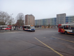
| Start Location | Bedford Bus Station |
| End Location | St Neots Market Place |
| Start time | 07.54 |
| End time | 14.48 |
| Distance | 18.7 miles |
| Description | This was a varied walk folowing the Ouse Valley Way between Bedford and St Neots. Whilst there were many miles of riverside walking, thre were also some extesnive less than pleasant stretches, for instance alongside the A1. |
| Pack | Today I carried my 30-litre Karrimor rucksack, filled with water, my waterproofs, a book and other odds and ends. |
| Condition | I am fairly tired after this walk, but otherwise I am fine. |
| Weather | Today was warm, almost unseasonably so, and the wind that plagued me on the last walk was thankfully absent. There was some light drizzle towards the end of the day, but not enough to caue me to don my coat. |
| OS map | Landranger number 153 (Bedford & Huntingdon, St Neots & Biggleswade) |
 |
 |
|
Map of the walk
Maps courtesy of Google Maps. Route for indicative purposes only, and may have been plotted after the walk. Please let me have comments on what you think of this new format. For a detailed table of timings for this walk, please see the table file.
 |
 |
|
Notes
I wanted to do the next stretch of the Ouse Valley Way today, and a quick look at bus timetables showed that I could park in St Neots, catch the first morning bus to Bedford, and walk back in time to pick my son up from school. I quickly calculated the distance at about fifteen or sixteen miles. I arrived in St Neots ridiculously early and, as no shops were open, I strolled around a little to waste time. There are worse places for an early morning amble, and before I knew it the X5 coach arrived. The coach felt luxurious inside, and once again I felt rather messily dressed in comparison with my fellow passengers. Perhaps it is finally time to buy some new, more reputable walking clothes.
The coach arrived at Bedford bus station just before eight. I got out a little bleary-eyed, and immediately found a Greggs to buy some snacks for the day ahead. Since it as going to be a short day's walk I decided to extend it; instead of going straight down to the river, I would head to the railway station before joining the trail by the river. The walk proved to be dismal; the centre of Bedford is not the most attractive place in the world, and the link between the bus and rail stations appeared grey - and not just from the clouds overhead. It was ugly - it says something when the railway station is the most attractive building. To make matters worse, I needed the toilet and could find no pubic conveniences.
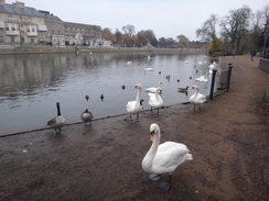
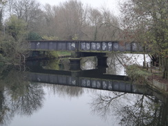
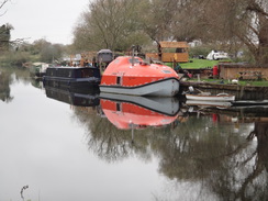
The short walk from the station down to the river seemed similarly grey and dirty, an impression perhaps not helped by the early hour and the desperate need for a pee. It was a relief to reach the river and the start of what turned out to be a slightly more interesting stroll. Some people were getting some eights ready for a row on the river, and a wedge of swans congregated on the concrete riverbank opposite the Swan hotel. A swanky and modern-looking Vue cinema added some much-needed glass to the concrete surroundings, and a new metal footbridge across the river was also welcome - although this is considered an eyesore by some. Sadly, the nearby old stone road bridge was overshadowed by a dark, dank concrete tower block.
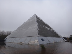
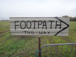
Shortly after this I went slightly wrong and crossed some footbridges onto an island between two streams of the river. I soon got back onto the proper path, but I will have to go back sometime to walk the short section I missed. Soon afterwards I saw two odd pyramidal buildings standing in dank pools of water. They turned out to be a local swimming pool, and their decrepit nature seemed to sum up my feelings of Bedford very well. To make matters worse, there were very few waymarkers for the trail in Bedford; I saw my first after a couple of miles, and as the day went on the numbers slowly grew.
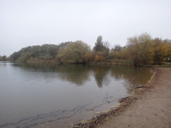
The trail crossed the river and started following the northern bank of the river, which often remained out of view behind trees. It should have been a pleasant walk, but I found it hard to lift my spirits; there was something about this walk that I was just not enjoying. At Cardington lock the trail headed inland slightly to pass some lakes in the Priory Country Park. Again waymarkers were conspicuous by their absence, but fortunately I manage to orientate myself from the map and find the trail without putting a foot wrong.
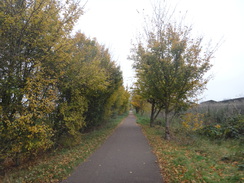
Soon the trail joined the course of the old Bedford to Sandy railway line, closed in 1968 as part of the Beeching Cuts and which may be reopened as part of a rebuilding of the Cambridge to Oxford railway line. Initially the route passed a sewage works, part of which had an array of solar panels high-up on a bank. An old overbridge was one of the few signs that the cycle path had once been a railway, and soon the old line was left behind for a while as the path headed up to a bridge over the A421 dual carriageway.
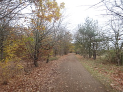
On the other side of the bridge the path passes a series of sand and gravel paths. Some of these were now returned to nature as green-fringed lakes, yet were shown as virgin untouched ground on my twenty-year old maps. The walk through the trees was a pleasant stroll with a carpet of brown leaves underfoot, although I soon realised that the path had taken me off the course of the railway line. I kept with it, and soon a track took the path back to the trackbed near a car park. I thought I had made a mistake, but there was no obvious route from the car park back along the line - the trail's route has obviously changed.
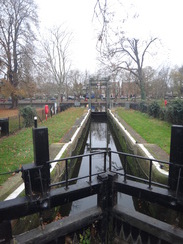
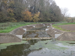
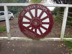
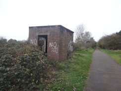
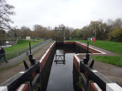
An old brick hut and the edges of the platform marked the site of Willington station, and soon afterwards the trail passed the site of Danish Camp (apparently Bedfordshire's best-kept secret) and left the railway trackbed to reach Willington Lock. A little beyond this the path followed the river bank where the map showed it cutting across fields; the riverside diversion is much better than the path marked on the map, and might be a recent improvement to the trail. If so it is a welcome one.
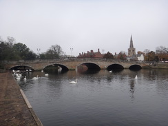
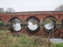
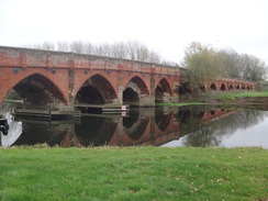
A short stroll took me into the village of Great Barford, the first sight of which was the seventeen arches of the magnificent fifteenth-century bridge over the river. It is a truly stupendous structure, with more modern (although still historic) red-brick arches hiding the older stone bridge behind. The village pub was sadly not open, and so I was faced with a short stroll up a road out of the village. The trail left the road by the second sewage works of the day, and soon I was following the river once more.
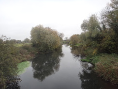
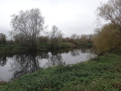
The next couple of miles were an enjoyable stroll along a good path beside the river, and it gave me perhaps the best views of the day. I started to feel a little better about the walk in general, and I had a spring in my step as I reached Roxton Lock. A rather bitty and uninteresting stroll took me into the village of Roxton, where the village pub was not due to open for another few hours. I was left with a little problem: it was clear I had miscalculated the distance of the walk by a couple of miles, and I was out of snacks and nearly out of water.
There was little choice but to press on as the trail headed north along paths and roads, crossing the A421 once again on a big road bridge to reach Chawston. More paths and a road took me to Wyboston and the noisy, bustling A1 dual carriageway. A pub marked on my map appeared to have closed many years ago, but from the footbridge over the road I saw a nearby McDonalds. With a rumbling tummy and low on energy, and I nipped in for my first McDonalds meal for four years. I had a large of everything, and when I left twenty minutes later I was feeling much better. Fast food gets a bad name, but at times it serves a purpose.
For the next half mile the trail follows the A1 northwards, sometimes on a local by-road and at others on a pavement beside the road. Perhaps it was the food, but I found I did not mind this stretch of walk as much as some of the earlier ones, despite the traffic rushing past to all points south. This is perhaps the longest distance I have walked along the A1 since the stretch of my coastwalk through Northumberland, and that connection through distance and time made me smile. Soon the pavement followed the A428 slipway, and I had to slightly take my life in my hands to cross the dual carriageway to reach the road that leads into St Neots.
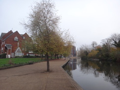
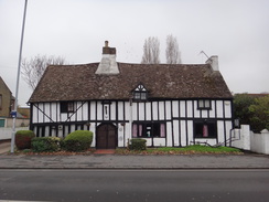
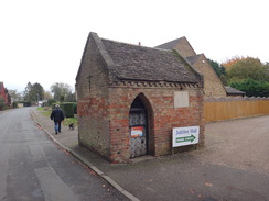
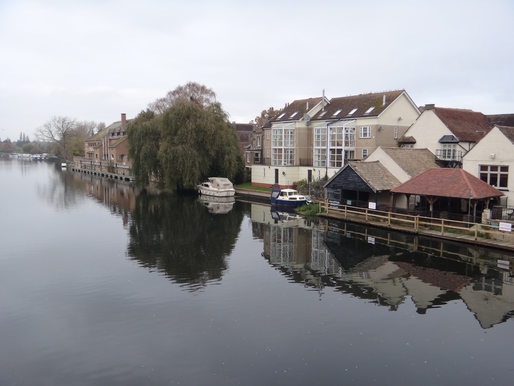
I was now on territory I knew well, and I put myself on autopilot as the road headed past my local B&Q store and various other shops to reach Eaton Socon church, near which is a small building that was once the village's lock-up complete with a Weight Watcher's sign on the heavy door - I suppose that's one way to lose weight! From here a road led back to a lock by the river, and the trail crossed bridges to reach the eastern bank of the river. I've walked this stretch of path many times, although it was perhaps the muddiest I can remember - my trousers, which had remained mostly mud-free for the day, were soon brown up to the knees. It was a relief when the path crossed another bridge over the river to enter the riverside park, after which it was a short stroll to the road bridge over the river. The end of the walk in the market place was then just a short distance away.
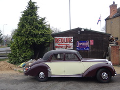
St Neots was much more bustling than it had been that morning, and it felt a little odd to see so many people. I was tired after what had hardly been a classic walk, and I am left wondering if my downer on Bedford is a little harsh. Perhaps I will get a different perspective when I do the next stretch of the trail to approach the town from the west.
 |
 |
|
Directions
This walk starts off at Bedford bus station a TL047498. Leave the main bus station building, keeping a multi-storey car park across the bus station on the right, and head out onto the A6 Greyfriars, with a large roundabout a few yards away to the right. Cross the A6 using the traffic light controlled pedestrian crossing, and then turn right for a few yards towards the roundabout, following the Station Link route, which is marked on the pavement. Take the first exit off the roundabout to continue along the A6, and after about fifty yards turn left down Alexandra Place. When this road ends at a T-junction, turn right down Alexandra Road. This soon curves to the left to become Woburn Road, which in turn ends at a T-junction with the A5141 Ashburnham Road. Turn left for about thirty yards to reach the pedestrian crossing over the road, cross the road, and then continue straight to reach the railway station.
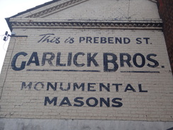
From the railway station, head back to the A5141 and then turn right to follow it south. After a couple of hundred metres a roundabout is reached with a footbridge ahead; turn left to follow the road; when a crossing is reached, cross to the other side of the road and continue a short distance to another roundabout. Take the second exit to the right, carefully crossing a road to join Prebend Street. Follow this, and just before a bridge over the river is reached, turn right down a path that slopes down to meet another path that runs along the northern bank of the Great Ouse. Turn left to follow the path under the bridge, and carry on with the river on the right for 500 metres until the path rises to meet the A6 road by a stone bridge over the river.
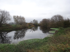
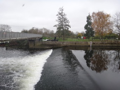
Turn right to cross the bridge; at the southern end turn right along a path that leads into St Mary's Gardens, and then immediately right along another path that leads down to the riverside path. Here turn right once more to head under a low archway of the bridge. On the other side, continue on across a series of footbridges with the river on the left until a bridge over a weir is reached. Cross the bridge over the weir to join a path that runs along a narrow island between two different river streams. The path passes a bridge over the end of a canal lock before reaching a large bandstand. Take a path that leads off to the right, heading towards a bridge over one of the river streams.
Cross this bridge, and on the other side turn left to follow a path that heads east with the river to the left. After nearly half a mile it passes under a bridge that carries the A5140 overhead. A few metres beyond the bridge, turn left to cross a pedestrian bridge over the river. On the other side turn right along a path that follows the river away to the right. The path soon rises to cross the course of an old railway line, before descending down into a field and turning left to parallel the river. It passes a clump of trees, and at the end of the field reaches a footbridge over anotehr river stream. Cross this and turn right to follow the riverside path, which soon rises to cross a footbridge over the entrance to a marina. The path crosses a couple of other bridges, including one over the entrance to a flood relief channel. Three-quarters of a mile after the marina, Cardington lock is reached at TL078488.
Immediately before the lock, turn left along another path that heads away from the river, crossing a footbridge over a stream to enter a small area of woodland. It crosses the other end of the flood relief channel on another footbridge before reaching another track in front of a lake in Priory Park. Turn right along this new path, with the lake's shore to the left, and when it curves to the left after a few metres, turn right across a grassy area. This heads north between another lake on the left and the river on the right, with both hidden by trees for long periods. Half a mile after leaving the lake, the path climbs slightly to reach the course of the old railway line at TL079496.
Turn right to follow the cyclepath running along the old railway eastwards, immediately crossing a large bridge over the river and passing a sewage works on the right. After a little over half a mile the cyclepath curves to the left and climbs to reach a bridge over the A421 dual carriageway. Turn right to cross the bridge, and continue as the cyclepath descends before curving to the left to resume its easterly course. It crosses a couple of tracks, the second of which is a large access road to a sand and gravel pit, before it angles slightly off to the left through trees. Nearly a mile after the A421 bridge, the path ends at a T-junction with another track. Turn right to follow this track as it crosses a bridge over a stream to reach a gate that leads into a car park at TL104501.
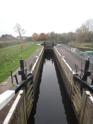
Enter the car park and turn left past a metal gate to rejoin the course of the old railway line. It passes the site of the old Willington station and an attraction called Danish Camp; after 0.8 miles the trail ends at a T-junction. Turn left to follow a narrow cycle path away from the railway trackbed. This approaches the southern bank of the river and then turns to the right to head towards Willington Lock. Ignore the cycle path as it turns to the right through a gate, and instead continue on past the lock on the left. Continue along the footpath as it follows the southern bank of the river; it crosses a couple of small footbridges, and three-quarters of a mile after the lock it reaches a footbridge over the river at TL129510.
Cross the bridge, and on the other side turn right to start following the northern bank of the river past a series of fields; after half a mile the ancient Barford bridge becomes visible ahead. The path curves slightly to the left and goes through a metal gate to reach the road in Great Barford. Carefully cross the road and head north along New Road, immediately passing the Anchor Inn on the left. After some speed limit signs are passed after a third of a mile, turn right off the road to enter a field. Follow a hedge guarding a sewage farm on the right; the hedge and path turn to the right and then the left, before continuing on to reach the western bank of the river at TL13815199
Turn left to follow the path alongside the river. It passes a number of fields as the river twists and turns, and a couple of miles after leaving the road it reaches Roxton Lock at TL160534. When a little brick building is reached just before the lock's weir, turn left to pass behind the building. Do not cross the footbridge over the weir, and instead head on along a path through trees, which soon crosses two footbridges over inlets. The path emerges from the trees and continues with the river away to the right; after about a third of a mile it curves sharply to the left to head away from the river, following a small ditch on the right.
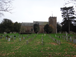
After a couple of hundred metres the path reaches a field gate ahead; here turn right to cross a plank bridge over a ditch and go through gap in a hedge to enter a field. Turn right to walk along the edge of the field, immediately passing under some power lines. When the corner of the field is reached turn left, keeping the field on the left, and then turn slightly right to enter a wooded area. Ignore a footbridge off to the right; at the end of the trees the path curves left to emerge into a field. Follow a hedge on the right; at the end of the field, go through a narrow band of trees and continue along a good path that runs between an avenue of trees. It curves to the left and then right, and continues on before ending at a fence that guards some housing. Turn right into a field, and when a pond is reached on the left angle left away from the field to join a path that runs between trees to reach Roxton churchyard. Follow a set of stone slabs to reach Roxton church at TL15355452.
Continue past the church to reach the far side of the churchyard, and then turn half-right for a short distance to reach a step-stile that leads out onto School Lane. Turn right up School Lane for a few metres, and then left to join a footpath that follows fences and hedges on the left. At the end of the Millennium Green, cross into a farm field and continue on, eventually reaching a second field. Continue straight on when the houses on the left end, passing a barn on the left to enter a third field. At the end of this field, cross a ditch to reach a rough track. Cross this, and head on for a few metres with a field to the right. After a few metres, cross a plank bridge across a small ditch that leads onto Bedford Road at TL153550.
Turn right to follow the road northeastwards; there is a pavement on the right-hand side of the road. After 250 metres, turn left and carefully cross the road to head up Roxton Road, which soon climbs to a bridge over the A421 dual carriageway. After a little over half a mile it reaches a crossroads at TL152561. Turn right down Chawston Lane; just before a house on the left is reached after 200 metres, turn left through a wooden gate that leads into a small garden. It emerges from the garden into a field, with a scrappy hedge on the left. Follow this as it heads northwards; when the hedge curves away to the left, the path angles slightly to the left to meet the corner of a track.
Head straight on down this track as it passes a pond on the left. When the track turns to the right, continue straight on along a footpath that cuts across a field. Go through a gap in a row of tall trees to reach a little car park, and then head on along an access road, passing a barn on the left. When this soon ends at a T-junction, turn right down another road that curves around for a short distance before ending at a road imaginatively called The Lane at TL154569.
Turn right to follow The Lane as it heads east-southeastwards. After two-thirds of a mile it abruptly ends at the A1(T) dual carriageway. Turn right to follow the A1 southwards for a short distance to a footbridge over the road; cross this, and on the other side double back to start following the road on the left northwards; thankfully the pavement is wide. The pavement diverts off to follow a side road for a short distance before rejoining the A1 once again. Two-thirds of a mile after the footbridge the A428 sliproad leads off to the right; follow this as it climbs and sweeps onto an easterly course. Cross an access road coming in from Wyboston Lakes on the right using the traffic lights, and continue on to reach a roundabout at TL16925791.
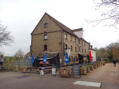
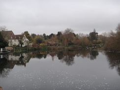
Pass the roundabout, and immediately on the other side carefully cross the A428; this is perhaps the worst road crossing of the entire day, as the road can be very busy at times. On the other, northern, side of the road, turn left back towards the roundabout and follow the Great North Road as it swings off to the right to head towards the centre of St Neots. Follow this northwards as it passes a B&Q, a Lidl and an Aldi, crossing several small roundabouts on the way. Just before Eaton Socon war memorial is reached after half a mile, turn right down School Lane, passing Eaton Socon church on the left. School Lane ends at an old mill building; pass this, and then turn right along a path past a small marina on the right. At some gates leading into a boatyard angle half-left along a tarmac path to reach Eaton Socon Lock at TL174586.
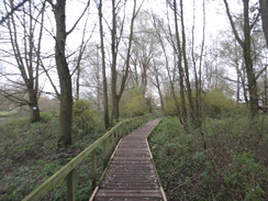
Cross the lock and its neighbouring weir using footbridges, and on the other side turn left to descend some steps to join a footpath that runs along the river's eastern bank. Follow this northwards with the river on the left; it passes under a long footbridge, crosses a caravan park and two stretches of boardwalk, and after three-quarters of a mile climbs some steps to reach a small car park. Go through the car park to reach its entrance, and then immediately turn half-left along another path for a few metres to reach another path.
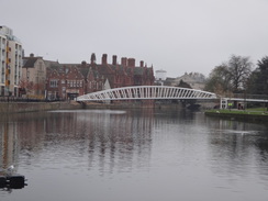
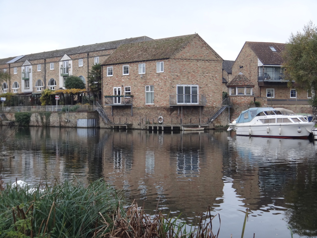
Turn left along this new path as it immediately crosses the river on a footbridge. A short section of path leads to a second footbridge. At the end of the second bridge enter St Neots Riverside Park and turn right to follow a surfaced path that keeps a stream to the right. The stream becomes the river proper, and when the Town Bridge is reached ahead, the path turns sharply to the left, keeping the bridge to the right. After a few metres turn right to head under the bridge's approach viaduct, and on the other side turn right once more to reach some steps that lead up onto the bridge at TL18036018. Use the bridge to cross the river, and on the other side continue on into the town. The end of this walk at St Neots market place is a short distance away on the right-hand side of the road.
 |
 |
|
Distances
| From | To | Distance (m) | Ascent (ft) | Descent (ft) |
|---|---|---|---|---|
| Bedford bus station | Bedford rail station | 0.4 | 0 | 4 |
| Bedford rail station | Willington station site | 6.0 | 31 | 55 |
| Willington station site | Roxton church | 6.1 | 61 | 64 |
| Roxton church | St Neots market place | 6.2 | 60 | 76 |
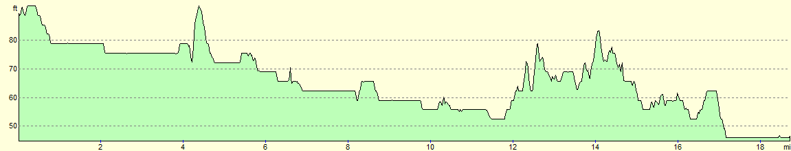
This makes a total distance of 18.7 miles, with 152 feet of ascent and 200 feet of descent.
For more information on profiles, ascents and descents, see this page
Transport
The Stagecoach X5 service runs hourly on weekdays between St Neots and Bedford, as part of their Cambridge to Oxford service.
 |
 |
|
 |
 |
|
 |
 |
|
 |
 |
|
 |
 |
|
 |
 |
|
 |
 |
|
 |
 |
|
 |
 |
|
 |
 |
|
 |
 |
|
 |
 |
|
 |
 |
|
 |
Disclaimer
Please note that I take no responsibility for anything that may happen when following these directions. If you intend to follow this route, then please use the relevant maps and check the route out before you go out. As always when walking, use common sense and you should be fine.
If you find any information on any of these routes that is inaccurate, or you wish to add anything, then please email me.
All images on this site are © of the author. Any reproduction, retransmissions, or republication of all or part of any document found on this site is expressly prohibited, unless the author has explicitly granted its prior written consent to so reproduce, retransmit, or republish the material. All other rights reserved.
Although this site includes links providing convenient direct access to other Internet sites, I do not endorse, approve, certify or make warranties or representations as to the accuracy of the information on these sites.
And finally, enjoy your walking!
Nearby walks
| # | Title | Walk length (miles) |
|---|---|---|
| 119 | Huntingdon to St Neots | 11.8 |
| 120 | St Neots to Biggleswade | 13.0 |
| 122 | Biggleswade to Hitchin | 11.6 |
|
|

|