Walk #967: Essex Way: Great Leighs to Marks Tey
 |
 |
|
General Data
| Date Walked | 13/11/2012 |
| County | Essex |
| Start Location | Great Leighs |
| End Location | Wellside, Marks Tey |
| Start time | 07.20 |
| End time | 17.05 |
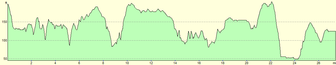
| Distance | 27.4 miles |
| Description | This walk follows the Essex Way from Great Leighs to White Notley, then northeastwards to Cressing, Coggleshhall, Great Tey and finally Fordstreet. The trail is then left behind for a two mile road walk to Marks Tey. |
| Pack | Today I carried my 30-litre Karrimor rucksack, filled with water, my waterproofs, a book and other odds and ends. |
| Condition | I am unsurprisingly very tired after this walk, but could easily have walked further after a little rest if there had been more daylight. |
| Weather | Today's weather was quite warm for the time of year, with a mixture of sunshine and light cloud overhead. Some of the sunny periods were prolonged. |
| OS map | Landranger number 167 (Chelmsford, Harlow & Bishop's Stortford) and Landranger number 168 (Colchester, Halstead & Maldon) |
 |
 |
|
Map of the walk
Maps courtesy of Google Maps. Route for indicative purposes only, and may have been plotted after the walk. Please let me have comments on what you think of this new format. For a detailed table of timings for this walk, please see the table file.
 |
 |
|
Notes
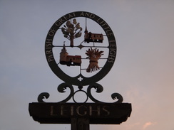
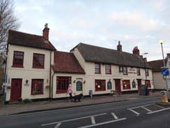
I have got an urge to complete the Essex Way as soon as possible, and so this morning I got up as early as possible for the drive down to Great Leighs, which was the point I had left the trail the previous week. There was no obvious place to park in the village, and in the end I settled for a spot between two cars in a residential street. After nipping into the village shop to buy some provisions I headed down the road to the bus stop where I had finished the last walk.
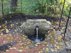
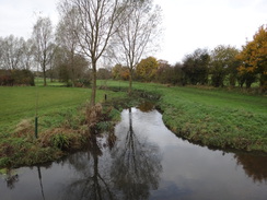
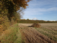
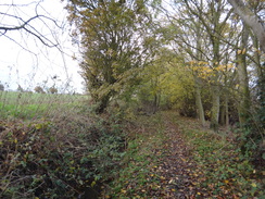
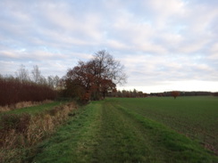
A short stroll took me down to the Essex Way, where a curious stepped stile led over the crash barrier to some steps that led down into a field. The going was wet and muddy as the sun continued to rise; the trail headed through some woodland before emerging into a field. Here I made the first mistake of the day: I continued along the wrong side of a hedge and had to walk back for a hundred yards to reach the correct route. This allowed me to access the road, where I made the second mistake, although this was unforced. The map showed the trail following roads that crossed a stream before heading east towards a wonderful round-towered church. However a little further on a waymarker showed the trail taking a more direct off-road route along a footpath. The path has obviously been diverted, and I will have to return to walk this stretch another time. At the point I rejoined the trail, there was a little spring bubbling out of the ground.
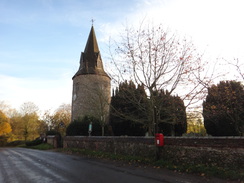
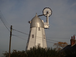
Paths led across fields to Fuller Street. The village pub - the Square and Compasses - had been recommended to me, but it was not open at this early hour. More paths and tracks led southeastwards to the village of Terling. In what was becoming a trend I went wrong again, walking down the wrong road through the village. Fortunately I soon realised my mistake and headed back to pass a wonderful windmill sans sails.
More paths zigzagged northwards to the village of Fairstead, where a road led to a track. A man was walking along the road in front of me, a large, seemingly home-made rucksack hoisted high on his back. His pack intrigued me and I sped up, but before I caught up he headed off the trail and started ploughing across a pathless field. I stopped on a couple of occasions to watch him as he headed into the distance, well off any right of way.
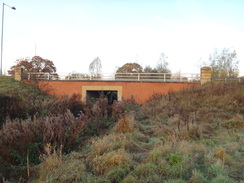
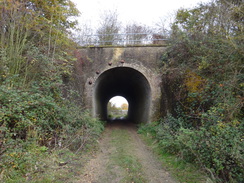
Good green tracks led past Troys Hall before diverting to the east of the village of White Notley. My map showed a diversion off the trail heading towards the ancient Templar barns at Cressing Temple, which includes the oldest timber-built barn in Europe. Although this side-path is not marked on later OS maps, I want to walk the path sometime, if only as a reason to visit the barns. The main trail bypassed White Notley railway station and headed under an inverted-horseshoe-shaped tunnel under the line.
An easy climb then took me up towards Cressing church, where a board told me that there had been a church on the site since Saxon times. More tracks took me past Egypts Farm and onto another series of zigzag paths that led northeastwards. A waypost was leaning at a jaunty angle and I turned to head down a hedge. Eventually I realised something was wrong and that the path lay on the other side of the hedge and ditch. I walked to and fro for a few hundred yards before eventually spotting a waypost on the other side. Although there was a small gap in the hedge, I did not fancy the chances of my getting across the water-filled ditch. Instead I walked back to the leaning marker post and realised I had walked along the wrong side of the hedge.
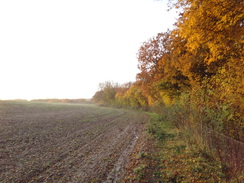
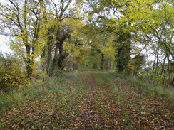
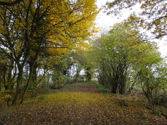
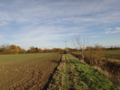
Fortunately this was the last navigational mistake of the day, although I was annoyed at my mistakes and extra-careful as I passed the banks that guarded a large sand and gravel pit. After meeting a road near Bradwell Hall, the trail started paralleling the River Blackwater eastwards, although the water mostly remained out of sight. By now the mistakes and problems of earlier in the day were well out of my mind. I was in my flow as I strode along paths that were thankfully relatively dry.
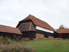
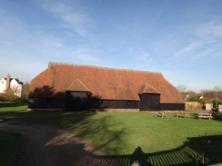
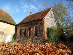
Soon a massive structure became visible to my left; black timbers topped by a gigantic roof of orange-red tiles. I had a strange sense of déjà vu, and I realised that I had walked this way before. The barn was Coggleshall Grange Barn, probably built in the thirteenth century and now in the custodianship of the National Trust.
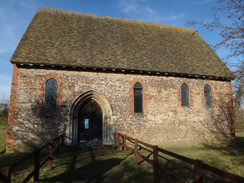
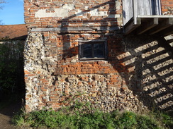
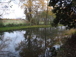
The barn was not open; besides, there was still a long way to walk today. I crossed a road that got more rustic as it passed an exquisite chapel on the left, part of the old abbey that built the barn. Shortly afterwards a spectacular building became visible to the left, a chaotic jumble of styles and periods all vying for my attention. I stared at it for a few minutes, and in particular the Elizabethan chimneys poking up above the roof. Soon a man approached and we ended up chatting for a while. He was the owner of the house, and he was clearly lavishing lots of love on his pile.
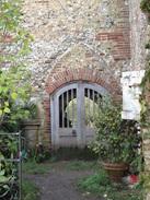
The house is occasionally open to the public and I continued to study the architecture as he fetched me a brochure. A solitary arch of the abbeys old cloisters had been converted into a small doorway, and more of the bricked-in cloisters were visible alongside. The entire place was a chaotic mixture of alterations and patches that detailed the buildings history. Some of the earliest medieval bricks in the country are in the fabric, the industry restarting nearly a millennium after the Romans left. Nearby stood the Guest House, a spectacular building of brick, stone and timbers, as perfect as it was petite.
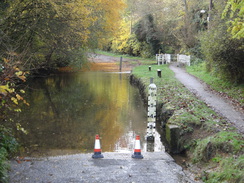
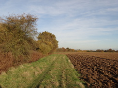
The trail passed the site of a mill, after which the path became very churned up by horses hooves. It was heavy going, although thankfully things improved by the time the trail deposited me onto the road in Coggleshall. The trail misses the centre of the village, and instead cuts across some playing fields. I had yet to have a rest, and a handy bench seemed as good a place as any. I shrugged off my rucksack and retrieved the sandwiches which Sencan had made me.
The sandwiches were absolutely delicious, as was a thick slice of stollen. Sadly I could not afford to hang around too long, and so I shouldered my rucksack and headed off once again. A road led me around the town, before another path headed towards the A120 bypass. I was getting short of water on the unseasonably warm day, but had passed nowhere in the village in which to get my bottle filled. Instead I walked on, hoping I would pass somewhere that I could get a fill-up.
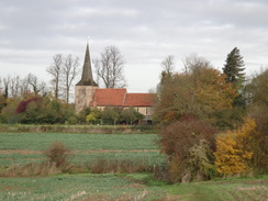
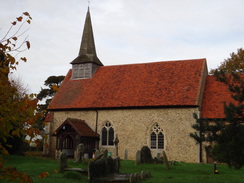
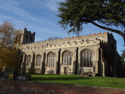
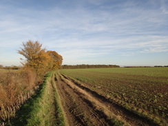
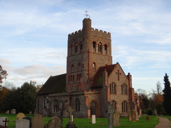
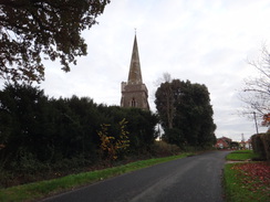
Paths led east across the fields, before curving to take a more northeasterly course through East Gores to Great Tey. Great Tey church seems rather imposing, with a large Norman tower that seems out of proportion to the nave. The reason might be that part of the church has been demolished, and the roofline certainly looked as though it had been lowered.
Here I was faced with a choice. My plan had been to walk south along roads to Marks Tey, but I was still feeling fit and so decided to walk on. The trail took me on a zigzag route across paths and tracks to reach the railway line to Braintree. There was another option here: to walk north to Chappel railway station. Instead I walked on, and a lady at a nearby farm was kind enough to fill up my water bottle as her dogs yapped around my feet.
The trail descended to reach the southern bank of the River Colne which it started to follow eastwards, although the river mostly remained out of view. After squeezing past a nursery it emerged out onto the road in Fordstreet. Earlier in the year I had walked a stretch of the Essex Way east of here, but that was a kilometre away. The sun was starting to sink lower and lower in the sky, and I realised there was no chance I was going to join up with that route. Instead, I turned right and started following roads south towards Marks Tey.
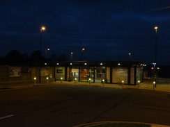
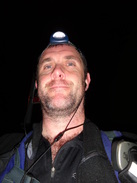
I put my headtorch on as I reached Aldham, and the gloom grew as I continued southwards. It was well and truly dark by the time I reached Marks Tey station, and I had to find the correct bus stop. I soon found one and my mobile told me a No. 70 bus was coming in a few minutes. One soon arrived but annoyingly did not stop; I waited a few more minutes before deciding to walk on into the village, hoping to find a better bus stop away from the busy roundabout. After a few hundred yards another 70 bus came past, but there was no way I could reach the distant bus stop in time. Instead I walked on into the centre of the village and waited for another half-hour for the next bus.
It had been a marathon walk, and I had really enjoyed it despite a few navigational problems. Another days walk should see the Essex Way done and dusted.
 |
 |
|
Directions
This walk starts off at the St Annes Castle pub in Great Leighs at TL727171. Follow the road south out of the village; after nearly half a mile a bridge over the River Ter is reached. Immediately before the bridge, turn left to cross a stile over a crash barrier, then descend down steps into a field. Turn right to reach the northern bank of the river, which is scarcely more than a large stream, and then left to follow the stream on the right.
Cross a footbridge over a ditch that leads into some trees. It crosses a track by a bridge on the right, then fifty yards on reaches a second footbridge over a ditch. Do not cross this, and instead turn left, keeping a fence on the left. When the fence ends, turn right to reach a stile that leads into a field. Cross this and turn right to start following the edge of the field southwards, with a fence and the trees on the right. As the field edge curves away to the left, continue straight on. At the end of the field turn left, following a fence on the right for about ten yards, then turn right to cross a stile into another field at TL728159.
Follow a hedge on the left; at the end of the field cross a stile, then immediately turn left to reach another stile. Cross this into another field and turn right to follow a hedge on the right. At the end of the field, go through a gap in a hedge to join the road. Turn right to follow the road downhill to the south. As it approaches a ford over the river at TL731156, cross the river using a footbridge off to the right, then rejoin the road on the other side. The road continues to climb for a short distance before reaching a road junction near Goodmans Farm.
Turn left to follow another road as it climbs slightly uphill, passing Hole Farm down to the left. When the road forks, take the right-hand branch that descends downhill to reach a T-junction. Turn left to follow another road north-northeastwards, passing Great Leighs church and heading on. 200 yards after the church at TL 738157 turn right down a track, passing a vehicle barrier to enter a field. The path climbs up a narrow grassy path between fields and curves slowly to the right. A ditch is joined on the left, after which the path curves to the left to follow a bank on the left. It head under power lines, then curves to the right to head down the middle of a field towards houses ahead. The path leaves the field and passes a house on the right to reach a road in Fuller Street at TL746160.
Turn right down the road; it passes near the Square and Compasses pub before curving to the left. Pass some houses on the right, and then turn right past a vehicle barrier to enter a field. Follow a hedge on the right downhill, heading back towards power lines. In the bottom corner of the field the path curves to the right and then left to enter another field. Follow the edge of the field as it immediately curves to the right, following a hedge on the left. After about 20 yards turn left into another field and head on downhill following a hedge on the left. At the bottom of the field cross a footbridge over a stream and continue through a wooded glade. After leaving the glade, follow a wide path with a fence on the right and Sandy Wood on the left. Pass under power lines and continue south; after nearly a quarter of a mile the path emerges through a gap in a hedge ahead to reach a track at TL748151.
Turn left to follow the track east-southeastwards, with Sandy Wood on the left. As the track curves to the right, head straight on through a gap in a hedge to enter a field, still following the woods edge. When the trees end, turn left for about thirty yards, then turn right to follow a path east across the middle of a field. At the bottom of the field cross a farm bridge over a ditch and continue on between a fence and hedge. The path becomes a track that runs between hedges, and then the track becomes a surfaced lane that ends at a junction with Waltham Road at TL759148.
Turn left to follow the road as it curves to the right to head east. After a sixth of a mile the road curves sharply to the right; here turn left along a narrower road called Hull Lane. This passes close to Terling windmill on the left before curving to the right to reach a triangular junction Turn left to follow a road northeastwards; it descends to reach a deep ford over the River Ter; there is a footbridge on the left that will help keep feet dry. On the other side of the bridge, continue along a road uphill for a short distance until the road end at a T-junction at TL768151.
Turn left along the road for a few yards, and then right up a track that leads towards a farm storage area. Cross this and pass a vehicle barrier to continue along the track, which becomes unsurfaced as it curves slightly to the left and right to follow a hedge on the right. At the corner of the field, do not go through the gap in a hedge ahead and instead turn left to follow a hedge on the right. The hedge heads downhill; at the bottom turn right through a gap in the hedge and follows a hedge on the left which immediately curves to the left. After a few yards it crosses a farm bridge over a ditch and curves to the right to follow the ditch on the right.
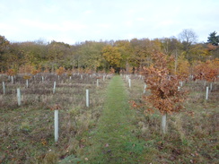
The path enters an area of newly-planted woodland; just before the end of the field, turn left to head northwestwards along a gap between the young trees. The path crosses a grass track and a plank footbridge to enter an area mature woodland. Follow the obvious path through the trees; the path leaves the wood into a field and curves to the right, keeping the trees to the right. After 150 yards turn left along a path that runs between fields, heading straight for a church ahead. At the bottom of the field skirt the end of a hedge on the right, then cross a plank footbridge and stile to head up a slight slope across a small field. At the top of the field cross a stile and follow a path between hedges. The path curves to the right to cross a plank footbridge over a ditch, then curves to the left through the graveyard of Fairstead church. Continue through the churchyard to join a road at TL767167.
Turn right to follow the road northeastwards; at a triangular road junction after 200 yards turn right along another road. Ignore the first footpath off to the left, and 250 yards after the junction turn left down a surfaced track that runs between hedges. After a quarter of a mile the track approaches Troys Hall; as the track curves to the left towards the hall, turn slightly to the right along a broad green lane that runs between hedges. This track curves to the left, then winds slightly before settling on a northeasterly course. After 200 yards the track curves to the right once more and passes a vehicle barrier, before making one final left hand-curve to join a concrete track called Pink Lane at TL777172.
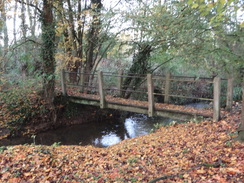
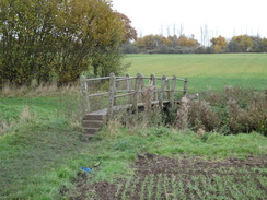
Follow Pink Lane as it heads eastwards for 0.7 miles until it passes the end of some barns to end at a road. Turn left along the road; care needs taking as there is no pavement. After about 100 yards, turn right down a surfaced driveway that immediately curves to the right. It then swings to the left and heads on, initially following an avenue of trees on the left. Just before a house is reached, turn left to follow a footpath that squeezes past the house on the right. Go through a gap in the hedge and continue along a path downhill across a field. At the end of the field it goes through a hedge to enter a second field, following a hedge on the left. As the hedge ends, continue straight on down the field, aiming for a footbridge over the river Brain at TL792181. Here the diversion to Cressing Temple leaves the official route.
Cross the footbridge, and on the other side turn left to start following a hedge on the right, with the river away to the left. Cross a stile at the end of the field to enter a second field Continue following a hedge on the right to reach a ladder stile next to a gate that leads to a track, with a sewage farm to the right. Follow this track northwestwards; it passes through a clapper gate before reaching Station Road in White Notley at TL787184.
Turn right down the road, and after a short distance turn left up a surfaced track. This gently curves to the right, and after a sixth of a mile reaches the buildings of Fambridge Hall. As the track forks, take the left-hand branch, passing a house on the left. Cross a concrete pad and then turn slightly to the left to pass a barn on the left. Continue along a track between hedges, and then turn right along a track through a hedge. Head straight on, following a hedge on the left and aiming for a bridge under a railway line.
Head under the bridge, and on the other side join a track that heads up a slope, initially following a hedge on the left. Continue along this track for about two-thirds of a mile as it winds in a north-northeasterly direction. It passes Newbarns Farm on the right; shortly after the farm buildings, turn left through a gap in a hedge, then right to follow a hedge on the right for about fifteen yards to reach the B1018 road at TL789200.
Carefully cross the road to join a pavement on the other side, and then turn left to follow the road northwestwards. After 200 yards look out for a path leading off to the right, following a hedge on the right. When the hedge on the right ends, the path continues alongside a hedge on the left across a field. Soon the hedge ends and the path continues directly between two fields; it goes through a gap in a hedge ahead to reach a road by Cressing church at TL793203.
Turn right down the road for a few yards past the church, then immediately after the churchyard wall ends, turn left through a gap in a hedge to enter a field. Follow a hedge on the left downhill to reach a farm bridge over a stream. On the other side continue up a slight slope following a hedge on the left. When the hedge soon ends, continue straight on along a broad green track between fields. As it approaches a fence near Egypts Farm turn right, keeping a fence on the left. The fence is soon replaced by a ditch; follow this for a few yards before turning left to cross a farm bridge over the ditch. Follow a hedge on the left, which soon leads to a track. Follow this track past the farm until it ends at a T-junction with a road at TL801207.
Turn right to carefully follow the road southeastwards. After 300 yards turn left along a grassy path that runs between hedges. This curves to the right before emerging out into a field. Turn left to keep a hedge on the left as the path heads northwards. At the corner of the field, go through a gap in a hedge ahead and cross a farm bridge over a ditch before turning right to follow a hedge on the right eastwards. After a quarter of a mile look out for a marker post in the hedge on the right, then turn left to strike directly north across the field, aiming for a gap in the hedge ahead.
At the hedge, do not go through the gap and instead turn right to follow the hedge and a ditch on the left. At the corner of the field squeeze through a gap in a hedge ahead and continue following a hedge on the left. As the hedge starts to curve slightly to the left, look out for a gap in the hedge on the left. Turn left through the gap and follow a hedge and ditch on the right. When a ditch is reached at the bottom of the slope, turn right across a field bridge and follow another ditch on the left. The path and ditch head eastwards; it squeezes past the end of a coppice on the right and after a third of a mile emerges through a gap in a hedge onto a road at TL815217.
Turn left along the road for a few yards, then right along a footpath that runs eastwards through scrub woodland. This area is being quarried, so route diversions may occur. When the path forks, take the left-hand branch and continue to reach a quarry access track. Cross this, and then follow a hedge on the left, with a bank guarding the quarry on the left. After about fifty yards the path turns left away from the bank and runs through more scrub woodland. It descends a few steps and ascends another flight as it continues on through the trees. Eventually the path emerges onto the edge of a field; turn left to follow a fence on the left to reach field gates that guard a road at TL819220.
Turn right and follow the road as it heads uphill to the east. After a sixth of a mile the road curves sharply to the right; here turn left down a track. As a gate guarding a compound is reached after sixty yards, turn right to start following a fence on the left towards another quarry, with the River Blackwater out of view on the left. At the end of the field the path starts following a fence guarding the quarry on the right. When the fence ends by two large gates, turn half-right across an access track into the quarry. Do not take either of the obvious tracks leading east, and instead turn hard right to follow a path uphill with a fence on the right.
As the fence curves to the right, turn left along another footpath which follows a ditch on the right. The ditch swaps over the left-hand side of the path; continue on until a track is reached. Turn right up the track for about 100 yards until it reaches a better track. Turn left to follow this track as it heads in a rough easterly direction. After a mile it passes the magnificent Grange Barn away to the left before ending at a junction with a road to the south of Coggeshall at TL849221.
Carefully cross the road and continue on along a surfaced road called Abbey Lane. The road becomes potholed as it heads downhill, passing the old gatehouse to Coggeshall Abbey on the left before reaching a wonderfully jumbled group of buildings. The track passes the buildings and curves to the left, passing a pond on the right. As the track curves to the right, turn left along a path that runs between a ditch and fence to reach a concrete track that leads into a water compound on the left. Cross the track and a stile to join another footpath, following a hedge. Go through a clapper gate into another field and continue following the hedge. This path emerges out onto a road at TL855226.
Turn left along the road for 100 yards, and then turn right through a small gate in a brick wall to enter a park. Do not follow the obvious path diagonally though the park, and instead follow a hedge on the right. In the far corner, turn right to join a surfaced path that follows a fence on the right north. This path ends at a road in Coggeshall at TL853229, opposite the church.
Turn right and follow the road east for 150 yards to a mini roundabout. Turn right to follow St Peters Road south; as a road comes in from the right, turn left and go through a pedestrian gate to join a footpath. The path emerges into a field; follow the path across the middle of the field. At the end of the field pass a hedge on the right and continue into another field, following a hedge on the left. At the corner of this field, squeeze through a gap in the hedge and climb some steps to reach the A120 road at TL859231.
Carefully cross the main road, turn left for a few yards, and then right down some steps to reach a stile that leads into a field. Follow a hedge on the left; after a fifth of a mile it passes a track leading off to the left; ignore this and continue following a ditch on the left. About fifty yards before the fields corner, turn left through a gap in a hedge, descend steps and cross a footbridge over a stream to enter another field. Turn right to follow the hedge and stream on the right. At the end of the field the path curves to the right to reach a road at TL870233.
Cross the road and continue along another footpath; this immediately curves to the right and then left to run along the base of a reservoir bank. As the bank ends, the path curves to the left and then right to follow a ditch and hedge on the left. At the corner of the field, go through a gap in a hedge ahead, and then turn left and immediately right to start following a hedge on the right eastwards. The hedge eventually curves to the left; at a broad gap turn right and immediately left to continue with the same hedge on the left. This curves to the right to take a more northeasterly course and ends at a road in East Gores at TL879239.
Turn right along the road for 150 yards, and then turn left down a track that follows a hedge on the left. The track leads into a field; follow a hedge on the left northeastwards. At the end of the field, turn half-left across a ditch, and then turn left; when another ditch is reached after twenty yards, turn right to keep the ditch on the left. At the corner of this field head straight on over a footbridge and through a clapper gate to enter another field. Follow a hedge on the left. The path curves to the left to reach a second clapper gate; go through this and cross another footbridge to reach a third clapper gate. On the other side, turn right to follow a fence on the right.
The path and fence curve to the left, passing woodland on the right. Follow the fence and path as it winds around the edge of the woodland. It turns right; go through a clapper gate and then shortly afterwards turn left to head north past the woodland. At the end of the woodland cross a footbridge over a ditch to reach a clapper gate, then turn right, following a fence and trees on the right. As the fence turns to the right, continue straight on across a short field to reach a footbridge over a stream and continue on along a path.
The path passes a chain-link fence on the right that guards a sewage works. When the fence ends, continue on following a ditch on the left with a field to the right. Cross a concrete track and continue along a footpath with a hedge on the right. This curves to the left and right before continuing north to emerge onto a grassy area with a beacon to the right; turn left to head along the edge of the grass. Go through a pedestrian gate to meet the end of a track; continue along this past a church on the right to emerge onto a road in Great Tey at TL891258.
Turn right to follow the road east past the church on the right; after a short distance it ends at a T-junction with another road. Turn left to follow this road northwards; after a quarter of a mile at TL891262, turn right down a narrow path that squeezes between houses to enter a field. Follow a hedge on the left; at the corner of the field turn left through a gap in a hedge to enter a second field. Follow a hedge on the right; this curves to the left; as it curves left for a second time, turn right down a couple of steps through the hedge. On the other side turn left to join a path that runs between hedges.
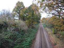
When the path reaches a junction of paths, turn right to continue between hedges. Just before this path emerges out into a field, turn right up three steps, then follow a hedge on the left. At the end of the field go through a gap in the hedge and continue following a hedge on the left. At the corner of this field turn left to join a surfaced road. Turn right down this road for a few yards to reach a bridge over a railway line at TL896270.
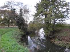
Cross the bridge and continue along the track towards Bacons Farm. Pass the farmhouse on the left, and at the bottom of the track turn right to pass barns on the right. After a few yards turn left through a pedestrian gate to enter a field. Follow a hedge on the left; it soon curves to the left to take a northeasterly course downhill towards the River Colne. When a farm bridge over the river is reached, turn right to start following the southern bank of the river downstream.
At the end of the field go through a pedestrian gate and cross a footbridge to enter a second field. Cross a ditch and continue into a third field; half a mile after joining the river, the path continues to the right along the edge of the field as the river curves away to the left. Continue along the edge of the field with trees away to the left; after three-quarters of a mile a track is reached on the right at TL914269. The trail crosses a farm bridge over a ditch and continues on with sparse woodland and the river away to the left. A nursery starts on the right, with some greenhouses in the distance. Pass a pillbox and continue on past a picnic area and ornate railings on the right. When the railings end continue on between hedges; the path curves to the right and then left, crosses a footbridge over a ditch and crosses a track before reaching the A1124 in Fordstreet at TL920270.
Here the Essex Way is left behind for the long walk down to Marks Tey. Turn right along the A1124; after 200 yards turn right along New Road. This heads southwestwards, passing the nursery on the right, and after a quarter of a mile curves to the left to head uphill to the south. After another half mile it reaches a crossroads beside the church in Aldham. Continue straight on along a road south; care needs taking as the road can get busy. After half a mile the road curves to the right beside a farm at Aldham Hall, then curves to the left to head south. It crosses a bridge over a stream then curves to the left and right. A pavement starts on the right as the road continues south past houses. The road crosses a bridge over a railway line and then passes Marks Tey station on the right at TL916239.
Many people will want to stop the walk here, but I continued on along the road for another few hundred yards until it reached a roundabout off the A12(T). Follow the pavement on the right, and take the first road off the roundabout on the right, the A120. This heads westwards, crossing a bridge over the railway line. Nearly half a mile after the roundabout, turn left at a mini-roundabout into Asbury Drive. Follow this road as it curves around to the right; this walk ends at quarter of a mile further on, at a bus stop at TL905233.
 |
 |
|
Distances
| From | To | Distance (m) | Ascent (ft) | Descent (ft) |
|---|---|---|---|---|
| Great Leighs | Terling | 5.2 | 226 | 328 |
| Terling | White Notley | 3.9 | 164 | 171 |
| White Notley | Coggeshall | 8.5 | 351 | 308 |
| Coggeshall | Fordstreet | 6.7 | 161 | 240 |
| Fordstreet | Manningtree | 3.2 | 151 | 75 |
This makes a total distance of 27.5 miles, with 1053 feet of ascent and 1122 feet of descent.
For more information on profiles, ascents and descents, see this page
Transport
Regular bus services run between Marks Tey and Great Leighs, on a 'First in Essex' Colchester to Chelmsford service 70 that runs via Braintree. The bus stops in Marks Tey are on the A120 road.
The Traveline East Anglia website provides useful transport information in the area.
 |
 |
|
 |
 |
|
 |
 |
|
 |
 |
|
 |
 |
|
 |
 |
|
 |
 |
|
 |
 |
|
 |
 |
|
 |
 |
|
 |
 |
|
 |
 |
|
 |
 |
|
 |
 |
|
 |
 |
|
 |
 |
|
 |
 |
|
 |
Disclaimer
Please note that I take no responsibility for anything that may happen when following these directions. If you intend to follow this route, then please use the relevant maps and check the route out before you go out. As always when walking, use common sense and you should be fine.
If you find any information on any of these routes that is inaccurate, or you wish to add anything, then please email me.
All images on this site are © of the author. Any reproduction, retransmissions, or republication of all or part of any document found on this site is expressly prohibited, unless the author has explicitly granted its prior written consent to so reproduce, retransmit, or republish the material. All other rights reserved.
Although this site includes links providing convenient direct access to other Internet sites, I do not endorse, approve, certify or make warranties or representations as to the accuracy of the information on these sites.
And finally, enjoy your walking!
Nearby walks
| # | Title | Walk length (miles) |
|---|---|---|
| 271 | Fingringhoe to Tollesbury | 16.7 |
| 603 | Bishop's Stortford to Braintree | 18.9 |
| 630 | Braintree to Marks Tey | 14.4 |
|
|

|