Walk #879: Ryde to Ventnor
 |
 |
|
General Data
| Date Walked | 19/01/2011 |
| County | Isle of Wight |
| Start Location | Ryde |
| End Location | Ventnor |
| Start time | 08.01 |
| End time | 15.26 |
| Distance | 19.0 miles |
| Description | This was a varied walk following the coastal path around the eastern side of the Isle of Wight. |
| Pack | Today I carried my 30-litre Karrimor rucksack, filled with water, my waterproofs, a couple of books and other odds and ends. |
| Condition | I feel fairly tired after this walk, but have no problems that will prevent me from doing another walk tomorrow. |
| Weather | Today was mostly sunny, with only occasional clouds spoiling the views. It was fairly cold, but there was little wind to spoil the walk. |
| OS map | Landranger number 196 (The Solent & The Isle of Wight, Southampton & Portsmouth) |
 |
 |
|
Map of the walk
Maps courtesy of Google Maps. Route for indicative purposes only, and may have been plotted after the walk. Please let me have comments on what you think of this new format. For a detailed table of timings for this walk, please see the table file.
 |
 |
|
Notes
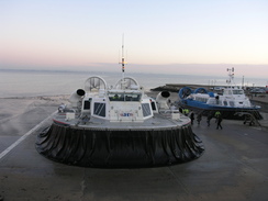
For various reasons it had been a couple of weeks since my last walk, and I am fairly desperate to complete the coastal path around the Isle of Wight. I finished my last walk in Ryde, so early this morning I drove down to Southsea in order to catch the hovercraft over the Solent. People were boarding as I entered the building, and they pulled the steps away the moment I boarded.
It was my first time on a hovercraft and the experience was less noisy than I expected it to be. We skimmed over the waves, but the views out to sea were obscured by moisture on the windows. The crossing was surprisingly quick, and soon we were all clambering off on the apron in Ryde.
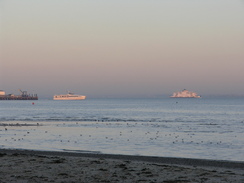
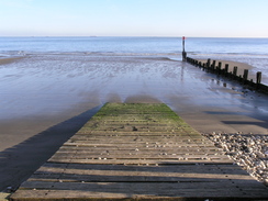
Ferries plied the waters of the Solent as I strolled eastwards along the promenade. Ryde seemed a glorious place in the sunshine, and the beach was surprisingly quiet, perhaps because of the cold - the sand on the beach shimmered white with the frost. Soon a large round tower appeared head, with castellated battlements and a taller round tower to one side. This is Appley Tower, a Victorian folly. Out to sea were two round forts - No Man's Land and Horse Sand forts, beyond which lay the coast at Portsmouth.
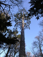
A pub at Puckpool had a sign outside proclaiming that it was open after the floods - an indication of the recent heavy rain in the area. There was no sign of this as I walked on along a road, watching a freighter pass between the two forts out to sea. A pleasant walk led through to Nettlestone Point in Seaview, after which the path diverted inland for a distance. Unfortunately this meant that there were few views out to sea, so instead I concentrated on following the path as it headed around the grounds of The Priory Bay Hotel. A coniferous tree grew out of a compound nearby; a closer look showed that this was actually a man-made radio mast designed to blend in with the surrounding trees.
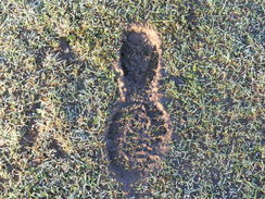
I really wanted to get back to the sea, but first I had to negotiate an area beside a stream. Ordinarily this would have presented no problems, but the area of the field was flooded. My feet left deep muddy prints, but the situation got worse near the stile. The water came up towards the top of my boots, and it was a relief when I crossed over onto the road on the other side.
I decided not to visit the tower of St Helen's church nearby - the rest of the church having been claimed by the sea - and instead headed along the road across a spit called The Duver. This led to a perfectly magnificent stretch of walk along a causeway, with old mill ponds off to the right and Bembridge Harbour to the left. The walkway was narrow, and in one placed lowered down across a series of blocks. Water rushed under a small bridge to fill up the old mill ponds. If only all walks could be like this.
Unfortunately the walk along the southern edge of the harbour was along a road, although there were frequent views across the harbour past moored boats. It was a relief when the road was left behind and the path headed inland slightly uphill before rejoining the coast. I went wrong here, taking a path that eventually fell onto the foreshore. I was unsure whether the path continued on back up the cliffs or along the foreshore; any indication of a path had been obliterated by the sea. Instead I trudged through the shingle on the narrow foreshore, every step hard and annoying. Soon I came across a sign pointing up the cliffs; the coast path heading down and proof that I had gone wrong somewhere.
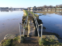
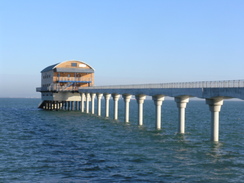
The Bembridge lifeboat house was easily visible ahead, situated at the end of a long concrete pier. The going was surprisingly energy-sapping along the shingle and I was glad when I finally reached the station. The pier leading to the lifeboat was narrow and concrete, a surprisingly graceful structure. It looked new and it is indeed new - Google Maps Streetview shows it under construction.
After this the path headed inland, diverting around a golf course and large building (hotel?) to reach a pub. Here the map showed a path heading along the top of the cliffs, but stern warning signs stated that this was close due to cliff falls. The diversion was a fairly uninteresting stroll along roads parallel, but out of sight of, the coast before a path took me back to the cliffs. I took a little diversion down the closed path on this side, but aside from a view into a cove there was no sign of the cliff fall.
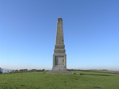
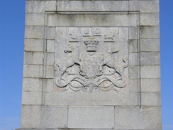
Another path took me on past the site of the old Bembridge School - the only sign of which was an information board - and through the grounds of a caravan park to the start of the climb up onto Culver Down. My target was obvious: the Yarborough Monment, an obelisk planted at the summit of the down. This was originally built elsewhere on the down, but was moved when Bembridge Fort was built. The views from the top were superb in either direction and it would have been a god spot to stop for lunch had it not been for the slight breeze and the sopping wet ground underfoot.
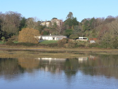
The descent down towards Yaverland was enjoyable, along good paths that were easy to follow. There was a cafe -sadly closed - near the point where the path met a road in Yaverland, and I sat down at a table to scoff the lunch I had prepared. Some children were eating their lunches at some nearby tables, their adult helpers keeping a wary eye on me, as if muddy walkers were an unusual sight on this part of the coast. The Isle of Wight zoo was nearby, and from the harsh stone walls this seemed to have been built within an old fort.
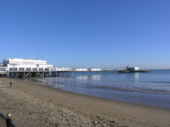
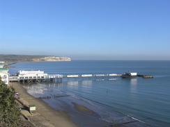
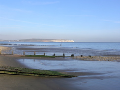
The walk into Sandown was uncomplicated and unremarkable. Sandown Pier grew larger as I approached, and soon I was at its entrance. The interior was dominated by an amusement park that I did not want to enter in muddy boots, so I tried following a walkway that was off to one side. Sadly this ended in a door leading back into the building, meaning that I never got to the end of the pier.
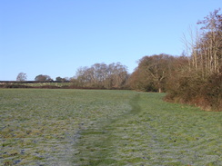
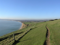
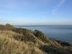
A good promenade runs along the coast from Sandown to Shanklin, and I was expecting the coastal path to follow this. Instead, to my surprise, it clambers up onto the cliff top between the two towns. A zig-zag path took me up, and some earth had slipped off the cliffs onto the path, nearly blocking it - another sign of the recent rains? The climb was worth the effort, as what followed was a superb stroll along good paths and quiet residential roads by the cliff top. The views out to sea were good in places and I found my mood soaring for no particular reason.
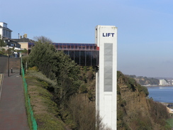
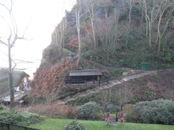
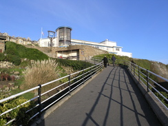
Eventually a large concrete column loomed up ahead, parallel to the cliff. Most cliff lifts have a certain charm, but this literal lift was an ugly eyesore. It was also an ugly eyesore that was not running for the winter. It is a shame that they could not have built a more interesting structure; indeed the first such lift built on this site was a more attractive structure. The path soon reached the edge of Shanklin Chine, and for the first time in a couple of miles I descended down to the foreshore.
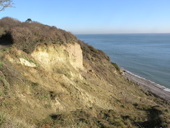
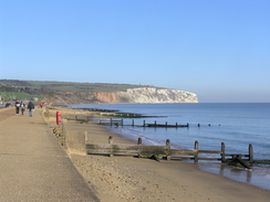
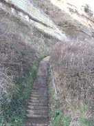
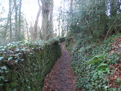
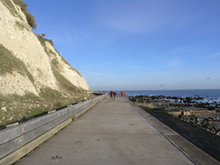
Some people were playing with a ball on the beach, but soon I was climbing up a long set of steps back onto the cliff top. It was a strenuous walk on tired legs, but the top was soon reached. The next few miles followed a road and then path over the hills past Luccombe Village, including a little shack at the end of a garden that sold goodies to passers by - not surprisingly it was shut on this winter's weekday. Part of the path passed through an area of landslips that are quite similar to those found around Lyme Regis; a series of small but wearying ascent and descents, before the promenade was reached to the east of Ventnor.
The last stretch of the walk was an easy end-of-day stroll along the promenade into the town. I must admit to not being too impressed by the place - the beach was little more than a rocky foreshore. I had no idea where the bus stop was in town and there was no bus station marked on the map, but it seemed like a safe guess that it would be at the top of the cliffs. A good zig-zag path took me up onto the top of the cliffs, and I soon saw a bus stop ahead of me beside the Boots.
I did not have long to wait for the bus back to Ryde, and as I sat on it I looked back on what had been a good day's walk. There was one other item of note, however; as the bus was descending into Ryde it got trapped between parked cars on one side and an emergency ambulance on the other. The ambulancemen were obviously on a call, so the bus driver opened the doors and we all got off. Fortunately the hovercraft terminal was only a short distance away, so I walked the rest of the way down the hill; yet again I did not have long to wait to board the hovercraft, a lot muddier than I had been for the morning's flight.
 |
 |
|
Directions
This walk starts off at the bus station in Ryde. Leave the bus station and turn left to head eastwards along the road called the Esplanade for a little under half a mile, passing a roundabout on the way. At SZ600926 turn left along a promenade, following it as it passes a lake, a lifeboat station and Appley Tower on the right. 1.2 miles after leaving the road it passes Puckpool Point and reaches a Springvale Road beside a pub.
Continue straight on along Springvale Road (later Duver Road) for 0.6 miles until it curves sharply to the right at SZ625917. Here continue straight on along a promenade for a quarter of a mile until it ends at a road. Turn left and follow the road as it curves around, following the foreshore before curving to the right uphill, becoming the High Street. Head uphill along the High Street for a couple of hundred yards and then turn left along Pier Road.
When Pier Road meets the shore once more continue straight on along a path in front of some flats; it curves to the right to meet the road once more. Turn left and head south along the road until it ends, and then take a footpath that heads off to the left, angling down towards the sea. The path ends by some public toilets on Ferniclose Road. Turn right up the road and follow it as it curves to the left, becoming a track. It curves to the right once more to take a south-southwesterly course.
A quarter of a mile after the bend a junction with another path is reached on the left at SZ630902; turn left down this footpath and follow it southeastwards for a fifth of a mile until it meets a track by a golf course. Turn right to head south down this track; it passes the entrance to a caravan park on the right. At SZ632897 turn left across a stile to enter a field. Descend down the field to the southeast, aiming for the far corner. Cross a stile at the bottom and then turn left to head southeastwards with a stream on the left. The path emerges out onto Duver Road at SZ635894.
Turn right to follow The Duver as it twists and turns in a rough southerly direction for about a fifth of a mile, passing the entrance to a car park on the left. At SZ636891 turn right along a footpath that heads southwestwards across an area of boggy ground to meet Bembridge Harbour by the start of a causeway. Turn right and follow the causeway southwestwards; it eventually curves to the right just before joining dry land at a road. Turn left along this road with water on the left, and then turn right to head west with houses on the left. After a short distance turn right and then left to reach Latimer Road. Turn left and follow Latimer Road westwards for a few hundred yards until it ends at the B3395 road.
Turn left and follow the B3395 road as it follows the southern edge of Bembridge Harbour eastwards for a mile. It reaches the Pilot Boat Inn on the right; as the road curves to the right two tracks head more or less straight on; take the left-hand one of these and follow it uphill until it ends at Ducie Avenue. Turn left down the avenue and follow it for a short distance towards the sea. At the bottom take a path leading off to the right, which soon joins the foreshore.
Follow the foreshore for about 0.8 miles until it reaches the pier belonging to Bembridge Lifeboat. Climb up and pass through the car park to join a road, Fishermans Walk, which runs just inland of the shore. As it approaches a small golf course turn right down a narrow footpath southwestwards until it ends at Foreland Farm Lane. Turn left along this lane and follow it as it curves to the right, then turn left along Beachfield Road. This curves to the right to pass a coastguard building. Immediately after the building turn left to pass through the car park of the Crab and Lobster pub to reach a path beside the coast. The path curves to the right and runs along the ntop of the cliffs westwards before reaching a lane at SZ654872.
The footpath along the tops of the cliffs from here has been shut due to landslips, so turn right to walk north up this road. Take the first road off to the left, Howgate Road, and follow that southwestwards for a little over half a mile until the road curves to the right at SZ645870. Pass a gateway and then turn left and follow a path back down to the clifftops. Once there, turn right to rejoin the path as it heads southwestwards, passing seawards of the old Bembridge school.
The path emerges out onto into a grassy area of a caravan park; continue on along the edge of the cliffs, passing a sloping track leading down to the beach, and on out of the park. The path curves to the left and then starts to climb up through some scrubland, taking a more westerly course. It emerges out onto grassland near the top of the ascent; make your way to a gap in the hedge and then turn half-right to head towards the Yarborough Monument.
From the monument turn left to head down towards the road. Turn right for a few yards, passing a cafe on the left, and then turn left down a footpath that heads across grassland to reach the clifftop path. Turn right and start following the path downhill for a little over a mile; it is never strays too far from the edge of the cliffs. It eventually reaches a car park, and then the B3395 road at SZ610849. Do not join the road, but instead take the promenade that runs alongside it for 0.6 miles, and then turn left down Avenue Road Slipway to reach the promenade once again.
The road soon ends at the sea once again; turn right and continue southwestwards along the promenade for half a mile, passing the pier. When the promenade ends at SZ596838, turn right to join a path that angles steeply uphill behind some apartments. It curves to the left once more to reach a path that runs along the top of the cliffs. Follow this for about one and a half miles as it follows the cliffs, initially southwestwards and then southwards.
At SZ586817 it crosses Hope Road Approach; continue on up Eastcliff Promenade. When this ends continue on along the path southwards; it joins a road for a while, and when this curves to the right head straight on uphill along another path before joining Chine Avenue. Follow this downhill for a short distance; when it curves to the right continue on downhill along another path. This curves to the right past a pub, and then to the left once more, curving more before ending at the promenade at the base of the cliffs.
Turn right and follow the promenade southwards past the mouth of the chine. When Appley Steps are reached at SZ584808, turn right to ascend the long flight of steps onto the top of the cliffs. At the top the path turns to the right to head inland, becoming Popham Road. This swings to the left, and then turn left up Luccombe Road. Follow this road for half a mile; there is a path skirting through a field to the right for a short stretch, but the road is quiet enough for this not to be needed.
At SZ583300 the road splits; take the left-hand fork which soon becomes a path that heads through scrubland to seaward of Luccombe Village. It is easy to follow as it enters an area of landslip, now thoroughly populated with trees, eventually dropping down onto the end of a promenade at SZ578779.
Follow the promenade as it twists and turns southwestwards for a mile until it reaches the harbour at SZ563773. Here turn right and take a zigzag footpath that heads uphill, part of the time in companion with a road. The path meets the road at the top of the hill; continue straight on uphill along Shore Hill. It swings to the left, becoming Pier Street. Continue on until Pier Street ends at a T-junction with the High Street; the bus stop is a few yards away on the left.
 |
 |
|
Distances
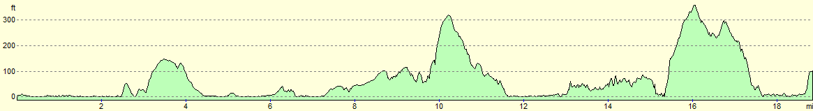
| From | To | Distance (m) | Ascent (ft) | Descent (ft) |
|---|---|---|---|---|
| Ryde | Bembridge | 7.2 | 486 | 486 |
| Bembridge | Sandown Pier | 5.8 | 604 | 604 |
| Sandown Pier | Ventnor | 6.0 | 1112 | 1014 |
This makes a total distance of 19.0 miles, with 2202 feet of ascent and 2104 feet of descent.
For more information on profiles, ascents and descents, see this page
Transport
Southern Vectis route 3 operates half-hourly between Ventnor and Ryde.
 |
 |
|
 |
 |
|
 |
 |
|
 |
 |
|
 |
 |
|
 |
 |
|
 |
 |
|
 |
 |
|
 |
 |
|
Disclaimer
Please note that I take no responsibility for anything that may happen when following these directions. If you intend to follow this route, then please use the relevant maps and check the route out before you go out. As always when walking, use common sense and you should be fine.
If you find any information on any of these routes that is inaccurate, or you wish to add anything, then please email me.
All images on this site are © of the author. Any reproduction, retransmissions, or republication of all or part of any document found on this site is expressly prohibited, unless the author has explicitly granted its prior written consent to so reproduce, retransmit, or republish the material. All other rights reserved.
Although this site includes links providing convenient direct access to other Internet sites, I do not endorse, approve, certify or make warranties or representations as to the accuracy of the information on these sites.
And finally, enjoy your walking!
Nearby walks
| # | Title | Walk length (miles) |
|---|---|---|
| 304 | Langstone to Tipner | 16.8 |
| 305 | Tipner to Browndown | 18.9 |
| 306 | Browndown to Bursledon | 12.9 |
|
|

|