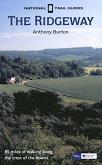
The Ridgeway National Trail
The Ridgeway is an 87-mile long National Trail that follows ancient tracks and pathways from the Marlborough Downs to the Chiltern Hills. It starts at Cold Overton Down, just a stones' throw away from the fantastic settlement at Avebury, and ends high on the top of Ivinghoe Beacon.
It is a walk of two very disparate halves; the western half keeps high, following the top of ridges east towards the Goring Gap. This stretch is a walk through history; there are signs of neolithic life everywhere, from barrows to hill forts. In places the views are superb. This stretch passes the hill forts at Barbuey Castle, Liddington Castle and Uffington Castle (the highest point in Oxfordshire), and as well as Avenbury, it also passes several long barrows, such as Wayland Smithy.
The eastern half initially follows the Thames northwards, then heads off northeastwards across the Chiltern Hills. The path rises and falls much more in this strech as it heads across fields and through woodland. Whereas the western half of the walk stays away from settlement, this half passes through several towns; Goring, Princes Risborough, Wendover and finally Tring.
Much of the Ridgeway is a bridleway, and (particularly east of Goring), the bridleway and footpath diverge frequently. This means that there can be two seperate Ridgeway routes between any two locations, a situation that is confused by the western extension to the Icknield Way, which is often coincedent with the Ridgeway.
The Ridgeway is part of a longer set of tracks called the Greater Ridgeway that are based on neolithic routes. This heads off from the Dorset coast on the Wessex Ridgeway, then the Ridgeway; the Icknield Way from Ivinghoe Beacon to Thetford; and finallt the Peddar's Way National Trail from Thetford to the Norfolk Coast.

