Walk #992: Jurassic Way: Barrowden to Stamford
 |
 |
|
General Data
| Date Walked | 18/04/2018 |
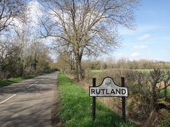
| County | Rutland, Northamptonshire, Lincolnshire |
| Start Location | Barrowden |
| End Location | Stamford |
| Start time | 08.10 |
| End time | 13.20 |
| Distance | 14.3 miles |
| Description | This was a very pleasant walk, following the Jurassic Way to its eastern trailhead. |
| Pack | Today I carried my 30-litre Karrimor rucksack, filled with water, my spare waterproofs, a book and other odds and ends. |
| Condition | I feel absolutely fine after this walk. |
| Weather | Today was hot and sunny, a dramatic difference to the last few months. There was not much breeze, and it was a nearly perfect day for a walk. |
| OS map | Landranger number 141 (Kettering, Corby & surrounding area) |
 |
 |
|
Map of the walk
Maps courtesy of Google Maps. Route for indicative purposes only, and may have been plotted after the walk. Please let me have comments on what you think of this new format. For a detailed table of timings for this walk, please see the table file.
 |
 |
|
Notes
After the last rather boggy walk, it had been my intention to follow roads today, which would hopefully be a little drier. However my mind kept on being drawn to the eastern end of the Jurassic Way, so early this morning I set off for the drive to Stamford. I love this town, with its rosy-yellow stone buildings topped with Collyweston slate roofs. The main railway to Scotland bypassed the coaching town, meaning that it did not become a major city as Peterborough did, and as I waited for my bus this morning it felt as though time was bypassing the town as well. The bus station is on the site of the old castle - of which no trace remains - and the bus shook and jolted its way across country lanes and MOD bases before dropping me off in Barrowden.
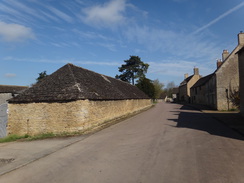
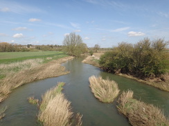
The village was just as beautiful as it had been on Friday, but the addition of sunny skies gave it a bright sheen. I had taken my fleece off on the bus, and the day was already getting warm as I left the village via the site of an old mill and crossed the River Welland for the first time in the day. Some large circular brick structures stood away to the east; the Internet tells me they were calcining towers built in the First World War, and which were never used.
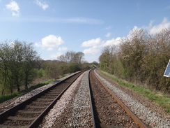
Soon the trail passed under an old railway bridge and entered the hamlet of Wakerley. The trail followed a road for a short distance, before taking a footpath that skirted a church before rejoining the road. Workmen were digging up the tarmac, and I passed a crossing for noisy quarry workings that were not marked on my old map.
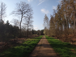
Woodland soon started on the right, and the map has the trail diverting off the road through the trees. I found a suitable path that headed in the correct direction, but there were no waymarkers on the ground. A couple of cars were scattered around the higgeldy parking area, as if avoiding the wooden toilet block. I headed down an off-road biking course that seemed to head in the correct direction - a silly decision, but fortunately there were no cyclists about at the early hour. This led out onto a track, where a Jurassic Way marker pointed through the trees towards the road. There was no waymarker leading from the road, so I headed back to the car park along a track, and then retraced the same route back to the marker. I'm still unsure whether this is the proper route, but it will do.
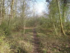
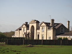
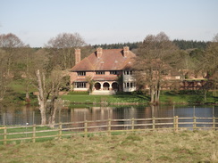
The rest of the waymarkers through the woodss were excellent, sometimes with a couple within a few metres. It was a very pleasant stroll, and although there were a few damp patches it was a world apart from the bog of the last walk. The trail left the woods and descended towards a main road. A large and stately building was visible to the right in the distance - Laxton Hall, a Grade-II listed building that is now a residential care home for the Polish community. The road was crossed near a dramatic gateway that also seems to be a house, and by this time I was starting to feel quite warm.
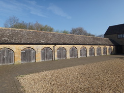
The trail climbed a hill passing another grand building down to the left - this is the site of Fineshade Abbey, a stately home that was demolished in 1956, and which itself was on the site of Castle Hymel. The grand buildings that remain are the old stables - and they are magnificent enough in themselves. A couple of stretches of path were a little boggy, but nothing as bad as the ones I had crossed last Friday, and I started really enjoying the walk.
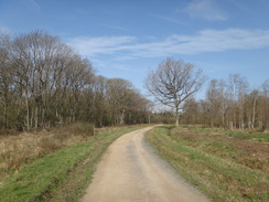
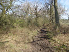
A road was met near a bridge over the old railway line, and soon afterwards the trail passed a rather grand cafe in a converted stables - part of a forestry commission visitors centre. Good, firm tracks led on, with signs for the Gruffalo that is apparently found nearby - I could only hope that no-one would mistake me for him! The walk through the woods was easy and enjoyable as it headed eastwards, and after a mile or two the track curved left to head northwards. The map showed the trail following it, but waymarkers pointed off a rougher track that continued straight on. A gateway was flooded, giving me memories of last week's walk, but this was easy enough to divert around
Another path led north past a shed with a rather ominous warning sign. The path became fairly muddy; it improved when it rejoined the main track once more, but it soon headed off along another path through the trees that had been badly churned up by horses. It was a bit of a pain to negotiate the worst stretches, but still much preferable to last week's constant boggyness. Sections of gas pipe sat in a compound as the woodland ended, and an access track led on to a road, beyond which was the village of Duddington.
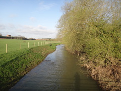
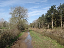
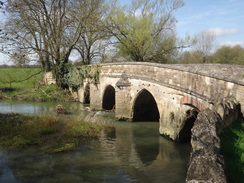
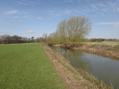
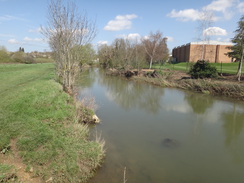
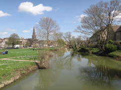
If Barrowden is beautiful, then Duddington requires a more extreme superlative. It is picture-postcard perfect, and the sunshine just added an extra cherry on top. If you were to remove the cars and put some gravel over the tarmac and you could be back to an ancient year. Sadly the trail did not spend long in the village, heading across a bridge over the Welland before heading under a large bridge carrying a main road overhead - an unwelcome intrusion of modernity. Driftwood against a gate showed how high the river had recently been, but now it was fairly quiescent, as if t had been calmed by the sun.
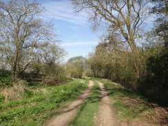
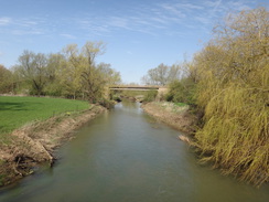
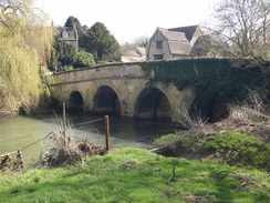
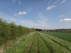
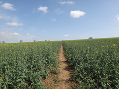
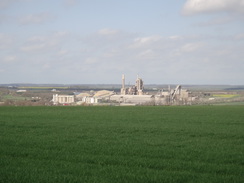
A short but pleasant riverside stroll was followed by a ramble alongside a large field, which led into the village of Ketton. After this I was on familiar territory, as from here on the Jurassic way follows the route of the Hereward Way, which I have walked several times before. It is not a bad walk to repeat, and the sun shone brightly as a road led down to the Collyweston bridge over the Welland. In fact it was shining too brightly, as my arm was starting to get red and I had no suntan lotion with me. A pleasant climb followed, albeit the first part was across a rough-ploughed field. There were views across the valley towards the massive quarry and cement works that dominate the area.
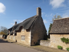
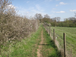
A long track called Ketton Drift took me into Easton on the Hill. The initial stretch was through ordinary suburbia, but after buying an ice lolly from a small shop I reached another the core of the village, which is filled with stone buildings. Collyweston slate roofs topped most of the houses, and the narrow road leading down towards the church was beautiful. All too soon the path left the village. A well-walked path was obvious on the ground, but this was a slightly different route to the one marked on the map; it is also the path I have walked before. The sun was getting warmer though, and I was keen to get to Stamford.
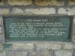
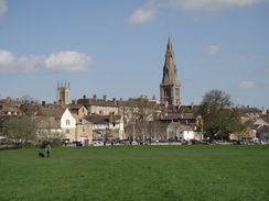
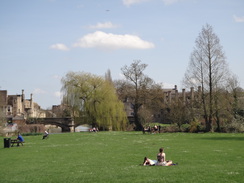
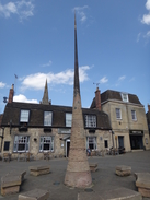
The trail crossed a railway line, and then headed under the A1 to reach the riverbank. The last mile into Stamford was a pleasant walk along the floodplain; a little monument marked the place where a Roman ford once crossed the river as their main route from London to the north. People were sunbathing by the river nearer the town, using perhaps the first opportunity this year to do so. I was unsure where in the town the Jurassic Way actually ends, so I headed into town, buying a 99 on the way, to the stone spire that replaces the Eleanor's cross that once stood nearby. I had last passed one of these in Stony Stratford, and it is pleasing to see that Stamford has embraced this part of its history.
I had intended to extend the walk with a seven-mile loop to the east of the town, but my right arm was burning badly by this time, and it felt like a good idea to stop early. It has been a short walk, but a very enjoyable one though some stunning villages. Even better, it looks like we're finally in summer, having missed out on any spring. Time to do more walks.
 |
 |
|
Directions
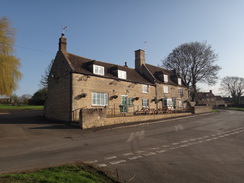
This walk starts off outside the Exeter Arms pub in Barrowden at SK94640009. Leave the Eexter Arms and head down towards the village pond for a few metres; before the pond is reached, turn left along Main Street, and follow it eastwards through the village. After 350 metres Main Street forks; take the right-hand fork that becomes Mill Lane. This soon curves to the right, and when it ends take a surfaced footpath that leads off to the right. This descends down, curving right and then left past an old mill pond to reach a footbridge over the River Welland at SP95089991.
Cross the footbridge and go through a pedestrian gate to enter a field. Head straight across the field, aiming for a bridge under an old railway line ahead. Go through a pedestrian gate beside a field gate and pass under the bridge; a track on the other side leads up to reach Main Street in Wakerley. Turn left along the road and follow it through the hamlet; after 400 metres a road comes in from the left. Cross the road, and a few metres further on, turn right up the driveway of a house at SP95539944.
Continue on along a footpath with a fence and a house on the right; this leads to a stile. Cross this into a field and continue between fences to a second stile. On the other side, enter a field and turn left, keeping a hedge on the left. Head towards Wakerley church; the hedge becomes the church's boundary wall. When the stone wall turns left, angle slightly left across the field, aiming for the far corner (alternatively follow the field boundary around the edge). At the field corner, turn left to descend a few steps to reach a road. Turn right up the road; it curves left and right and starts to climb a slight slope. After about 500 metres, just at the end of a left-hand curve, turn right through an unsignposted path into the trees on the right. This soon curves left and forks; take the left-hand branch. It becomes wider as another path joins from the right and soon emerges out into a car park in Wakerley Woods at SP96089856.
Wind left and then right through the car park, keeping the toilet block away to the right, soon joining a track that parallels the road through the trees on the left. This soon ends at another track, with a junction with the road off to the left. Turn right down the track away from the road, immediately passing a vehicle barrier. When the track curves right, turn left down a path that heads eastwards. Take the second path off to the right after about fifty metres, which heads south through the trees. The path descends to end at a T-junction with a grassy path; turn right down the path, and after about ten metres turn left up another path that heads uphill through the trees. At the top of the climb the path joins a better-quality path; when this path soon curves right, continue straight on along a lesser path that leaves the woodland and passes between fences to reach a stile at SP96580769.
Cross the stile to enter a field; head straight on downhill, angling slightly away from the fence on the left. At the bottom of the field cross a stile into a second field and angle slightly left to join the fence on the left. Before the corner of the field is reached, turn left through a field gate to enter a third field. Head straight on across this field, and at the far side go through a bridleway gate beside a field gate to reach the A43(T) road at SP96899749.
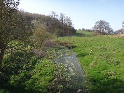
Carefully cross the road, turn left along the far verge, and then immediately right to go through a clappergate beside a field gate into a field. Head straight on down this field, aiming for the corner of some woodland in the distance. At the bottom of the hill cross a wide concrete bridge over a stream, and then immediately turn left. Follow the stream on the left for a few metres, and as the stream curves away, continue straight on uphill, aiming slightly to the right of a house in a hollow ahead. In the corner of the field at the top of the hill, cross a stile to join a narrow path that runs between fences to reach another stile into a field at SP97409772.
Enter the field and turn left, keeping the fence on the left. After a few metres turn half-right away from the fence. At the end of the field cross a stile to enter some woodland. Follow the obvious path through the woods as the path climbs, cresting the hill before leaving the woods through a gap into a field. An obvious path heads across this field, descending into a dip before climbing up to reach a gap beside a field gate that leads onto a road immediately beside an old railway bridge. Turn right to cross the bridge, and continue along the road until it soon ends at the Fineshade Wood visitors complex. When the road forks, take the right-hand branch that reaches a cafe on the left at SP97929828.
Continue past the cafe and then a house on the left to reach a fork in the surfaced road. Take the right-hand branch, go past a vehicle barrier and follow the unsurfaced track as it curves to the right. When the track forks once more, take the left-hand major branch. Continue on this good track eastwards for a mile, ignoring any other tracks leading off it, until it curves sharply to the left. Continue straight on past a vehicle barrier along a rougher path for 150 metres until a field gate is reached at SP99779767.
Go past the gate and immediately turn left, passing a barn on the right, to join a bridleway. Initially this squeezes between a fence on the right and woodland to the left; the fence soon ends and the path continues northwards though the trees. After about 900 metres the path joins a good track; turn right down this track, and when it curves left after 200 metres, continue straight on along a rough path northwards through the trees. When the woodland ends head straight on (do not enter a field to the right). After 600 metres a track is reached; cross this and continue straight on along the path as it descends. After another 400 metres, go past a field gate and continue past a gas compound on the right. The bridleway joins the compound's access track; follow this for 800 metres until it ends at the A43 road at SK98800030.
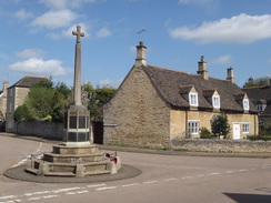
Turn right along the road for a few metres, and then carefully cross it to reach a pavement on the other (northern) side. Continue along the pavement as it curves to the left alongside a slip road to reach the Royal Oak pub in Duddington. Continue along High Street through Duddington; ignore Todd's Hill leading off to the left, and a short distance further on, turn left at a triangular junction down Mill Street. Follow Mill Street as it descends, passing the war memorial and church on the left to reach a bridge over the Welland. Cross the bridge, and immediately on the other side turn right through a bridleway gate to enter a field. Keep the river to the right, aiming for a large road bridge ahead that carries the A47(T) overhead. At the end of this small field, cross a stile beside a field gate and squeeze between the river and the bridge's abutment to reach a field gate at SK98470098.
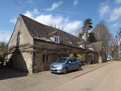
Go through the field gate to enter a field. Continue straight on, roughly following the river on the right. Descend into a little dip with the river immediately on the right, and then angle slightly left to cut off a loop of the river. Rejoin the riverbank, and shortly after the river curves to the right, turn left up a bank to reach a stile through a fence. On the other side, turn right to follow a fence and scrubby hedge on the right and a band of trees on the left. Before a 'keep out' gate is reached ahead, turn left across a stile beside a field gate to enter a field. Head across the middle of the field, angling slightly to the right, to reach a stile in a hedge that leads onto a road. Turn right down the road for a short distance until the entrance to Tixover house care home is reached on the right at SK97880168.
Continue down the road for a short distance, and then turn left across a stile though a hedge to enter a field. Turn half-right to head diagonally across the field, climbing a slight slope and then descending to reach another stile in the bottom hedge that leads out onto a bend in a road. Turn left along the road for a few metres, and then turn right past a vehicle barrier into a field. Follow a rough track alongside a hedge on the left; it gently climbs, crests a hill and then starts to fall; after nearly a mile a fence is approached ahead. As the hedge ends, curve left alongside a fence on the left, and then head up a path with a fence on the right and a hedge on the left. At the top corner of the field, turn right, still between a fence and a hedge. At the end of the field, go through a pedestrian gate, cross an access track, and then continue along a path with fences on the left guarding houses and a hedge on the right. The path curves right and then left, before emerging out onto Geeston Road in Geeston at SK98560383.
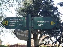
Here the Hereward Way is joined, and the two trails follow the same route all the way into Stamford.>
Turn right to follow the road as it leaves the village. It descends onto the floodplain and after 600 metres reaches Collyweston Bridge over the River Welland. On the other side of the bridge the road curves to the right; ignore a track coming in from the left and immediately afterwards turn left to cross a footbridge over a ditch into a field. Turn half-right to head east-northeastwards uphill diagonally across the field, and at the top, cross a ditch and go through a pedestrian gate to enter a second field. Head straight on diagonally across the corner of the field, soon reaching a gap in a hedge that enters a third field. The path continues to climb diagonally; at the top corner of this field, go through a gap to join a track called Ketton Drift at TF00010405.
Follow this track eastwards; initially it is a green lane, but it gradually improves, and after half a mile it ends at a public road called West Fields. Continue straight along the road; when it ends at a T-junction in Easton-on-the-Hill, cross the road ahead and continue straight on up the High Street. Pass the Blue Bell Inn on the left, and at the war memorial turn left down Church Street. After a third of a mile it reaches the church on the left; continue along the track immediately beyond the church, passing a car park on the right, and then turn right through a gap beside a field gate to join another footpath. This heads across an extension of the car park to reach a stile through a hedge at TF01160481.
On the other side the footpath cuts diagonally across a field to reach another stile about a third of the way along the hedge on the left; the path continues diagonally across a second field. Go through a gap in an intermittent hedge to enter a third field, and then turn left to keep a hedge on the left down the third field; the path takes a slightly more direct route than that shown on the map. It passes through a narrow patch of woodland to enter a fourth field; at the northern end of this it descends into some boggy land to reach a long footbridge across a stream. On the other side of the bridge, turn right and climb up some wooden steps to reach a gate guarding the Stamford to Oakham railway line at TF01700570.
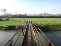
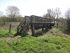
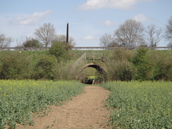
Very carefully cross the railway line to reach a gate on the other side. The path immediately crosses a footbridge over a stream and then descends down steps to enter a field. Turn half-right to head northeastwards across the field for a short distance to reach an underpass under the A1(T). On the other side, go through a gap beside an (in 2018) overgrown stile, and head straight on northeastwards across a field on the other side. This soon reaches the river Welland on the left; after a quarter of a mile a green footbridge (Broadeng Bridge) over the stream is reached at TF02120610.
Cross the bridge, and on the other side turn half-right to continue northeastwards across the floodplain, aiming towards a church spire in the distance. When the grassy path forks, take the vague right-hand fork, aiming roughly towards a squat brick building on the other side of the river ahead. The path skirts a stream of the river on the right before crossing a gap in a fence into a meadow. Continue on across this to reach a surfaced path at TF02880689.
Turn left along the path as it crosses a small stream of the Welland on a bridge to reach a road. Head straight on up a road ahead, Castle Dyke, until it reaches Sheep Market. Cross this to reach the modern replica of an Eleanor's Cross at TF02850705.
In the absence of a known trailhead, I've classed this as being a worthy eastern trailhead for the Jurassic Way. What follows are the directions to Stamford railway station.
Leave the Eleanor's Cross and cross the Sheep Market before heading down a road called Castle Dyke. When this soon ends, join a footpath ahead that crosses a stream of the Welland. Head on along the surfaced path across the meadow to reach a second footbridge (George Bridge) over the river at SK028068. Cross this and then head straight on uphill along Wothorpe Road, passing a car park on the right. Immediately after the car park, turn right along Gresley Drive. This curves right and then left before reaching a mini-roundabout in from of Stamford station at TF02880667.
 |
 |
|
Distances
| From | To | Distance (m) | Ascent (ft) | Descent (ft) |
|---|---|---|---|---|
| Barrowden | Duddington | 7.3 | 541 | 555 |
| Duddington | Easton on the Hill | 4.5 | 327 | 183 |
| Easton on the Hill | Stamford station | 2.5 | 51 | 248 |
This makes a total distance of 14.3 miles, with 919 feet of ascent and 986 feet of descent.
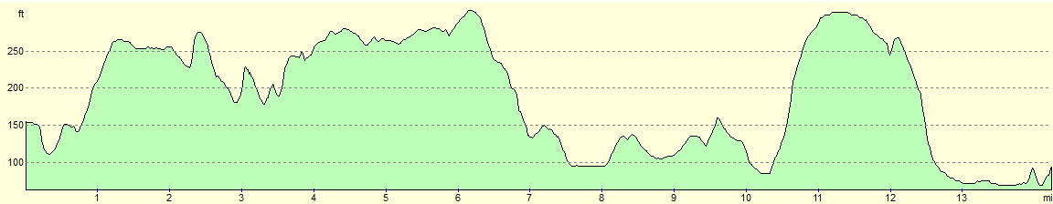
For more information on profiles, ascents and descents, see this page
Transport
Centrebus Midlands service 12 currently runs between Stamford and Barrowden. This runs every couple of hours during the day, and takes abut forty minutes for the journey.
 |
 |
|
 |
 |
|
 |
 |
|
 |
 |
|
 |
 |
|
 |
 |
|
 |
 |
|
 |
 |
|
 |
 |
|
 |
 |
|
 |
 |
|
 |
 |
|
 |
 |
|
 |
 |
|
 |
 |
|
 |
 |
|
 |
 |
|
 |
 |
|
 |
 |
|
 |
Disclaimer
Please note that I take no responsibility for anything that may happen when following these directions. If you intend to follow this route, then please use the relevant maps and check the route out before you go out. As always when walking, use common sense and you should be fine.
If you find any information on any of these routes that is inaccurate, or you wish to add anything, then please email me.
All images on this site are © of the author. Any reproduction, retransmissions, or republication of all or part of any document found on this site is expressly prohibited, unless the author has explicitly granted its prior written consent to so reproduce, retransmit, or republish the material. All other rights reserved.
Although this site includes links providing convenient direct access to other Internet sites, I do not endorse, approve, certify or make warranties or representations as to the accuracy of the information on these sites.
And finally, enjoy your walking!
Nearby walks
| # | Title | Walk length (miles) |
|---|---|---|
| 56 | Peterborough to Stamford | 16.5 |
| 58 | Stamford to Oakham | 16.8 |
| 647 | A circular walk from Oundle to King's Cliffe | 19.6 |
|
|

|