Walk #900: A linear walk from Woodhall Spa to Fulletby and return
 |
 |
|
General Data
| Date Walked | 17/05/2011 |
| County | Lincolnshire |
| Start Location | Woodhall Spa |
| End Location | Woodhall Spa |
| Start time | 07.47 |
| End time | 16.13 |
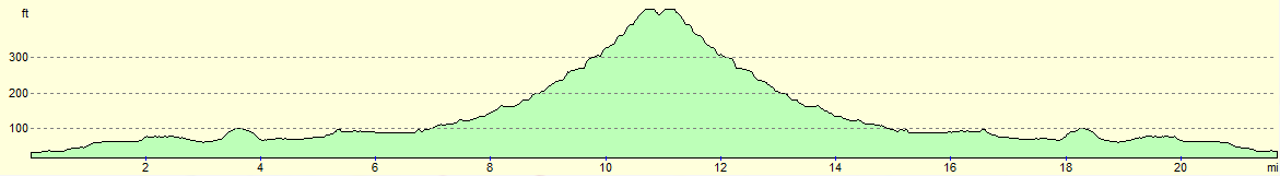
| Distance | 22.0 miles |
| Description | This walk heads northeastwards from Woodhall Spa throgh Horncastle to Fulletby, before returning via the same route. A good proportion of the day is spent walking along an old railway line, with heights and views only really coming as the trail climbs near Fulletby. |
| Pack | Today I carried my 30-litre Karrimor rucksack, filled with water, my waterproofs, a couple of books and other odds and ends. |
| Condition | The underside of my feet are aching after this walk, a result of the many miles walked along roads and hard tracks. Otherwise I feel fine. |
| Weather | Today was fairly cloudy without many views of the sun; there was also a fairly fierce breeze. Unlike yesterdy there was no sign of any rain. |
| OS map | Landranger number 122 (Skegness & Horncastle) |
 |
 |
|
Map of the walk
Maps courtesy of Google Maps. Route for indicative purposes only, and may have been plotted after the walk. Please let me have comments on what you think of this new format. For a detailed table of timings for this walk, please see the table file.
 |
 |
|
Notes
I had a good night's sleep, and the morning showed quite how lovely the campsite was. There was plenty to see; rabbits running about; squirrels wiping their faces with their paws and ducks leading their ducklings to the water. It was all quite magical.
Today was a red-letter day - my 900th walk since I started logging my trips back in 1999. I lay in my tent this morning thinking back over those hundreds of walks, the highs and lows of this obsession of mine. It is almost unimaginable to think that I would manage another 900, but 1,000 seems like an achievable target - only another 100 walks to go!
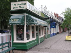
I was keen to get on with this walk and therefore set off at seven - the moment the campsite's gate opened - and headed back to Woodhall Spa where I had ended yesterday's walk. Knowing that there was plenty of time in which to finish the walk I faffed around a little and bought myself some chocolate from a shop and had a quick look around the town.
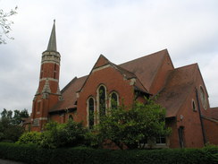
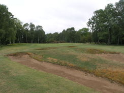
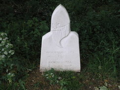
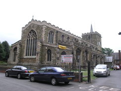
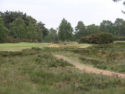
The Viking Way headed down the main street through the town, passing an imposing red-brick church before heading off past the tiny town museum and crossing an old railway line. It then followed a road before entering a golf course. Unlike most paths across golf courses, this one went through trees and bypassed most of the greens, crossing only a couple of fairways before reaching a road.
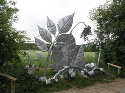
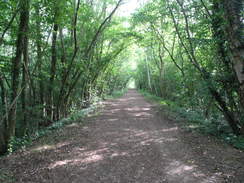
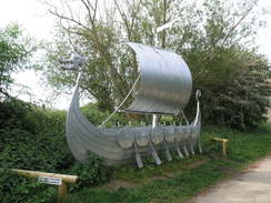
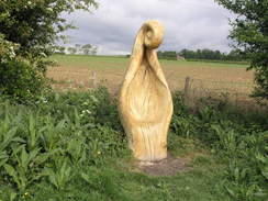
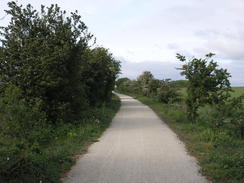
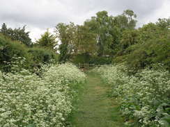
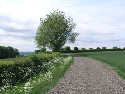
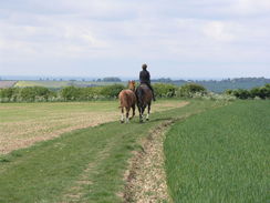
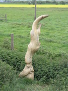
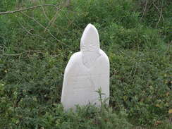
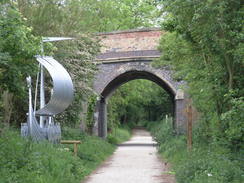
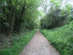
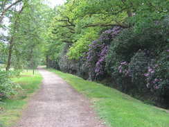
The next three or four miles were along a good trail that followed the course of the old Hornchurch railway line; I generally enjoy walking such trails, but they are usually through scenic areas. This was not going to be the case with this trail which ran through a very flat area. Fortunately the creators of the trail had spent some money adding some sculptures to the trail; some carved wooden ones and four metal ones that were spectacular both in size and form. Wildlife seemed to love the trail: several squirrels ran in front of me and I narrowly avoided treading on two snails that were mating right in the middle of the path.
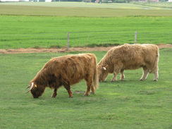
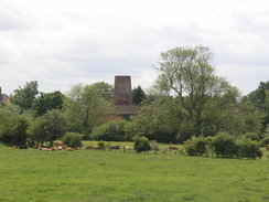
There were few other sign of the old railway line; no signal post bases, sleeper imprints or even drainage covers. The conversion of the railway line to a path seemed to have removed a great deal of the character of the former. A farm near the end of the path had five highland cattle in a field, the farmer feeding them from a trailer.
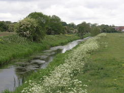
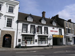
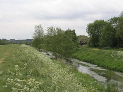
Eventually the path reached a road, and here the trail crossed over to the other side of the River Bain, which despite its large banks was little more than a stream. The next stretch to Horncastle proved to be an improvement: the surface was grassy instead of unyielding compacted gravel, and the views were better with the Bain taking centre-stage. It had to end and soon the trail got sucked into Horncastle. This proved to be a busy town with lots of people going to and fro from the shops. I noted a couple of pubs for later and headed out of the town.
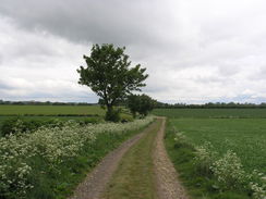
The Viking Way headed eastwards out of the town, passing a couple of schools before squeezing behind houses and emerging out onto a road. The next mile or so of tarmac proved to be hard on feet that were overheating - indeed I was overheating as a whole, mainly because I had yet to take my coat off. There had been no rain aside from a few spots earlier, but there was a chilly breeze that forced me to keep my coat on. One of my failings as a walker is proper temperature control - i.e. taking off or adding clothes as necessary to keep warm, and this was the case today. Instead of stopping I pressed on as the trail left roads and started slowly ascending uphill.
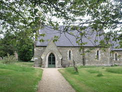
It was an easy yet gradual climb northeastwards, the only troublesome bit coming when the track was covered in old railway ballast (which included a couple of old metal spikes for good measure). After passing a farm it joined a road and continued uphill into Fulletby. It did not take long to find the church, which was the point where I had decided to call it a day and start back. So far I had done eleven miles, meaning that the entire day would be about 22 miles - a good distance.
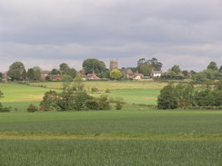
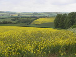
On the way back I noticed something that I had not seen on the journey uphill; some grand views onto the plains to the south and west. These had been to my back during the climb and I had missed them. As I had once more beaten my target of completing twelve miles by midday it seemed like a good spot to stop for a rest. I hunkered down out of the wind and positioned myself with a good view down into the valley. Several fats jets flew overhead, but due to the cloud I only got to see one. It also seemed like a good opportunity to take my coat off.
The return to Horncastle was uneventful; once in the town I sought somewhere to eat. The first pub I tried was not serving food; the second was, so some ham, egg and chips were washed down with a bitter shandy. The food was good, and revictuled I headed off along the trail. Return journeys always seem to take less long, and soon I found myself back on the railway path. My feet were starting to ache by now, and the end of the trail always seemed a little too far away. After recrossing the golf course I reached my car, thankful that the day was over. It had been a good day's walk, but end-to-end return walks always make me feel vaguely dissatisfied, and this had been just such a day. Perhaps the overcast weather had not helped, but I could not help but feel that it was hardly a classic stroll.
 |
 |
|
Directions
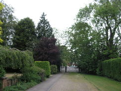
This walk starts off from the Co-Op in Woodhall Spa at TF194632. Leave the Co-Op and head head northweastwards up the road for a couple of hundred yards. Pass a red-brick church on the left and turn left up Iddesleigh Road. When the road ends go through a wooden gate and continue along a track for a short distance; go through a second gate to reach Spa Road. Turn right and follow Spa Road east-northeastwards with a row of trees on the left; after passing a large building on the left the track curves to the right; leave the track and continue straight on northeastwards along a rough track.
Initially this heads past trees before following a hedge on the left. Go through a couple of gates as the track plunges though more trees. It crosses a series of golf fairways; a mile after the large house the path ends at a road at TF213647. Turn right to head southeastwards for a quarter of a mile, and then turn left through a gate to join a good track that follows the course of an old railway line. Follow this as it heads northeastwards for nearly 2.5 miles, crossing Martin Bridge at the halfway point. It curves slightly to the left before reaching a road beside Thornton Lodge Farm at TF256680.
Do not continue along the path ahead, and instead turn right to head east along the road for a few yards. It crosses a bridge over the River Bain and then turn left through a wooden clappergate to start following the eastern bank of a stream northwards for 0.8 miles, passing another clappergate on the way.
It goes through another clappergate and squeezes past a building on the right before passing a footbridge on the left. Immediately after the bridge the river curves to the right to head eastwards for about a quarter of a mile, with a road on the right. Eventually the path meets the A158 in the centre of Horncastle.
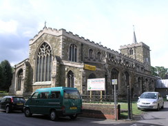
Carefully cross the A158 and follow the road eastwards. Just before Waring Street comes in from the right, turn left to cross a bridge over a stream. On the other side head north along Church Street, passing Horncastle Church on the left. When this ends at the High Street turn right and follow this road as it curves eastwards through the town. When it reaches the A153 cross the main road and continue straight on down Banks Street. This curves to the right and then the left to continue in an easterly direction with a stream on the right.
Take the first road to the left, Linden Road, and almost immediately turn right down the Becks. When it ends at a T-junction with Stanhope Road turn left to head north along this road. Take the first road to the right, Bowl Alley Lane, and follow this as it curves to take an east-northeasterly course. It passes a couple of schools on the left, and when it curves to the left turn right to rejoin Bowl Alley Lane, which is now a green lane. Continue on until this lane ends at a field, with houses on the left.
Do not enter the field but turn left to head north for nearly a fifth of a mile, keeping the fences of the housing estate to the left. When the path ends at Low Toynton Road, go through a wooden clappergate and turn right to follow this road as it winds northeastwards for a fifth of a mile until a road junction is reached. Turn left and follow this lane northeastwards until it reaches another junction after half a mile.
Here leave the road and turn left to start following another track northwestwards for 300 yards, after which it curves to the right to head northeastwards with a hedge on the left. It soon curves to the left once again, and soon to the right to head north-northeastwards, initially with a ditch on the left before the path swaps over so that the ditch is on the right. This path ends at a T-junction with another path at TF272718. Turn right along the edge of the field, and soon it curves to the left to head north-northeastwards across another field. Cross into the next field and turn right with a hedge on the right. When the corner of the field is reached follow the hedge as it turns to the left, still with a hedge on the right.
At the far corner of the field turn right through the hedge and then left on the other side to follow the path northeastwards. After 0.4 miles the path curves to the right across a field and soon joins a rough track with a hedge on the right. This starts winding, passing Grange Farm to end at a road at TF289732. Turn right and follow this road as it curves to head eastwards into Fulletby. Pass a garage on the left, and then turn left to head north along Mill Lane through the village. Follow this as it curves to the right, becoming Church Street, and follow this eastwards as it passes Fulletby Church on the left.
From Fulletby Church, turn around and head back the way you came, passing through Horncastle to reach Woodhall Spa once more.
 |
 |
|
Distances
| From | To | Distance (m) | Ascent (ft) | Descent (ft) |
|---|---|---|---|---|
| Woodhall Spa | Horncastle | 6.8 | 167 | 102 |
| Horncastle | Fulletby | 4.2 | 381 | 49 |
| Fulletby | Horncastle | 4.2 | 49 | 381 |
| Horncastle | Woodhall Spa | 6.8 | 102 | 167 |
This makes a total distance of 22.0 miles, with 699 feet of ascent and 699 feet of descent.
For more information on profiles, ascents and descents, see this page
Accommodation
I spent the night at the Woodhall Spa Camping and Caravanning Club site. This is situated a couple of miles out of the town. The facilities at the site were good, and the toilets and showers were clean and tidy.
 |
 |
|
 |
 |
|
 |
 |
|
 |
 |
|
 |
 |
|
 |
 |
|
 |
 |
|
 |
 |
|
 |
 |
|
 |
 |
|
 |
 |
|
 |
Disclaimer
Please note that I take no responsibility for anything that may happen when following these directions. If you intend to follow this route, then please use the relevant maps and check the route out before you go out. As always when walking, use common sense and you should be fine.
If you find any information on any of these routes that is inaccurate, or you wish to add anything, then please email me.
All images on this site are © of the author. Any reproduction, retransmissions, or republication of all or part of any document found on this site is expressly prohibited, unless the author has explicitly granted its prior written consent to so reproduce, retransmit, or republish the material. All other rights reserved.
Although this site includes links providing convenient direct access to other Internet sites, I do not endorse, approve, certify or make warranties or representations as to the accuracy of the information on these sites.
And finally, enjoy your walking!
Nearby walks
| # | Title | Walk length (miles) |
|---|---|---|
| 899 | Lincoln to Woodhall Spa | 24.4 |
|
|

|