Walk #738: Thames Path: Oxford to Cholsey
 |
 |
|
General Data
| Date Walked | 09/09/2006 |
| County | Oxfordshire |
| Start Location | Oxford station |
| End Location | Cholsey station |
| Start time | 08.45 |
| End time | 18.18 |
| Distance | 27.3 miles |
| Description | This was a long but beautiful walk, following the Thames Path as it winds its way southwards from Oxford. The riverside scenery was pleasant in the sunshine, and there was lots to see as I walked along. |
| Pack | Today I carried my 30-litre Karrimor rucksack filled with my waterproofs, three litres of water, a book and various other odds and ends. |
| Condition | I am surprisingly well after this long walk; the chaffing inb my achilles that I had on the last trip was protected by a Compeed, and I think that I only have one blister to complain about. |
| Weather | The day started off foggy, but after a couple of hours this had lofted and the day was left clear, bright and sunny, with scarcely a cloud in the sky. |
| OS map | Landranger number 164 (Oxford, Chipping Norton & Bicester), Landranger number 175 (Reading & Windsor, Henley-on-Thames & Bracknell) and Landranger number 174 (Newbury & Wantage, Hungerford & Didcot) |
 |
 |
|
 |
 |
|
Map of the walk
Maps courtesy of Google Maps. Route for indicative purposes only, and may have been plotted after the walk. Please let me have comments on what you think of this new format. For a detailed table of timings for this walk, please see the table file.
 |
 |
|
 |
 |
|
Notes
I started the drive down to Cholsey from Cambridge early this morning, but daylight had broken when I headed off down the road. It was not a bad journey as it took me an hour and forty minutes, and when I pulled up in the car park at Choseley station I purchased a ticket for the car park (one pound fifty per day at weekends) and got all my kit organised in my rucksack. By the time that I had bought my train ticket I had a twenty minute wait for the train to Oxford, and so I paced up and down the platform to keep warm in the chilly morning air.
When the train arrived I piled on board, and the journey was quite quick as the train only stopped at Didcot on the way. During the journey I chatted for a few minutes to a Chinese girl on the train, who was with friends travelling to explore Oxford for the day. When the train pulled up at Oxford station I went to the W.H. Smiths to buy a can of Red Bull, and walked the short distance to the River Thames at Osney Bridge, feeling very fresh and ready for a long walk.
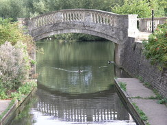
Almost immediately I crossed a weir to reach Osney Lock, which like all of the locks on the Thames was superbly looked after. The towpath was very popular, and there were may joggers running past me as I strolled along, taking advantage of the glorious weather. It looked like it was going to be a glorious day, and this put me into a very good mood for the long walk. After passing under a large railway bridge I reached a footbridge that I had crossed on a previous walk from south of Oxford north along the Oxford Canal, and after this the towpath reached Folly Bridge, which carries the A4144 road over the river.
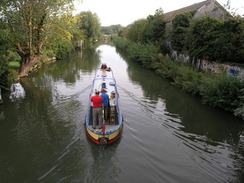
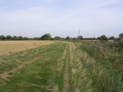
Below this there were many rowers in single and double sculls, and the boathouses that lined the other side of the river were busy with people either getting ready to row or having just finished. At the next bridge the rowers stopped, and I was left with a few narrow boats and one large tourist for company as the towpath became much narrower, rougher and nicer. The towpath passed by Iffley Lock, another pleasant lock, and headed on southwards to a fairly ugly bridge that carries the A423(T) road over the river. Over the next mile to Sandford Lock the going became more rural, although occasionally the railway line a short distance to the west became audible as trains passed, although the ever-present power lines that ran along the floodplain or across the river prevented a truly rural view from being obtained.
To the east of Lower Radley the towpath passed a boatyard that had many sculls stacked up outside it, along with a few Pedallos and other boats. There was a minibus for a women's rowing club outside it, although there were not many rowing boats on the river or people on the riverbank. After this the towpath started to curve to a more southwesterly course, with a wooded hillside on the other side of the river, before passing under a railway bridge. Once on the other side there was a great deal of noise, and a short distance further on I could see a scramble bike contest on the other side of the river. The loud lawnmower-like noise of the bike was very intrusive, but the sight of the bikes racing up and down the bare earth hillside was interesting, and it seemed like they were all enjoying themselves. It seemed like quite a big meeting, with at least one trade stand for a large motorbike company and several large motor homes present.
This was also the start of the Abingdon loop, a large westwards loop in the river, taking several miles to end up only a couple of miles southwards. At one point the path left the river to cross a small stream, and in the undergrowth was the remains of an old moped, the metal trusted away and only some pitted stainless steel of the wheels giving an indication of what it had once been, It seemed to take me an eternity to reach Abingdon, a fact not helped by the path over Abingdon lock being closed for five minutes whilst boats entered - the path crossed the top of the lock gates. This also meant that the path had crossed over to the other side of the river for the first time in the day, and the remainder of the walk into the town was very pleasant, with some superb views across the river.
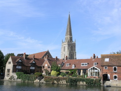
Abingdon Bridge in particular was beautiful, and there was a line of boats moored up alongside the river before and after the bridge. Close by the spire of St Helen's church rose above the riverfront buildings, and this added to the undoubted ambience. Heading on the river curved to head south, and there were a few fishermen lining the banks on what was a glorious stretch of river. Before I knew it the river had curved once again to join the Culham Cut, a man-made diversion channel away from the river which winds away to the south, There was a sign inviting people to visit a pub a few hundred yards away from the river, but this did not tempt me too much and I headed on to Culham Lock, which again looked pretty in the sunshine.
At the lock was a group of older people, and I stopped to chat to them for a couple of minutes. It turns out that they were walking the Thames Path in one trip, using cars to get from start to finish. They had taken a week to reach this point, and it looked as though they were very much enjoying themselves. As we talked a couple of men passed, looking weary under heavy backpacks and not stopping to say hello. I set off a couple of minutes after them, and after a further delay caused by the busy traffic over the narrow bridge I set myself a target of catching up with them.
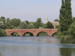
The next stretch of riverside walking to Clifton Hampden Bridge was pleasant, the miles being broken up by a railway viaduct across the river. Shortly before this I passed the two men, and I discovered that they were backpacking from Oxford along the path to London. One in particular seemed to be struggling slightly under his pack, and I continued on, soon leaving them behind me. Clifton Hampden bridge is made of red brick and looked absolutely superb, the sun literally gleaming off the bricks and making a pleasant ambience. It was designed by Sir George Gilbert Scott, which to some extent explains the elegant design. Here the towpath crossed the bridge to reach the other side of the river, and as the bridge was narrow a little care had to be taken.
Once on the other side I decided to divert the short distance to The Barley Mow pub, a riverside pub of Cruck construction made famous by Jerome K. Jerome in Three Men in a Boat. I ordered a pint of bitter and a pint of orange and lemonade, and went to sit outside in the sunshine. As my feet were aching slightly I took my boots off and did some stretching exercises for my feet - there was still many miles to walk on this long day, and I did not want my feet to give in before I reached the end. My right knee had also been giving me problems, and so I used the opportunity to put on a tight strapping to help reduce the discomfort.
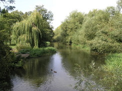
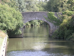
The drink soon disappeared, and wearily I hoisted my rucksack onto my back and headed off down the road, my legs stiff after the short break. The towpath was soon rejoined, and headed along the southern bank of the river, heading eastwards towards Burcot. The initial views back to the bridge were nice, and the long curving walk to Day's Lock was along an easy to follow footpath across a wide floodplain. At Day's Lock the towpath crossed over to the eastern side of the river, and almost immediately reached the attractive Little Wittenham Bridge. Rising ahead of me was a hill called Wittenham Clumps, and the river turned sharply to head eastwards to avoid the hill.
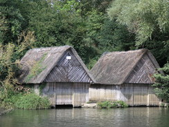
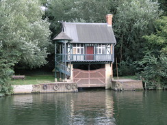
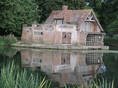
I found the next couple of miles to Shillingford to be surprisingly hard going, mainly because the strapping on my knee was itching and far too hot. The towpath left the riverside to join the A423 for a few hundred yards into the village, but fortunately there was a wide pavement to separate me from the traffic. At the village pub I had to carefully cross the road and head south, following a couple from a nearby wedding back towards the river, where there was a slightly ruinous thatched boathouse - and intriguing sight. A narrow path between walls took me past Shillingford Court and back to the river at Shillingford Bridge, which the couple crossed presumably to reach another bridge.
As I started along the towpath eastwards from the bridge I stopped for a minute to pull the strapping down from my knee, as it was getting far too hot and uncomfortable. Fortunately my knee was not hurting as much as it was before I had put the strapping on, and so in a slightly better mood I headed on towards Benson. Here there was a very pleasant caravan and campsite; I had tried to book into here for tonight, but unfortunately they were full and only take bookings for two nights or more during the summer. Attached to the site was a little café, and I nipped into this to buy a quick ice lolly, and over the next quarter mile I ravenously devoured this.
The towpath joined a road that led down to Benson Lock, and as I walked I chatted to a man who gave me some information about the local area, including the water levels during floods. A long weir led across to yet another attractive lock, which was crossed so that the trail could follow the southern bank southwards towards Wallingford. By this time I was getting increasingly fatigued, and although there was plenty to see I put myself on autopilot for the couple of miles towards the town. The river approaches from the north, and one solitary section of wall marked the site of the castle to my right before I reached Wallingford Bridge. This marked the lowest place down the river where it was possible to ford at any time of year, and the town had built up around the crossing place.
The sun was too low and in the wrong place for me to be able to get a good photograph of the open stonework of St Peter's Church, and a rather ordinary road took me south through the town before heading back to the river. Unfortunately this was for only a few yards, as a new building being constructed by the river caused a temporary diversion of the footpath away for a couple of hundred yards. A short distance further south a large concrete bridge carried the A4130 over the river, and the towpath carried on southwards for a couple of miles along a very pleasant stretch of river. The only problem was that after twenty-five miles I was not in the best state to take advantage of it, and although it was only a couple of miles it seemed to take an eternity to reach the Papist Way, where I was to leave the river for the day.
Initially the Papist Way was a wide, uneven track, with a couple of large potholes that cars had to avoid, but shortly afterwards it became surfaced as it headed westwards to the A329 road. This was easily crossed, and after passing a pub and a little newsagents shop the road descended down into Cholsey. Before I knew it I had walked the mile from the river to the station car park, which was far busier than it had been when I had set off in the morning. Some youths were skateboarding, skilfully avoiding the parked cars and jumping a few feet off a low stone wall before sliding on. I literally flung my rucksack into the back of the car before gleefully taking my boots off and stretching my feet with relief. My GPS showed over twenty-seven miles walked, which is the longest distance that I have walked for several years. I was surprised that I had managed to walk so far so late in the year, when the days were starting to close in.
I had booked into a campsite in Wallingford for the night, and this proved easy to find as it was right by the bridge over the river. After paying the owner I drove around the site for somewhere to park - most of it was full, but an area of grass nearer the road was sparse except for two caravans. I parked up and quickly erected my tent, slightly concerned that the noise of the traffic might keep me awake during the night. Although I had been absolutely worn out at the end of the walk, a half-hour rest whilst reading helped me recover, and as evening started to draw in I headed off across the bridge into Wallingford, initially to find a cash point before having a quick stroll around the town.
I was looking for a pub that served food, but most pubs were full of noisy Saturday revellers, and when I did find a quiet one beside the river it turned out that they had stopped serving food ten minutes earlier, despite it still being early on in the evening. They told me of a pub that did serve food, but it took me ten minutes to reach as it was back across the river. When there it turned out that there was an hour wait for food, so I decided to subsist on a couple of packets of crisps and a pack of nuts as I drunk a pint of Abbott. This was soon followed by another couple of pints as I watched Who wants to be a Millionaire', and I was in a much happier state as I headed back to the campsite in the dark, ready for a deep sleep.
 |
 |
|
Directions
| The walk is also covered in detail in the Thames Path National Trail Guide, by David Sharp, ISBN 1-84513-062-6 published by Aurum Press Ltd. Click on the image to the right to go to the Amazon page for the book. The exceptions to this are at the start and end of the walk. At the start, leave Oxford station and turn right to head down to the A420 Botley Road. Turn right to heads westwards, almost immediately passing under the railway bridge before Osney Bridge on the Thames is reached. Here turn left to join the towpath that runs along the western side of the river. At the end of the walk, when the end of the track called Papist Way is reached at about SU601855 turn right and follow the track as it heads uphill; it soon becomes surfaced and reaches a crossroads with the A329 road, Cross the A329, and continue along the Papist Way as it heads westwards for another half-mile into the centre of Cholsey. When a junction is reached with Station Road, turn left for a few yards and then right up the approach road that leads to Cholsey Station. | 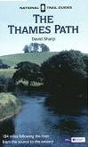 |
Distances
| From | To | Distance (m) | Ascent (ft) | Descent (ft) |
|---|---|---|---|---|
| Oxford station | Abingdon | 9.6 | 62 | 79 |
| Abingdon | Clifton Hampden | 5.5 | 56 | 66 |
| Clifton Hampden | Shillingford Bridge | 5.4 | 30 | 36 |
| Shillingford Bridge | Wallingford | 2.9 | 52 | 59 |
| Wallingford | Papist Way | 2.8 | 30 | 36 |
| Papist Way | Cholsey station | 1.1 | 39 | 56 |
This makes a total distance of 27.3 miles, with 269 feet of ascent and 332 feet of descent.
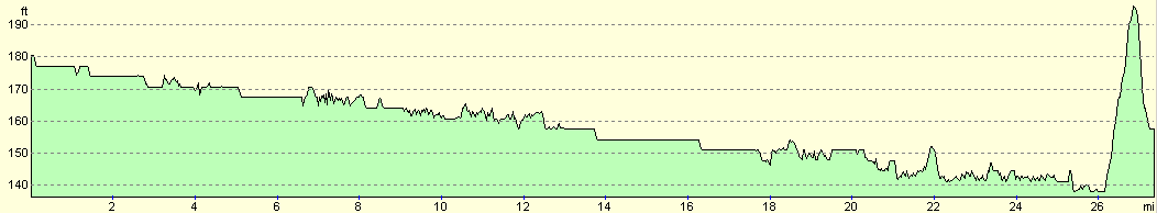
For more information on profiles, ascents and descents, see this page
Accommodation
I spent the night at a campsite in Wallingofrd, which was very cinvenient for the centre of the town. The site was slightly expensive at thirteen pounds, but the facilities were palatial and very plush. All in all it was not a bad place to stay, although for the cost I should have spent a few more hours there, using it as a base to explore Wallingford. They are at, Bridge Villa International Camping Park, Crowmarsh Gifford, Wallingford, Oxfordshire, OX10 8HB, Telephone (01491) 836860,
Transport
There ar regular train services from Cholsey back to Oxford. If you wish to break this walk up into two or more pieces, there are also railway stations at Radley and Culham.
Disclaimer
Please note that I take no responsibility for anything that may happen when following these directions. If you intend to follow this route, then please use the relevant maps and check the route out before you go out. As always when walking, use common sense and you should be fine.
If you find any information on any of these routes that is inaccurate, or you wish to add anything, then please email me.
All images on this site are © of the author. Any reproduction, retransmissions, or republication of all or part of any document found on this site is expressly prohibited, unless the author has explicitly granted its prior written consent to so reproduce, retransmit, or republish the material. All other rights reserved.
Although this site includes links providing convenient direct access to other Internet sites, I do not endorse, approve, certify or make warranties or representations as to the accuracy of the information on these sites.
And finally, enjoy your walking!
Nearby walks
| # | Title | Walk length (miles) |
|---|---|---|
| 571 | Oxford to Lower Heyford | 16.4 |
| 731 | Wayland Smithy to Goring | 23.0 |
| 737 | Thames Path: Rushey Lock to Oxford | 21.4 |
|
|

|