Walk #893: A circular walk from Dunwich to Southwold
 |
 |
|
General Data
| Date Walked | 08/04/2011 |
| County | Suffolk |
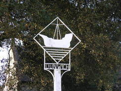
| Start Location | Dunwich |
| End Location | Dunwich |
| Start time | 08.06 |
| End time | 14.25 |
| Distance | 16.7 miles |
| Description | This was a very pleasant walk following the Sandlings Walk to near its end in Southwold, before returning via rivers and the coast. |
| Pack | Today I carried my 30-litre Karrimor rucksack, filled with water, my waterproofs, a couple of books and other odds and ends. |
| Condition | I feel absolutely fine after this walk. |
| Weather | Today's weather was bright and sunny, with scarcely a breeze to cool me down. |
| OS map | Landranger number 156 (Saxmundham, Aldeburgh & Southwold) |
 |
 |
|
Map of the walk
Maps courtesy of Google Maps. Route for indicative purposes only, and may have been plotted after the walk. Please let me have comments on what you think of this new format. For a detailed table of timings for this walk, please see the table file.
 |
 |
|
Notes
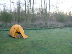
I awoke this morning to find moderate condensation in my tent - nowhere near as it had been the previous week, but bas enough. This was a shame as the previous night had been fine; it appear that leaving the entrance flap half-open did not allow enough air to circulate on this cold night. I did not hang around, but pulled down the tent and set off on the forty-five minute drive north to Dunwich. The sun was low in the sky as I drove along the winding narrow lanes, and despite driving at thirty miles an hour I still managed to hit one pheasant and a little bunny rabbit; not an auspicious start to the day.
The car park was empty when I arrived aside from one other car (perhaps they had been warned about the wildlife murderer who was arriving. A man came out of the only other car and asked where my fishing rods were; apparently he is more used to fishermen being around at this time of day. He had just walked up the beach from Sizewell, and his partner was returning him to his car. The cafe was not yet open, so I scoffed down a couple of bananas and set off.
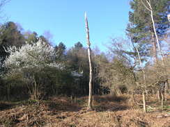
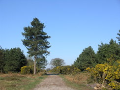
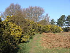
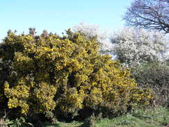
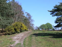
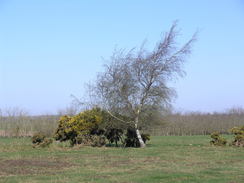
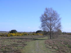
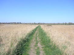
The Sandlings Walk takes perhaps the most indirect route possible between Dunwich and Southwold, and headed west towards the church, passing the village museum on the way. A track followed, heading through woodland and the rather neat Sandy Lane Farm. It then entered Rookyard Wood, part of Dunwich Forest and perhaps some of the best woodland walking of the Sandlings Walk. It was very enjoyable through sparsely-spaced trees, and the day only got better as the path emerged out into some heathland, squeezing between flowering gorse bushes. I did not even mind when it soon dived back into the western side of Dunwich Forest once again.
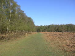
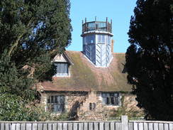
The path angled through the forest, avoiding the adjacent quiet road that may have given better views, but the walk through the woodland was pleasant enough, especially when it emerged out onto the heathland once more. I was feeling good, and the next stretch of track along a broad, sandy track was pleasant, and the sort of terrain I could walk for miles along. Tarmac took over near Westwood Lodge, which had a rather spectacular lantern on the roof. Even the following road walk was interesting, especially when a motorhome pulled up alongside me to ask if I had heard any Nighingales. Only after they had stopped did the passenger notice the headphones I was wearing!
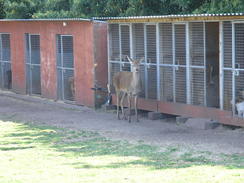
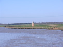
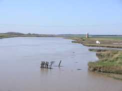
Another stretch of pleasant heathland followed, but this soon ended at another road. Dogs yapping alerted me to a farm on the left; the dogs were all in kennels. Standing statuesque beside the kennels was a deer - it was so still that I thought it was a model, until it took a quick glance towards me. After the farm the trail took a path northeastwards across Walberswick Common, and I revelled in the scenery. The concrete abutments of an old rail bridge on the left showed that I was walking next to the old Southwold narrow-gauge railway line, long gone and much lamented. The line ran in a gorse-filled cutting on the left, before the path eventually joined the old railway trackbed as it crossed the low-lying marshy land on a small bank.
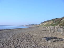
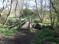
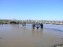
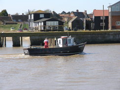
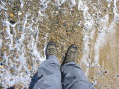
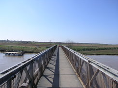
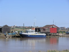
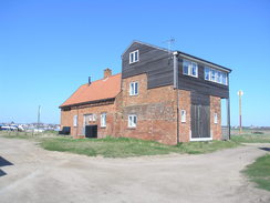
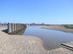
Just before the bridge over the River Blyth was reached I met a man walking in he opposite direction. We chatted for a few minutes before I strode on along the footbridge, which used the piers of the old railway bridge. On the eastern side the trail heads down a bank and a track alongside the river, which was bustling with people. Industry dominates, with ship restoration, woordworking and other ship-related industries. I ignored the pub and walked on, looking for the point where the trail dives off to its end-point to the south of Southwold. Unfortunately a sign stated that the path was closed and there was obvious signs of work being done. I was tempted to walk to the end of the trail, but in the end the obvious work made me decided to walk past the Alfred Corry lifeboat museum to the sea. I walked across the sand towards the tideline and let the breaking waves lash at my boots.
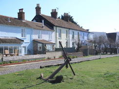
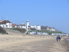
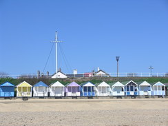
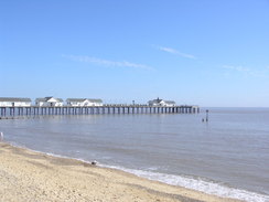
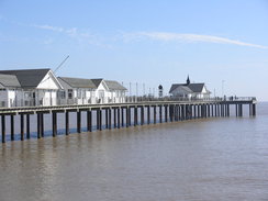
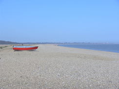
I have always liked Southwold, and there was nothing today to make me change that opinion. The disappointment of not being able to walk the last half-mile of the Sandlings Walk was more than made up for by a brilliant walk along the beach. When the promenade started on the left, I nipped up onto it to buy an ice cream, which I licked hungrily as I strolled along. The pride of Southwold has to be its pier, which is an archetypal promenade pier and utterly unspoilt. This is rather an illusion, as the original pier has been damaged in many times, being reduced to just 100 feet after a 1979 storm. Restoration work has extended it to 623 feet, not quite its original length but long enough.
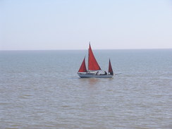
I stopped off on the stepped floodwall next to the pier, unshackled my rucksack and took my boots off to allow my feet to cool down. It was a wonderful spot for a break, and I watched a ladybird dancing around on my notebook and a kayaker out at sea. Memories flooded back of the coastline to the north of here, and I was filled with the temptation to throw caution to the wind and do another lap of the entire coastline. A quick phone call to Sencan persuaded me otherwise...
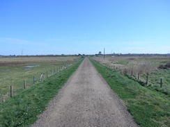
Eventually I put my boots back on and set off. It was tempting to continue back along the coast, but instead I decided to take a looping walk following Buss Creek, which surrounds the northern and western side of the town. Initially the path passed through a wonderful area of reeds, before crossing a road bridge and joining the flood bank. The sunshine made this stretch of walk particularly pleasant with the water off to the right. After a couple of miles it met the footbridge over the Blyth that I had crossed earlier.
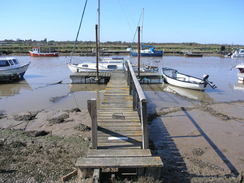
On the western side of the river I turned left to follow the flood banking downstream. On the way I met the same man I had chatted too earlier, in almost exactly the same spot. We had another chat, after which I continued on. Whereas the northern bank of the river is cluttered with businesses, the southern bank is lined only with moored boats until a car park and some buildings are reached near the river mouth.
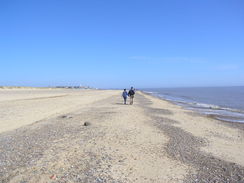
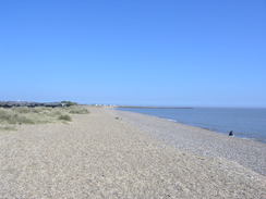
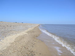
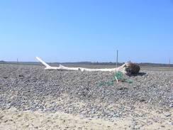
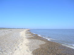
Here I was faced with a choice; my planned route was to follow the Suffolk Coast and Heaths Path past the marshes, but a sign in Southwold had stated that this stretch of path was shut. I decided not to risk it, and instead strolled along the shingle beach. Initially a good path ran down a bank, but when this ended I was forced to walk along the shore. A band of hard sand near the tideline allowed me to make good progress, but when it ended I was forced to go along the energy-sapping shingle. In all the miles that I have walked along the coast, shingle is by far my least favourite terrain. It may look spectacular, but a few miles along it is hell on the legs and feet.
I chatted to a French couple on the shingle, who were wondering why I was sweating so heavily - the distance walked provided them with the answer. I was dog-tired by now and was faced with a long drive home, so I was glad that it was going to be a relatively short day as my car came into view. It had been a glorious day's walk, and the disappointment at not doing the last half mile of the Sandlings Walk having been more than compensated for by the memories of three wonderful walks.
 |
 |
|
Directions
This walk starts off at the car park in Dunwich at TM479706. Leave the car park and head up the access track for a short distance until it reaches St James's Street in Dunwich, with the village pub on the left. Follow St James's Street westwards and when it curves to the right with Dunwich Church on the left, continue straight on along a track between hedges. This curves to the left to take a rough southwesterly course across Broom Hill.
Shortly after passing Sandy Lane Farm on the right, turn right along a track that runs northwestwards through some woodland. After a few hundred yards turn left to head westwards along another wide track that plunges through Rookyard Wood. At TM455701 the track curves to the right to head west-northwestwards through the woods. After a few hundred yards it leaves the trees; as it does so, turn right to head northeastwards along a rough path across scrubland, with trees on the right. It eventually emerges into a field; angle across slightly to the right to join a hedge on the left. Cross a footbridge over a stream, and head on along the path through gorse until it angles to the right at TM457708.
Here turn left and follow another path west-northwestwards, with some scrubland on the right. After a short distance turn right across the scrubland. Just after some trees are reached on the right, turn left along another track until a T-junction with another track is reached at TM454712. Turn right along this track and follow it for a short distance until it reaches a road at TM455714. Turn right along this road for a few yards, and then turn left to join a track that heads northwestwards.
After a couple of hundred yards turn right to head eastwards through woodland for a little over a quarter of a mile until it ends at a road at TM458717. Cross the road and go into the trees on the other side; after a few yards turn left along a rough path that angles through the trees. Initially it follows the road on the left before the latter angles away to the left; the ground becomes clearer until a track is reached at TM45327. Turn left along this track for a few yards past a gate, and then turn right at a bend in another track.
Follow this track as it heads northeastwards through sparse woodland. After 0.8 miles it curves to the right to take a more east-northeasterly course, climbing up a small hill. It passes to the south of Westwood Lodge, becoming the surfaced Lodge Road on the way. Continue on along the road; a mile after the lodge turn left at TM480742; turn left to head westwards along a path across a field. When this meets the eastern edge of some woodland, turn right to head north with the trees on the left. Just before the trees end, turn right along a path that heads northeastwards, passing through a sparse hedge and crossing a hedge before ending at the B1347 road at TM479748 directly south of Eastwoodlodge Farm.
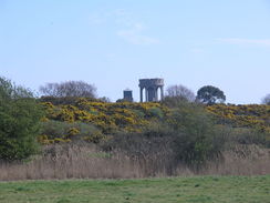
Turn right to head eastwards along this road for a couple of hundred yards, before turning left through a gate to join a footpath. Head northeastwards along this footpath, which parallels the course of an old railway line on the left. Aim for the water tower that could be seen on a hill in the distance. After a while the path joins a track, which then joins the course of the old trackbed. Continue straight on for a quarter of a mile until a bridge over the River Blyth is reached at TM494757.
Cross the bridge, and on the side turn right to follow a footpath that heads southeastwards downstream along the eastern flood bank of the river. It drops down off the bank to join Ferry Road and passes the Harbour Inn on the left. The road ends three-quarters of a mile after the bridge. Continue straight on, pass the Alfred Correy lifeboat museum on the left to reach the beach. Turn left to follow the beach northwards for a little over a mile until Southwold Pier is reached; after 0.7 miles a promenade is reached on the left. This allows easier walking.
Walk past the pier and enter a car park, with the promenade on the right. After a short distance turn left along a footpath that winds westwards with a flood bank away to the right. After half a mile the path reaches the A1095, with a bridge on the right. Carefully cross the road, and on the other side join a footpath that heads along a flood bank, with Buss Creek on the right. Initially it heads in a rough westerly direction before curving to the left to take a southerly direction past Busscreek Marshes. After a little over a mile the footbridge over the River Blyth is reached at TM494758.
Cross the footbridge, and on the other side turn left to start following the floodbank southeastwards. After two-thirds of a mile a car park is reached at the end of the B1387 road; cut diagonally across the car park to reach a footbridge over a stream. Continue on along the other side to cross the sand dunes to reach the beach. Once at the beach, turn left and follow it southwestward for three miles until the car park is reached at Dunwich. The going on the shingle is hard in places, and it may be easier, if less direct, to take the Suffolk Coast and Heaths Path, which crosses the marshes inland.
 |
 |
|
Distances
| From | To | Distance (m) | Ascent (ft) | Descent (ft) |
|---|---|---|---|---|
| Dunwich car park | Southwold Pier | 10.7 | 292 | 292 |
| Southwold Pier | Dunwich car park | 6.0 | 89 | 89 |
This makes a total distance of 16.7 miles, with 381 feet of ascent and 381 feet of descent.

For more information on profiles, ascents and descents, see this page
 |
 |
|
 |
 |
|
 |
 |
|
 |
 |
|
 |
 |
|
 |
 |
|
 |
 |
|
 |
 |
|
 |
 |
|
 |
 |
|
 |
 |
|
 |
 |
|
 |
 |
|
 |
 |
|
 |
 |
|
 |
 |
|
 |
 |
|
 |
 |
|
 |
 |
|
Disclaimer
Please note that I take no responsibility for anything that may happen when following these directions. If you intend to follow this route, then please use the relevant maps and check the route out before you go out. As always when walking, use common sense and you should be fine.
If you find any information on any of these routes that is inaccurate, or you wish to add anything, then please email me.
All images on this site are © of the author. Any reproduction, retransmissions, or republication of all or part of any document found on this site is expressly prohibited, unless the author has explicitly granted its prior written consent to so reproduce, retransmit, or republish the material. All other rights reserved.
Although this site includes links providing convenient direct access to other Internet sites, I do not endorse, approve, certify or make warranties or representations as to the accuracy of the information on these sites.
And finally, enjoy your walking!
Nearby walks
| # | Title | Walk length (miles) |
|---|---|---|
| 132 | Wickham Market Station to Darsham Station | 12.7 |
| 135 | Darsham Station to Brampton Station | 12.3 |
| 167 | Brampton to Lowestoft | 12.3 |
|
|

|