Walk #886: Cambridge to Littleport along the Fen Rivers Way
 |
 |
|
General Data
| Date Walked | 14/03/2011 |
| County | Cambridgeshire |
| Start Location | Cambridge railway station |
| End Location | Littleport Station |
| Start time | 07.15 |
| End time | 16.13 |
| Distance | 24.5 miles |
| Description | This was a long and flat walk following the Cam and Great Ouse northwards towards the sea. |
| Pack | Today I carried my 30-litre Karrimor rucksack, filled with water, my waterproofs, a couple of books and other odds and ends. |
| Condition | I feel absolutely fine after this walk. |
| Weather | The day started sunny, with almost no cloud in the sky. The clouds gathered towards the afternoon, but cleared away before the end of the walk. There was a slight breeze, but this was not too chilly. |
| OS map | Landranger number 154 (Cambridge & Newmarket, Saffron Walden) and Landranger number 143 (Ely & Wisbech, Downham Market) |
 |
 |
|
Map of the walk
Maps courtesy of Google Maps. Route for indicative purposes only, and may have been plotted after the walk. Please let me have comments on what you think of this new format. For a detailed table of timings for this walk, please see the table file.
 |
 |
|
Notes
I had not been able to do a walk for a month due to a rather stressful and prolonged house move to Cambridgeshire. Three and a half years later I had welcomed our move to the south coast as a break from the flat walking around the Fens; I was now welcoming the move back as an opportunity to revisit my old haunts. It took me some time to decide which walk to do first, and in the end I decided upon re-walking the Fen Rivers Way, which follows the Cam and Great Ouse from Cambridge to King's Lynn. The stretch between Waterbeach and Ely holds fond memories for me, as it was the walk I used to regain health after many years of trouble with my ankles. Unfortunately an old knee injury got aggravated shifting boxes during the move, and therefore I decided to alter the walk so that I could bail out early if there was a problem. for this reason I decided to set off from Cambridge, which meant that I could stop at Waterbeach after seven miles if necessary.
Despite the pain, I was keen to get as long a walk as possible done. My plan was to drive to Littleport, six miles north of Ely, and catch the train down to Cambridge. However getting trapped behind two slow-moving lorries caused me to change my mind, and I drove instead to Waterbeach station. I used to live in this village for many years, and remember a couple of occasions when this car park flooded, wrecking the cars parked there. Happy that there was no chance of the Cam bursting its banks, I bought a ticket and caught the train down to Cambridge.
Cambridge station was chaotic, a result of a power outage caused by a break-in. Unfortunately this meant that the toilets were locked shut, so I just set off along the road. It felt good to be strolling through the city once more, even if it was very chilly, with frost on the ground in places. There were lots of people about and I felt remarkably out of place in all my gear, especially with my walking poles sticking out of the top of my pack.
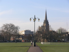
If it had been left to me, then I would have joined the River Cam near the centre of the city. The Fen Rivers Way, however, joins it on Midsummer Common, to the east of the centre. To get there, I had to cross Parker's Piece, an area of grassland that is famous as being the place where the Cambridge Rules for football were formulated in 1848; these were later used as the basis of the modern rules of the game. It was also used for first-class cricket matches in the 1800s. Not being a fan of the game, I was more interested in the lampost that stands at the centre of the paths that cross the green. This is informally known as the Reality Checkpoint', perhaps so called because any students returning to their digs from a night on their town would have to check their sense of reality.
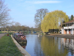
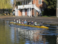
Unfortunately the toilets at the bus station were not due to open until eight, and as I did not fancy waiting around I pressed on. The path cuts diagonally across Midsummer Common, meeting the Cam for the first time at the Cutter Ferry footbridge over the river. The banks on the other, northern, side of the river are dominated by boathouses, and there were several eights on the river. As I walked along I was glad to see an old colleague and friend rowing strenuously down the river,
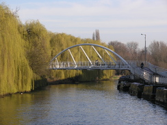
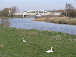
The skis were gloriously blue as I passed under the Elizabeth Way dual-carriageway bridge, where some works were being done, and passed the Museum of Technology which, to my shame, I have never visited. An unexpected sight came a short distance further on: a new and remarkably elegant white arch bridge, Riverside Bridge, which opened in 2008. Next came Stourbridge Common, a lovely area of grassland that stretches as far as Fen Ditton. My route took me as far as the Green Dragon footbridge over the river where the Way bifurcates, with an eastern and western route to Ely. My route took me across the bridge and along roads for a short distance to join the western bank of the river, which I would be following for the rest of the day.
The river here is the end point of what are known as the Bumps'. This is a rowing competition dating back to the 1820s, and is held twice a year: in February and May. Seventeen or eighteen crews line up along the river with a boat and a half gap between them. A boom of a cannon signals the start, and they try to bump the stern of the boat in front before they are in turn bumped from behind. It is a massively popular spectator sport and the river banks are always teeming with people. I have, however, always found it rather hard to understand what is going on when watching!
A pleasant stroll followed in glorious sunshine, albeit with a slightly chilly breeze. The river looked spectacular, and was only let-down by a drain filled with litter and old Shopping trolleys. Further on, near the bridge that carries the A14 over the river, was the hut used by boat crews; this had been burnt out. Newham' had been painted on the A14 bridge; this regularly-changing graffiti is somewhat of a tradition by the boat crews competing in the bumps.
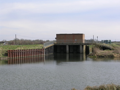
Shortly after this came Baits Bite Lock, a large lock that lies between the villages of Milton and Horningsea. The first fishermen of the day sat on the banks, and I strode on feeling good. This was my old home turf, a route that I used to regularly walk into work along. It felt like an old friend, all the better for being enjoyed in sunny weather. All too soon the river approached Waterbeach, and here the path left the riverbank for a short period to head towards the railway station. I nipped into the car park to get a bottle of water from my car, before pressing on. The path headed back to the river bank, and then up towards Bottisham Lock.
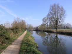
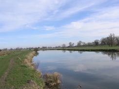
This is the last lock on the Cam and Ouse until Denver Sluice, many miles to the north. It has always felt slightly strange to be so far from the sea, yet for the surrounding land to be at, or below, sea level. My old flat is only a few hundred yards away to the west, but instead I strode on along the floodbank, a walk that I have done dozens of times before. So far today's walk had been through well-populated areas, but for the next twelve miles it would be relatively rural. My knee was feeling fine so I pressed on, following the flood banking before dropping down onto the river bank for a couple of miles. I passed opposite the pub at Upwell on the eastern bank, which goes by the rather excellent name Five miles from anywhere no hurry'. The name is a slight exaggeration, but it is easy to imagine how remote it would have been just one hundred years ago.
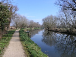
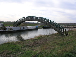
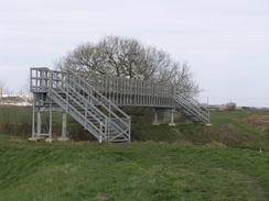
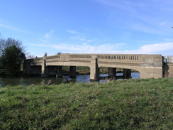
The skies were starting to cloud over as I approached Dimmock's Cote bridge, a concrete structure that carries the A1123 road over the river. Its arch can seem surprisingly elegant despite being made from concrete, and it seemed to shine when struck by the sun. eventually I reached Holt Fen, where the Cam drains into the Great Ouse. This marks the end of the Cam, and as usual I felt slightly sad to leave that famous river behind. The graceful green arch of the Holt Fen footbridge took me over the Great Ouse; this first opened in 1998, before which a diversion to a tricky crossing by the railway bridge was required. Sadly the footbridge was starting to look a little tired and in need of some TLC, with flaking paint and greasy boards.
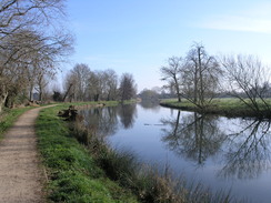
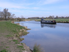
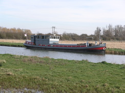
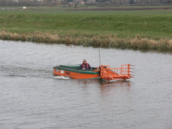
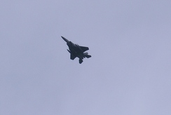
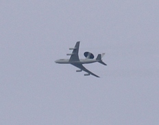
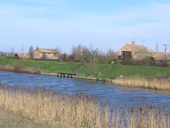
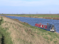
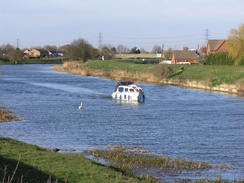
From here the Great Ouse flows more or less straight north to Ely; as I walked two strange watercraft came by, the first being a blocky blue hull carryingf branches, and the other an orange machine with nasty-looking claws - obviously river clearance craft. Next came Braham Dock, a drain into the river. In the past this involved walking inland to cross a narrow causeway beside the railway embankment. To my surprise I found a rather substantial bridge had been built over the drain. As the Fen Rivers Way signs still pointed along the old route, I walked this before returning to the bridge. I could not resist the opportunity to cross the bridge, and as usual I wondered who lives in the narrow boat this seems to be permanently moored in the drain. I started to see aircraft climbing up from the east, possibly from Mildenhall or Lakenheath. A fihter flew overhead first, followed by a tanker and, most impressively, an AWACS plane with its distinctive radar dome on top.
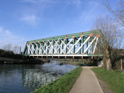
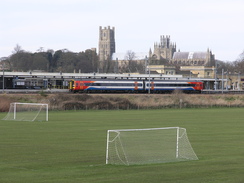
Just before Ely I reached Hawks Bridge, which carries the Ely to Newmarket railway line over the river. This structure looked remarkably different to the one I remember, and for good reason: in 1997 a derailed train demolished part of the bridge, and wagons filled with stone ended up blocking the river (see the official report) for more information and pictures. The replacement structure opened within six months of the accident, and has already been defaced with graffiti.
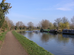
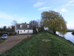
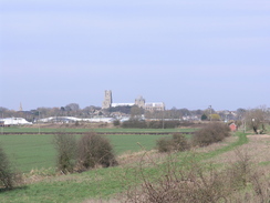
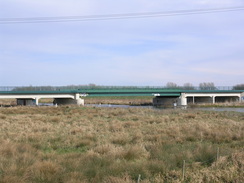
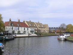
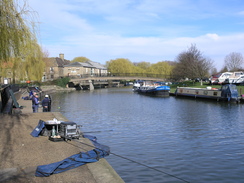
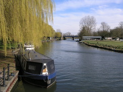
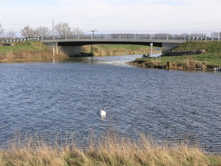
My knee was still feeling fine when I reached Ely, so I walked on before eventually stopping for a break at the Cutter Inn. I had my usual - a pint of bitter and another of orange and lemonade - before sitting outside in the sunshine, with a glorious view over the river. The man on the next table used to row, and he availed me of some of his life on the river. It would have been easy to stop the walk here, but instead it seemed sensible to walk on for another six miles to Littleport. Initially the path passed through a pleasant riverside park, after which a newly-improved stone path led across the floodplain towards a factory. A track then led pat the factory towards the Cuckoo Bridge that carries the path over a lake. This was another relatively new structure, having replaced an earlier bridge in 2000.
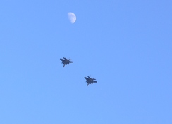
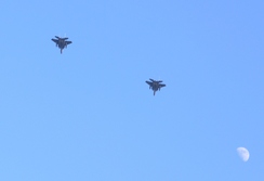
Another footbridge soon took me over to the eastern bank of the Great Ouse, and for the next half mile there was no choice but to follow a road. Fortunately this was quiet with only occasional traffic, so I soon reached the Queen Adelaide bridge over the river. Here the Way returns to the western bank of the river, which is followed arrow-straight for three miles along a floodbank that is trapped between the railway line on the left and the river on the right. It was a pleasant walk, with occasional glimpses of the sun to warm me from the excesses of the slight breeze. After a while I felt a stone against my left heel, and as I knelt down to remove it I got my first major twinge from my knee. Cursing, I walked on, but the pain soon eased. Two pairs of jet fighters flew overhead, allowing me to get some good photographs of them flying past the moon. Frankly, it was a spectacular sight.
The path passes through a series of gardens on the way into Littleport, each garden protected by a little gate that made me feel as if I had gone wrong somewhere. Fortunately I had not, and the path emerged out to join a road beside Sandhill Bridge over the river. Littleport station is situated to the north of the village, so I had to follow the floodbanks for another half-mile to reach it; a little confusion occurred near the station, where my instincts told me to turn right, but the signs indicated left. I followed the signs, and soon reached the station.
I bought my ticket for the journey back to Waterbeach and sat down; there was not long to wait for the train. It had been a good day's walk along familiar, friendly terrain, with a total ascent that could probably be counted on the fingers of one hand. The long distance means that the end of the Fen Rivers Way in King's Lynn is probably accessible in another 25-mile day. If so, then I would have walked it in a third of the time that I did in 1999...
 |
 |
|
Directions
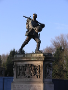
The Fen Rivers Way starts off at Cambridge railway station. Leave the station by the main entrance and start walking westwards up Station Road for a third of a mile until it ends at a junction with Hills Road beside the impressive war memorial. Turn right and follow Hills Road northwestwards towards the centre of the city for a third of a mile until the junction with the inner ring road is reached at TL454577, directly opposite the Catholic church. Turn right along Gonville Place for about fifty yards; after Regent Terrace heads off to the left, turn left to join a footpath that cuts diagonally across an area of grass called Parker's Piece, immediately passing some public toilets on the right.
Head across Parker's Piece until it reaches a road called Parkside. Turn left to head northwestwards along this; it becomes Parker Street as it approaches the bus and coach station in the centre of the city. Just before this is reached, at a mini roundabout turn right up Emmanuel Road, following it in a rough northerly direction for about a quarter of a mile until it reaches a roundabout at TL454587. Carefully cross the road straight ahead, keeping the roundabout on the left. Ahead is an area of grass called Midsummer Common; cross a cattle / bike grate to join a surfaced path that leads on northeastwards from the road across the grass. Soon the path reaches some housing on the right; here it curves slightly to the right to head directly across the common to reach the southern bank of the River Cam beside the Cutter Ferry footbridge over the river at TL459590.
Turn right and start following the southern bank of the River Cam as it winds northeastwards out of the city. It soon passes under the Elizabeth Road bridge, which carries a dual carriageway overhead. A stretch of road walk follows, passing the elegantly-curved riverside bridge. Shortly after this Midsummer Common is reached. Continue on with the river on the left until the Green Man footbridge is reached at TL467598; here the western and eastern routes converge. The rest of this description relates to the western route. Cross over the bridge and turn right to follow Water Street east-northeastwards. Shortly after the Penny Ferry pub (currently closed - 2011) is reached, turn right to rejoin the river and the towpath.
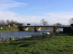
The towpath continues along the western bank of the river as it winds northwards for a little under two miles, passing under a railway bridge and then the A14 to reach Bait's Bite Lock a TL485620. There is a bridge at this lock that allows you to gain access to the eastern bank of the river, and there are footpaths that lead from here eastwards to Horningsea and southwards to Fen Ditton. This network of paths form part of the Fen Rivers Way. Two miles after Bait's Bite Lock you reach Clayhithe bridge. Immediately before the bridge is reached, turn left and follow a path that runs towards Waterbeach with the road on the right; it soon swings to the right, with some woodland on the left; it then swings to the left to continue northwestwards towards Waterbeach railway station. Just before the station car park is reached, turn right along a footpath to reach the road at TL501648.
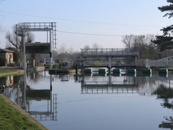
Cross the road and take a bridleway that heads northeastwards for a couple of hundred yards until a junction is reached with another footpath. Here turn right, to head runs eastwards with a hedge on the left. Continue along the obvious footpath as it skirts a boatyard. When the hedge ends, the footpath curves to the right to rejoin the western bank of the River Cam. Here turn left and follow the river as it winds in a rough northerly direction for about half a mile until Bottisham Lock is reached at TL507656. Pass through a gate that leads to the surfaced path that leads across the lock; do not cross the lock or go down the slope to the left, but instead continue on along the western floodbank.
The rest of the walk is fairly easy; just continue following the Fen Rivers Way as it heads northwards; for most of the time this follows the top of the flood banking, but at TL526681 it drops down onto the floodplain and follows the riverbank for a little over a mile. The floodbank is rejoined at TL532696, just before Upware is reached on the other side of the river. The A1123 road is reached five miles after Bottisham Lock, with the arched Dimmock's Cote bridge to the right. Cross the road and continue on along the floodplain, immediately passing a farm on the left.
The only problem comes a mile and a half later, at the point where the Cam and Great Ouse rivers meet at Pope's Corner (TL534745). The Fish and Duck pub is a short distance away. Just before the rivers meet, the path leaves the riverbank and continues along a bank with a marina on the right, heading to an attractive arched footbridge arches over the Great Ouse, which allows you to cross the river safely. Continue on northwards along the western bank of the river; soon a grassed landing stage is reached, complete with a couple of benches. A couple of miles further north of Pope's Corner there is a little inlet called Braham Dock that needs crossing; simply follow the bank inland for about fifty yards to the railway line; a narrow path crosses the inlet using the side of the railway embankment, then turn right to head back along the northern bank of the drain to reach the river once more. A new bridge over the mouth of Braham Dock has recently been built, but the Fen Rivers Way markers still point the old route down the drain. I think that the route over the bridge is a perfectly sensible diversion, and cannot in any way be called cheating!
Half a mile further on the Ely to Bury St Edmunds railway line is reached; cross this with care and continue on for another 0.7 miles until the A142 road is reached on the outskirts of Ely at TL54479. Cross the road and follow the path northwards, with the river on the right. The path dives under a railway bridge and past a couple of marinas before reaching the Maltings, which is now a prettified commercial area, with some lovely views along the river. Walk past the Maltings for a short distance along Quayside past a little inlet on the right; then turn right to head towards a footbridge over the river.
Do not cross the bridge and instead turn left to start following the riverside path eastwards, initially squeezing between the river and a waterside building. After a few hundred yards it passes under a railway bridge and curves to the left to take a more northeasterly course. It soon starts curving away from the river bank, following a hedge on the left to reach the grounds of a factory. Here turn left to follow a footpath that runs north for a short distance with a depot on the right; this soon ends at a T-junction with a track called Kiln Lane.
Turn right and follow Kiln Lane as it twists and turns in a rough easterly direction; the depot is soon left behind on the right, and rhe pat continues between fences to reach a footbridge called Cuckoo Bridge that leads over the Roswell Pits, some flooded clay pits. Soon after the bridge the path jinks to the right, following a fence on the left, and then to the left to rejoin the riverbank. Head northeastwards for a few yards to reach a metal footbridge over the Great Ouse at TL561805. Use this to cross over to the eastern bank of the river, and then climb up onto the road and turn left.
Continue northeastwards along the road for 0.6 miles; it passes under a railway bridge before reaching the B1382 road in Queen Adelaide. Turn left along this road to cross the river and descend down the other side. Turn right to join a footpath that heads back to the river to rejoin the floodbank, with the river on the right. Continue on northwards for a little over three miles until a gate is reached. A series of other small gates follows as the path passes through a series of gardens belonging to homes on the left. At the last gate it turns to the left for a short distance to meet a road on the eastern outskirts of Littleport at TL576864, with Sandhills Bridge a few yards away to the right, and the Black Horse pub directly opposite.
Follow the road westwards towards the railway line for a few yards, then turn right to join a footpath that squeezes between the railway line and the car park belonging to the Black Horse pub. Initially the path heads north with the railway line close by to the left; as the railway line curves to the left the path goes straight on alongside the river bank. A house is soon reached; the path squeezes between this and the river, before curving to the left to run along the southern bank of the inlet to near the railway line once more near the signal box. Turn right to follow a planed causeway across the water, with a building on the left, to reach a road immediately to the south of Littleport railway station at TL574873.
 |
 |
|
Distances
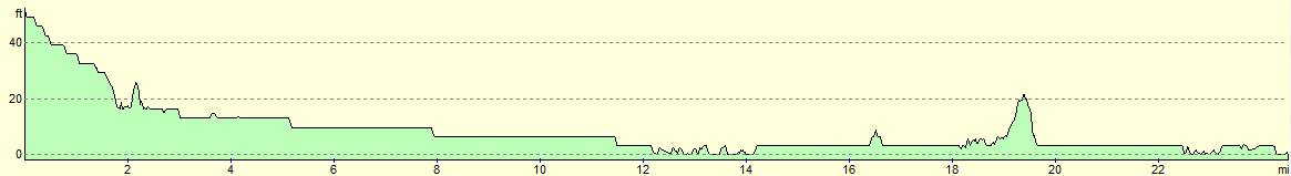
| From | To | Distance (m) | Ascent (ft) | Descent (ft) |
|---|---|---|---|---|
| Cambridge station | Waterbeach station | 7.0 | 16 | 59 |
| Waterbeach station | Ely station | 11.0 | 33 | 39 |
| Ely station | Littleport station | 6.5 | 49 | 52 |
This makes a total distance of 24.5 miles, with 98 feet of ascent and 150 feet of descent.
For more information on profiles, ascents and descents, see this page
Transport
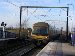
Regular railway services run between Littleport and Cambridge, running along the line between King's Lynn and Cambridge.
 |
 |
|
 |
 |
|
 |
 |
|
 |
 |
|
 |
 |
|
 |
 |
|
 |
 |
|
 |
 |
|
 |
 |
|
 |
 |
|
 |
 |
|
 |
 |
|
 |
 |
|
 |
 |
|
 |
 |
|
 |
 |
|
 |
 |
|
 |
 |
|
 |
 |
|
Disclaimer
Please note that I take no responsibility for anything that may happen when following these directions. If you intend to follow this route, then please use the relevant maps and check the route out before you go out. As always when walking, use common sense and you should be fine.
If you find any information on any of these routes that is inaccurate, or you wish to add anything, then please email me.
All images on this site are © of the author. Any reproduction, retransmissions, or republication of all or part of any document found on this site is expressly prohibited, unless the author has explicitly granted its prior written consent to so reproduce, retransmit, or republish the material. All other rights reserved.
Although this site includes links providing convenient direct access to other Internet sites, I do not endorse, approve, certify or make warranties or representations as to the accuracy of the information on these sites.
And finally, enjoy your walking!
Nearby walks
| # | Title | Walk length (miles) |
|---|---|---|
| 2 | Waterbeach to Newmarket Road, Cambridge | 5.4 |
| 3 | Littleport to Downham Market | 14.0 |
| 5 | A short walk around Waterbeach to Car Dyke | 3.0 |
|
|

|