Walk #854: Bulbarrow Hill to Rampisham Down
 |
 |
|
General Data
| Date Walked | 11/05/2010 |
| County | Dorset |
| Start Location | Bulbarrow Hill |
| End Location | Rampisham Down |
| Start time | 07.40 |
| End time | 18.32 |
| Distance | 23.2 miles |
| Description | This was a long day following the Wessex Ridgeway through eastern Dorset. |
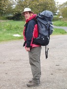
| Pack | Today I carried my Macpac Glissade rucksack containing my North Face Westwind tent, spare clothes, waterproofs, water, and enough food to last three days. In total it weighed about thirty pounds. |
| Condition | I am very fatigued after this fairly strenuous walk. I have a couple of very minor blisters that should not give me any trouble, and my shoulders have coped with the heavy load better than I had expected. |
| Weather | Today was mostly dry, with sme sunny periods and cloud. The breeze was quite chilly, which meant that I kept both my fleece and my coat on until lunch, when I took the fleece off. There were a few spots of rain at times, but nothing too serious, and the long periods of sunshine more than made up for these. |
| OS map | Landranger number 194 (Dorchester & Weymouth, Cerne Abbas & Bere Regis) |
 |
 |
|
 |
 |
|
Map of the walk
Maps courtesy of Google Maps. Route for indicative purposes only, and may have been plotted after the walk. Please let me have comments on what you think of this new format. For a detailed table of timings for this walk, please see the table file.
 |
 |
|
 |
 |
|
Notes
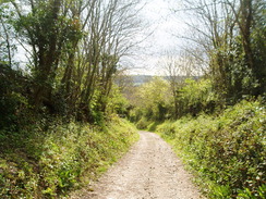
Over the last month I had walked about two-thirds of the Wessex Ridgeway, a trail that I had been intending to walk for a few years, but injury and the wedding had got in the way. The trail was complete was far as Dorset, but was now getting a little too far away to drive to for a day's walk. For this reason it seemed sensible to backpack the last 38 miles. Therefore Sencan drove me to Bulbarrow Hill, just to the northwest of Milton Abbas, early this morning. I remembered some spectacular views from here on my previous walk, but unfortunately the weather this morning was hazy and unclear.
It took a few minutes of faffing to get my kit together; my rucksack contained my North Face Westwind tent, three days of food, water, spare clothes and, of course, my sleeping bag. There was also my new Thermarest Neoair mattress, which I had high hopes for, and a new inflatable pillow . I had no idea where I was going to be spending the night, but I hoped to get at least sixteen miles of the route walked. This was to be my first backpacking trip for three years, and therefore I was more than a little nervous about the task ahead.
I kissed Sencan goodbye and watched as she set off for the drive back to Romsey and to her work. Missing her already, I strode off down the road past the massive masts that dominate the hillside, and which I would be able to see for most of the day. The initial mile of road walking was helpful as it allowed me to get used to my rucksack, which I had to adjust to sit correctly on my back. It already felt very heavy, a worrying sign considering the distance left to go. Therefore I did not spare too much attention for the hillfort of Rawlsbury Camp that was soon passed. The grassy ramparts were pleasant, and the remains of what was apparently a wooden cross stood at an angle near the summit.
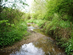
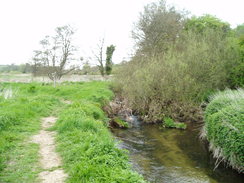
A steep descent took me down to a stream that had to be forded, and then the first real ascent of the day started. It was not too steep, but I still felt it under the still-unaccustomed weight of the pack. Eventually it started to descend once more to Dorsetshrie Gap, where a locked metal box contained a notebook in which notes could be entered. The pen was about dead, not helping to make my rather poor handwriting more legible! It was a nice touch, and after passing through a wooded glade the path passed the promontory fort at Nettlecombe Tout and started the descent down to a road at a hamlet called Folly - which by this time was what I was thinking of this walk!
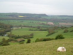
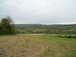
Another steep climb took me up Ball Hill. On the way a horse and rider came down, the horse seeming very upset by the sight of my pack and walking poles. Or perhaps it was the smell coming off my now sweat-covered coat. After they had passed I plodded on to the top of the hill, from where good views allowed me to see back towards the masts on Bulbarrow Hill. What followed was a long plod along a more-or-less flat hillside that slowly started descending westwards. More hoof prints on the ground showed that it was a popular area for horseriders, and sure enough a couple more riders came past, these horses less concerned by my presence.
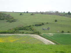
I went slightly wrong coming down the hill, staying to the track rather than following the Wessex Ridgeway as it followed a field boundary slightly further to the north. It was no great problem, and a short walk along the road took me to the route proper. Next came another climb uphill; on the way a familiar whump-whump sound came from behind and to my right. I stopped to watch as a Chinhook flew up the valley alongside me, so low that it seemed to be nearly at my height. It was a magnificent, if slightly noisy, sight. A few minutes later it flew back on my left, this time at a more respectable height.
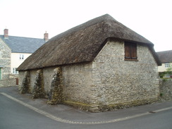
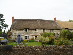
More views unfolded to the east as I headed past the campsite at Giant's Head campsite - sadly too early in the day to make use of. Afterwards a steep descent took me down into the valley, and I craned my neck to see if I could get a sight of the infamous phallus of the Cerne Abbas Giant - but to no avail as it was hidden around the hillside. The small hamlet of Minterne Parva was then passed through, with a large circular brick building that, according to the guide book, once housed cock-fights. A little further on was a stream, with some vertical slate slabs with writing on them, yet I could not discern their purpose.
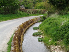
The path followed a main road for a short distance, but fortunately a path had been created through the trees on the left, avoiding the traffic. Then came an unexpected climb and steep fall to the hamlet of Up Cerne. I was tempted to stop for a break in the bus shelter here, but something drove me inexorably on up the road, alongside which trickled a pleasant, crystal-clear stream. My feet were aching slightly by now, and the tarmac soon made me regret not having stopped for a while to take my boots off. Soon another climb started, taking me up onto Gore Hill, and from here I got my first glimpses of the Cerne Abbas Giant, too distant to get a decent photograph.
The path became indistinct as it crossed a ploughed field at the top of Gore Hill. I headed off in roughly the correct direction, looking for a gap in the hedge opposite. Eventually I reached a track and turned along this to rejoin the path proper, which was about a hundred yards away. In the process I turned over on my left ankle slightly. I stopped at a junction in the tracks to sit down and rub my ankle, which was already feeling fairly sore. My left ankle in particular is fairly weak after a series of operations, and such minor twists occur from time to time and are not of immediate worry. After a couple of minutes I got up and continued along the track.
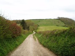
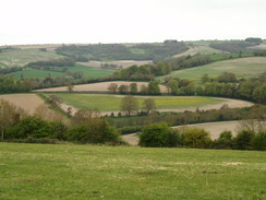
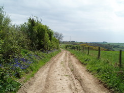
Unfortunately what should have been good views were often blocked by hedges, although some started unfolding down into the valley on the right. A series of large blocks of pitted stone lay on the track to the left before a large mast was reached. After this a long descent down to the village of Sydling St Nicholas began. I was limping slightly by now, and I took the wrong path on the descent from Cowdown Hill, taking one that dropped me off in the north of the village. This was no hardship, as it meant a little stroll through the pretty village to reach the pub.
This seemed like as god a place as any to have a break, so I sat down on a table outside, took my rucksack off and floated inside. Unfortunately they had only just stopped serving food, so I ordered some drinks and went back outside. A couple were sitting on the adjacent table, and we chatted for a while as I aired my feet. My ankle was starting to feel better, and I could only hope that it would keep up for the rest of the day. I had only intended to walk sixteen miles today, and I had already done fifteen by mid-afternoon, so it felt like an ideal opportunity to walk on.
Another ascent took me up to a main road on a ridge, after which a long descent started down towards Maiden Newton. On the way I passed a couple of other walkers who had started off from Lyme Regis a couple of days before. They were B&B'ing the Way, and this was to be their last day on this part of the trip. They were only the third and fourth people I had met walking the way, which is a shame as it definitely deserves more attention - and hopefully more care would come with more walkers.
Maiden Newton was a pretty little town, and I stopped off to buy a large two-litre bottle of water that would see me through the night and my cooking. It was tempting to try and find a place to stop for the night nearby, but instead I plodded on along a path that followed the floodplain of the attractive River Frome. A quick diversion off the route to go up to the course of the old Bridport railway line - this section of which was now a cycle path, soon to be extended by Sustrans to reach Bridport and the sea.
I started looking for somewhere to camp for the night, but the surrounding ground was low-lying and boggy and besides, it was still early and the area a little too built-up for my liking. Instead I progressed on past the tiny church at Chilfrome to start a long ascent along a road westwards. By this point I was getting very tired, but there was nowhere obvious to camp alongside the road as the fields were filled with sheep and Black Alpacas, the last animal I expected to find in rural Dorset!
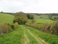
After crossing a main road the path descended down towards Lower Kingcombe. For the first time on the trip I found the path to be blocked by a couple of gates that were securely tied shut. Try as I might I could not undo the knots, so I was forced to climb over them, always a hard task with heavy rucksack and tired legs. I hardly noticed the buildings in Lower Kingcombe, and then headed off up yet another hill, which I instinctively knew would be the last of the day. A rough, wet track took me uphill, before the gradient slackened as it headed through Kingcombe Coppice.
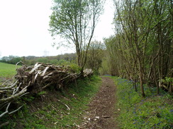
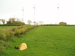
I started looking for somewhere to put my tent, hoping that the trees would keep the bright yellow fabric safely out of sight. Unfortunately the hillside to the right was too steep to safely camp, whilst the level sections of ground by the path were covered in a carpet of bluebells. It would feel like a heresy to flatten them with my tent so I plodded on as the path left the trees and entered a shallow-sided valley. I found a suitable place just as the path met a small lane, with the masts of the BBC World Service transmitter station on Rampisham Down close by. There were no cattle in the field and long grass lay underfoot. It was not a flat spot, but I could cope with the slight gradient. Although I would be hidden from the road, I would be clearly visible from the east, so I lay down in the grass and listened to my radio as I waited for the skies to darken. The moment I took my pack off I knew that I would not be putting it back on again today.
I started to get engrossed with the comings and goings in Downing Street, with the would-he-wouldn't-he saga of whether David Cameron would enter Number Ten as Prime Minister. Eventually I started to get a little cold so I quickly put my tent up, inflated my new Neoair mattress and made myself some tea. It was only then that I noticed that I had lost my spork, making it impossible for me to cook my food. An utterly stupid mistake, and one that would have been much more serious if I had been in the wilds. I walked up the lane to check that my tent could not be seen, and then clambered in. I continued to listen to the radio as the sun sunk below the horizon, and the sound of the cows in the field across the lane farting accompanied me as I drifted off to sleep.
 |
 |
|
 |
 |
|
Directions
|
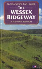
This walk follows the Wessex Ridgeway for the entire day. The route of the Wessex Ridgeway is detailed in the 'Wessex Ridgeway Recreational Path Guide', by Anthony Burton, ISBN 1 85410 613 9 published by Aurum Press Ltd. |
 |
Distances
| From | To | Distance (m) | Ascent (ft) | Descent (ft) |
|---|---|---|---|---|
| Bulbarrow Hill | Giant's Head | 8.8 | 1306 | 1378 |
| Giant's Head | Sydling St Nicholas | 6.7 | 636 | 1079 |
| Sydling St Nicholas | Maiden Newton | 2.6 | 443 | 489 |
| Maiden Newton | Rampisham Down | 5.1 | 768 | 423 |
This makes a total distance of 23.2 miles, with 3153 feet of ascent and 3369 feet of descent.
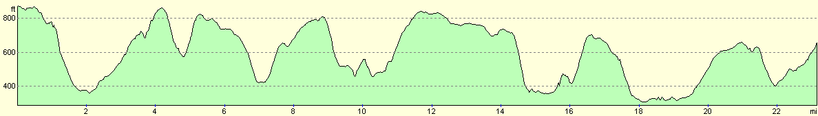
For more information on profiles, ascents and descents, see this page
Accommodation
I camped for the night in a field by a lane just down the hill from the BBC World Service transmitter masts on Rampisham Down.
 |
 |
|
 |
 |
|
 |
 |
|
Disclaimer
Please note that I take no responsibility for anything that may happen when following these directions. If you intend to follow this route, then please use the relevant maps and check the route out before you go out. As always when walking, use common sense and you should be fine.
If you find any information on any of these routes that is inaccurate, or you wish to add anything, then please email me.
All images on this site are © of the author. Any reproduction, retransmissions, or republication of all or part of any document found on this site is expressly prohibited, unless the author has explicitly granted its prior written consent to so reproduce, retransmit, or republish the material. All other rights reserved.
Although this site includes links providing convenient direct access to other Internet sites, I do not endorse, approve, certify or make warranties or representations as to the accuracy of the information on these sites.
And finally, enjoy your walking!
Nearby walks
| # | Title | Walk length (miles) |
|---|---|---|
| 810 | A circular walk from Shapwick to Stourpaine | 22.8 |
| 811 | A circular walk from Durweston to Woolland Hill and Milton Abbas | 22.9 |
| 821 | A circular walk from Bere Regis to Milton Abbas and Tolpuddle | 24.5 |
|
|

|