Walk #1043: Retford to Lincoln
 |
 |
|
General Data
| Date Walked | 18/09/2019 |
| County | Nottinghamshire, Lincolnshire |
| Start Location | Retford station |
| End Location | Lincoln station |
| Start time | 06.45 |
| End time | 14.55 |
| Distance | 23.9 miles |
| Description | This was a walk of two halves; a rather dreary first leg took roads and a footpath down to join an old railway line, after which the railway line took me arrow-straight eastwards across the border into Lincolnshire and to Lincoln. |
| Pack | Today I carried my 30-litre Karrimor rucksack, filled with water, my waterproofs, a book and other odds and ends. |
| Condition | I had recently hurt my left knee running, and unfortuantely it caused me a little pain before I joined the old railway line. It progressively got worse, until in the end it rather spoilt the walk. |
| Weather | Today dawned bright and sunny, with scarcely a cloud in the sky. It was chilly, but it warmed up considerably as the morning wore on. All in all it was a good day for walking. |
| OS map | Landranger number 120 (Mansfield & Worksop, Sherwood Forest) and Landranger number 121 (Lincoln & Newark-on-Trent) or Explorer number 271 (Newark-on-Trent, Retford, Southwell & Saxilby) and Explorer number 272 (Lincoln, Sleaford, Metheringham & Navenby) |
 |
 |
|
Map of the walk
Maps courtesy of Google Maps. Route for indicative purposes only, and may have been plotted after the walk. Please let me have comments on what you think of this new format. For a detailed table of timings for this walk, please see the table file.
 |
 |
|
Notes
It has been five and a half months since my last walk; shortly after my last walk in April, Sencan was taken rather ill. Although she has almost fully recovered, it did not seem fair or right to have her look after Robert all day as I enjoyed myself gallivating around the countryside. Instead, I have been doing lots of running to keep fit - the only downsides being that I hate running and that my old left knee injury has returned. However Sencan had today off work, and as Robert is at school for most of the day, it seemed fine for me to go for a stroll.
But first I had to choose where to go. I have around one hundred walks roughly planned ready to do, all over the country. These are either based on trails (e.g. Southern Upland Way, Trans Pennine Trail), or to fill in 'interesting' areas I haven't walked before. Since it could only be a day walk, it had to be relatively local - but as I hadn't had to drive a lot recently, I could make it near my limit of a two-hour drive for a day walk. In the end I settled on Retford to Lincoln, which would include a stroll along a stretch of old railway line east to Lincoln.
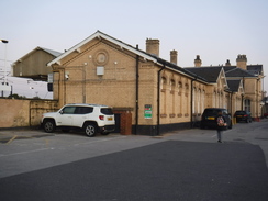
The early morning drive went well, and I parked up at Retford station just after dawn had broken. It cost ten pounds to park there; more than I wanted to pay, but it was convenient. I nipped in to have a look at the station, and then headed off - calling in first at a small corner shop to buy some batteries.
It had been so long since my last walk, and this opportunity had arisen so suddenly, that I hadn't spent as long as I wanted getting my kit ready. I'd already forgotten to pack spare batteries, and as I walked through the town I went through my pockets, checking I had everything.
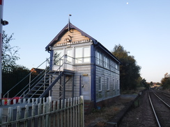
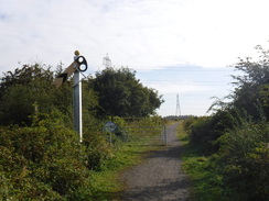
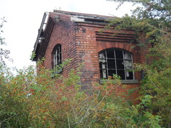
A level crossing took me across the low-level railway line (Retford station is on two separate lines that cross each other at right angles - until a dive-under was built in 1965, the two lines used to cross on the level), where a signal box stood beside the crossing. Network Rail has a program to remove these old signal boxes, with a few being left for preservation - I was therefore surprised to see that Retford Thrumpton had recently been modernised.
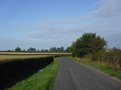
A couple of roads took me southeast out of Retford, and I easily found the path that was to help me avoid some road walking. The was partly constrained between a hedge on the left and fencing on the right, protecting me from a new development. It did not protect me from a rather growly and aggressive dog whose owner appologeticaly approached as I pushed myself into the hedge!
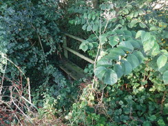
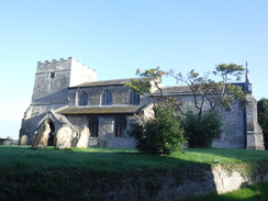
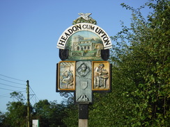
A long and unpleasant road walk followed southeastwards; initially up a hill, with narrow verges, fast traffic and some bends. I diverted off to try to find a trig pillar marked on the map; this should have been on the edge of some woodland, but I could not find it. Quick research when I got back showed that it is still extant, albeit half-buried, and it must have been under a fallen tree I saw. It was a bit of a shame that I missed it, especially as the next few miles continued along the road. Fortunately it became slightly safer going, and eventually I reached the point where a path should have taken me off the road for a few hundred metres into the twin villages of Nether Headon and Headon. Unfortunately the bridge over the ditch was overgrown with weeds and a tree branch, making it near-to impassable; instead of struggling through, I diverted along the road instead, as it was not much longer.
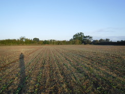
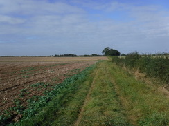
Nether Headon / Headon was a pretty little place, and the road through it was thankfully quiet. The road led me to Upton, after which another road headed southeastwards once more. After a while I used a footpath to cut a corner off the walk. This soon entered a very large field, the path running along a grassy border between a hedge and a thick mass of vegetation - presumably biomass growing for nearby power stations.
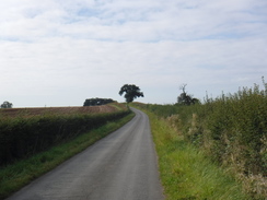
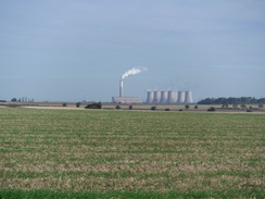
The path led back to a road, which in turn led to the A57. I managed to cross this road quickly, after which another road took me south and east. Views of Cottam power station occasionlly intruded off to my left. I decided to try yomping for a mile, and this proved to be a big mistake - I had slightly injured my left knee running, and it soon started aching a little. Cursing my silliness, I continued on down the road.
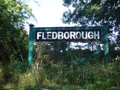
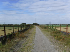
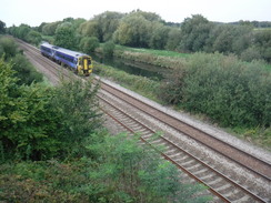
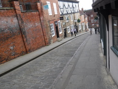
This led to the main target for the day - the old Lincoln to Ollerton railway line, part of which carries a cycle path east to Lincoln. The Lancashire, Derbyshire and East Coast Railway opened the line in 1896, making it a relative latecomer to the railway network. Although passenger servics were withdrawn in the 1950s and 1960s, the line remained open all th way to Lincoln to provide High Marnham power station with coal. A derailment in 1980 closed the stretch of line between Lincoln and the power station, with coal being delivered from Ollerton in the west. High Marnham power station closed in 2003, and the site has since been cleared. The railway line to Ollerton reopened in 2009 as a Network Rail test track; the rest of the line to Lincoln is now a cycle path.
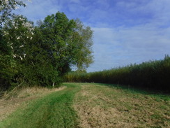
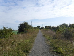
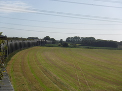
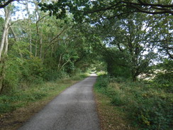
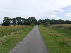
The path passed high fences guarding the old power station site; young trees were growing around concrete bases, but the only real sign of the old station were a multitude of overhead power lines. The path was unsurfaced, and in places quite a narrow avenue between bushes. This is the way old railway paths should be: passable, with gravel or ballast underfoot, instead of the bland tarmac paths that Sustrans tend to make. A few cyclists came past me, including a couple on a tandem - I'm unsure if they'd agree with me!
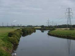
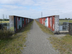
I soon reached the main reason I'd chosen to do this walk - the magnificent Fledborough Viaduct over the River Trent. This viaduct opened with the line in 1896, and comprises 59 arches made of nine million bricks. The viaduct has a slight curve, allowing me to take some photos along its length - necessary, as there was no way of getting down to take photos from below. The central spans over the river was narrower and enclosed by high steel girders; a rebuild in 1964 of an earlier bowstring spans. A signal, its arm forever bowed as if in sorrow, had original ironmongery at its base. Had it been deliberately abandoned as a tribute to the line, or had the scrapmen forgotten it?
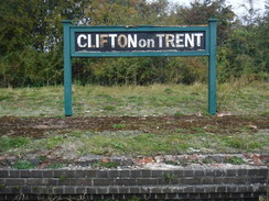
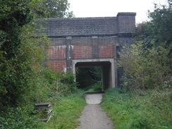
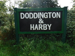
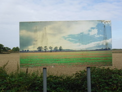
The cycle path took me eastwards past the site of a few stations; including Clifton on Trent, and Doddington and Harby, both of which had mock running-in boards on the old platforms. A couple of old underbridges had been partly filled in, leaving only a concrete culvert to walk through. In a couple of places there were large signs, with pictures of the landscape printed on them - if I positioned myself correctly, I could get the picture to match the landscape behind it. This was an oddity, and something I have never seen before. Eventually the unsurfaced cycle path ended, and a good, if bland, tarmac surface continued on.
By now my knee was aching a great deal. I stopped off on a bench in Skellingthorpe to slip a knee brace on, but initially this just seemed to transform the pain into severe pain. I limped on, and eventualy reached the place where the cycle path met the A46, just before the old line met the current railway at Pyewipe Junction. A sloping path led up to a bridge over the railway and river, after which a steeper ramp took me down to a road. The riverside Pyewipe Inn was busy with people enjoying the sunshine.
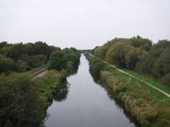
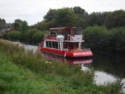
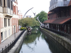
This marked the western outskirts of Lincoln, and a good path took me southeast besides the Fossdyke Navigation. It was a pleasant walk, although a flood bank blocked the view of the water from the cycle path - eventually I climbed up onto a grassy path at the top of the bank where the views were better. My knee was still hurting, but I was enjoying the walk, and soon had a decision to make. I could either continue along the river into the centre of Lincoln and the station, or I could divert into the centre. Since there was a train back to Retford every hour, and I would have to rush to get the next one, I decided to extend the walk.
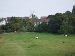
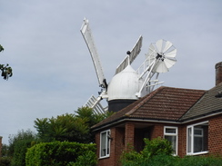
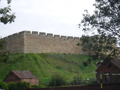
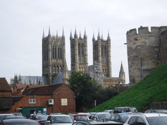
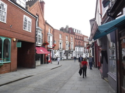
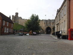
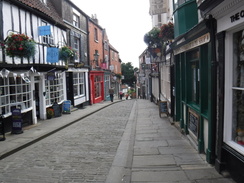
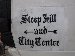
A path led away from the river, crossing a road and then climbing up along the edge of a grassy field called Carholme, almost directly towards a windmill ahead. I joined a road which continued steeply uphill past the 1798-built Ellis Mill, before the gradient thankfully flattened out to approach Lincoln Castle's long curtain wall. I was tempted to nip in for a visit as I passed, but as usual when I was on a day walk, I didn't have the time. Instead I descended past the entrance to the castle and cathedral - situated opposite each other - and then down the aptly-named Steep Hill. The ascent had not bothered my knee too much, but the descent was very painful, and I found myself having to try to keep my leg straight, giving me a gait that amused passers-by!
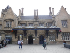
I love Lincoln, but instead of looking around I made my way down to the station, where crossing the footbridge to catch my train proved problematic. Eventually I reached the train, and settled down for the journey back to Retford.
It had been a mixed walk, with a fairly uninteresting road walk followed by a long trek along the old railway. The highlights had to be the viaduct and the centre of Lincoln, but both had been let down by my knee problems. To make matters worse, a lorry carrying a digger had hit a bridge on the A1, meaning I got home about an hour later than I should have. It was not a great start back to walking.
 |
 |
|
Directions
This walk starts off at Retford railway station, at SK70188033. Leave the station and head down Victoria Road; after 300 metres this ends at a T-junction with Albert Road. Turn right to follow Albert Road eastwards; after another 300 metres, and just before some traffic lights are reached, turn right down Thrumpton Lane. Follow the road south; it crosses a level crossing over a railway line and then curves left, becoming Whinney Moor Lane. This eventualy ends at London Road at SK71147999.
Carefully cross London Road (there is a pedestrian crossing immediately to the left), and then turn right to follow the road south. After about 140 metres, turn left along Grove Coach Road. After nearly 200 metres and just before the start of a gentle left-hand bend, turn right down Five Fields Lane. As this curves right, continue straight on down a track. As this curves left after a few metres, head straight on along a grassy path, with a fence on the left. This emerges into a field (note: 2019: the field is being built on; the path's route may be subject to change) at SK71417962.
Turn left to follow a hedge on the left, with houses beyond. The hedge ends and the path curves to the right; continue along the field boundary until it narrows. At the corner, go across a footbridge over a stream to enter a second field. Head diagonally across this field, aiming for the hedge on the other side, which is in front of a road. Aim just for the right of where the field boundary curves slightly. Search for a gap in the hedge that leads out onto a road at SK72107917.
The next stretch involves walking along a busy road, with poor verges. Turn left to start following the road eastwards; it climbs uphill. After 3km a triangular road junction is reached on the right. Turn right onto a thankfully quieter road called Greenspotts Lane, and follow it as it twists and turns in a rough southerly direction, passing through Nether Headon and Headon. After 1.3km another road junction with Yew Tree Road is reached. Turn right and follow the road southwestwards for 600 metres until it ends at a T-junction with Main Street in Upton at SK74537639.
Turn left to follow the road as it heads east-southeastwards, winding occasionally as it does so. When a sharp left-hand bend is reached after 2km (just before field Farm), continue straight on through a broad gap in a hedge. Follow a field boundary on the right for a short distance to another gap in a hedge; go through this into a second, slightly larger field. At the end of this field, cross a plank bridge over a ditch in a gap in the hedge to enter a third field. This field is very long; just follow the hedge on the right as it slowly swings to the left, to take a more southeasterly route. After 1.8 km it reaches a vehicle barrier that leads onto Darlton Road. Turn right down the road; it soon curves left and then sharpy right over a stream. After 550 metres the road ends at a T-junction with the A57 in Darlton at SK77207362.
Carefully cross the busy main road, and then turn left to follow it eastwards into Darlton. After 150 metres, turn right down Woodcoates Road. After 1.7km this turns sharply to the left to heads eatwards, becoming Green Lane. After another 900 metres it curves right to head past some old farm buildings at Gibraltar, before taking a more southerly course. When the road curves very sharply to the right beside a small spinney, turn left through a gateway to join an obvious green lane that carries cycle route 647, following a hedge on the left. This climbs a slight hill, and after 850 metres emerges out through a bridleway gate to join a road by Station Cottages in Marnham at SK79727114.
Immediately before the road is reached, turn right down a winding, sloping path that leads down to the course of the old Lincoln to Ollerton railway line. At the bottom, join an unsurfaced cycle path that heads under the railway bridge, and follow it eastwards for 2km onto Fledborough Viaduct; the central spans over the river is reached at SK81647156.
Continue following the cycle path and old railway line eastwards; it passes through a fairly rural area, passing uder bridges carrying roads overhead, before entering the first settlement of any size, Skeelingthorpe. 12.9km after the Fledborough Viaduct, the cycle path reaches the A46 road. Here the old railway line is left, and a sloping path climbs up to the left, paralleling the road to the right. This eventually joins the roadside, just in time to cross a bridge over a railway line and the Fossdyke Navigation - this path is between narrow fences, so beware of oncoming cyclists. Immediately on the other (northern) side of the bridge, turn left down a zig-zag path that descends, eventually ending at a road at SK94787249.
Turn right along the road, immediately passing through a bridge under the A46. On the other side, the road passes the Pyewipe Inn; turn right into the car park, aiming for the far left-hand corner (away from the pub), where a cyclepath runs below the Fossdyke Navigation's flood bank.Follow this southeastwards; 600 metres after the car park, it crosses a bridge over the end of the Catchwater Drain. Continue along the cycle path past the bridge; the bank and river turn right and then left, and 750 metres after the bridge, and just before housing starts, turn left down a narrow path that squeezes between the housing and a golf course. This soon emerges out onto the A57 Carholme Road at SK96207176.
Cross the road using the pedestrian crossing, and then go through a gate on the other side; walk a few metres to and through a second gate. When a junction of paths is reached a few metres further on, beside a small building, turn right along a rough track that skirts a small patch of woodland on the left, and then starts to climb up grassland, with houses a short distance away to the right. The track becomes indistinct; head straight on, roughly heading uphill towards a windmill. Cross another path, and continue up to the top of a field, where a clappergate leads onto Long Leys Road at SK96927218.
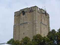
Carefully cross the road, and then turn right uphill for a few metres to reach a junction with the B1273 Yarborough Road. Very carefully cross the busy road, and head straight on uphill along the steep Upper Long Leys Road, which passes the windmill to the left. This road ends at a crossroads with Burton Road; turn right down the road to follow it into the centre of Lincoln; after 150 metres a mini roundabout is reached in front of Lincoln Castle's curtain wall. Turn left at the roundabout to follow Westgate past the castle on the right and Lincoln Waterworks tower on the left. When the road ends at a T-junction with Bailgate, turn right down this road as it heads south, soon passing between the castle entrance on the right and the cathedral entance on the left at SK97647181.
Continue down the road as it stats to fall; it soon becomes the aptly-named Steep Hill. At a crossroads angle slightly left to head down Steep Hill as it curves around. As the gradient slackens, it becomes High Street. Continue along this as it crosses a couple of roads, and then passes under the magnificent Guildhall, and crosses the River Witham. The High Street eventually ends at Wigford Way. Immediately cross the road ahead using a pedestrian crossing, and then turn left along the road for a short distance to reach the entrance to Lincoln railway station at SK97597091.
 |
 |
|
Distances
| From | To | Distance (m) | Ascent (ft) | Descent (ft) |
|---|---|---|---|---|
| Retford station | Headon church | 4.7 | 232 | 154 |
| Headon church | High Marnham | 6.4 | 89 | 176 |
| High Marnham | Fossdyke Navigation | 9.6 | 30 | 62 |
| Fossdyke Navigation | Lincoln station | 3.2 | 213 | 230 |
This makes a total distance of 23.9 miles, with 564 feet of ascent and 622 feet of descent.
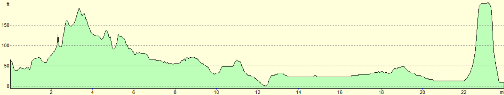
For more information on profiles, ascents and descents, see this page
Transport
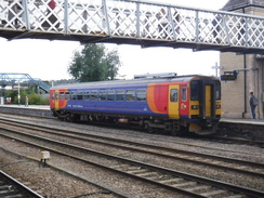
Regular (hourly) train services run between Lincoln and Retford, running via Gainsborough.
 |
 |
|
 |
 |
|
 |
 |
|
 |
 |
|
 |
 |
|
 |
 |
|
 |
 |
|
 |
 |
|
 |
 |
|
 |
 |
|
 |
 |
|
 |
 |
|
 |
 |
|
 |
 |
|
 |
 |
|
 |
 |
|
 |
 |
|
 |
 |
|
 |
 |
|
 |
 |
|
Disclaimer
Please note that I take no responsibility for anything that may happen when following these directions. If you intend to follow this route, then please use the relevant maps and check the route out before you go out. As always when walking, use common sense and you should be fine.
If you find any information on any of these routes that is inaccurate, or you wish to add anything, then please email me.
All images on this site are © of the author. Any reproduction, retransmissions, or republication of all or part of any document found on this site is expressly prohibited, unless the author has explicitly granted its prior written consent to so reproduce, retransmit, or republish the material. All other rights reserved.
Although this site includes links providing convenient direct access to other Internet sites, I do not endorse, approve, certify or make warranties or representations as to the accuracy of the information on these sites.
And finally, enjoy your walking!
Nearby walks
| # | Title | Walk length (miles) |
|---|---|---|
| 600 | Newark on Trent to Lincoln | 19.5 |
| 608 | Market Rasen to Lincoln | 24.1 |
| 724 | Retford to Woodhouse | 23.4 |
|
|

|