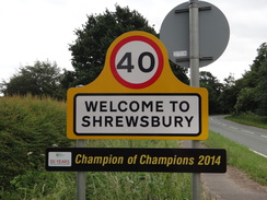
Walk #1004: Yorton to Shrewsbury
 |
 |
|
General Data
| Date Walked | 15/06/2018 |
| County | Shropshire |
| Start Location | Yorton station |
| End Location | Shrewsbury station |
| Start time | 05.59 |
| End time | 11.31 |
| Distance | 15.7 miles |
| Description | This was a fairly uninspiring stroll along roads south from Yorton to Shrewsbury, taking a long arc to the west to increase the mileage. The best part was at the end, when I followed the riverside into the town. |
| Pack | Today I carried my 30-litre Karrimor rucksack, filled with water, my spare waterproofs, a book, trainers and other odds and ends. |
| Condition | I feel absolutely fine after this walk. |
| Weather | Today was generally cloudy and warm, with not much wind after yesterday's gales. |
| OS map | Landranger number 126 (Shrewsbury & Oswestry) |
 |
 |
|
Map of the walk
Maps courtesy of Google Maps. Route for indicative purposes only, and may have been plotted after the walk. Please let me have comments on what you think of this new format. For a detailed table of timings for this walk, please see the table file.
 |
 |
|
Notes
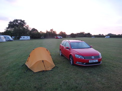
I woke at four thirty in the morning, and there seemed little point in hanging around the campsite. I had planned to drive down to Shrewsbury, park, and catch the first train of the day to the start of the walk at Yorton station. However that train was not due to depart until eight, meaning I would have hours to wait for it. As this is the last day of this short trip, and I was hoping to drive home afterwards, I wanted to finish as early as possible. I therefore changed my plan and drove to Yorton station, parked in the small car park and got my kit together.
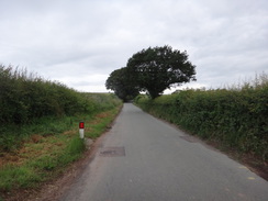
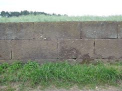
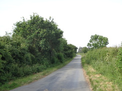
Because of yesterday's difficulties, my route was going to be different from the one I had planned before the trip. I would therefore have to rely on my 1:50,000 map rather than the 1:25,000 ones I usually use. A road took me westwards from the station towards Alderton, and then on towards Balderton. Here walls made of large stone blocks lined both sides of the road, all finely cut with little mortar between the joints. It must have been an expensive wall to build, and the closeness of the walls to the road made it rather difficult when a lorry had to pass.
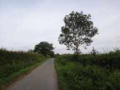
Thankfully the walls ended, and the road continued on towards a main road that led me into the little village of Myddle. A much quieter road took me southwestwards out of Myddle, and only a handful of cars passed me over the next few miles. Occasional good views south towards the Shropshire hills lifted my spirits, and I whiled away a few minutes planning future walks toward them. The road led out to a main road in Walford Heath, after which I followed another road into Yeaton. At one point I saw a statue of some form of raptor standing on a gatepost beside the road, and as I approached the statue flexed its wings and flew away!
This road became busy as it left the village, crossing the River Perry and heading south into Grafton and then Fitz Mill. A stream of cars heading north were waiting to turn towards the small village of Fitz, and as it was just before nine I had assumed that there was a school up there, but none of the cars I could see had children in them.
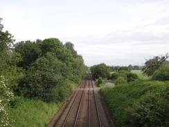
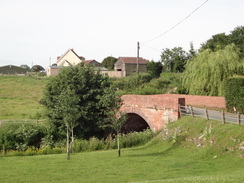
The next mile or so was rather unpleasant, with narrow or non-existent verges and many cars, vans and lorries streaming past. I had not expected the road to be so busy, and I guess that the river Severn immediately to the south channels traffic into a few crossings. The old Montford Bridge airfield lay off to the right, but remained totally out of sight. It was a relief when a pavement started in the village of Montford Bridge, and the road ended at the B4380. I used this to cross the Severn at Montford Bridge, from where Shrewsbury was almost in sight.
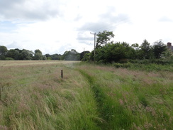
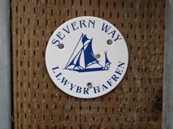
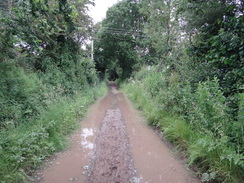
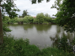
The map showed the long-distance Severn Way following the southern side of the river, and that seemed like a better alternative than more road walking. Unfortunately there was no sign pointing away from the road, and I had to walk back to a small track that led to a gate and field. I walked across this, and on the other side a footbridge led into an overgrown area. Tall grass grew nearly as high as my head, and pollen and dust engulfed me as I waded through it. Worse, the ground was very boggy, and my new boots, which had remained clean for the past three days, were soon covered in muck. I waded through to a field of corn and, seeing no easy way through, returned to the footbridge.
I was tempted to return to the road, but instead I splashed through to the corner of the field, and followed the edge around until I found a way out - it turns out the boggy route I had initially taken had been the correct one, and that the farmer had not left a clear route through. Fortunately the next field had been ploughed, allowing me to climb up the hill along the clear ground rather than the overgrown field edge. This led to a track that, despite the recent dry spell, was in places flooded from one side to the other. It was a relief when this ended at a road, and I decided to leave the Severn Way for a while and follow the road into Shrewsbury.
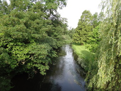
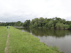
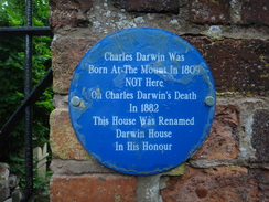
Fortunately there was a pavement, and I made good time into the town, aware that there was only one train back to Yorton every two hours. The Severn Way headed off again on the outskirts of the town and, assuming that it would be more frequently walked this near town, I rejoined it. A seemingly never-ending descent along paths and tracks was followed by a very pleasant stroll along the riverbank, a walk that 'saved' the day from being a fairly miserable one. I passed signs stating that Charles Darwin had been born in a house on the hillside and, a little further on, a house called 'Darwin House' outside of which a plaque stated he had not been born.
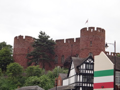
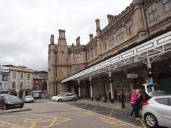
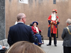
I was fairly keen to end the walk and, not wanting to miss the next train, left the Severn Way and headed directly to Shrewsbury railway station. This is a rather impressive structure that nestles right behind the castle, and its frontage is suitably grand. I bought a ticket and headed to the platform, only to find a town crier, whose beard was as impressive as his height, a mayor, and several other dignitaries waiting. I watched bemused as they started to make speeches, and a BBC radio man asked me he could interview me. I responded that I had no idea what was going on, and he went away to try to find someone who was not totally clueless.
It turned out that the ceremony was for the opening of new waiting rooms and facilities on the platform, and very smart they seemed to. However it was a shame I could not use the waiting room, as it was filled with people connected to the ceremony eating snacks!
The train arrived, and I was soon back at the car, ready for the three-hour drive back home. It had been a frustrating day, although the trip as a whole had been a success: I had walked the full distance that I had wanted, completed my first multi-day trip in several years, and had broken in my new boots. The only problem is that I have regained my taste for it, and am already covetously eyeing up other trips ...
 |
 |
|
Directions
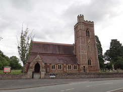
This walk starts on the northbound platform of Yorton railway station at SJ50452375. Leave the station and descend some steps to reach a road, with a railway bridge to the right. Turn left down the road and follow it westwards; after half a mile the B5476 road is reached. Carefully cross the B5476 and continue westwards along another road; this passes Balderton Hall on the right, and after 1.5 miles ends at a T-junction with the A528. Carefully cross the main road, and then turn right to walk along the verge for a couple of hundred metres until a road leads off to the left into the village of Myddle. Follow this road as it winds through the village, until Myddle church is reached on the left at SJ46742362.
Continue westwards out of the village, and 0.4 miles after the church take a road that leads off to the left. This winds around as it heads in a rough southwesterly direction, and thankfully does not carry a lot of traffic. After 2.3 miles it crosses a railway line on a bridge, and another 0.6 miles later ends at a T-junction with another road. Turn right to head southwestwards down this road for 250 metres until it ends at a T-junction with the B5067 road in Walford Heath at SJ44811988.
Carefully cross the main road and continue southwestwards down another road. It curves to the right to head westwards into the village of Yeaton, where it curves left to head south to a bridge over the River Perry after 1.2 miles. Cross the bridge and continue south along the road; after 0.6 miles it curves left to head eastwards, and after another 0.6 miles a junction with a road to Fitz is reached. Follow the road as it swings sharply to the right to head southeastwards; care needs to be taken, as the road is busy and the verges are sometimes non-existent. After 1.5 miles the road passes Forton Farm and curves to the left to head in a more southerly direction; a pavement thankfully starts on the left as the road enters Montford Bridge, and after another 0.4 miles the road ends at a T-junction with the B4380 at SJ43111542.
Turn left to follow the B4380, soon reaching a bridge over the River Severn. Cross the bridge, and when the Wingfield Arms is reached, turn left down a track that ends at a bridleway gate beside a field gate. This route is the Severn Way, although it is not waymarked from the road. Go through the gate and head on across a field, with a hedge on the right and the river away to the left. In the corner of the field, go through a bridleway gate and then cross a footbridge over a stream. This leads out into an overgrown area; on the map the path heads straight on across the field, but due to boggy ground and crops I had to turn left and then right to follow the edge of the field around. At the far side of the field, go through another bridleway gate that leads into another field. Head straight on up the edge of the field, with scrubland to the left. At the top, go through a bridleway gate beside a field gate and continue on along a rough track between hedges. The track curves to the left, passes a little pond on the right, and then ends at a public road in Bicton at SJ44571517.
Turn right to join the public road and follow it as it heads eastwards; it soon curves to the right to head southwards, leaving the Severn Way behind. Follow the road south for a quarter of a mile, passing Bicton church on the left until it ends back at the B3480. Turn left to follow the B3480 southeastwards; it starts to curve to the right, and after 1.3 miles a track leads off to the left at SJ46541358, carrying the Severn Way.
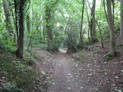
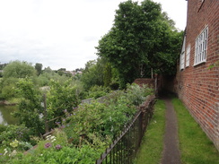
Turn left down the track, which heads down into woodland. Continue along the track as it narrows; it curves to the right to become a sunken lane as it continues to fall. After about half a mile the track emerges out onto a surfaced road, with Mountwood Park off to the right. As the road curves left, turn left to join a path that follows a hedge on the left. The path leads to a long flight of steps that descends down; at the bottom, follow the path with a high chain-link fence on the right and a hedge on the left. It reaches some more steps that lead down to a clappergate, with the river just visible through the trees on the left.
The clapperhgate leads into a field; at the end of the field, go through a clappergate through a hedge into a second field, with the river away to the left. Go through a clappergate into a third field, and then cross a footbridge guarded by gates over a dry ditch to enter a fourth field. This field is quite short; when it ends go through a pedestrian gate into a fifth field. At the end of this field, go through a clappergate and follow a hedge on the right to another clappergate to reach Doctors Field, still following the river down to the left. Continue alongside the river, and go through another clappergate; the path curves to the right and climbs up steps to reach the end of a road. Do not join the road but turn left to join a surfaced path that runs behind houses, with a wall to the right and a hedge to the left. The path curves right up more steps to reach the end of Hunter Street at SJ48791317.
Walk down Hunter Street, and when the road ends, turn right along Alma Street. When this ends left down Mount Street, which itself ends at a T-junction with Frankwell in front of the Theatre Severn. Turn right along Frankwell, and carefully cross the road to reach the southern (left-hand) side. Turn left to cross Welsh Bridge over the Severn, and on the other side turn left to follow the pavement between the road on the right and the river on the left. As the road curves left, carefully turn right to cross the road into an island, and then left to join the other side of the road. Turn right towards the castle and Shrewsbury railway station at SJ49491289, where this walk ends.
 |
 |
|
Distances
| From | To | Distance (m) | Ascent (ft) | Descent (ft) |
|---|---|---|---|---|
| Yorton railway station | Myddle church | 2.5 | 174 | 151 |
| Myddle church | B5067 | 3.4 | 79 | 105 |
| B5067 | Montford Bridge | 4.3 | 148 | 236 |
| Montford Bridge | Shrewsbury railway station | 5.5 | 262 | 305 |
This makes a total distance of 15.7 miles, with 663 feet of ascent and 797 feet of descent.
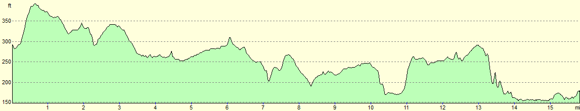
For more information on profiles, ascents and descents, see this page
Transport
Trains run between Shrewsbury and Yorton once every two hours during weekdays; see the National Rail Enquries website for more information. Yorton is a request stop.
 |
 |
|
 |
 |
|
 |
 |
|
 |
 |
|
 |
 |
|
 |
 |
|
 |
 |
|
 |
 |
|
 |
 |
|
 |
 |
|
 |
 |
|
 |
Disclaimer
Please note that I take no responsibility for anything that may happen when following these directions. If you intend to follow this route, then please use the relevant maps and check the route out before you go out. As always when walking, use common sense and you should be fine.
If you find any information on any of these routes that is inaccurate, or you wish to add anything, then please email me.
All images on this site are © of the author. Any reproduction, retransmissions, or republication of all or part of any document found on this site is expressly prohibited, unless the author has explicitly granted its prior written consent to so reproduce, retransmit, or republish the material. All other rights reserved.
Although this site includes links providing convenient direct access to other Internet sites, I do not endorse, approve, certify or make warranties or representations as to the accuracy of the information on these sites.
And finally, enjoy your walking!
Nearby walks
| # | Title | Walk length (miles) |
|---|---|---|
| 1003 | Whitchurch to Yorton | 18.3 |
|
|

|