Walk #1002: Nantwich to Whitchurch
 |
 |
|
General Data
| Date Walked | 13/06/2018 |
| County | Cheshire, Shropshire |
| Start Location | Nantwich station |
| End Location | Whitchurch station |
| Start time | 06.58 |
| End time | 14.08 |
| Distance | 19.1 miles |
| Description | This was a pleasant walk following the Shropshire Union and Llangollen canals south from Nantwich, with only a couple of miles of road walking. |
| Pack | Today I carried my 30-litre Karrimor rucksack, filled with water, my spare waterproofs, a book, trainers and other odds and ends. |
| Condition | My feet ache after this walk, and my left ankle had a few twinges of pain as well. Aside from this I am fine, and ready for another stroll tomorrow. |
| Weather | Today started off fairly sunny, although clouds gathered and the wind rose as the day progressed. It was pleasantly warm. |
| OS map | Landranger number 118 (Stoke-on-Trent & Macclesfield) and Landranger number 117 (Chester & Wrexham, Ellesmere Port) |
 |
 |
|
Map of the walk
Maps courtesy of Google Maps. Route for indicative purposes only, and may have been plotted after the walk. Please let me have comments on what you think of this new format. For a detailed table of timings for this walk, please see the table file.
 |
 |
|
Notes
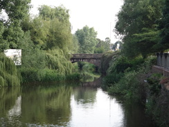
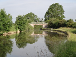
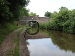
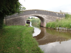
My legs felt tight after yesterday's walk, although my feet felt fine as I walked around the campsite early this morning. It was a short drive into Nantwich, where I parked in the same space as I did yesterday and pulled my kit together. The first four miles of today's walk were the same as yesterday: a mile's stroll to the Shropshire Union Canal, and then northwestwards along the canal to Hurleston Junction, where the Llangollen Canal leaves the Shropshire Canal Main Line. A man was painting a watercolour of the canalside scene, and was already quite advanced despite the early hour. The miles flew by, and before I knew it I was crossing a bridge to reach the Llangollen's towpath.
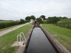
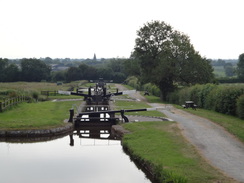
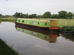
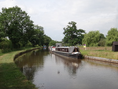
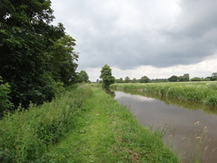
A flight of locks takes the canal past Hurleston Reservoir, which provides drinking water to the surrounding area. The canal seemed to have an unusually fast flow for a canal, delivering 12 millions gallons a day to the reservoir from the Welsh hills. It was a pleasant walk, with long straights separated by sharp bends. A new marina stood across the canal at Burland, and a sign advertising a shop was of little use to me, as there was no easy way to get across the water!
After eight miles I decided to take a rest at a lock. I had walked all of yesterday's walk without a break, and my feet had suffered in the new boots, so it seemed sensible to stop and take them off to let my feet rest. There was no bench, so I sat down on the brickwork by a gate and munched some sandwiches. My grand-aunt lives near the canal in Nantwich, and I decided to give her a quick call to see if I could nip around later. We had a quick chat and agreed to meet up. After this I ate some sandwiches I had bought in Nantwich and watched as a jogger sped past.
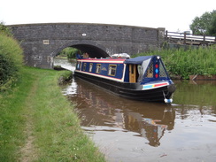
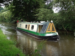
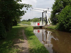
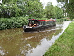
The canal approached Wrenbury, and I caught a glimpse of my tent in the camping field off to the left, and it felt weird to be walking past my tent without stopping. Shortly afterwards the canal turned sharply to the left, and a boat was struggling to negotiate both the bend and the lift-bridge alongside. I stopped to chat to a man who had a tablet computer hanging from his neck - he turned out to be a surveyor for the Rivers and Canal Trust, and he was performing surveys of the locks on the canal.
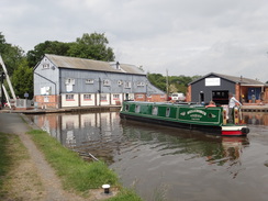
A long straight stretch took me to Marbury, and then under the A49 at Quoisley, after which it paralleled the main road as it headed southwards. I had promised myself another break at fourteen miles, and I reached this target as I approached Wileymoor Lock a few minutes after midday. This was a happy coincidence, as the adjacent pub has just opened. I went in and bought a pint of shandy, and supped it whilst watching a boat negotiate the lock.
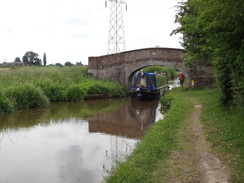
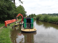
Refreshed, I shrugged my pack back on and continued along the towpath. A Rivers and Canal Trust boat was moored to the bank, and a digger was driving piles into the water to replace old corroded ones. Canals need a great deal of work to keep them operational; from the replacement of lock gates to the cutting down of vegetation to prevent silting, and massive works like the repair of the breach in the Middlewich branch that I read about yesterday. It was therefore good to see people working to keep the canal in tip-top shape.
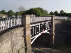
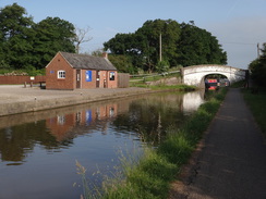
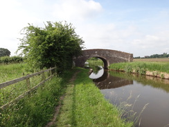
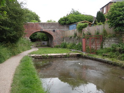
After passing under a railway bridge that once carried the Whitchurch and Tattenhall railway line, an early closure in 1963, the line passed under another bridge carrying the A41 overhead and onto Grindley Brook, where I had to resist the temptations of another pub. A little further on the Whitchurch Branch of the canal leaves the main canal, and I had to wait for another lift bridge to come down before I could cross and start along the branch. The branch had been abandoned for many years before it was reopened for a short distance in the 1980s. It was a pleasant stroll, but ended all too soon at the oddly named 'Chemistry Bridge'.
A path led on towards the centre of Whitchurch, along a small stretch of canal that might soon be reopened. A road then took me on through the town and on to the station, where the next train was due in forty minutes. I sat on a bench, took my boots off to allow my feet to cool down, and wondered why people seemed to prefer to stand rather than sit next to me.
Odd, that !
The train took me back to Nantwich, and rather than go straight back to my campsite to spend the rest of the afternoon in my tent, I explored the town and had a meal in a pub. It is a pleasant place, with lots of little nooks and crannies. After this I went back to the campsite and had a shower, before driving to my grand aunt's house.
In films, grand aunts are stern, austere creatures, disapproving of everything that youngsters do nowadays. I'm glad to say that my grand aunt is the antithesis of this. She is very sprightly and, most importantly, fun - and the same can be said for my grand-uncle. I can only hope I'm the same when I'm in my nineties.
It was a wonderful end to a very long day of canal walking.
 |
 |
|
Directions
This walk starts off at Nantwich railway station, at SJ65265191. Leave the station, cross the B5341 road (Pillory Street), and then turn right to walk a short distance to a roundabout, with the Railway Hotel on the other side of the road. Take the first road off to the left, Water-Lode, and follow it as it passes the Love Lane car park on the other side, after which it curves to the right. A short distance after the bend (and opposite the junction with Mill Street), turn left to cross the River Weaver on a bridge to enter an area of parkland.
The path immediately branches into three; take the middle one, which curves to the left across the parkland, and then curves right to reach a second, longer, footbridge over another river stream. On the other side, turn left along another path, that initially parallels a road off to the right. Shortly after the road curves to the right, a crosspaths is reached. Turn right along a path that follows a hedge on the right before ending at Queen's Drive. Turn left and follow the road as it curves to the right. After 0.4 miles it ends at a T-junction with Marsh Lane at SJ64185166.
Turn right to head north along Marsh Lane, and follow a hedge on the left for about fifty metres until a gap is reached. Go through the gap, and turn right to join the canal towpath, with the water away to the left. Follow the canal northwards; after 2.8 miles it reaches Hurleston Junction at SJ62625530.
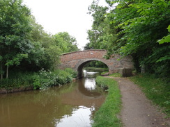
Carefully cross Bridge 97 just before the junction to join the Llangollen canal's towpath. Follow the canal southwards, with the water to the right, as it immediately climbs up past four locks. Continue south along the canal for 8.3 miles, until Marbury Lock is reached at SJ56224644.
Use bridge 23 immediately before the lock to cross over to the towpath, which now runs on the other (western) side of the canal, with the water on the left. Follow it south for another 5.3 miles, until the junction with the Whitchurch arm of the canal is reached at SJ52794155.
Cross the New Mills lift bridge (no. 31) over the canal, and then continue along the towpath of the Whitchurch arm, with the canal away to the right. After a sixth of a mile the watered canal ends at a stone bridge called Chemistry Bridge. A path heads under the bridge, and under another concrete bridge immediately afterwards. The path then heads across a grassy area of parkland before ending at a road called Greenfields Way. Turn right and follow the road for a short distance until it ends at a T-junction with Chemistry Road at SJ53334151.
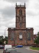
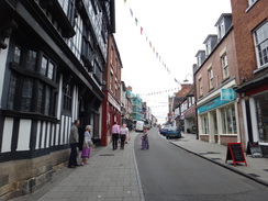
Turn left to follow the road eastwards; it soon becomes Smallbrook Road. When a mini-roundabout is reached, continue straight on to reach another. Turn left up Yardington Road and follow it up towards Whitchurch church. At a mini-roundabout in front of the church, turn right down Bargates, passing the church on the left, and as the road immediately curves left, head straight on down the High Street. By the clock tower at the bottom of the High Street, turn left along Green End. This climbs up a slight slope, and when it ends at a T-junction with the B5395, use the pedestrian crossing to cross the road ahead and turn half-right down Station Road. Continue along this road for 0.3 miles until Whitchurch railway station is reached on the left at SJ54984135.
 |
 |
|
Distances
| From | To | Distance (m) | Ascent (ft) | Descent (ft) |
|---|---|---|---|---|
| Nantwich station | Marsh Lane Bridge | 1.1 | 59 | 20 |
| Marsh Lane Bridge | Hurleston junction | 2.8 | 0 | 16 |
| Hurleston junction | Wrenbury Bridge | 6.2 | 95 | 33 |
| Wrenbury Bridge | Wileymoor Lock | 4.6 | 33 | 0 |
| Wileymoor Lock | Whitchurch Branch Junction | 2.8 | 43 | 20 |
| Whitchurch Branch Junction | Whitchurch railway station | 1.6 | 105 | 59 |
This makes a total distance of 19.1 miles, with 335 feet of ascent and 148 feet of descent.
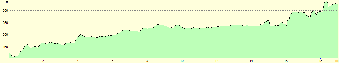
For more information on profiles, ascents and descents, see this page
 |
 |
|
Transport
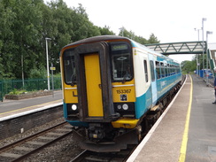
Regular rail services run between Whitchurch and Nantwich; see the National Rail Enquries website for more information.
Accommodation
I spent the night camping at the Cotton Arms in Wenbury, a few miles to the south of Nantchurch and right next to the Llangollen Canal. It cost me 5 pounds for the night for a single tent, and 1 pound for the shower. The food in the adjacent pub was nourishing and excellently priced.
 |
 |
|
 |
 |
|
 |
 |
|
 |
 |
|
 |
 |
|
 |
 |
|
 |
 |
|
 |
 |
|
Disclaimer
Please note that I take no responsibility for anything that may happen when following these directions. If you intend to follow this route, then please use the relevant maps and check the route out before you go out. As always when walking, use common sense and you should be fine.
If you find any information on any of these routes that is inaccurate, or you wish to add anything, then please email me.
All images on this site are © of the author. Any reproduction, retransmissions, or republication of all or part of any document found on this site is expressly prohibited, unless the author has explicitly granted its prior written consent to so reproduce, retransmit, or republish the material. All other rights reserved.
Although this site includes links providing convenient direct access to other Internet sites, I do not endorse, approve, certify or make warranties or representations as to the accuracy of the information on these sites.
And finally, enjoy your walking!
Nearby walks
| # | Title | Walk length (miles) |
|---|---|---|
| 1001 | Nantwich to Chester | 21.3 |
| 1003 | Whitchurch to Yorton | 18.3 |
|
|

|