Walk #974: Pennine Bridleway: Cromford to Blackwell
 |
 |
|
General Data
| Date Walked | 05/03/2013 |
| County | Derbyshire |
| Start Location | Cromford |
| End Location | Blackwell |
| Start time | 08.36 |
| End time | 17.08 |
| Distance | 22.2 miles |
| Description | This pleasant walk follows the Cromford Canal for a mile, before tackling the entire High Peak Trail, durting which it passes the start of the Pennine Brildeway. When the High Peak Trail ends, roads and tracks had north to the A6 and Blackwell. |
| Pack | Today I carried my 30-litre Karrimor rucksack, filled with water, my waterproofs, a book and other odds and ends. |
| Condition | I feel absolutely fine after this walk. |
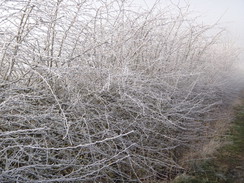
| Weather | Today started off well belwo freezing and foggy. The fog remained until mid-morning, when it started to lift and be replaced with beautifully blue skies. It was a warm day got the time of year; indeed, it was the first pleasant day's weather. |
| OS map | Outdoor Leisure number 24 (The Peak District - White Peak Area) |
 |
 |
|
Map of the walk
Maps courtesy of Google Maps. Route for indicative purposes only, and may have been plotted after the walk. Please let me have comments on what you think of this new format. For a detailed table of timings for this walk, please see the table file.
 |
 |
|
Notes
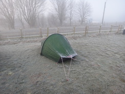
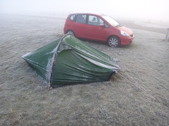
I awoke this morning to find that it had been a very cold night -the hose of my Platypus water bladder had frozen, and chunks of ice were floating in the bladder itself. It was the first nght I had spent in my new Akto tent, and I was slightly dismayed to see that there was a small amount of condensation within - however a look outside showed that the flysheet was frozen, and that there was freezing fog. The thermometer in my car recorded -4 degrees.
My plan for today was to walk the first stretch of the Pennine Bridleway, a new National Trail. I have been reluctant to walk this as it is not yet complete; however a new stretch has recently opened up towards Cumbria, and so reluctantly I have decided it needs doing. As the trail runs right past the campsite, all I had to do was get a bus towards the southern trailhead and walk back. Sadly the trailhead is at Middleton Top, which is not well served by public transport. Instead I walked down to the bus stop near the campsite on the A6, and caught an early bus through the Peak District to the village of Cromford.
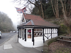
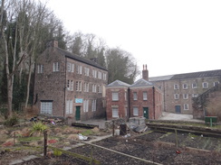
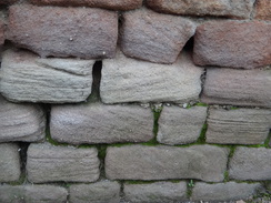
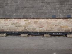
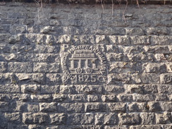
A cafe right by the bus stop provided me with a bacon sandwich which I munched as I walked down towards Cromford Mill, the first water-powered cotton spinning mill in the world. The mill has been restored, and is now the home of the Arkwright Society, and is also part of a World Heritage Site. Sadly a lovely cast-iron aqueduct that spanned the road was hit by a lorry and destroyed in 2002 - a true loss. The society want to rebuild the aqueduct, but are being stymied by the fact that the council say it is too low to allow traffic under. A stupid decision that is preventing a historic item from being rebuilt.
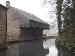
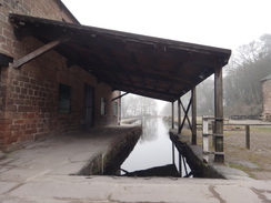
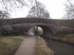
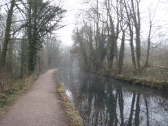
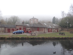
Water soon appeared on my right, the site of a beautiful wharf, marking the end of the Cromford Canal. This canal opened in 1794 and included the massive 3,063-yard long Butterley Tunnel. Although the canal is out of use, the wharf has been restored and the six-mile stretch to Ambergate is still in water, if unnavigable. The wharfside buildings are incredibly atmospheric, even with no boats present. I stood there and tried to imagine the bustling scene that would have greeted me from the same vantage point 200 years before. A woman in front of me nipped into the public toilets at the wharf before powering past me; she said she was in a hurry and had to get to work.
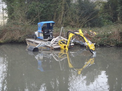
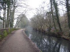
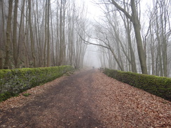
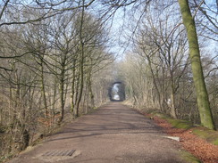
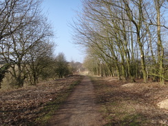
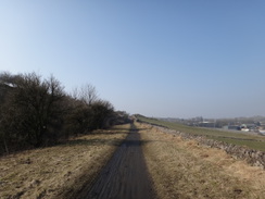
A pleasant stroll led me south along the canal's towpath. Trees were being cut back as a precursor to having the canal dredged to make it navigable once more. It was bitterly cold, and the morning fog had still not lifted. However the fog made the tree-lined canal feel even more atmospheric and overworldly. I still had a long way to go, but I was already thoroughly enjoying the day.
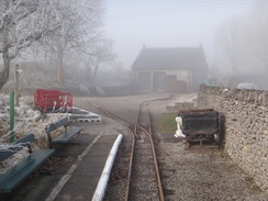
Soon a bridge took me across the canal to reach High Peak Junction. The buildings here marked the transhipment point between the canal and the feature I would be following for most of the rest of the day - the Cromford and High Peak Railway. This was opened in 1831 to solve a problem: the Cromford Canal provided a link with the eastern Peak, shilt the Peak Forest Canal flowed along the eastern. A link between the two would be massively useful for trade, but the high hills of the Peak District lay in the way.
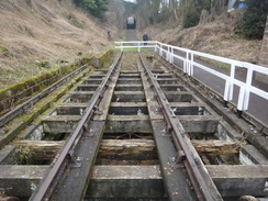
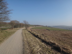
Various schemes including a canal were considered, but the engineer Josias Jessop came up with another scheme: a railway to link the two canals. Jessop had experience of plateways with partners and his famous father, William Jessop, and the line was soon built. To get over the hills, a series of inclines were built which would take the line up 1,000 feet in about five miles. Early experiments in carrying passengers stopped after a crash on one of the inclines, but the lines was well-served by the quarries and industry on the route. The unusual line survived in use until 1968 and became famous for its operation; after closure, it was purchased by the council and converted into a cycle path.
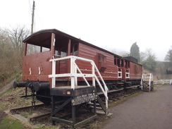
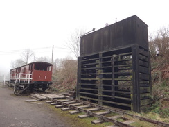
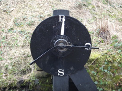
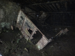
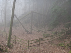
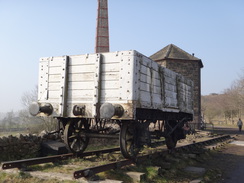
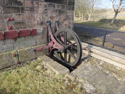
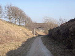
After passing the buildings and a couple of brake vans that sit on a couple of panels of track, I passed the bottom winding wheel of the cable that hauled wagons up the hill. Soon the trail passed under the A6 and past another feature - a large pit that was designed to catch any wagons before they reached the junction below. The skeletal remains of one wagon still lies forlornly in the sand at the bottom of the pit, where it lay since an accident over half a century ago.
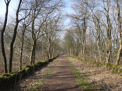
The ascent up the first incline was difficult with legs that had yet to warm up, but I enjoyed the walk through the trees as the woman passed me once more. A windowless stone building marked the site of an old steam winding house at the top of the incline. After this the gradient slackened, granting my legs a welcome rest. A narrow-gauge track marked the site of the Steeple Grange Light Railway, a preserved railway that gives visitors a picture of the old railways that served the local quarries.
A little further on the path gave views down over the National Stone Centre near Wirksworth, and an old diesel shunting locomotive sat in a car park beside the path. This marked the start of the ascent of the Middleton Incline. As I struggled up this, the same woman hurried down in the opposite direction; I've no idea what she was doing, but she as certainly taking a roundabout route into work! The temperature was rising rapidly as the fog cleared, and I found it was hailing out of the blue sky - closer examination showed that the hail was in fact thick hoar ice that was falling off the branches overhead.
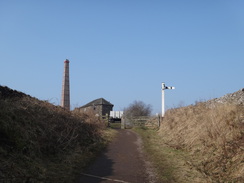
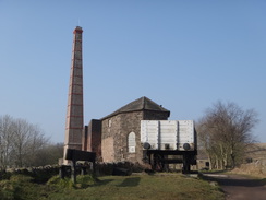
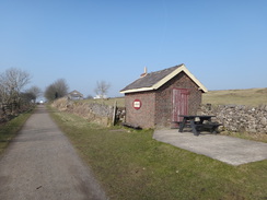
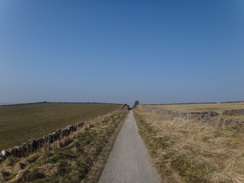
The winding house at the top of the incline is still extant, with its tall chimney stretching up into the sky. I had a look around, but the visitor's centre was closed. Instead I took my coat off and shoved it into my rucksack as I as stating to get warm. Middleton Top marks the start of the Pennine Bridleway, meaning I had walked well over six miles just to get to the start of my walk! A sign denoted the start point, and I studied the terrain I would be walking over during the next few months.
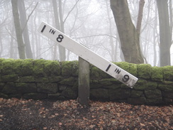
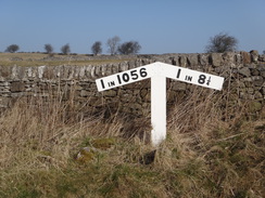
A level area was soon replaced by the Hopton Incline, which was once another cable-hauled incline. However the gradient was later slackened to 1 in 14, making it the steepest adhesion-hauled railway in Britain; sometimes locomotives required several attempts to reach the top. I have driven along the road that runs alongside on numerous occasions, and it never feels too onerous a climb in a car!
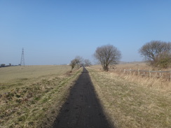
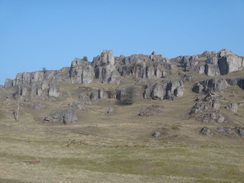
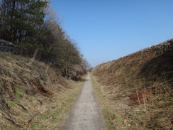
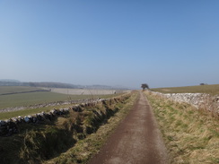
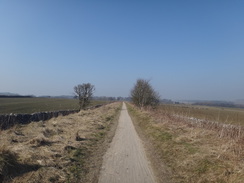
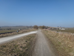
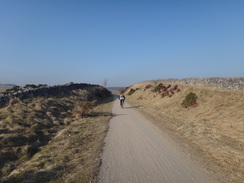
The path passed close by the spectacular Harboro' Rocks, which I have walked in the past. I still had a long way to walk today so I chose to walk on without visiting them, but cast envious glances at the people visible at the top. Soon afterwards the line crossed the route of the Limestone Way, a Peak District trail that I have walked on a couple of occasions and would not mind doing again. After this the trail continued on, the straight sections and sharp bends being more reminiscent of canals than railways.
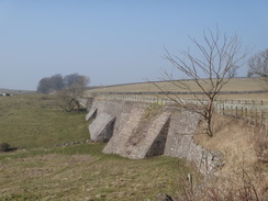
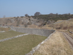
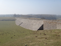
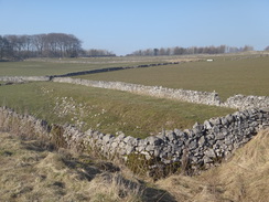
I could see a figure a few hundred yards ahead of me, and I set myself a target of catching up with him or her. Unfortunately the person was moving almost as fast as I was, meaning that the gap was closed at what seemed like glacial pace. It turned out to be a woman, and I caught up with her just before the car park at Minninglow was reached, and we chatted for a few minutes as we strolled along. A sharp bend just before the car park is dominated by views of a massive stone wall forming the railway's embankment, including buttresses that must have contained thousands of tons of stone.
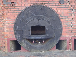
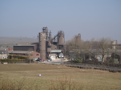
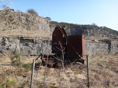
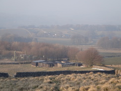
Soon after the car park, the line reached the famous Gotham curve, at 55 yards radius the tightest bend in the country. There are several photos of people at the end of a train taking photos of the front going around the curve. Another stroll took me onto Newhaven Crossing, where the railway line crossed the A5012 road. About a mile further on, another car park was reached at Friden, after which the path passed the Friden brickworks. A series of information boards gave a fascinating history of the works, which has carved a niche making refractory bricks.
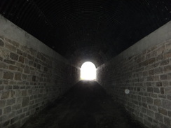
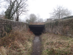
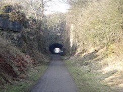
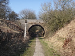
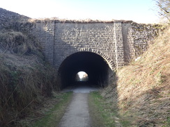
By this stage it was getting quite warm and I was running out of water. The next place to get some was at Parsley Hay, another few miles on. I did what I could to try to keep myself cool and strode on. Eventually I reached a tunnel under the A515 main road, whose portals contain engravings; one commemorating the name of the line, and the other William Jessop, the line's engineer.
Another short stroll led me on to Parsley Hay Junction, where the path meets the Tissington Trail which runs along the closed Ashbourne to Buxton railway line. This opened in 1899 as part of a planned direct route to London; although the bridges, cutting and embankments were made to double-track width, the line was only ever single track. The opening of this line led to a rationalisation of the Cromford and High Peak, with the line north being either straightened or, in the case of the stretch between Harpur Hill and Peak Forest, closed. Later on I would see the remains of the old route as sharp bends off the main route.
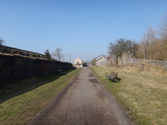
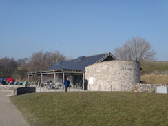
The line closed as part of the Beeching Cuts, surprisingly before the Cromford and High Peak. Like its neighbour, the line was purchased by the council and converted into a cycle path; there is an alternative trailhead for the Pennine Bridleway a mile and a half south at Hartington. A quarter of a mile north of the junction I reached the site of Parsley Hay station, which is now a visitor's centre. I shrugged my pack off on a picnic bench, took my boots off to allow my feet to cool, and then went to find some water. After returning, I chatted to a couple of cyclists before slowly getting ready for the remainder of the walk.
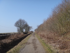
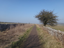
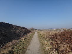
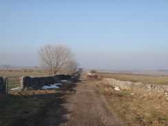
A 3.5-mile walk took me through the hamlet of Sparklow, where the pub was a temptation that I could resist, to reach the end of the trail near Pomeroy. The line north of here is still extant for use by the Dowlow and Hindlow limestone quarries, the massive works having removed a vast area of land. For this reason the trail diverted off, heading up to parallel the A515 before crossing it and following a road north. The road was soon left behind, and a good bridleway continued on towards Chelmorton. Scattered snow drifts still lay beside the stone walls, and some of these were still a couple of feet deep.
Another road took me north uphill, and when this ended a track headed to Pilwell Gate, at the top of a little escarpment. A sign beside the path pointed out that there was a chambered tomb called Five Wells ; ordinarily I might have gone off track to visit this, but I was tired and the end of the day was almost in sight. A descent along tracks took me down towards the A6, which I crossed and hurried back towards the campsite and my tent.
It had been a pleasant day's walk in glorious spring weather, and one that was topped off by a visit to Bakewell for an evening meal.
 |
 |
|
Directions
This walk starts off at the crossroads on the A6 in Cromford at SK296569. If necessary cross the road to reach the eastern side and then head down Mill Road. This curves to the right and then left to pass Arkwright's Mill on the left. After a quarter of a mile, the wharf at the end of the Cromford Canal is reached at SK299570.
Just before a low wall starts on the right, turn right to enter an area of wharfside buildings. Walk between the buildings and the road, and then turn right to start following the canal on the right. Follow the towpath as it passes a car park on the left. This is replaced by an area of playing fields, before a railway line curves in to run along the base of the canal. A swing footbridge over the water is reached on the right after a little over a mile on the canal, at SK3144559. Cross the bridge to reach High Peak Junction workshops. Pass the buildings on the right and then a couple of brake vans on a solitary panel of track that marks the start of the High Peak Trail. Join the trail and start the ascent up the Cromford Incline, one of three inclines that will be climbed on this walk.
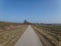
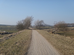
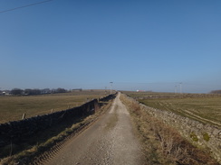
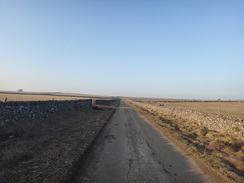
The next seventeen miles are easy; just follow the trail as it heads northwestwards across the heart of the Peak District. All gates have been made easy to open by cyclists and horseriders. It reaches the following places:
- Black Rocks / Steeple Grange: 1.7 miles
- Middleton Top: 1.0 miles
- Hopton Top: 1.6 miles
- Longcliffe: 1.8 miles
- Minninglow: 3.0 miles
- Newhaven Crossing: 1.5 miles
- Friden: 0.9 miles
- Parsley Hay: 2.5 miles
- Sparklow: 2.1 miles
- Dowlow (end of trail): 1.4 miles
After 17.5 miles, the end of the trail is reached at Dowlow at SK110673. Go through a bridleway gate beside a field gate to reach a rough track; turn right to follow this uphill to the north for a fifth of a mile until the A515 is reached. Just before the main road is reached, go through a bridleway gate beside a field gate and turn right to join a bridleway path that parallels the A515 with a fence on the left and stone wall on the right. When the fence on the right ends after 200 yards, carefully cross the A515 to reach a road called Upper Bindlow Lane opposite.
Follow this road north; at a left-hand bend after a third of a mile, continue straight on along an unsurfaced track that runs between broadly-spaced stone walls. Follow this north-northeastwards; eventually it curves to a more northerly course and after a mile ends at a junction with a road at SK119696 near Chelmorton. Cross the road and start following another road north-northeastwards.
On a right-hand bend after a quarter of a mile, turn part-left to head straight on north up another road. This becomes unsurfaced, and after half a mile reached Pillwell Gate. Go through the gate and continue along the rough track as it descends the hillside. Go through a farm gate and turn right to head east along a firmer track. This soon swings to the left to head downhill for a quarter of a mile until it reaches the A6 at SK122717. Just before the main road is reached, turn left along a short path that runs between two stone walls that lead to a safe crossing point. Carefully cross the main road and follow a lane on the other side northwards. After a fifth of a mile the road curves to the right; the campsite where this walk ends is immediately on the left after this bend.
 |
 |
|
Distances
| From | To | Distance (m) | Ascent (ft) | Descent (ft) |
|---|---|---|---|---|
| Cromford | High Peak Junction | 1.4 | 29 | 74 |
| High Peak Junction | Longcliffe | 6.2 | 1065 | 280 |
| Longcliffe | Parsley Hay | 7.9 | 257 | 227 |
| Parsley Hay | A515 | 3.7 | 207 | 10 |
| A515 | Blackwell | 3.0 | 169 | 370 |
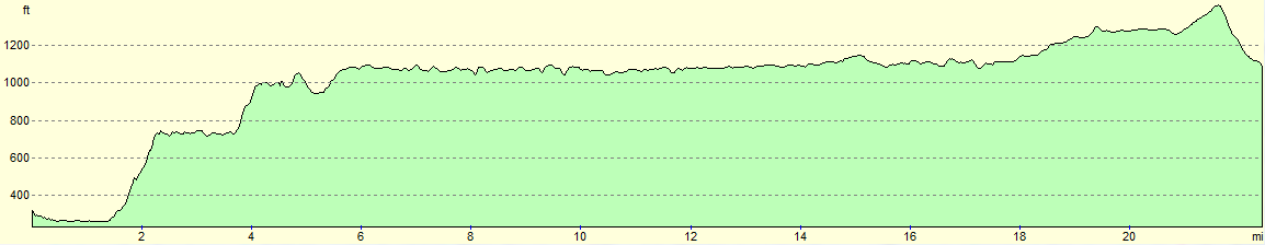
This makes a total distance of 22.2 miles, with 1727 feet of ascent and 961 feet of descent.
For more information on profiles, ascents and descents, see this page
 |
 |
|
Accommodation
I spent the night at Beech Croft Farm Caravan Park & Camp Site, a lovely caravan and camping site near Taddington. This is a lovely little campsite that is situated just off the A6 between Bakewell and Buxton. They can be contacted on 01298 85330.
Transport
The High Peak Transpeak bus service follows the A6 from a bus stop near the campsite in Taddington ("Blackwell Turn") to the start of this walk in Cromford (the "Cross Roads" stop). It runs roughly every hiur during the week, and takes under an hour for the journey.
 |
 |
|
 |
 |
|
 |
 |
|
 |
 |
|
 |
 |
|
 |
 |
|
 |
 |
|
 |
 |
|
 |
 |
|
 |
 |
|
 |
 |
|
 |
 |
|
 |
 |
|
 |
 |
|
 |
 |
|
 |
 |
|
 |
 |
|
 |
 |
|
 |
 |
|
 |
 |
|
 |
 |
|
 |
 |
|
 |
 |
|
 |
 |
|
 |
 |
|
 |
 |
|
 |
 |
|
 |
 |
|
 |
 |
|
 |
 |
|
 |
 |
|
 |
 |
|
Disclaimer
Please note that I take no responsibility for anything that may happen when following these directions. If you intend to follow this route, then please use the relevant maps and check the route out before you go out. As always when walking, use common sense and you should be fine.
If you find any information on any of these routes that is inaccurate, or you wish to add anything, then please email me.
All images on this site are © of the author. Any reproduction, retransmissions, or republication of all or part of any document found on this site is expressly prohibited, unless the author has explicitly granted its prior written consent to so reproduce, retransmit, or republish the material. All other rights reserved.
Although this site includes links providing convenient direct access to other Internet sites, I do not endorse, approve, certify or make warranties or representations as to the accuracy of the information on these sites.
And finally, enjoy your walking!
Nearby walks
| # | Title | Walk length (miles) |
|---|---|---|
| 11 | Stanton Moor | 2.9 |
| 12 | Darley Dale, Stanton Moor and Rowsley | 8.7 |
| 14 | Friden, Long Dale and Gratton Dale | 7.8 |
|
|

|