Walk #948: Stour Valley Path: A linear walk between Stoke-by-Clare and Little Bradley and back
 |
 |
|
General Data
| Date Walked | 18/05/2012 |
| County | Essex, Suffolk |
| Start Location | Stoke-by-Clare |
| End Location | Stoke-by-Clare |
| Start time | 08.12 |
| End time | 16.23 |
| Distance | 20.2 miles |
| Description | This was a pleasant there-and-back walk along the upper stretches of the Stour Valley Path. |
| Pack | Today I carried my 30-litre Karrimor rucksack, filled with water, my waterproofs, a book and other odds and ends. |
| Condition | I feel absolutely fine after this walk. |
| Weather | Today's weather was dominated by cloud, with some sunny breaks. It was not overly warm, and indeed was ideal walking weather. |
| OS map | Landranger number 155 (Bury St Edmunds, Sudbury & Stowmarket) and Landranger number 154 (Cambridge & Newmarket, Saffron Walden) |
 |
 |
|
Map of the walk
Maps courtesy of Google Maps. Route for indicative purposes only, and may have been plotted after the walk. Please let me have comments on what you think of this new format. For a detailed table of timings for this walk, please see the table file.
 |
 |
|
Notes
It had been well over a month since my last walk, in what is turning out to be a disappointing year of walking so far. This has been due to a combination of factors: a foreign wedding and holiday, illness and the purchase of a house were all unavoidable. We finished the house purchase earlier in the week and Sencan ordered me to go out for a walk. Since I had started the Stour Valley Path earlier in the year, it seemed sensible to continue that campaign.
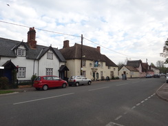
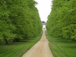
The drive to the pretty little village of Stoke-by-Clare went quickly and I was soon parked up beside the pub. Nearby was a little community shop, and after nipping in to buy some chocolate I headed off along the trail. I had little choice but to make this a there-and-back walk and return by the same route. This is something that I really try to avoid, and I was not in the best mood as I headed off down the road. A house was being demolished, the first-floor joists being tickled by a digger's bucket. The wall of Clare College - a private school - looked dark and forbidding.
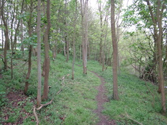
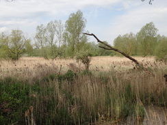
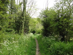
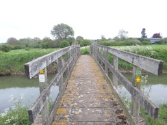
The road was soon left behind and the trail headed across the Stour's flood plain, crossing streams of the river on two bridges and entering some woodland. A stretch of narrow, sloping path was heavily pitted by rabbit holes, forcing me to take my time to avoid a twisted ankle.
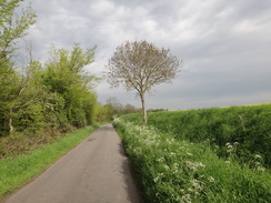
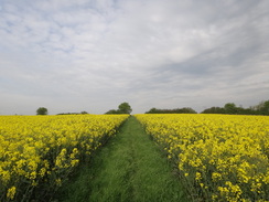
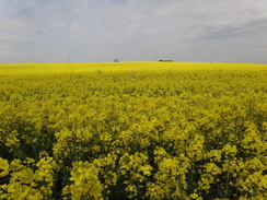
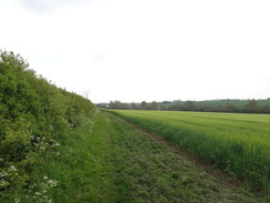
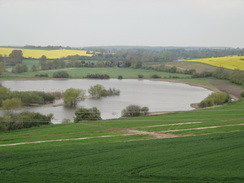
The trail skirted the well-kept driveway leading to Baythorne Hall before joining a main road and crossing the Stour on a narrow bridge. A road led uphill under an old railway bridge, before a path took me over a low hill which granted some reasonable views in three directions despite having to almost wade through oil-seed rape plants. What followed was an easy stroll north along the edge of several large fields, with the river out of sight to the right.
On the way I encountered a man carrying a Lidl bag coming in the opposite direction. As he passed me he burst into hysterical laughter and stood on the path staring at me as I continued on. There was something about his laugh - it was maniacal and far from friendly. Fortunately another couple further on were far friendlier, especially their Collie puppy that ran excitedly around my legs.
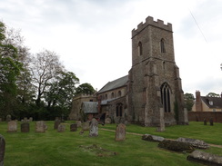
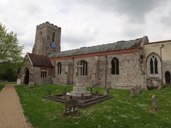
This stretch of path passed close by Cotton Hall, a name that for obvious reasons appeals to me, although the hall itself remained firmly out of view on the other side of the river. Eventually the path became a track and then a road that led into Kedington. After passing a pub, the path headed away from the road and passed a school to reach the church. This seemed fairly picturesque from the outside, but I had not time to visit and instead walked on.
A fairly nondescript stretch of path led on to the A143 road, and more paths led on towards Great Thurlow. Somehow I went wrong and walked through some woodland, diverting off through a gate to reach the proper path which ran through a field beside the woodland. A bitty stretch of path led north from Great Thurlow to Little Thurlow, passing The Cock pub on the way. This was not due to open for another half-hour, and a quick calculation told me that I would be returning back for almost exactly the opening time, so I decided not to hurry.
A path led past another school to reach Little Thurlow church. I was listening to 'The Day of the Triffids' on my MP3 player, which was about to reach a conclusion. The story came to a conclusion just as I reached the road where I had left the Stour Valley Path on the previous walk. Although I had read the book as a child, I could not remember the ending. The story is somewhat dated (especially in its attitude to women), but it is well-written and was thoroughly engrossing.
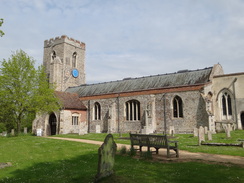
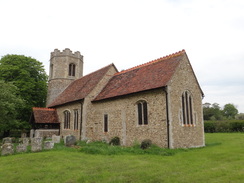
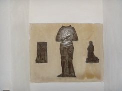
I decided to walk on a short distance to reach Little Bradley church, which is a superb example of a Suffolk round-tower church. I spent a few minutes photographing the exterior before entering. The interior was interesting; some of the statues within had their heads knocked off, granting the carvings a somewhat eerie air.
I did not spend long inside, and soon started back the way I came. The Cock Pub had just opened as I passed, and inside was a fascinating interior. Large fireplaces flank either side of the bar, each one aged and much-altered over the years. I chatted to the barmaid for a long time about the age of the building and its features. What was meant to be a half-hour stay extended to an hour, and even then I was reluctant to leave.
On the news there was a story of a crabbing vessel that had gone down off Portland; I started singling 'For those in peril on the sea' at the top of my voice, not caring who or what would hear me. It is very easy to get overly emotional on a walk, and this seemed like as good a time as any to let my emotions hold sway.
I usually hate there-and-back walks, although the return journeys always seem to fly. Today was an example, and before I knew it I was back in Kedington. My feet were starting to ache, which was annoying if understandable after such a long break from walking. I tied my laces tighter in a vain attempt to improve the situation. The weather was becoming brighter and warmer, and the climb up the hill from Water Hall Farm (the only significantly steep climb of the day) had me huffing and puffing. The fields had been planted with oil-seed rape, and although the path was wide my trouser legs were soon covered in yellow streaks.
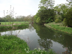
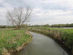
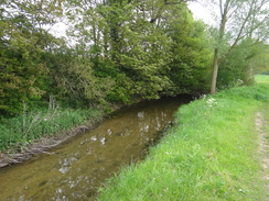
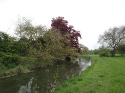
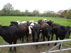
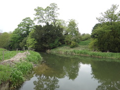
What remained was a simple riverside stroll beside the Stour; the long grass on the path had been cut, and the scent of freshly-cut grass hung in the air. The downside to this was that the rabbit holes were even harder to see, especially on tired and rubbery legs. Soon the dangerous area was past and I was strolling through woodland and fields. A herd of cows started to follow me as I made my way across the last field, and they congregated against the gate that guarded a sluice over the river.
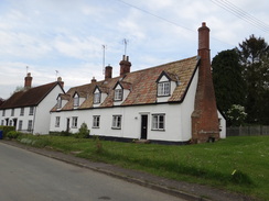
All that remained was a short walk up the road back into Stoke-by-Clare, passing the wall that protected Stoke School. The house that was being demolished this morning was now little more than a pile of rubble, with no walls remaining standing. I was tempted to visit the village church, but my feet were still aching so instead I got in my car without exploring the village. It had been a surprisingly enjoyable stroll, even if the scenery was fairly uninspiring.
 |
 |
|
Directions
This walk starts off opposite the pub in Stoke-by-Clare, at TL741435. It follows the Stour Valley Path as far as Little Bradley, before returning via the same route.
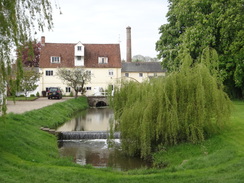
Opposite the pub, take Ashen lane which passes housing and a graveyard on the left before following the wall that guards Stoke College on the right. After passing a little whitewashed cottage on the right, turn right down a path that runs alongside a track to reach two stiles in quick succession. Cross these to enter a field; keep a fence on the right for a short distance to reach a bridge over Stoke College Mill Gate.
Head on for a short distance to a second bridge and to a gate on the other side. Go through this and continue on across a field, initially keeping the river to the right. As the river curves to the right, head straight on to reach a clapper gate in the far-left hand corner of the field. Go through the gate and cross a plank bridge to enter some woodland.
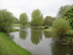
Follow the obvious path through the woodland; it emerges out and crosses a stile before following a narrow, sloping stretch of path between two fields. Follow a fence on the right as the river comes in from the right. At the end of the field the path crosses a plank bridge across a stream and continues on with the river on the right. At the end of this field it crosses a stile to enter another area of woodland. When this ends, cross a stile to reach an area of grassland beside a pond in Baythorne Park.
Keep the pond on the right to reach a stile beside a field gate at its far end. Cross this and head on westwards through the park, with the river a short distance away to the right. The path approaches the driveway leading to Baythorne House; cross a stile in a fence to reach the driveway and turn right to follow it westwards. After three hundred yards it goes through a gateway and ends at a junction with a bend in a main road at TM724428. Head straight on along the right-hand side of the road for about thirty yards to reach a junction with the A1017.
Turn right and follow the A1017 northwards; after a short distance cross the road to reach the pavement on the left-hand side and carefully cross Baythorne Bridge over the Stour. Continue on along the pavement; cross a minor road on the left and when the main road turns sharply to the right, turn left up Boyton End Road. The road climbs under an old railway bridge and passes the hamlet of Thistlely Common.
A farm is reached two-thirds of a mile after the junction; just before this turn left through a gap in a hedge to enter a field. Follow a path uphill across the field; at the top go through a gap in a hedge and cross a ditch into a second field. Head straight on until a hedge is met on the right; follow it for a few yards and then turn right down a slight bank through the hedge. On the other side turn left to follow the hedge downhill until a track is reach at the bottom near some barns beside Water Hall Farm at TL710438.
Cross the track and take a footpath that skirts to the right of a barn; this path is easy to follow as it curves behind the farm; it then passes between two fences to reach a footbridge over the Stour. Cross this, and on the other side follow a hedge on the left; after about a fifth of a mile a footbridge can be seen through the hedge on the left. Here turn right to join a bridleway that heads northwards; when the trees on the left end after about twenty yards, take a footpath that heads slightly uphill northeastwards across the field and do not continue along the obvious bridleway path. The path joins a hedge on the right, and at the corner of the field cross a stile to enter another field.
Continue along the edge of this field, following a hedge on the right (in 2012 there was also a fence on the left, although this might be temporary). Follow the hedge as it twists and turns northwards for a little over a mile, before emerging out onto a track near a cottage on the right. The track passes a sewage works on the left before becoming a surfaced road called Arms Lane. Follow this for a third of a mile before it ends at a T-junction with a bend in a road in Kedington at TL705464, beside the Barnardiston Arms.
Head straight on northwards along Silver Street. This crosses the Stour and heads up a slight hill through the village. Shortly after passing a junction with Rectory Road on the right, turn left down a broad path. This dips to cross a stream on a bridge before becoming a surfaced road as it passes a school. The road ends at a T-junction with Mill Road opposite Kedington Church. Turn left to follow the road downhill westwards; at the end of the churchyard turn right down a footpath that skirts the churchyard wall on the right.
When the wall ends the footpath continues straight on northwards across a field; when some power lines are met overhead, turn half-left to start following the path as it heads directly under the lines. When the edge of the field is reached, turn half-right to follow a hedge that twists for a short distance before going through a gap in a hedge ahead to reach another field. On the other side turn left for about ten yards, then left once more to cross another plank bridge through a gap in a hedge. The path curves to the right and becomes narrow for a period before a field opens out on the left. It skirts a cottage on the right and crosses a footbridge over a stream to reach the A143 road at TL699477.
Carefully cross the main road and on the other side descend a small bank to reach a footbridge over a ditch. On the other side, go through a clapper gate that leads into a paddock. Head north-northwestwards across the paddock, crossing any electric fences you meet whilst aiming for a stile in the far right-hand corner of the field. Cross the stile and aim for another in the hedge ahead, with Wash Farm visible to the right. Go through a clapper gate and cross a plank bridge and head on, with a hedge on the left and a field on the right. At the end of the field the path goes through a gap in a hedge ahead and curves to the left. Shortly afterwards turn right along another path that heads diagonally uphill across the field, aiming for some houses at the top of the field. At the top it squeezes between two hedges and emerges out onto a minor road at TL693485.
Turn right along the road for a couple of yards, and then left along a good unsurfaced track that passes a house on the left before running between fields. Soon hedges start on either side, and after half a mile the track reaches a surfaced area at TL689491. Turn right to follow a green track alongside a ditch on the left, and after a short distance follow the track as it curves to the left to cross a field bridge over the ditch. The track follows trees on the right; when the trees end and the track curves to the right, continue straight on, following a hedge on the right. The path and hedge curve to the right to take a more northerly course; when the field ends turn right through a gap and then left to follow the hedge on the left for a short distance.
Before an area of woodland is reached ahead, turn left across a stile and immediately turn right, keeping the woodland on the right. Follow the hedge that replaces the woodland, crossing any stiles you come across. In the third field the path curves slightly to the left and then right past some scattered trees to reach a stile in the far right-hand corner of the field. Cross this stile to reach a farm track. Turn left and follow this track northwards past Hall Farm until it ends at a T-junction with Bury Road in Great Thurlow at TM681503.
Turn left and follow the road as it heads westwards; shortly after passing the church on the left, turn right through a pair of gates to enter a small graveyard. Keep the hedge on the left to reach another gate that leads into a field. Keep a hedge on the left; when the field ends cross a stile beside a farm gate and continue on to reach the corner of the next field. Here the path heads through an area of woodland; halfway through it curves to the left to cross a stream on an elegant footbridge. When the path forks take the left-hand branch, which soon becomes a green track that passes a cottage before ending at the B1061 road in Little Thurlow at TL677507.
Turn right and follow the road as it heads northwards; immediately after passing a primary school on the right, turn right through the school's car park. Pass the school on the right and go through a clapper gate to enter a field. Turn half-left to cross the field northeastwards; go through another clapper gate and cross a plank bridge over a stream to enter a second field. The path runs across this field between fences and ends at a track near Little Thurlow church. Turn right up the track, then immediately left to join a path through the graveyard, passing to the left of the church. This path curves to the left to end at a road beside the River Stour.
Cross this road to follow a path, initially with the Stour on the right. When the river curves away to the right, head straight on northwards following a field boundary on the left. This eventually ends at a road at TL679518. Turn right and follow the road as it immediately crosses the Stour on a bridge. The road passes some houses on the right before curving to the left to reach Little Bradley church at TL681521.
This marks the northernmost point of this day's walk. The remainder of the day returns by the same route.
Leave Little Bradley church and turn left to start following the road south. It soon curves to the right to take a more southwesterly course, passing a number of houses on the left before reaching a bridge over the River Stour. On the other side of the bridge turn left. Pass a little weir on the left and then follow a path that runs south alongside a field boundary on the right. After a quarter of a mile the river comes in from the left; the path then follows the river before ending at a road opposite Little Thurlow church.
Cross the road and join a path that enters the churchyard. The path soon curves to the right to skirt the church on the left before ending at a track. Turn right down the track for a few yards, and before the road is reached turn left to join a path that heads southwestwards across a field between fences. Cross a footbridge over a stream to reach a gate; go through this and continue on in the same direction across a second field. The path reaches a clapper gate in the corner of a field, with the village's primary school on the left. Go through the gate and follow the path as it crosses the school's car park to reach the B1061 road at TL677510.
Turn left and follow the B1061 southwards through Little Thurlow. After a fifth of a mile turn left along a gravel track that runs between houses; when the gravel track ends at a house on the right continue straight on along a path. The path curves to the right and enters some woodland before reaching a bridge over the river; immediately afterwards turn right along another path that heads south with the river on the right. The path emerges from the trees into a field; continue on with a hedge on the right, aiming for a church tower ahead. Cross a stile through a hedge and continue on to reach the end of the second field. Go through a gate and continue on through a small graveyard to reach double gates that lead onto Bury Road in Great Thurlow at TL680503.
Turn left to follow the road eastwards, passing the church on the right. After a short distance turn right down a track that heads through Hall Farm, initially passing some barns on the right. Continue along this track; when it forks, turn right over a stile beside two gates to enter a field and turn left to follow a footpath across the field. It loops away from the hedge on the left before rejoining it at the field's corner. Cross a stile beside more field gates to enter a second field and continue on with a hedge on the left. In the far left-hand corner of the field cross a little footbridge guarded by two stiles to enter a third field. An area of woodland starts on the left; a few yards after this ends, turn left to cross a stile into a field at TL685495.
Turn left and follow the hedge on the left; after a short distance go through the hedge ahead and start following it on the left. The hedge soon curves to the left to take a more easterly course; it joins a rough track that continues on to cross a drain on a field bridge and end at a T-junction with another track. Turn right and follow the drain on the right for a short distance until a large concrete pad is reached at TL689491.
Cross the pad and join a track that heads south-southeastwards for nearly half a mile between hedges until it ends at a T-junction with a road at TL693485. Turn right along the road for a few yards, then left along a path that squeezes between narrow hedges. When the hedges end the path erupts out into a field; head straight on downhill across the field until an area of woodland is reached ahead.
Turn half-left, keeping the trees on the right. The path curves to the right to reach a field bridge over a ditch between two fields, after which it curves to the right to take a more southeasterly course, following a hedge on the right. At the corner of the field cross a footbridge over a ditch and go through a clappergate to enter a paddock. Cross the paddock, passing Wash Farm on the left to reach a stile. Cross the stile and then turn half-right to head towards a wooden gate. Go through the gate and cross a little plank footbridge before climbing a slight bank to reach the A143 road at TL699477.
Carefully cross the road and squeeze through a gap in a hedge to join another path. This soon crosses a footbridge over a deep stream and passes a cottage on the left before following a hedge on the same side. The path soon becomes narrower and overgrown. It crosses a plank bridge over a ditch before curving to the left and crossing a plank bridge to reach a stile that leads into another field. Turn right along the hedge for five yards before turning right to cross another plank bridge into another field. Follow the hedge on the right as it curves around.
After a short distance the path heads southeastwards away from the hedge, following some overhead electricity lines. At the third wooden pylons the path curves to the right to head south across the field, aiming just to the right of a church tower. When the field ends follow the path as it passes a churchyard on the left before descending to reach a road in Kedington at TL704469.
Turn left along this road, passing the church on the left. When the churchyard on the left ends, turn right down a surfaced track. The surfacing ends as it passes a school on the left, but a path continues on, descending to cross a stream on a bridge before ending at Westend Lane. Turn right to follow the road south; it crosses the Stour on a bridge before curving to the right beside the Barnardiston Arms at TL705464.
At the bend in the road, continue straight on down Arms Lane. Follow this southwards for a third of a mile; when the paving ends continue on along a rough track, passing a sewage farm on the right, and then continue along a footpath that follows a hedge on the left. Continue along this hedge as it winds southwards for 1.2 miles before it eventually ends at a footbridge over a ditch at TL705441. Continue into another field, following a hedge on the left. When the hedge curves away to the left after a short distance, continue straight on across a field for 150 yards to reach a hedge on the other side. Turn left to follow the hedge south for a few yards until another hedge is reached ahead, with a footbridge beyond.
Do not go through the hedge, and instead turn left to start following a band of scrubland on the right eastwards. After about a fifth of a mile a little footbridge over the Stour is reached. Cross the bridge and continue between fences. It crosses a field bridge over a ditch and curves to the left and then right, before ending at a track near a barn at Water Hall Farm at TL710438. Cross the track and start following a path uphill, following a hedge on the right. Just before the hedge curves to the left, turn right through a gap in a hedge and up a slight bank to enter another field.
Immediately turn left to start following the hedge; as it curves to the left continue straight on across the field. Cross a plank bridge over a ditch at the end of the field, and then descend down the middle of this field until the path crosses a field bridge over a drain and emerges onto Boyton End road at TL719440. Turn right and follow the road as it heads in a rough south-southeasterly direction for two-thirds of a mile; it passes the hamlet of Thistlely Common before descending. Shortly after passing under a railway bridge, the road ends at a T-junction with the A1017 road at TL724431.
Turn right to head straight on down the A1017, following a pavement on the right-hand side of the road. It immediately crosses a minor road and heads on to reach Baythorne Bridge over the Stour. Carefully cross this bridge, and on the other side cross the road to access the pavement on the left-hand side. Continue on until the road ends at a T-junction with another main road. Turn left and follow this road for a few yards until it curves to the right; at the bend continue straight on along the access driveway that leads into Baythorne Park.
Go through a gateway and continue for about 300 yards. As the driveway curves to the right to head up towards the house, turn left across a stile to enter some parkland. Turn half-right to follow a line of intermittent trees on the right until a pond is reached; cross a stile beside a field gate and then pass the pond on the left. At the far end of the pond the path crosses a stile to enter some woodland. When the trees end, cross a stile into a field and continue on with a hedge and the river on the left and a field on the right.
At the end of the field cross a plank footbridge over a ditch and continue on, initially following the river to the left. As the river curves away to the left, cross a stile on the left and turn right to continue along a narrow stretch of path with a fence on the right, soon entering an area of woodland. The path heads through the trees, crosses a footbridge over a stream and goes through a clapper gate to enter a field. Follow a fence on the right; as the fence curves away to the right continue straight on, following the river on the left. At the end of the field squeeze through a hedge and continue on with the river a few yards away to the left. When this field ends, go through a field gate that guards a concrete bridge over a stream of the river.
Head on to a bridge and sluice over another stream (College Mill Gate), then continue on to reach a stile beside a field gate. Cross the stile and head on for about ten yards to reach a second stile beside a field gate. Cross this and follow a hedge on the left for five yards to reach a road at TL743430. Turn left to follow this road uphill; after a quarter of a mile the road ends at a T-junction with the A1017 road in Stoke-by-Clare at TL741435, where this walk ends.
 |
 |
|
Distances
| From | To | Distance (m) | Ascent (ft) | Descent (ft) |
|---|---|---|---|---|
| Stoke-by-Clare | Kedington | 5.6 | 229 | 210 |
| Kedington | Little Bradley | 4.5 | 245 | 190 |
| Little Bradley | Kedington | 4.5 | 183 | 236 |
| Kedington | Stoke-by-Clare | 5.6 | 212 | 233 |
This makes a total distance of 20.2 miles, with 869 feet of ascent and 869 feet of descent.
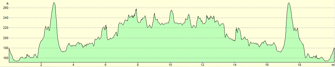
For more information on profiles, ascents and descents, see this page
 |
 |
|
 |
 |
|
 |
 |
|
 |
 |
|
 |
 |
|
 |
 |
|
 |
 |
|
 |
 |
|
 |
 |
|
 |
 |
|
 |
Disclaimer
Please note that I take no responsibility for anything that may happen when following these directions. If you intend to follow this route, then please use the relevant maps and check the route out before you go out. As always when walking, use common sense and you should be fine.
If you find any information on any of these routes that is inaccurate, or you wish to add anything, then please email me.
All images on this site are © of the author. Any reproduction, retransmissions, or republication of all or part of any document found on this site is expressly prohibited, unless the author has explicitly granted its prior written consent to so reproduce, retransmit, or republish the material. All other rights reserved.
Although this site includes links providing convenient direct access to other Internet sites, I do not endorse, approve, certify or make warranties or representations as to the accuracy of the information on these sites.
And finally, enjoy your walking!
Nearby walks
| # | Title | Walk length (miles) |
|---|---|---|
| 8 | Waterbeach to Newmarket | 17.5 |
| 26 | Waterbeach to Dullingham | 10.7 |
| 27 | Waterbeach to Newmarket | 16.5 |
|
|

|