Walk #697: Bromsgrove to Worcester
 |
 |
|
General Data
| Date Walked | 19/11/2005 |
| County | Worcestershire |
| Start Location | Bromsgrove station |
| End Location | Worcester Foregate Street station |
| Start time | 08.50 |
| End time | 15.42 |
| Distance | 17.3 miles |
| Description | This was a very pleasant walk on a foggy day, following the Worcester and Birmingham canal southwards from Bromsgrove to the centre of Worcester. |
| Pack | Today I carried my 30-litre daysack, filled with my waterproofs, a water bottle and my normal electrical odds and ends. |
| Condition | I had a little aching from my right knee during this walk, but this was not significant and I had no other problems. |
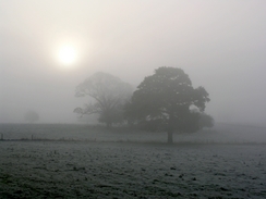
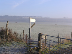
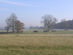
| Weather | The forecast was for sunny weather, although I did not get to see much of this due to the fog that persisted at various densities throughout the day. It was a very cold day, although this was not too bad as there was little of any wind to chill me, and the walking kept me warm. |
| OS map | Landranger number 139 (Birmingham & Wolverhampton) and Landranger number 150 (Worcester & The Malverns, Evesham & Tewkesbury) |
 |
 |
|
 |
 |
|
Map of the walk
Maps courtesy of Google Maps. Route for indicative purposes only, and may have been plotted after the walk. Please let me have comments on what you think of this new format. For a detailed table of timings for this walk, please see the table file.
 |
Notes
The forecast for today was for sunny weather and so on Thursday I decided that I would go away for a walk. After having done a few relatively local walks recently I wanted to go somewhere further afield for a walk, and as my knees are still not cured I had to go for relatively flat walks. After some thought I decided on extending the walk between Malvern and Hereford that I did at the beginning of the year. After exploring the maps I decided on a first day following the Worcester and Birmingham canal from Bromsgrove to Worcester, which would make a pleasant and easy seventeen mile walk. Thus I found myself on the long drive to Bromsgrove from Cambridge, and due to light traffic I managed to make the journey in a little over two hours, much quicker than I was expecting.
I parked my car in the little car park by Bromsgrove station, which cost me one pound for the day, which I thought good value after the expense of some car parks that I have parked in recently. I strode around the car park a little to stretch my legs - much to the bemusement of people on the platform waiting for a train - before throwing my rucksack onto my shoulders and heading off up the road. Initially I followed the B4184 road, but once the road crossed over the railway line I started following a footpath, which also carries the Monarch's Way. The fog had not lifted, and this gave a slightly ethereal look to the scenery, with trees converted to grey, pastel shades in the distance. It was an enjoyable walk, and it was a shame that I had to join a road to walk eastwards from Stoke Cross. Once this road ended I came across another problem - I wanted to follow the Monarch's Way eastwards towards the B4184 so that I cold join the canal by a tunnel portal, but I could not find the path in the fog and instead took a footpath that headed south to a little occupation bridge over the canal just below a lock.
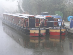
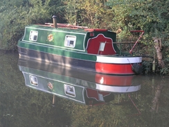
The Worcester and Birmingham canal was opened in 1815 to provide a more direct (by 30 miles) route between the Severn and Birmingham than the earlier Staffordshire and Worcestershire canal. Other canals were afraid of the competition, and so the last few feet in Birmingham were initially not dug out, leaving the canal disconnected from the rest of the canal network for some time. The canal has 58 locks and four tunnels, lifting the canal 428 feet up from the Severn, and I think that I passed the majority of these on today's walk! The canal was originally due to be a broad canal, but after the construction of two lock sin Worcester the idea was abandoned and it was constructed as a narrow canal. Unusually, however, all of the bridges and tunnels were constructed to a broad specification, which may have allowed the canal to be widened at a later date.
Missing seeing the tunnel portal did not bother me that much, and so after chatting to a couple of joggers for a while, I turned right and started heading southwestwards along the canal. Before I reached the next lock I passed a long line of anglers, there poles lying like gates at knee height across the towpath. As I approached they all lifted or shifted out of the way, and I thanked each man in turn as I passed. It was a cold morning, and to one man I expressed thankfulness that at least my hobby kept me warm in the cold weather! What followed afterwards was a seemingly never-ending set of narrow locks - the Tardebigge flight. The locks continued for a couple of miles, and the fog meant that I could not really get any good photographs of them. Once they ended near Stoke I continued on, only to find another, smaller flight of three locks awaiting me. All of these locks are required to get the canal down from Birmingham to the Severn, which is quite near sea level at Worcester.
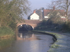
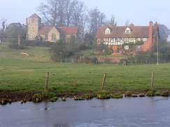
The canal passed a factory before reaching yet another flight of locks, and these took me on towards the B4090 road, immediately to the east of Droitwich Spa. On the map there was a pub marked here, but when I reached it I discovered that it was not due to open until midday, another ten minutes away. Instead of hanging around I decided to keep on walking, and I headed off south along the towpath. I passed through Sherna Green before following the towpath as it climbed up to avoid a tunnel that the canal used to penetrate a ridge. On the other side of the ridge the towpath descended to meet the canal once more at Dunhampstead.
It was a relief to find that the pub here, the Fir Tree Inn, was open, and I took my boots off before entering this superb little inn. I was instantly made to feel welcome, and I ordered myself a meal of Gammon, egg and chips, which was washed down well with a pint of Spitfire. Eventually I felt the need to leave, and I reluctantly left the warm, friendly atmosphere inside to site on a chair outside and put my boots on. Outside there was a Land Rover that had obviously been used in a shoot that morning, as braces of pheasants were hanging from the wire mesh over the back. The pub commemorates event in 1806 when the village parson was shot to death; 23 years later three men were found guilty of the murder, but were acquitted on a technicality. One of the men, Thomas Clewes went onto become the landlord at this pub.
I rejoined the canal to continue walking south, but soon I came across a barrier across the track and a sign stating that the towpath and canal were closed for maintenance. Ahead of me there was a bridge bedecked in wrapping, but as I could hear no workmen I decided that instead of undertaking the long diversion I would go through. The barrier proved easy to squeeze around on the landward side, and I soon found myself lifting up the sheeting and walking under the bridge, which was obviously under heavy repair. After emerging from under the sheeting on the other side of the bridge I continued on to another barrier. There was no obvious way to squeeze past this barrier, so I had to divert around it into the field in the left, using a handy gap in the hedge caused by a fallen tree.
This has been quite an enjoyable little diversion, and the walk soon got less enjoyable as the sound of the M5 got louder as the canal approached it. More locks followed as the canal headed away from the M5 towards the A449(T), and then started entering the outskirts of Worcester. One little diversion was a pair of boots standing in the middle of the towpath, laced up but with no sign of the owner. As the canal got more urbanised the sun started to sink lower to my left, and eventually I passed a little canal wharf to the right and reached a road in the centre of the city. I walked along busy streets towards Foregate Street station, and as I had fifty minutes to wait until the next train back to Bromsgrove I decided to divert to the tourist information office to book some accommodation for the night. This took some time, but the couple inside the office were very friendly, and I still managed to make it back to the station in time for the next train. Worcester was in full Christmas spirit, and I got a very favourable impression from my short walk through the centre.
I got to the B&B in Worcester by 17.30, and after I had had a shower I settled down to watch a program on a Domino-toppling event on Channel 5. By this time I was getting a little peckish, and after wrapping up warm I went downstairs to go and find somewhere to eat. Downstairs I met another guest who turned out to be a walker, and together we headed out to the local Weatherspoons pub. The gent's name was Michael, and ex-British Waterways employee who lives in London, and we chatted intensely over a couple of pints (including one with a curious name including the word Piddle). I had a superb Tagiatelli, and it was nice to have someone to talk to who had the same love of walking that I do. We eventually left at about 10.30, and the alcohol combined with the fatigue from the walk to give me a deep sleep.
Directions
This walk starts off at Bromsgrove railway station; leave the station and head for a few yards up New Road until it ends at a junction with the B4184 Finstall Road. Turn right and follow the B4184 road as it heads northeastwards; it curves to the right to cross the railway line, and when it curves to the left on the other side turn right down a footpath, following Monarch's Way. This is easy to follow as it slowly curves around, before ending at Walnut Lane in Stoke Cross. Turn right fopr a few yards until a crossroads is reached, and then turn left to head eastwards down Dusthouse Lane. When this road ends after about a kilometre continue on along a footpath, again following the Monarch's Way until it reaches the B4184 road. Turn right and follow the B4184 road southeastwards until the Worcester and Birmingham canal is reached.
Descend onto the towpath and follow the canal for about fourteen miles, until bridge 12 is reached on the northern outskirts of Worcester. Once the canal passes under an unusual uneven-arched railway bridge turn right at the next bridge, to head southwestwards along the B4550 road. When this curves to the left turn right along Lowesmoor Road and follow it westwards until it ends at another road. Cross this road and follow the B4550 road for a short distance to another junction, and the turn right up Foregate Street; this walk ends at Foregate Street station, which is directly next to the bridge over the road.
Distances
| From | To | Distance (m) | Ascent (ft) | Descent (ft) |
|---|---|---|---|---|
| Bromsgrove station | Canal at Tardebigge | 2.0 | 226 | 46 |
| Canal at Tardebigge | Dunhampstead | 8.6 | 167 | 453 |
| Dunhampstead | Worcester Foregate Street | 6.7 | 108 | 190 |
This makes a total distance of 17.3 miles, with 501 feet of ascent and 689 feet of descent.
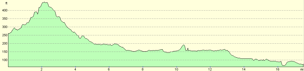
For more information on profiles, ascents and descents, see this page
Transport
There are regular train services running from Worcester Foregate Street railway station back to Bromsgrove; this cost me £2.70 for a single ticket. Note that there is another station, Shrub Hill, in Worcester, and it is important that you catch the train from Foregate Street.
Accommodation
I spent the night at Osborne House, 17 Chestnut Walk, Worcester, WR1 1PR, telephone (01905) 22296. This B&B cost me £25 for the night, and was a nice, comfortable place to stay, very handy for the city centre.
Disclaimer
Please note that I take no responsibility for anything that may happen when following these directions. If you intend to follow this route, then please use the relevant maps and check the route out before you go out. As always when walking, use common sense and you should be fine.
If you find any information on any of these routes that is inaccurate, or you wish to add anything, then please email me.
All images on this site are © of the author. Any reproduction, retransmissions, or republication of all or part of any document found on this site is expressly prohibited, unless the author has explicitly granted its prior written consent to so reproduce, retransmit, or republish the material. All other rights reserved.
Although this site includes links providing convenient direct access to other Internet sites, I do not endorse, approve, certify or make warranties or representations as to the accuracy of the information on these sites.
And finally, enjoy your walking!
Nearby walks
| # | Title | Walk length (miles) |
|---|---|---|
| 698 | Worcester to Malvern | 11.4 |
| 707 | Worcester to Kidderminster via Bewdley | 22.2 |
|
|

|