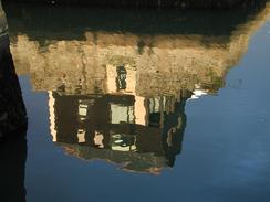
Walk #343: Falmouth to Mawgan
 |
 |
|
General Data
| Date Walked | 31/01/2003 |
| County | Cornwall |
| Start Location | Falmouth |
| End Location | Mawgan |
| Start time | 08.16 |
| End time | 15.43 |
| Distance | 17.0 miles |
| Description | This was another walk of two halves; an initial walk around the coastline from Falmouth to Helford Passage was followed by a long walk along roads and footpaths up the northern side of the Helford Estuary to Gweek and then Mawgan. |
| Pack | Today I carried my 30-litre Karrimor HotRock rucksack, which was filled with my packed lunch, waterproof leggings, water bottle and a couple of spare shirts, together with the usual assortment of odds and ends. |
| Condition | I feel absolutely fine after this walk, and I could easily have walked further if there had been somewhere convenient for Sam to pick me up. My angle ached slightly during the day, but again it was not enough to bother or worry me. |
| Weather | The weather today was far better than it had been over the last few days. The major point is that the wind had died down, which meant that the wind-chill factor was minimal. It was also milder (although it could just have been that the lack of wind made it feel milder). There were also some long sunny periods, and although it clouded over in the afternoon the only precipitation that I got was a few snowflakes in the air. |
| OS map | Landranger number 204 (Truro & Falmouth, Roseland Peninsula) and Landranger number 203 (Land's End & Isles of Scilly, St Ives & Lizard Point) |
 |
 |
|
 |
 |
|
Map of the walk
Maps courtesy of Google Maps. Route for indicative purposes only, and may have been plotted after the walk. Please let me have comments on what you think of this new format. For a detailed table of timings for this walk, please see the table file.
 |
 |
|
Notes
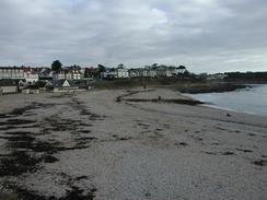
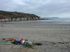
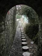
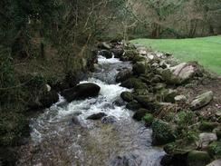
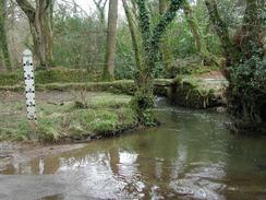
No sooner do I complete one estuary, than another estuary begins. Today I only had ten miles on the coastal path before I reached Helford Passage and I had to divert inland around the Helford River, but these ten miles were very nice indeed with some lovely views available, particularly so after having spent a few days walking around rivers. The going was also relatively easy, with few steep ascents or descents to tire me out or make me exert myself overly. At Polgwidden Cove I walked behind Trebah Beach using a curious stone tunnel structure with stepping-stones passing through - apparently this was built by Mr Healey (of Austin Healey fame), who owned Trebah and built the granite edifice in about 1950 - with the tunnel for the footpath - to keep "his" beach private.
When I reached Helford Passage I nipped into the Ferry Boat Inn so that I could have a drink. This pub is very nice, and I chatted to the barmaid whilst I supped my pint. The pub was deserted when I first walked in, but by the time I was getting ready to go it was much busier, and amongst the throng was another couple of walkers whom I had seen earlier in the day on one of the beaches. One of the nice things now that the days are starting to get longer (it is getting dark at about five thirty in the evening at the moment) is that I can start taking little rest breaks during the day without them affecting my mileage for the day - this is nice as I do not feel such a need to hurry on the walk. This reduces my stress levels quite considerably, which n such a long trip is something to be desired.
As I walked along today I listened to Radio Five, and I took a certain amount of wry amusement at the weather in Cambridgeshire. On the M11 some people had spent over fifteen hours trapped in their cars due to the snow and ice, despite a quite small fall of only three or four inches. The problem appears to be that there had been some snowfall the previous day, and although this had been cleared the roads were wet, and so when it snowed heavily and the temperature dropped suddenly during the early afternoon all the traffic came to a halt, preventing the gritters from getting to the icy sections of road. On the radio there were reports of some workmen trapped in their van on the westbound carriageway of the A14 who got out of the van and removed a section of the Armco separating the carriageways so that they could get their van out onto the other deserted carriageway!
One bad thing about the weather was that we were due to have a couple of friends from the diving club in Newmarket come down and visit us. They were going to fly from Stansted to Newquay and then pick up a hire car, but unfortunately Stansted airport was shut until just before four, and there was transport chaos on the train line down to the airport and on the main road to it, the M11. They therefore understandably decided to cancel the flight, hire car and accommodation as it looked highly likely that the flight would be cancelled even if they did make it to the airport. This is a shame, but I cannot blame them considering the way the weather had been in their area - I would have made the same decision. I phoned up Terry who lives in Cambridge this afternoon and he had spent the morning sledging down the Gog Magog Hills to the south of Cambridge, and he described the conditions on the roads as being very bad.
Today Sam bought us a cheap bottle of champagne so that we could belatedly celebrate having reached 2,000 miles. We have now had a bottle to celebrate the start and very 1,000 miles, so this is a trend that could well continue on throughout the walk. My next target to reach is Land's End, which I should reach next week - probably by Thursday. This is a very nice target to have, as it means that (along with the walk that I did from Land's End to Taunton in April 2000) I have walked a circular walk all the way around the south of England from London, which will be nice to see on my map of completed walks.
Tomorrow we are scheduled to be meeting up with Tom Isaacs outside the Tate Gallery in St Ives for a photo call at two in the afternoon. This is for an 'East meets West' publicity session, where we meet for the first time. This is generally inaccurate for two reasons; firstly I will not have reached St Ives by then (and so we are going to have to drive up to St Ives), and secondly it should really be 'clockwise meets anti-clockwise', as that is a more accurate description of what we are doing! Having said all that, I am very much looking forward to meeting Tom, whose walk is far more advanced than mine (he set off from London in April). His walk is an absolutely amazing achievement, as he has Parkinson's Disease and can only walk in a straight line if he takes drugs. As the meeting is at two and we have to drive to get up to St Ives, I am severely tempted to take tomorrow off and not do a walk, which will only be the second day that I have had off on the entire trip. One reason for this is that after Helford Passage there is nowhere convenient for Sam to pick me up for a fair few miles, so it would be a very short day's walk. I loathe taking day's off, however, so I may just wait and see what the weather is like in the morning before I make the final decision. This is yet another example of my prevaricating nature!
Directions
| During this walk I followed the South West Coast Path, the route of which is detailed in the Ordnance Survey National Trail Guide 9, Padstow to Falmouth (ISBN 1-854108-50-6). Unfortunately the route description is written in reverse to the direction that I am walking, but the 1:25,000 maps in the book are clear and the signs on the ground are very good. Also to be recommended is the South West Coast Path Association guidebook (ISBN 0-907055-04-4), which has less concise directions and no maps, but includes accommodation details and grades each section of the walk according to difficulty. They also publish reverse directions, which are suitable for walking in the direction that I walked the route. They have a website at www.swcp.org.uk, which is well worth a visit. | 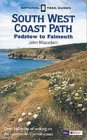
|
| 
| |
| |
| |
The first part of this walk is a short mile-long walk from where I finished yesterday's walk in Stratton Terrace to the Prince of Wales Pier in Falmouth, where the South West Coast Path begins. This is a very east walk as it just follows the road into the centre of the town and is very self-explanatory.
The last part of the walk is around the Helford River from Helford Passage to the little village of Mawgan on the southern bank of the river. The directions for this section of the walk are detailed in the South West Coast Path Association guidebook, so I will not replicate the directions here.
Distances
| From | To | Distance (m) | Ascent (ft) | Descent (ft) |
|---|---|---|---|---|
| Falmouth | Helford Passage | 9.4 | 1818 | 1824 |
| Helford Passage | Mawgan | 7.6 | 1414 | 1289 |
This makes a total distance of 17.0 miles, with 3232 feet of ascent and 3113 feet of descent.
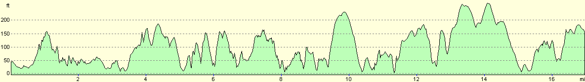
For more information on profiles, ascents and descents, see this page
Accommodation
We spent the night at the campsite at Merries Farm, Cury, Helston TR12 7RA, telephone (01326) 240398 or email wendy.cowling@btinternet.com. This site cost us eight pounds for the night including electric hook-up, and was a reasonable site except for the shower, which was warm but had a window missing so the room was exceptionally cold. Sam had a shower in the room and told me that it would be best for me to have one in the van, so I did so.
Disclaimer
Please note that I take no responsibility for anything that may happen when following these directions. If you intend to follow this route, then please use the relevant maps and check the route out before you go out. As always when walking, use common sense and you should be fine.
If you find any information on any of these routes that is inaccurate, or you wish to add anything, then please email me.
All images on this site are © of the author. Any reproduction, retransmissions, or republication of all or part of any document found on this site is expressly prohibited, unless the author has explicitly granted its prior written consent to so reproduce, retransmit, or republish the material. All other rights reserved.
Although this site includes links providing convenient direct access to other Internet sites, I do not endorse, approve, certify or make warranties or representations as to the accuracy of the information on these sites.
And finally, enjoy your walking!
This walk was mentioned in the following routes:
| My walk around the coastline of Britain |
| South West Coast Path |
Nearby walks
| # | Title | Walk length (miles) |
|---|---|---|
| 339 | Mevagissey to Portscatho | 18.3 |
| 340 | Portscatho to Ruan Lanihorne | 17.9 |
| 341 | Ruan Lanihorne to Feock | 16.6 |
|
|

|